


In the previous tip, we started talking about coordinate system transformations that you might encounter. We began with the simplest form from a user’s point of view—a transformation grid. Today, we’ll continue talking about more complex ones required for custom coordinate system setup. But first things first.
What if my coordinate system is not in the list?
Emlid Flow and Emlid Flow 360 contain the verified registry of local coordinate systems for specific countries. All you need is to find your coordinate system and vertical datum by country, its name, or EPSG code and apply it to your project. Learn more about setup in the Set up coordinate system from library guide in our Docs.
In this case, we have done everything for you. When you choose a coordinate system for your project in Emlid Flow and Emlid Flow 360, tap the info icon next to the coordinate system and you’ll see the parameters of the chosen coordinate system:
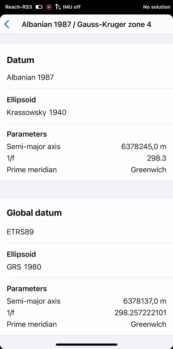
In most cases, these parameters are available, and we’re able to do all the calculations under the hood ourselves, so you can simply select a coordinate system from the library in Emlid Flow or Emlid Flow 360.
However, some coordinate systems do not have publicly available parameters, or have outdated parameters that prevent us from adding them to our library. If you have the parameters of the required coordinate system at hand, we have a workflow for you—you can create a custom coordinate system by entering them.
What is a custom coordinate system?
A custom coordinate system is simply a particular coordinate system made possible by entering the parameters you have. To configure the custom coordinate system in Emlid Flow or Emlid Flow 360, you may need to specify up to 4 different components which should be known to you:
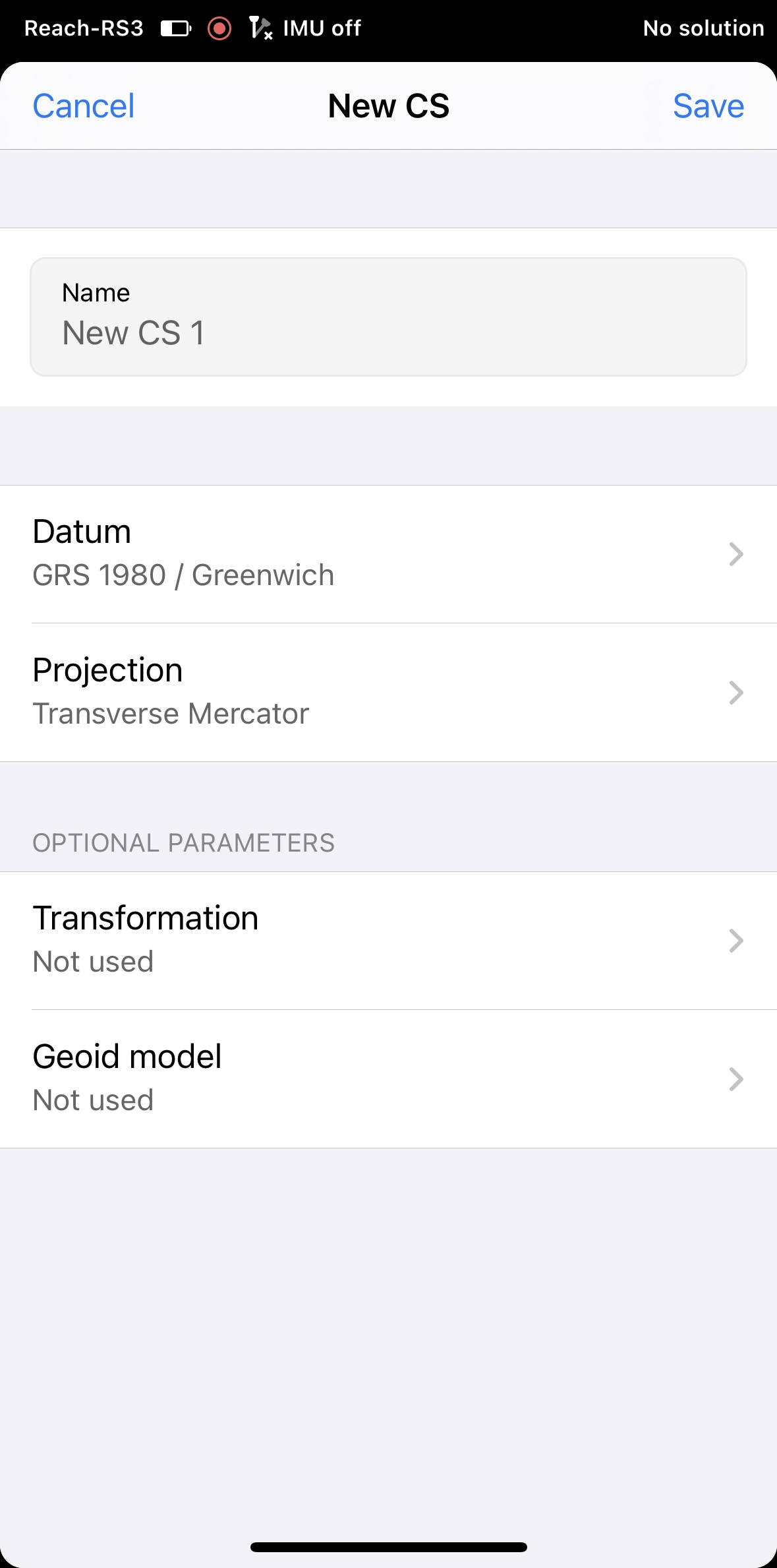
- Ellipsoid your datum is based on. Double-check you specify the one used for your country or region. If the projection is based on the same datum as the base, skip the transformation step.
- Projection type and its parameters.
- Transformation type and its parameters to get the desired datum. These things should be known beforehand—these are the name and a set of various coefficients which define the formula to calculate your coordinate system. But we’ll get back to this topic a bit later.
- Geoid model. Double-check you specify the right one for your region. If you decide to work with ellipsoidal height, don’t select the geoid model.
Let’s take a closer look at the case when the projection doesn’t match the datum your base has, and you have to apply transformation parameters. Don’t forget to get the parameters—you can usually contact your local authorities.
What are transformation type and parameters?
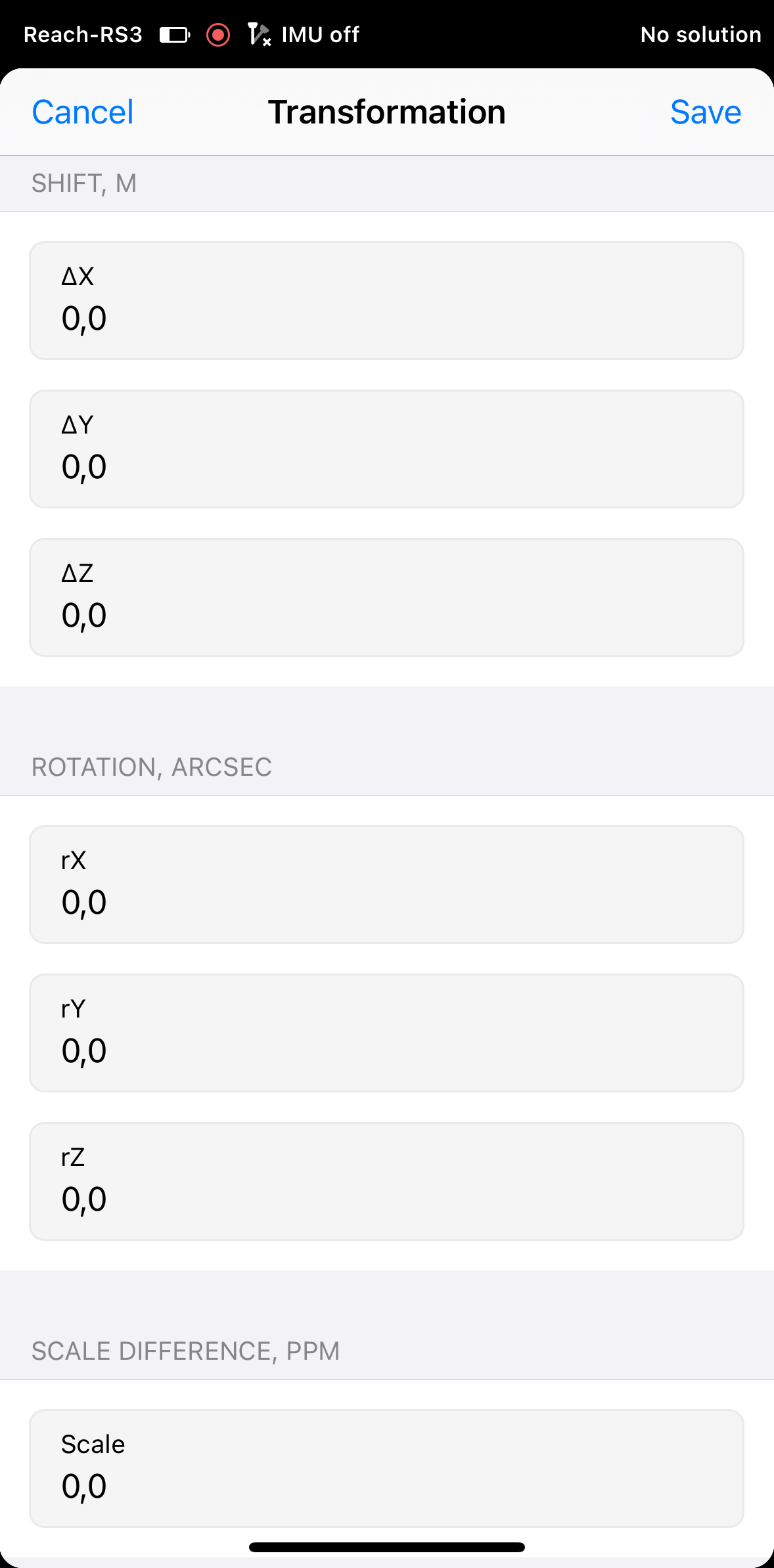
To get a coordinate system in the desired datum, you’ll need to choose between two transformation types first:
- Helmert 7-parameter transformation
- Molodensky-Badekas 10-parameter transformation
In both cases, you will shift, rotate, and scale your original datum to get the required one. But in the latter, you will also correct the origin of the coordinates if it doesn’t coincide with the existing one.
Then you’ll need to specify the transformation parameters. These are numbers that allow you to determine three origin shifts (ΔX, ΔY, and ΔZ), three rotation angles (rX, rY, rZ), scale difference, and the coordinates of the pivot point (X, Y, Z) if you choose the Molodensky-Badekas type.
Tap Save, and the app will calculate the required coordinate system. To better understand what’s going on behind the numbers and formulas, have a look at the illustrations below. Imagine you translocate the ellipsoid your datum is based on:
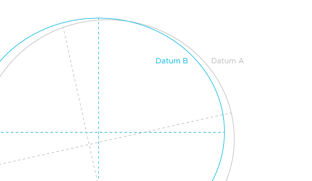
2D representation of the datum transformation
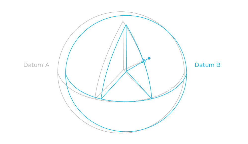
3D representation of the datum transformation
This is how it works! Learn more about the custom coordinate system setup in our Docs.
What if I don’t have the parameters?
Sometimes you have to survey a site without accurate coordinate system parameters or with none at all. It means the custom coordinate system setup is not your option. But there’s a way out.
With Emlid Flow you can calculate or adjust local coordinate system parameters to survey the area with high accuracy. The only requirement for this is the availability and applicability of benchmarks or known points. Emlid Flow will compare sets of known and measured point coordinates and calculate or adjust your local coordinate system parameters. Learn how to apply localization in Docs.
This is the last post in the series of the Support tips dedicated to coordinate systems. If you haven’t checked all of them yet, here they are:
- Сoordinate systems: ellipsoid and geoid
- Coordinate systems: datums
- Coordinate systems: projections
- Projections: Universal Transverse Mercator and Gauss-Krüger
- Coordinate systems: transformation grids
If you have any questions, leave us a comment below or contact us directly at support@emlid.com.