


In the previous tip, we talked about a projection, a component that helps you represent the surface of the Earth on a map.
In this tip, we will discuss the special cases—the Universal Transverse Mercator (UTM) and Gauss-Krüger map projections. They are commonly used and best suited for surveying large countries and countries elongated from north to south. These projections are divided into zones and cover the entire globe, which makes them different from any other map projection. Let’s take a closer look at them.
Universal Transverse Mercator
Type
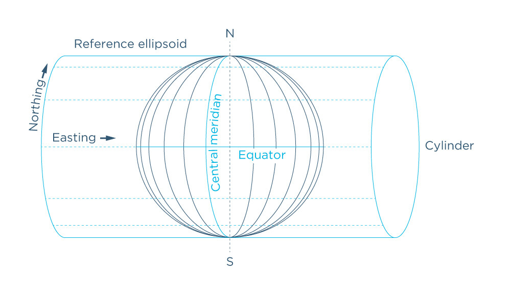
The Universal Transverse Mercator map projection is a special case of a cylindrical projection type and is based on the Transverse Mercator projection type in particular. What makes it different from the Transverse Mercator projection? The cylinder touches the sphere along a meridian, not along the equator as in Transverse Mercator.
Based on the type of distortion, the UTM projection is conformal. It preserves shapes over small areas but distorts their size. The minimal distortion is near the central meridian, increasing as you move away from it.
Zoning
As we can see from the name of the projection, it can be used anywhere on the globe. This is possible by dividing the Earth into 60 zones using 60 central meridians which serve as reference points. Each zone is 6 degrees of longitude, or 668 km wide, which allows for minimal distortion within it. Zone 1 is located around the Alaska area, Zone 60 is in the area of New Zealand.
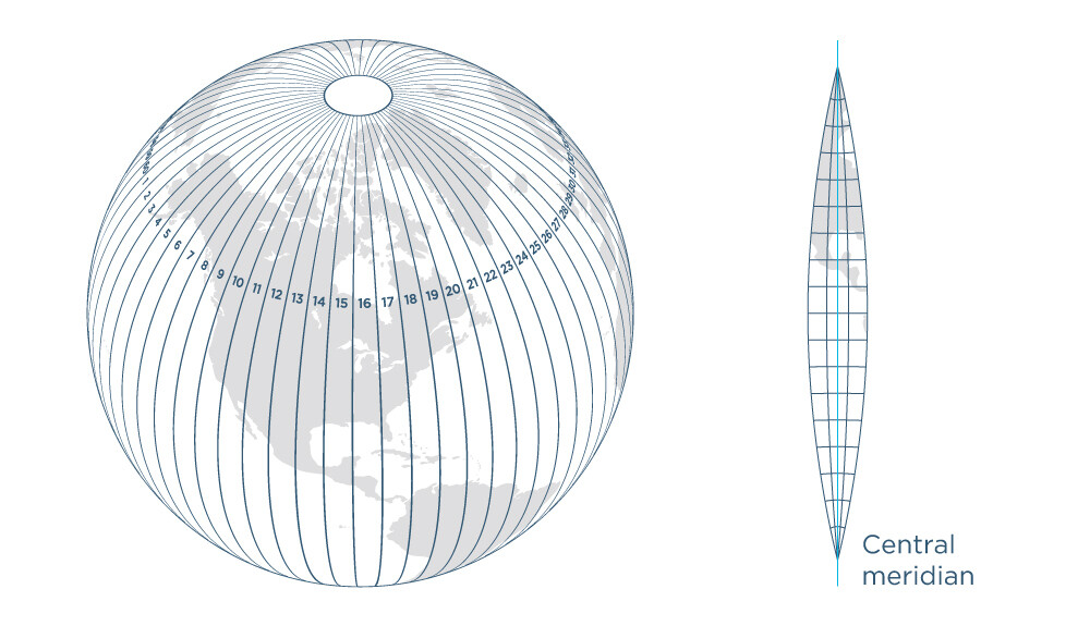
Thanks to this zoning, you can use the same projection across the whole territory of a large country—just pick up the right zone. Otherwise, it’d be impossible to create a projection which will fit all the parts of the country and feature only minor distortions.

Application
The Universe Transverse Mercator projection is often used for mapping narrow north-south oriented areas. Such areas nearly or completely fit the corresponding UTM zones. This way the projection can be successfully applied for the US states, Canada, New Zealand, and some other countries. With the UTM projection, local, national, and topographic maps are created.
Gauss-Krüger projection
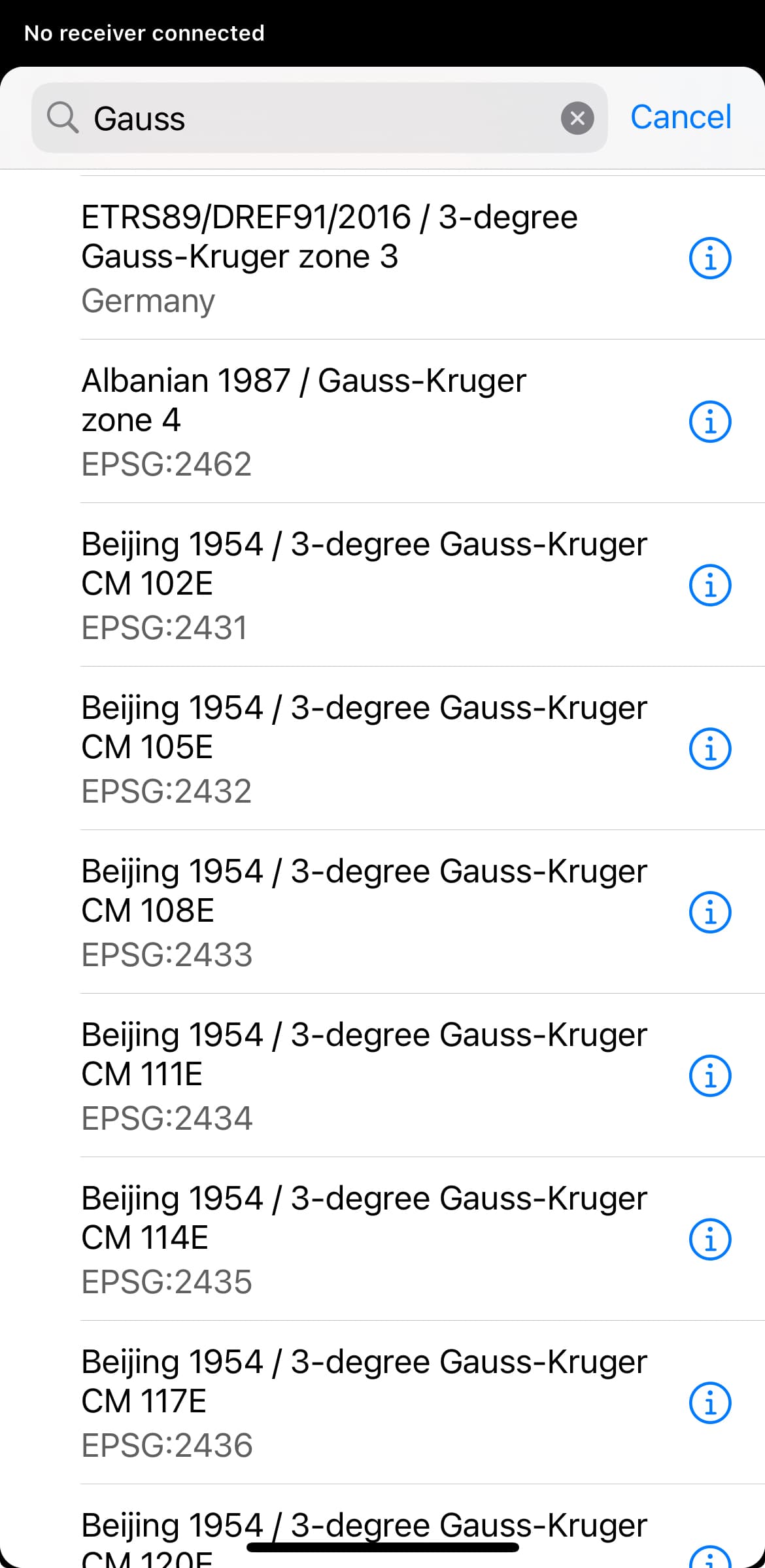
There is a projection that is very similar to the UTM projection—the Gauss-Krüger projection which is used mainly in Eurasia, in particular in China. The two projections are based on the same principle: both have zones and are based on the Transverse Mercator projection. However, the Gauss-Krüger projection’s zone 1 is located in the area of Germany, and the projection has both 3- and 6-degree-wide zones. Choosing the 3 degree zone wide provides more accurate results with less distortion.
UTM and Gauss-Krüger projections in Emlid Flow
In the Emlid Flow app, there are numerous coordinate systems with UTM and Gauss-Krüger projections. To select the right one for your project, you need to know in advance which zone you are in.
Also, if you don’t know exactly which local coordinate system to use for your project, it’s worth choosing one with the UTM or Gauss-Krüger projection. They allow working in meters/feet, the main reason you’re looking for a projection for your area of interest. Besides, you can easily convert any of them to other projection when necessary.

In the next tip, we will continue talking about coordinate systems, and will explain what a grid is.
If you have any questions about setting up a coordinate system for your survey project, just contact us at support@emlid.com.