Awesome work Emlid - this is a huge step in your journey! Trying it out now.
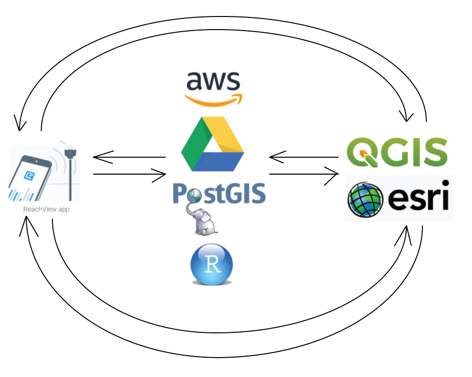
I ask to keep this workflow in mind. Basically, allow for users to connect to the cloud/server for real-time survey, importing datasets and exporting datasets.
Awesome work Emlid - this is a huge step in your journey! Trying it out now.
I ask to keep this workflow in mind. Basically, allow for users to connect to the cloud/server for real-time survey, importing datasets and exporting datasets.
I do ALL thay its not working
This is a great progress thanks emlid.
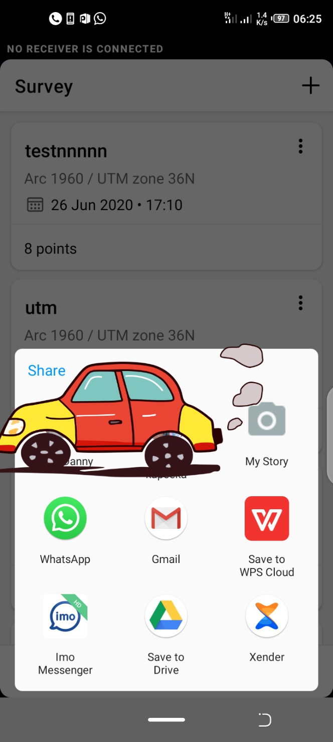
But am just curious where does the app save my .CSV project after exporting. Because it only brings me an option to share the exprted project .
Oh don’t mind about the car
Hi!
Android does not save generated CSV files in an accessible directory unless you directly asked to. This seems like the issue discussed previously:
Please, try installing a 3rd party file manager. It should bring the corresponding option to the sharing menu.
I have been using ES File Explorer for over 5 years. It also deals with network and USB storage very well.
Hi, @ivo.boskovski
Unfortunately, RV3 doesn’t support base coordinate system selection for now. For your case RV3 assumes that your base station is referenced in EPSG:3906(MGI 1901), that’s why TOWGS-parameters aren’t applied.
For the results to be correct you need to set up your base station in EPSG:3906(MGI 1901). For that purpose you can convert your original base coordinates from WGS84 to MGI 1901 with some geospatial tool like QGIS or PROJ. If you need some help with transformation, please contact me, I will be glad to help!
Thank you for your report, we will try to understand how to make RV3 more useful in cases like your one!
Hi @andrei.marshalov, @egor.fedorov,
Excellent work guys. This is a huge step forward.
When do you reckon the “Base Mode” would be active for ReachView3.
The reason I am asking is that CORS service is not fully operational at the moment and Nigeria and I am very sure that functionality would appeal strongly with the Nigerian market.
Regards,
Dapo
It would be a great advance to be able to configure the base from rechview 3! and I keep insisting that the csv of the start and end times are the same as rechview 2
hi egor
Malaysia epsg code for gdm2000 grid parameter is wrongnot same as our Survey department parameter.can i load custom coordinate (.prj) file? and also malaysia use custom geoid called mygeoid , can i load manually (.gtx) into reachview3 app?
thank you
Andrei thank you for the offered solution, but the problem is: i use base station from national service for ntrip correction, i don’t have access to it, and all other users in country is set by that set up, so i can’t change it.
For now i use rs 2 in wgs84 (transform coordinates in other software and put them in like that and work perfect), but in future would be nice if we have that transformation, and to have option to create custom transformation by users
Somehow, up-to-date info about the Android app releases hasn’t found its way to the forum! It’s a bit late, but I present you changelogs for the two latest updates.
4.4 Beta
4.5 Beta
I’m missing the option to measure/collect points during stakeout. Usually I would have x,y coordinates for stakeout, but need the z from the field (and updated x,y if the point is moved).
As stakeout and measure are separate functions you need to either mark all points in field, then walk another round and do the measure, or shift between stakeout and measure when at a point.
It would be great to choose a point (ex. “Point1”) -> “Stakeout” -> go to point -> Press a button to measure the point and save x,y,z as “StkdPoint” -> go to next point.
Thanks for a great app
Quick Question about version 3
I downloaded the new version, If I do the firmware update will it mess up previous updates using version 2.XX . We use verion 2.XX for doing commercial work??
So I held off loading the new firmware.
Hi Andri , it would be excellent if you consider in the future update, adding user profile and survey profile option which can enable certain user to save prefered presetting for various type of survies such as static, ppk or rtk mixed, with its options of base link and base location.
Also if can be backed up for restoration or sharing with other colleagues
ReachView 3 encompasses projections (in my case UTM 21N) which is great. I did not see this available in Reachview
However, I cannot view information as I could in ReachView such as no. of satellites, base mode settings, correction input settings etc.
Is reachview 3 designed to function independently or is it meant to work along with Reachview?
Just tried the beta today. Most of my settings were greyed out and could not be selected to change settings. Not sure if it was something I was doing wrong or not.
I want to try out Reachview 3 on my RS. I have Reachview 2.18.0. Installed and it tells me it is the latest upgrade. I have the dev version.
So when I open up the Reachview 3 app it says no receiver connected.
Am I missing a firmware upgrade or something?
Hi,
To continue receiving updates for Reach RS, please reflash your unit. We had this news quite a while ago, you can check it here:
Dmitriy
Thanks very much for bringing me up-to-date. I missed that notice.
Cheers
John