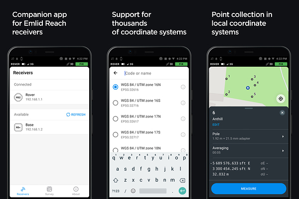
Today we are introducing a new app to work with Reach. Over the past years Reach has become incredibly popular among professionals in surveying, drone mapping, archaeology, bathymetry, topography, and many other industries and we are fully committed to supporting their needs. We are rebuilding ReachView from the ground up on mobile platforms, so we have the right tools for the job.
ReachView 3 is very different from ReachView 2 that you know. Unlike its predecessor, ReachView 3 is not a web app, but rather two native apps, built specifically for Android and iOS. Today we invite you to join the Android app beta test, with the iOS open beta coming in about a month. You can
sign up to get a notification when the iOS version arrives.
Coordinate systems support
-
Coordinate systems
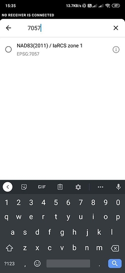
This has been our top priority for quite some time now. ReachView 3 supports working in different coordinate systems. The selection is based on the EPSG and IGN registries and supports thousands of different coordinate systems all over the world. -
Geoids and Grid Shift files are downloaded automatically
ReachView 3 has built-in support for grid and geoid transformations. Just choose the appropriate coordinate system code and the app will prompt you to download all the required additional files. We currently support EGM2008 and most vertical datums from the registries and will continue our work to add even more. -
Support for meters, feet, survey feet
With coordinate system support comes support for different units of measure. The pole height settings and stakeout distances will automatically work in feet or meters depending on the project’s coordinate system.
Projects, collection and stakeout
- Your projects are stored in the app, not on Reach, so you can access them anytime without turning the receiver on.
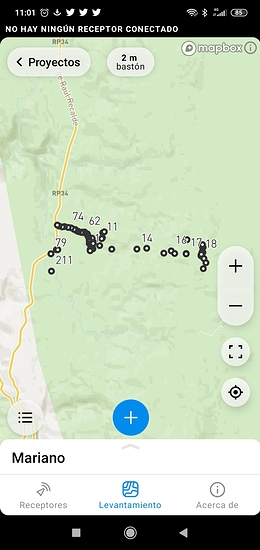
- All interactions are much faster. You can load thousands and thousands of points, the map pans and zooms are butter-smooth. We have tested up to 50 000 points on a recent Android phone.
- Import and export files using Dropbox, Drive, mail or any other file-sharing app on your phone. For now only CSV format is available, but we are working on more options. This is a great way to show how the new app can take advantage of the native mobile platforms and make your work more efficient.
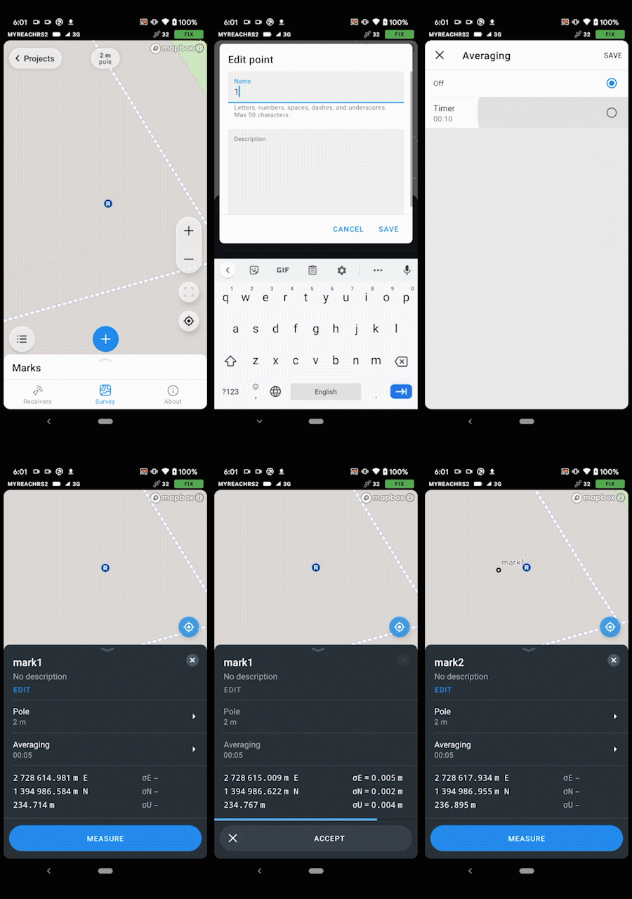
- Collect points by averaging or with just one click. Point names are auto-incrementing and you can also add a description.
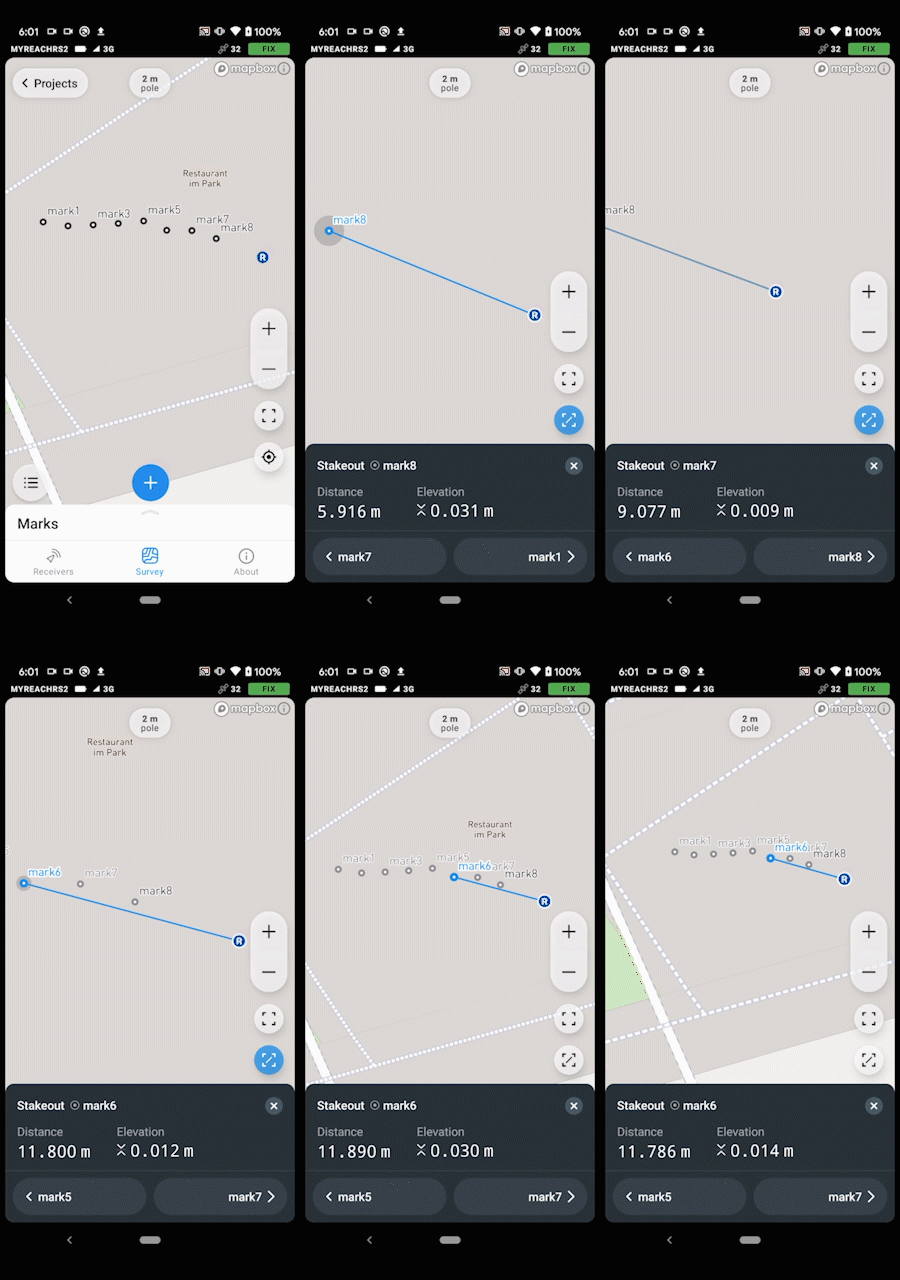
- Point stakeout with the ability to zoom and move the map freely.
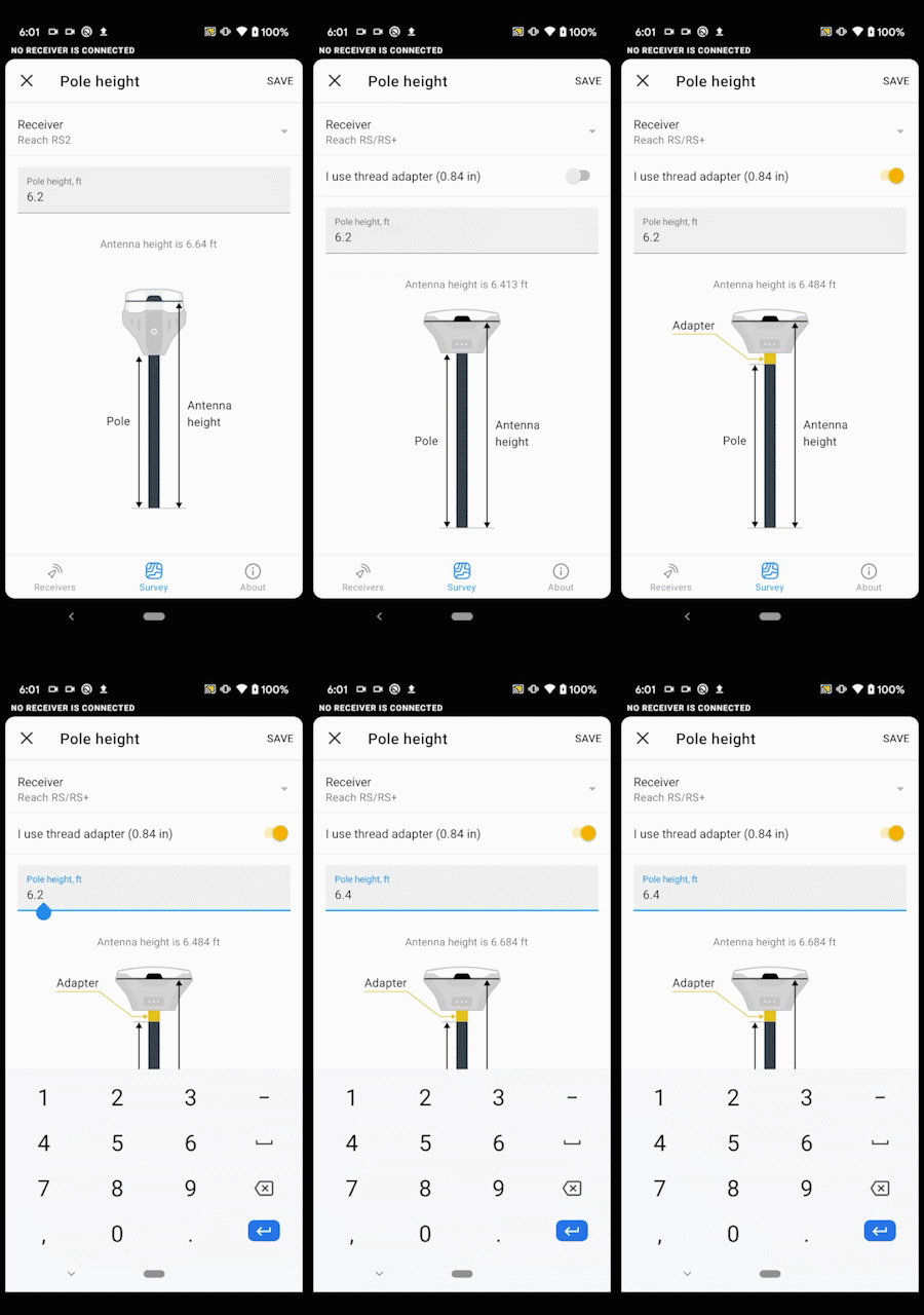
- Antenna height settings adapt to the Reach model you use and provide a simple switch to account for the thread adapter.
Receiver connection and configuration
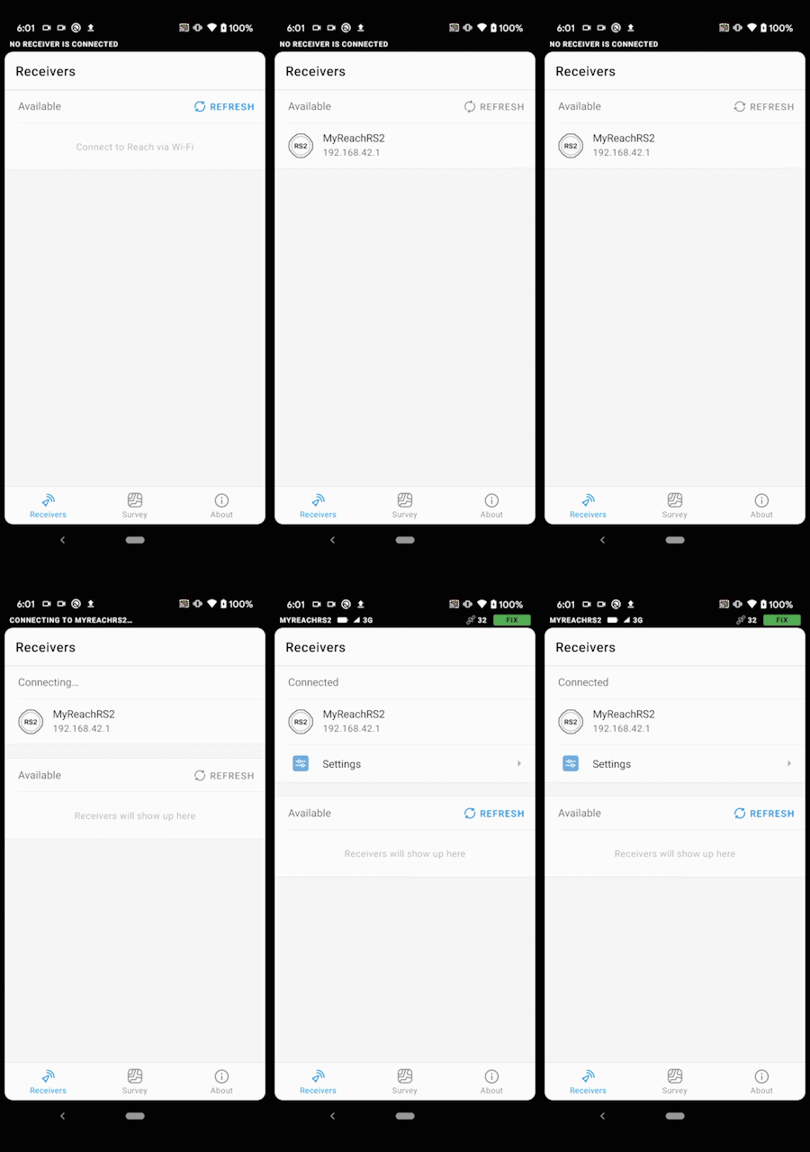
- Automatic connection to the only receiver on the network. If your phone is on a hotspot created by Reach the app will connect automatically. The connection is much faster too!
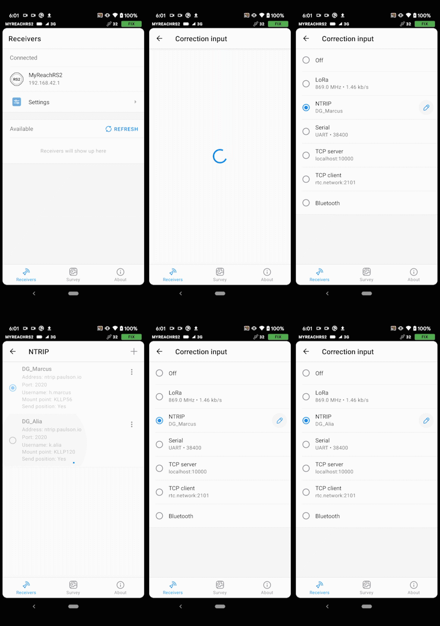
- NTRIP credentials are stored in the app as profiles. Effortlessly switch between different NTRIP casters. The profiles are stored on your phone, so you can configure several Reach units after only entering the credentials once.
- Globally visible status bar showing Reach solution status and more.
Languages and updates
- The app is available in English, Spanish, German and Russian today, with more languages to come. Translations appear after new features are introduced, so there might be some English text in the interface temporarily. We are currently working with our dealers on more translations. If you’d like to see your language supported, please let us know.
- New features will be delivered with a simple app update. Now we can deliver new features without updating firmware on Reach.
How it works
Coordinate systems support
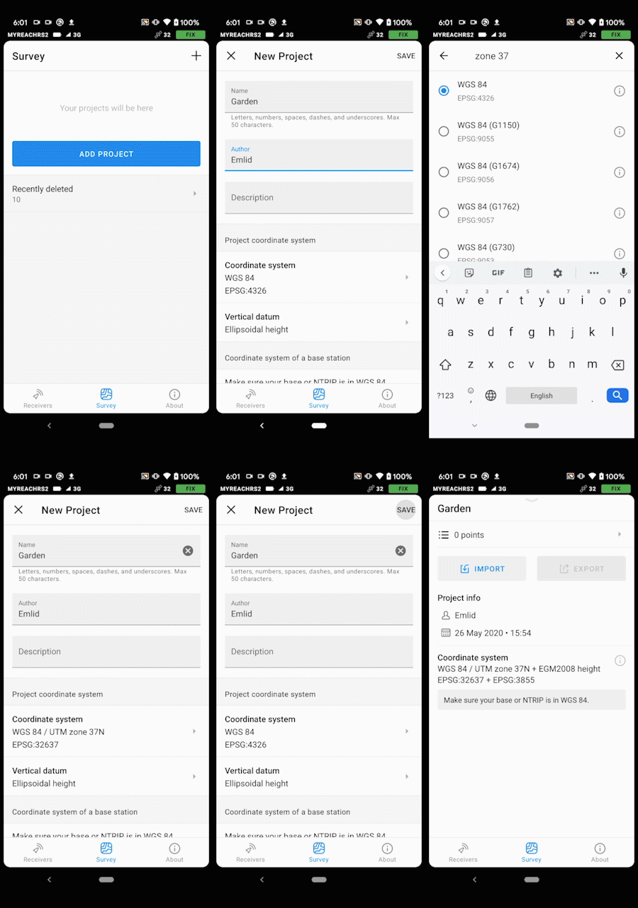
Here we create a new survey project. The coordinate system is WGS84 / UTM zone 37N and vertical datum is set to EGM2008 separately.
Import points from your phone
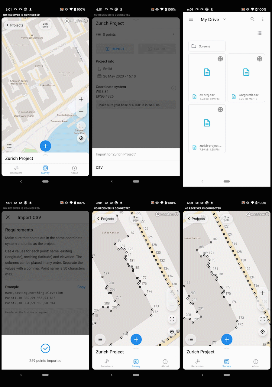
Export to Google Drive, Dropbox, mail, or any other app
You can export your project in the most natural way, just like you would share a photo.

Collect points without leaving the map
Names are automatically incremented, averaging time is configurable and you can skip averaging to collect points quicker.
Switch between NTRIP profiles
You only need to enter NTRIP credentials once on your phone. They are stored in the app and could be used to configure any connected Reach.
Stakeout points with the ability to zoom and move the map freely
You can choose to focus on the line from you to the point, or on the whole project.
Autoconnect to the only Reach in the network
If only one receiver is found, the app will connect to it automatically. This comes handy when working with the Wi-Fi hotspot created by Reach.
Change the pole height
The pole height dialog automatically adapts to your receiver.
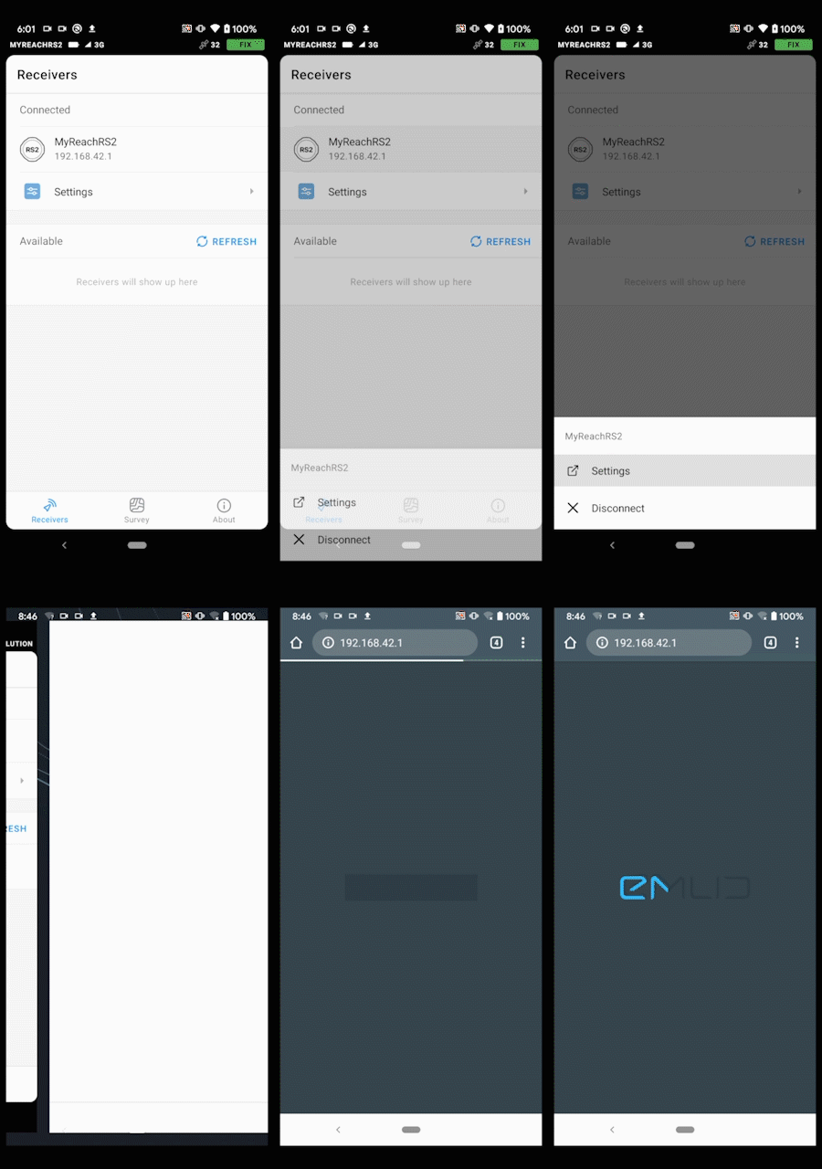
Quickly access ReachView 2
During the beta testing phase the apps will complement each other. You can do the configuration with ReachView 2 and surveying with ReachView 3. We’ve added a quick link to load ReachView 2 from the new app.
This is a beta and it requires DEV firmware on your Reach
To test ReachView 3 you need to update your Reach to the latest development version. Even though we spend a lot of time testing, this is the first public release and there will be bugs. Please do not rely on the beta version for your everyday work. This is an early release to get feedback.
There are still some things than you can only do in ReachView 2, like most of the receiver configuration. During the next few months we will cover all functionality from ReachView 2, so that everyone could move all of their work to ReachView 3. This will include:
- GNSS log controls, RINEX downloads
- All of the device settings — inputs, outputs, hardware, etc.
- Additional project export and import formats
During the beta testing phase the apps will complement each other. For example, you can do the configuration with ReachView 2 and surveying with ReachView 3.
How to sign up for the beta
Follow this link from your Android device. The minimum supported Android version is 5.1. Make sure that you enable auto-updates for this app in the Play Store settings to get new features and fixes. For all our iOS users, we will have a beta version ready in about a month. You can sign up to get a notification when it arrives.
Please give us feedback
We’ve been working on ReachView 3 behind the scenes for more than a year and are looking forward to your feedback! Let us know your first impression, what did work and what didn’t work, what you would like to see in the app in the future. If you see your coordinate system on the dropdown list please test that conversion works correctly by checking it on a benchmark.
If your case is not supported, contact us with the following information.
- What CS you use for your end results.
- What CS is your base usually referenced in.
- Links to any geoid or grid files you may be using.
- Some benchmark data before and after transformation from the base system to the target system.
A note on ReachView 2 future
We know that a lot of Emlid customers value that they can easily download log files from a browser. Because of that, ReachView 2 will continue to live on, and eventually become a web version of device settings and logging control. Some things, such as point collection and stakeout won’t be developed any further in the web interface and eventually will be deprecated. We will make sure to let you know of such changes in advance. All new features will be added to ReachView 3 from now on.
We are super excited to share the new app with the community. Thanks to everyone who helped us with beta testing, provided feedback and supported us over the years. A big thanks to everyone at Emlid who helped us get here, this a huge step for Reach!
Update 15.07.2020
The iOS version is out now. You can enroll here. Full details available is this post.


