Hi @Cowboys703,
Thanks for reaching out to us! Better be out with what frustrates you.
I can see our users have already described the main pros and cons of your setup. I’ll just be making the comments on some points. Sorry if I have to repeat what’s been already said.
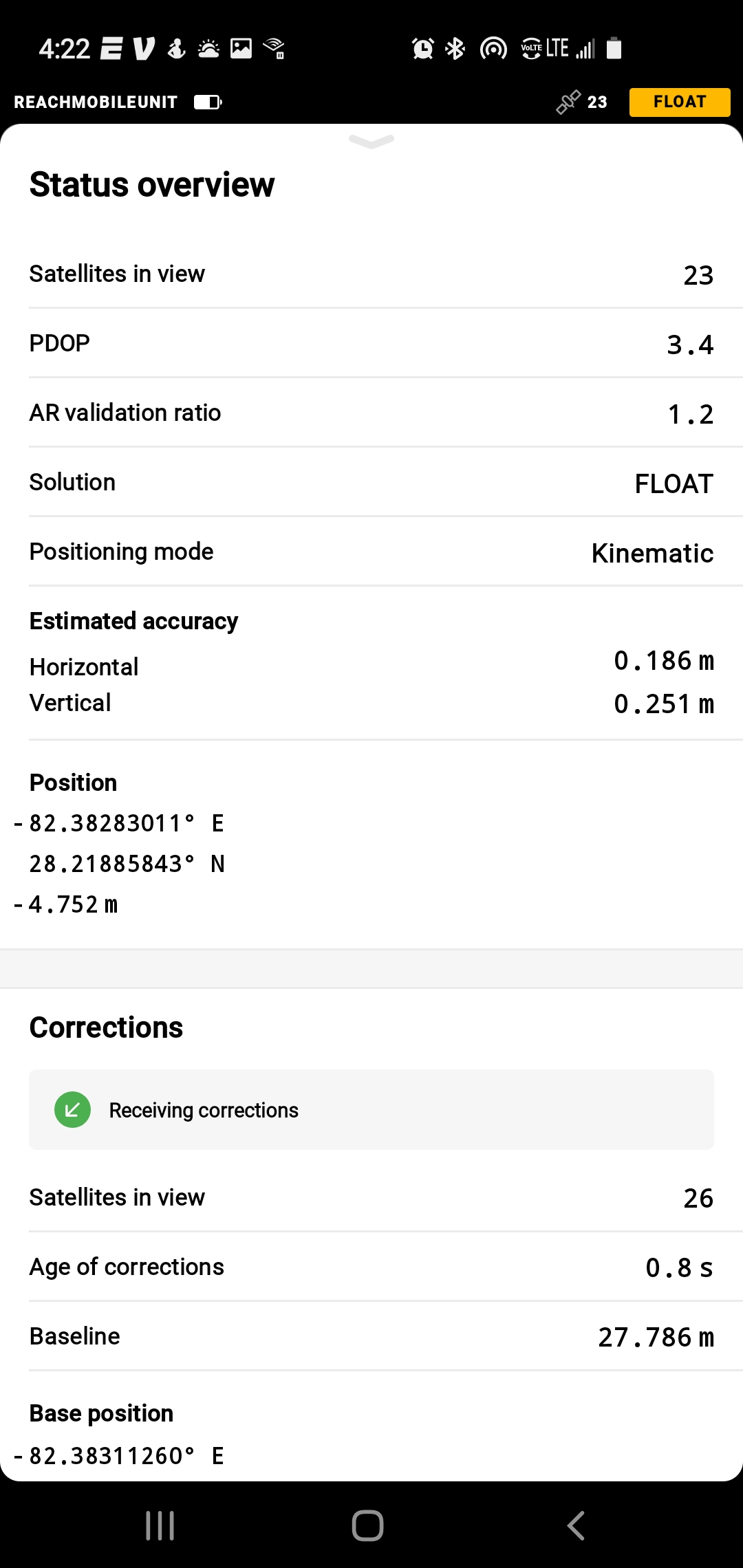
Generally, what you have now is a system that works as a single-band one, even though you have Reach RS2. This happens because your rover is Reach RS+, and it doesn’t have any multi-band advantages. It works with L1 signal.
I would also contradict @michaelL and urge you not to make RS+ a base in such setup. If you’re mixing the single-band and multi-band systems, the multi-band should be the base. Otherwise, RS2 has trouble understanding the L1-messages and may not even get the Float solution.
The messages are indeed different, that’s true. The reason for this is that we list the messages needed to work with another multi-band system. Reach RS+ is a single-band receiver. It can work with the same messages but it gets the L1 part of them.
Reach RS2 is a better option. But the main point here is that the whole RTK system (as in, base and rover) should be multi-band to get the use of this better option. In your case, it’s not.
Still, if you manage to get the mobile data coverage in your area, you can use Reach RS2 with a SIM and NTRIP service. This way, you’ll get all benefits: a more robust solution in somewhat difficult conditions, longer baselines, and shorter time for the first Fix.
From what I get, you’re surveying in rather harsh conditions for RS+. This means that the data quality on the rover is somewhat reduced. This affects the solution, of course.
Also, if you’re using LoRa to transmit the corrections, please make sure you have a line of sight and no obstacles. If that’s not possible, you might want to consider another way to transmit corrections (like external radios or NTRIP caster).
If you don’t have access to NTRIP services on-site to work with Reach RS2, I can see two ways of getting the cm-accuracy here:
- upgrading your RTK setup to be fully multi-band (as Michael mentioned, Reach M2 may be a more budget investment)
- using the non-GNSS solution for your environment
Just a quick reminder that dense forest and almost full sky coverage may be too harsh even for the multi-band receivers. Such environmental conditions ask for non-satellite-based ways to get the position there.