Emlid Flow Survey plan allows you to add and use WMTS and WMS layers. To get started, all you need is a URL from the web map service and a few manipulations in Emlid Flow 360. You can start working with layers in just a few steps. For more information, check these guides:
Don’t forget to log in to your account to get access to layers in Emlid Flow!
However, sometimes imported layers may be not enough, and you need to upload your own orthomosaic. For now, we have a workaround for you. You can host your own WMTS server to upload orthophotos to Emlid Flow:
Go to Mapbox Studio and create an account there, it’s free.
Create a new layer using the Streets template, upload your orthomosaic there, and obtain WMTS link.
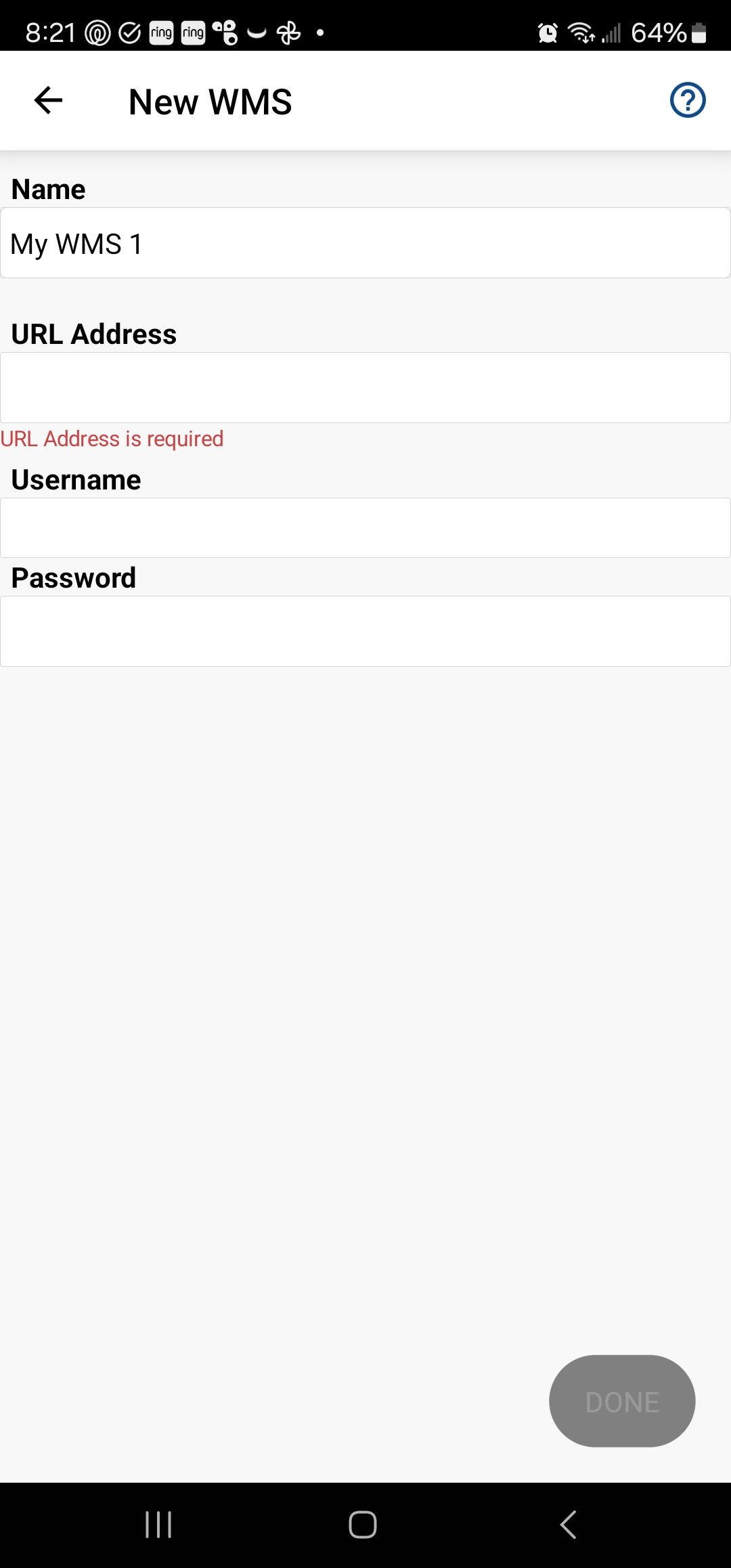
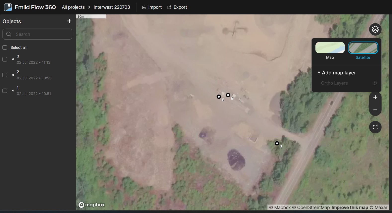
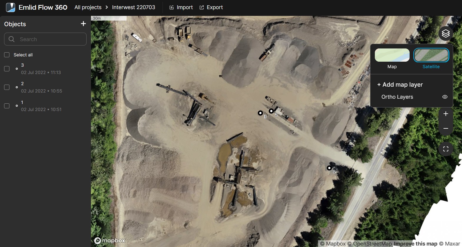
Add a new map layer using the obtained link in Emlid Flow 360 and access it in Emlid Flow.
The step-by-step process is shown in the screencast, check it in the video below:
Here’s how you can make it work with your own map layer sources!
And, as always, don’t forget to check our previous post which describes how to configure LoRa radio for RTK on Reach RS2+ in detail.
In my case, yes, my phone caches the tiles if I scroll around the ortho when I have a data connection, then they are still available later offline. That goes for satellite and even simple map layers. How much, and how long the tiles are retained, I don’t know.
Dave is correct: you need Internet access to download the layers and add them to your projects. However, once you uploaded them, they are cached and still visible even offline. If you want the data to be the latest available, I recommend keeping your app frequently connected to the Internet.
I’ve just checked the Mapbox Studio behavior and I worked with it without supplying any card info. The main thing to check is that you’re on the free tier and haven’t yet used up all of the free monthly options. Let me know how it goes for you.
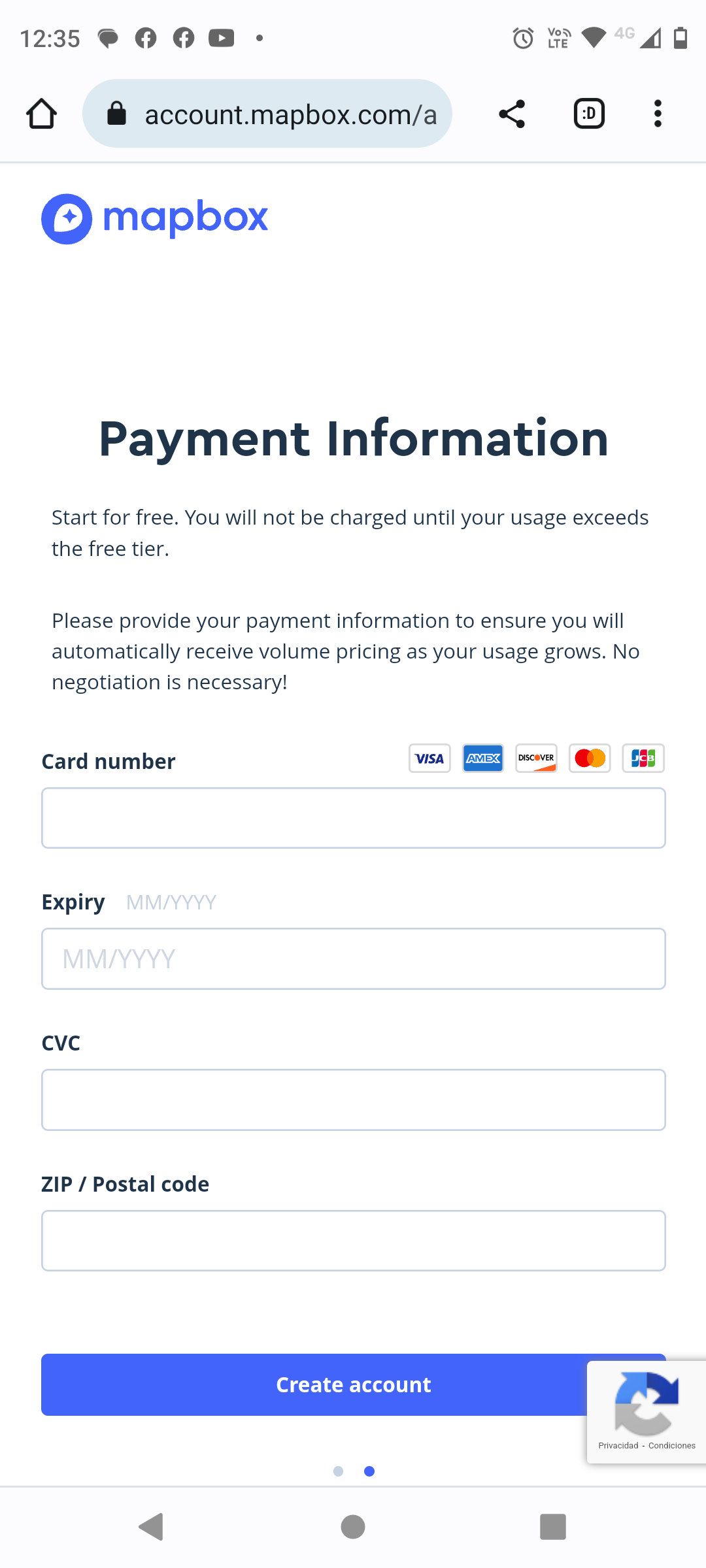
HELLO Polina! When creating the free account after indicating a username and password, it then takes me to a payment method. It will be that for these latitudes it is not free. If you can provide me with a link I will appreciate it. greetings Luis
Maybe you can try creating it via the PC through the desktop version? I did it with a PC and no card info appeared. Maybe this is the difference between the phone version and the PC version.
You can create a geotiff file in QGIS that you can then use in Mapbox Studio to use in Emlid Flow.
It is quite simple.
Open QGIS
Set the project coordinate system to WGS 84 / Pseudo-Mercator (EPSG:3857)
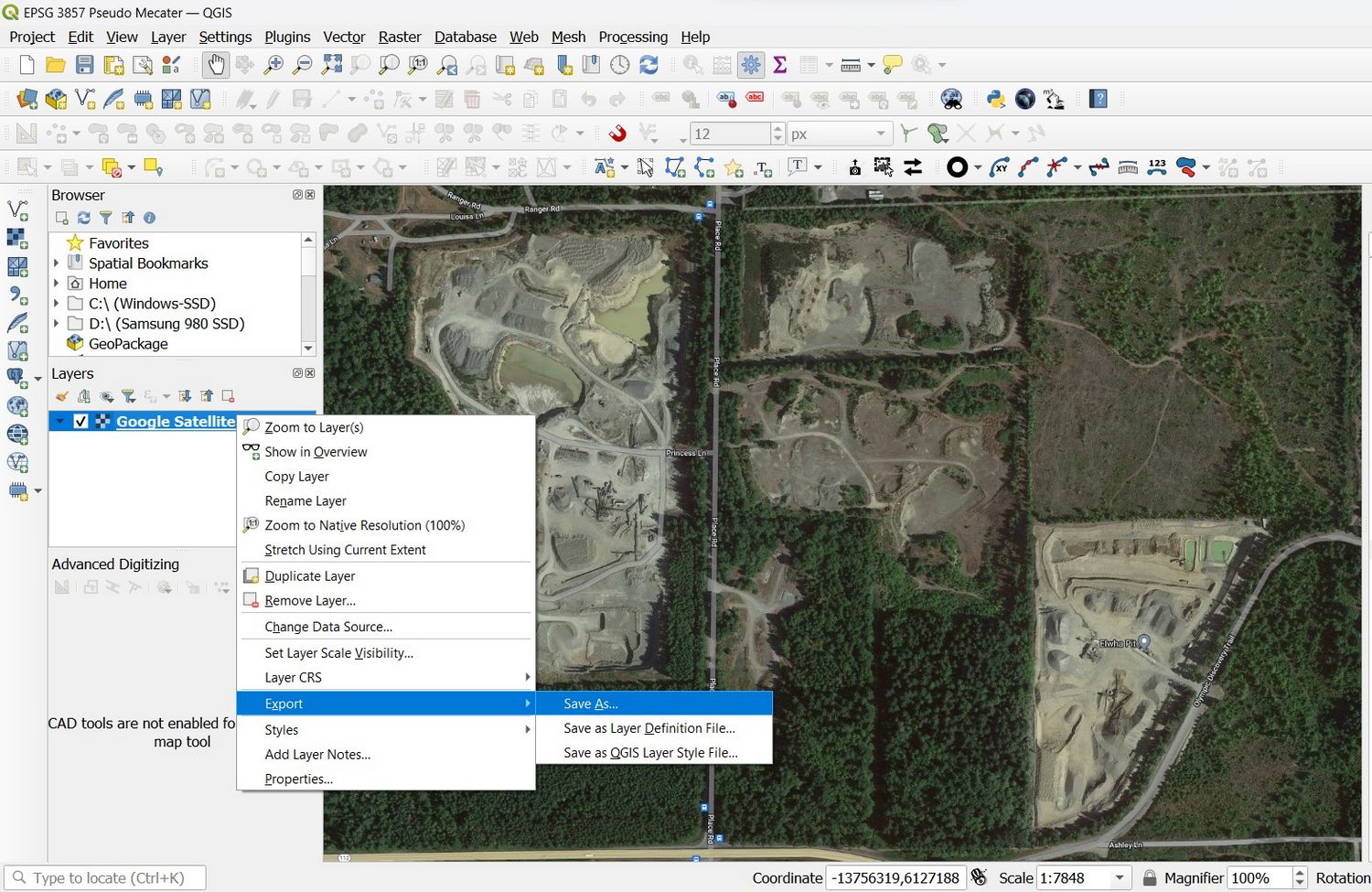
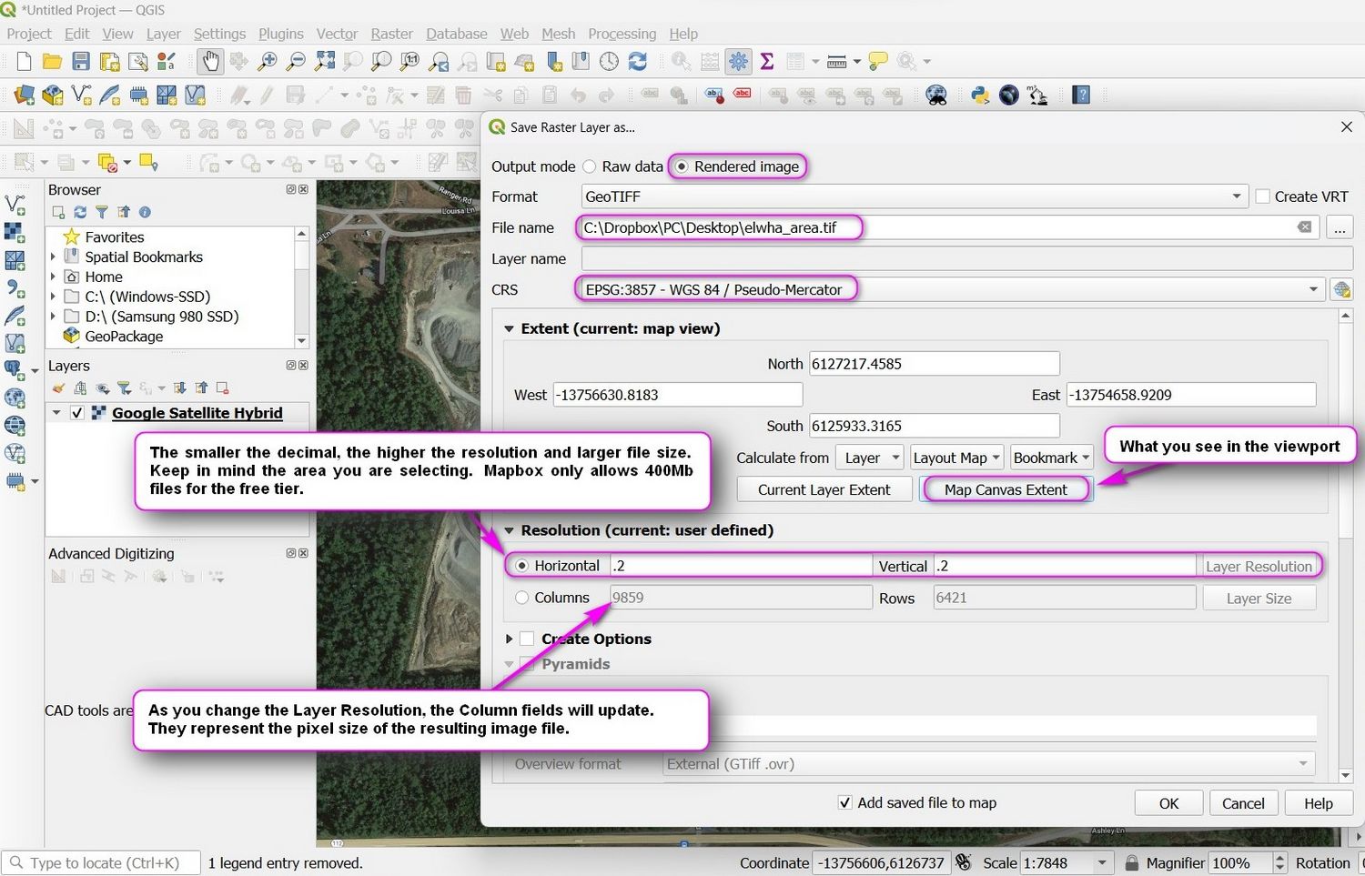
Load whatever layer you have available. In my example, I use a Google Satellite Hybrid layer.
Then right-click on the layer and select EXPORT > SAVE AS and, in the dialog, select the FORMAT > GeoTiff.
Look at the screenshots to see which settings to apply. When done, click on OK and your geotiff file will be rendered. If you plan to use this file in the Mapbox workflow, you need to keep the resulting file under 400Mb. If your file comes out too large, simply redo the process and either select a smaller area, a smaller resolution, or both.
This feature is not on our roadmap yet. But we’re collecting such cases for consideration and I’ll add yours as +1. I’ll let you know once we have any updates on it.
Here is an example to support the case of onboard background images.
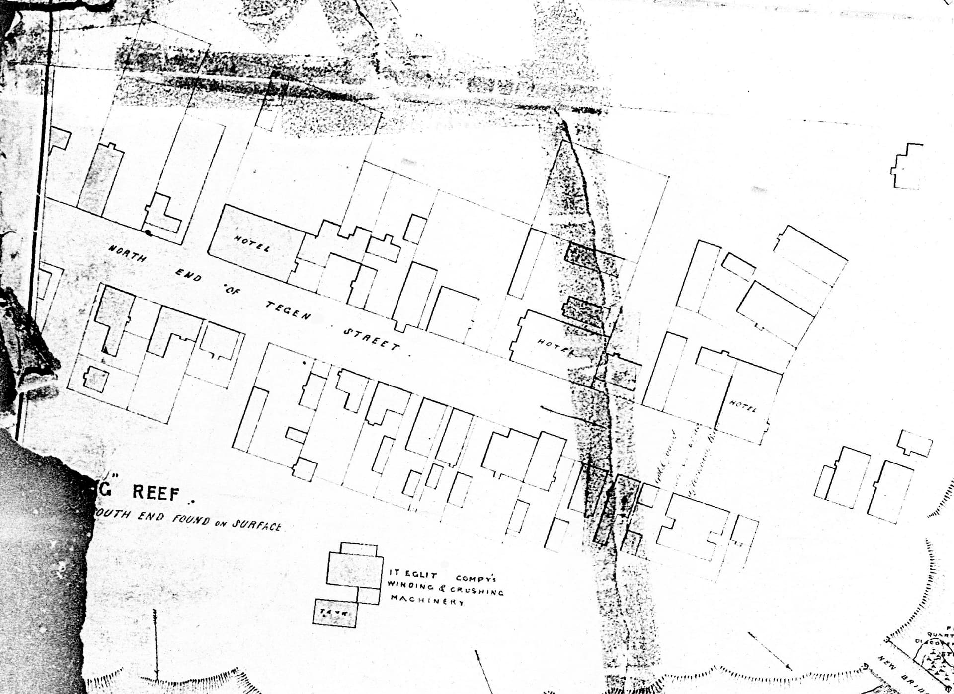
This example is part of a heritage study using RTK survey to identify building sites and historical features in an old gold mining town. This type of content, level of detail and high resolution is not available through common download sources.
And there are often multiple images required during a study, for example maps and plans of different areas, and multiple maps and plans of the same area but from different historical date periods to switch between. And sites are often remote and out of mobile coverage. The example below is from 1862.
Emlid is uniquely positioned in the industry and highly attractive for these sorts of studies. Not just because of low cost and high functionality, but also because the integrated equipment is more light weight and compact than traditional equipment so ideal for both travel to and walking into remote sites.
It would be great to have some of the functionality tweaked up to suit.
Not to interrupt your request; I’m curious how that [scanned?] historical drawing would be geo-referenced to any CRS which would seemingly be required to make it a beneficial background layer. Does the drawing include accurate monuments?
Would probably have to manually Rotate, Translate and Scale using whatever dimensions available on / in the record and whatever monuments, benchmarks, building corners etc that are available. Site Calibration. Localization.
Would be nice to be able to set drone aerial imagery also. I think Microsurvey FieldGenius for Android has more of this. Windows version i think just has GeoTiff support.
Yeah, probably not too difficult to scale and locate in CAD or maybe QGIS or Globalmapper and then export as a usable layer for a background so long as you have some type of reliable references.
In that case, you could add the layer via the MapBox workflow mentioned above but would be problematic in cell deprived zones if your device didn’t cache or lost the cached background tiles.
Good question, this map has no tied monuments but enough features including corner posts and foundations remained to get started.
The challenge though was figuring out which was a goody or a baddy. The place has a sordid history of murder and hotels burned down, rebuilt in different forms at different times, disputes and land encroached on, and which posts were put in by someone honest or sober, and when.
Research through land, court, newspaper records & historical photographs helped to narrow it down, then a LIDAR DEM and then modelling & testing what-ifs onsite to get a confident fit. Hence the focus now on RTK to zoom in on particular features and also continue in an iterative process refining section by section.
And many of these sections have their own specially rectified maps hence the number of maps to flick between is quite large and the map box process impractical even if mobile coverage is available.
A lot of different tools are used, for the map images where we have hard copies it’s sometimes scans and sometimes photographs by section shooting hi-res raw with different light to resurrect detail and color in ACR & Photoshop. Once that’s done the rest of the work is handled in Global Mapper. It has great rectification capability - more than simple shift, rotate scale, with enough points can address distortions across the image - and with simple linking/unlinking of image locations to data points on any layer. It’s simply an awesome tool to what-if, mix and match and bring everything together.
And back on topic, I did recently acquire FGA and Trimble TerraSync already does onboard images well, however just to clarify my ulterior motive here is to leverage what Emlid brings to the table to arm more non-technical helpers to assist with the mapping leg work, as well as to minimize cost as it’s all voluntary.
GM Mobile has some, but they also require the pro-licence at extra cost and then managing the activations between other peoples private phones. Otherwise, it’s more GIS focused and yet another layer with it’s own idiosyncrasies to further scare off non-technical volunteers.
What’s particularly got my interest here with Flow is support for RS3 IMU, it’s less intimidating and easier for the uninitiated to simply walk about and point a stick. And the data I get back has got to be better than when they are otherwise leaning on the pole and moving it around while talking to their friends.


 Access")