hi, im new in this forum, and an amateur learning about using of Emlid GNSS Recievers, so i want to know, if i m doing surveying with RTK (kinematic) first at all, i need to set the coordinates but this coordinates, specifically the Height, needs to be ellipsoidal, but when I create a new proyect, specially, when I set the input coordinates and if I set a geoid model (egm2008), when Im doing surveying, the height of all points im taking, it will be on Ellipsoidal Height or Geoidal Height when i set up the rover? Does not matter if the input height in the base is ellipsoidal?
Sorry if my English does not looks good , I will appreciate your response.
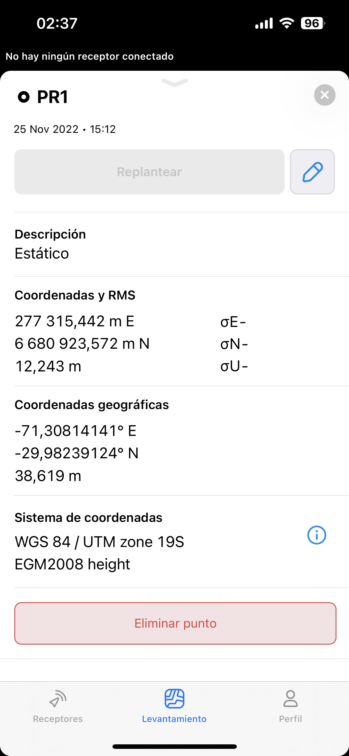
Hola, si creaste el nuevo proyecto y seleccionaste el sistema de coordenadas y el geoide correctamente, veras que los puntos que agregues tendrán los dos sistemas: global y local, elipsoidal y geoidal.
Disculpas si no entendí tu pregunta
Yep, in the Base settings the height should be ellipsoidal. But as Javier showed, when you collect the points in Emlid Flow in a project with a specified projection and geoid, you get both local and global coordinates with ellipsoid and orthometric heights.
By the way, we have a couple of posts that can help you set the base in Emlid Flow: