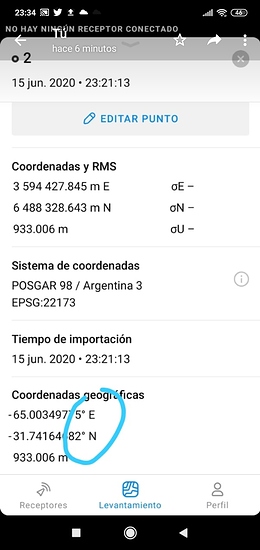
When importing CSV points they could add the point Description option. It would be a great help. Thank you
It also happened to me one day and so far it never failed again
@JAGUERO @agrimgalina Thank you for the reports!
We are aware of these random glitches and will fix them as soon as possible. The problem is that the cause of this issue is closely related to the map engine. I genuinely can’t promise a fix in the next update.
Sorry for the inconvenience.
Hi there,
Can I export a CSV file from ReachView 3 to the files/folders on the Android device the app is running on?
Hi!
Yes, it is possible. Exporting a project as CSV triggers the default Android sharing menu. You’ll need to look through this bottom sheet to find a file-manager-related option.
There is a possibility of this option being unavailable – it depends on the phone’s firmware/apps. If that is the case, you’ll need to install a 3rd party file manager from the Play Store (avoid ES File Manager – we have issues with it).
That’s Excellent Ale,
We are testing here in Nepal too, once I have the results, I will share in the forum
Congratulations to the entire EMLID team. Much appreciated and most awaited app.
Awesome, just awesome!!!
OK, brilliant, sounds good. I’ll try a 3rd party file manager then.
Thanks for the quick reply
Thanks for the suggestion! We’ll do this in one of the upcoming releases.
I like the ES File Manager app.
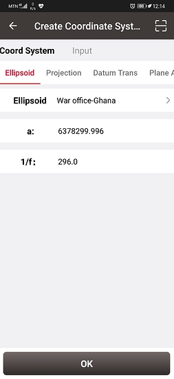
Hi @egor.fedorov, I just want to enquire if there’ll be provisions whereby you can create your own coordinate system just like what is shown in the photo below?
This is a beta and it requires DEV firmware on your Reach
To test ReachView 3 you need to update your Reach to the latest development version
Very nice work guys. So easy to use.
We still need to be able to create custom transformation like bursa wolf or molodensky badeks. But this is a big step thanks a lot guys
i try to get dev firmware update but its not working
Hey,
As pointed above, we can’t really support the ES File Manager. It does not play by normal Android rules and requires some special handling to be done, which we won’t be able to support right now.
Richard,
We’ve added Ghana support to our roadmap and it will be implemented. We’ll mention you in this thread, once it’s done.
Good news, everyone!
We’ve just released a new version, 4.3 Beta. This release is mostly focused on fixes and UI improvements, but we do have a couple of nice additions:
- ODN height vertical datum is now available and this release marks full UK support for ReachView 3.
- Support for Canadian geoid CGVD2013 has been reworked and we should properly support Canada now. @kildirtech, could you please double check this for us?
- Turkish locale has been added to the app.
There’s also a ton of fixes available in the full changelog below:
-
Added new CRSs for the UK: EPSG:5701(ODN height) vertical datum and EPSG:7405(OSGB 1936 / British National Grid + ODN height) compound CRS.
-
Fixed height transformation for systems based on EPSG:4617(NAD83(CSRS)) geographic CRS with EPSG:6647(CGVD2013(CGG2013) height) or EPSG:9245(CGVD2013(CGG2013a) height) vertical datum.
-
Added support for Turkish locale.
-
NTRIP profile wizard in the 3rd tab now has a hint about the mount points list. This little update should clarify the fact that the automatic mount points loading is currently accessible only via Correction input settings.
-
Serial ports now have correct names according to the type of connected receiver.
-
The collector tool now reuses the description of the last collected point for a new one. You still will be able to clear it via the Edit dialog.
-
EPSG:4289 Amersfoort was disabled for project creation due to internal technical issues. Existing projects will still be intact, but there is a high risk of collected data being unreliable.
-
Improved the search engine in the project creation wizard’s CRS list. You will now more accurate results while searching for a CRS by a part of its name/code.
-
Fixed the Receiver section in the antenna height wizard to always show a correct device model.
-
Minor fixes and stability improvements.
-
Minor visual updates.
We are extremely happy to see the warm welcome for ReachView 3, as well as the ongoing feedback from you. Please keep it coming. Even though it's not always possible to address your issues or feature requests immediately, every report shapes our roadmap and the future of the app. Thanks!


