If you find yourself with Reach RS2 on a desert island, you still have a chance to obtain coordinates with centimeter-level accuracy.
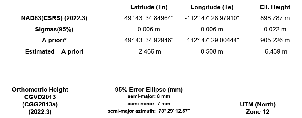
Let me tell you about Precise Point Positioning (PPP). This technique allows you to correct raw data from your receiver using precise ephemerides and clock offsets provided by a PPP service. All you need to do is to record a raw data log for at least 4 hours. Agree, quite long, but it’s worth it. After that, just upload it to a PPP service and get the results.
There are several PPP services. And you can use them all regardless of your location. If you’ve taken an interest and want to learn more, we have a guide about PPP.
If you already tried the technique, tell us where it was! Working in remote areas is usually rewarded by beautiful views ![]()
P.S. Now you’d ask—what’s about Reach RS+? Single-band logs can be processed in the CSRS-PPP and IBGE services, but the best accuracy you can achieve is 20-30 centimeters.
P.P.S. And don’t forget to check our previous post on using Reach RS2 as a permanent base, it could be the one you’re looking for.