


We would like to announce a low cost survey grade system DJI PHANTOM 4PRO GNSS RTK/PPK.
Survey grade Reach (GNSS GPS/QZSS L1, GLONASS G1, BeiDou B1, Galileo E1, SBAS) receiver built in standard DJI Phantom 4PRO body and integrated with calibrated camera.
It allows to record photos locations with centimeter level accuracy. Now you can process data in Photoscan or Pix4D, etc. software and turn your images into highly precise, georeferenced 2D maps and 3D models without ground control points (GCP).

DJI PHANTOM 4PRO GNSS RTK/PPK is a easy to use survey tool.
Just prepare flight mission in UGCS or etc software, switch on the drone, perform a flight mission. GNSS receiver will store events of making photo automatically, after landing download data from a drone via wi-fi.
The total weight of DJI PHANTOM 4PRO GNSS RTK/PPK increased by only 100 grams and removable antenna mount allows carrying a drone in a standard DJI case.
Please see the following example of the project with DJI PHANTOM 4PRO GNSS RTK/PPK
Stage 1. We installed GNSS base station on the point with known coordinates and measured locations in RTK mode of six ground control points distributed over the survey area. (Pic. 1, Pic 2).
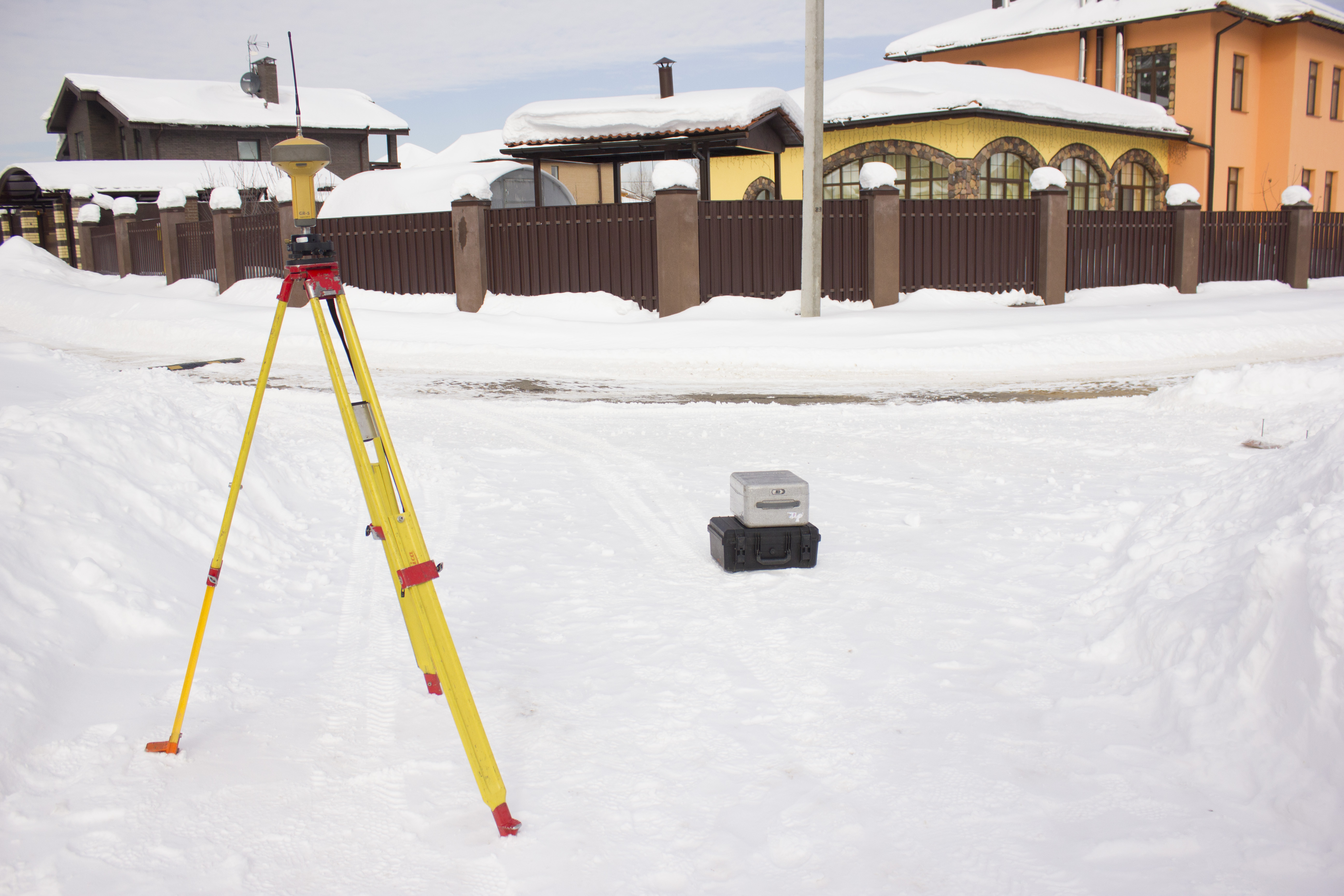
Pic.1 Topcon GR 5 GNSS base station
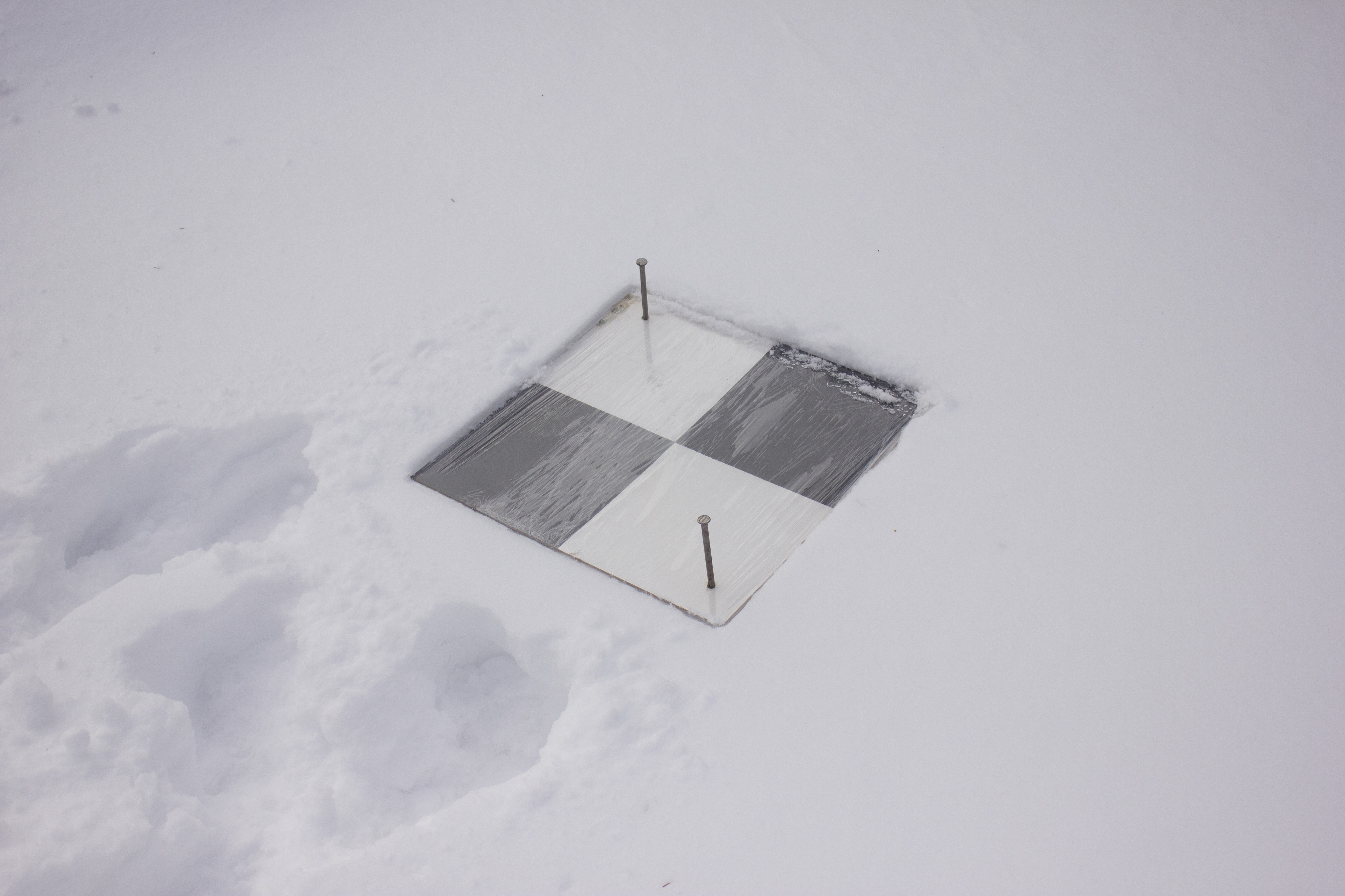
Pic.2 Ground control point
Stage 2. Drone mission was planned (Pic.3) , uploaded to DJI PHANTOM 4PRO GNSS RTK/PPK (Pic. 4). The flight mission was performed with the following parameters:
- survey area 40 hectares
- flight speed 10 m/s
- overlap 80/80%
- altitude 200 meters above ground level.
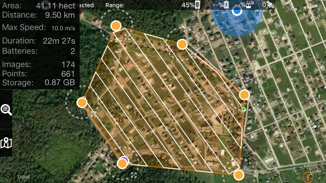
Pic. 3 Location of the survey area and flight routs
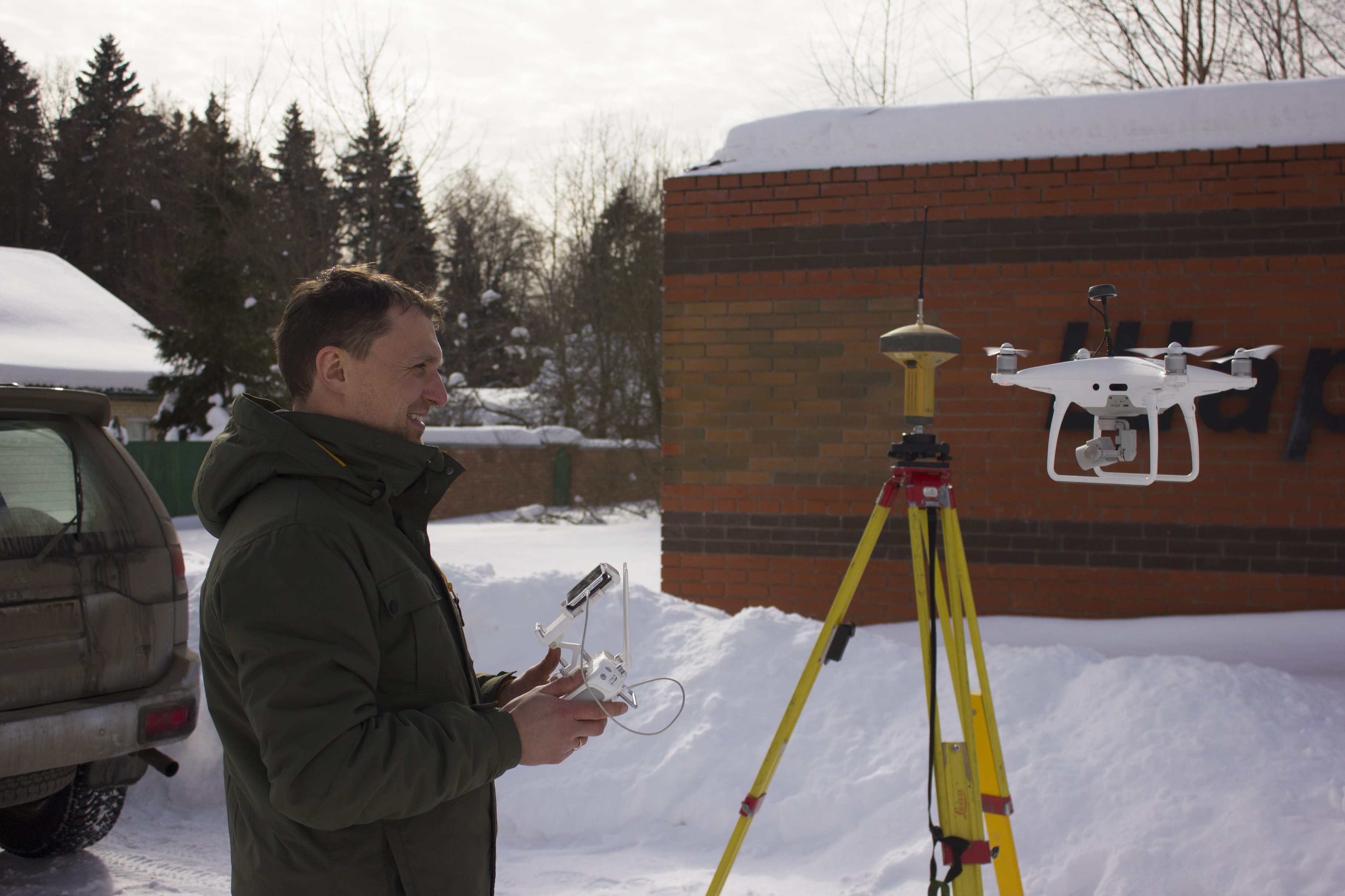
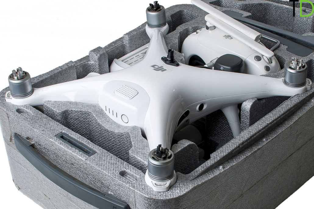
Pic.4 DJI PHANTOM 4PRO GNSS RTK/PPK
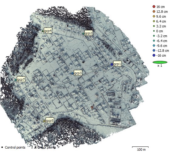
Stage 3. Photogrammetric processing. After landing, GNSS data were download from the drone via wi-fi and we processed RINEX files from drone and base station together using RTKLib postprocessing software (Pic. 5.). Differences between images locations measured by standard DJI GPS and upgraded GNSS system are shown at Pic.6
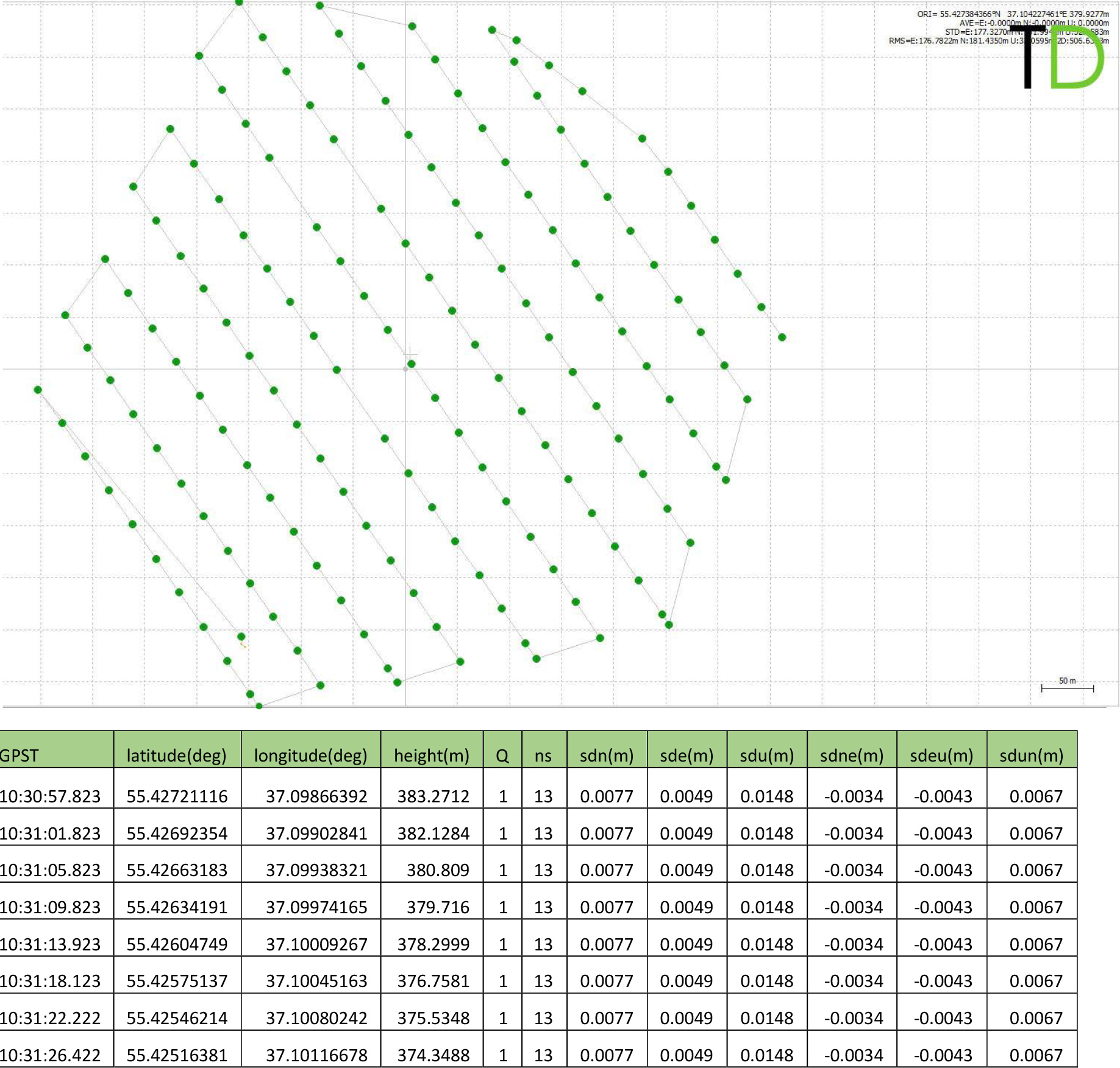
Pic.5 GNSS post processing report
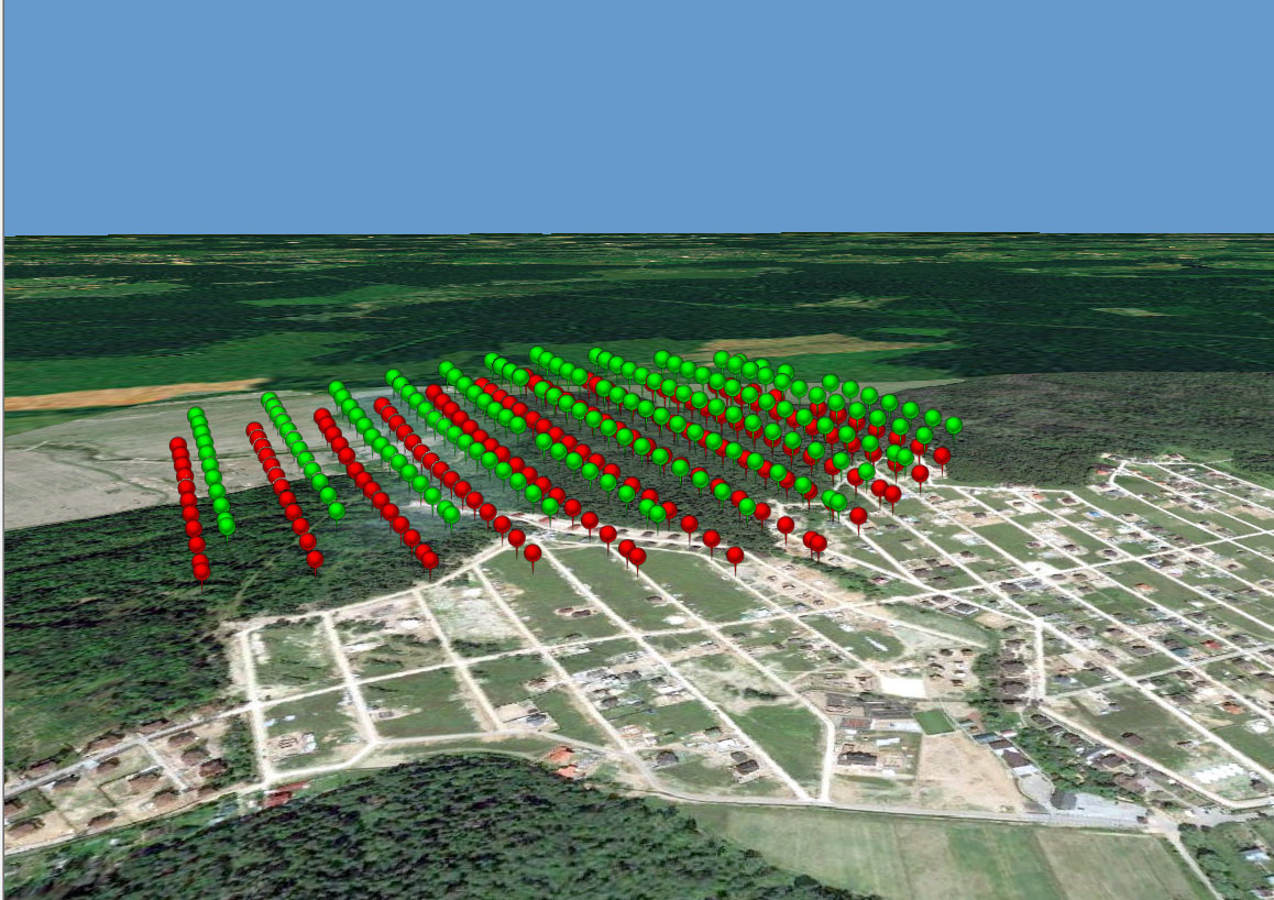
Pic.6
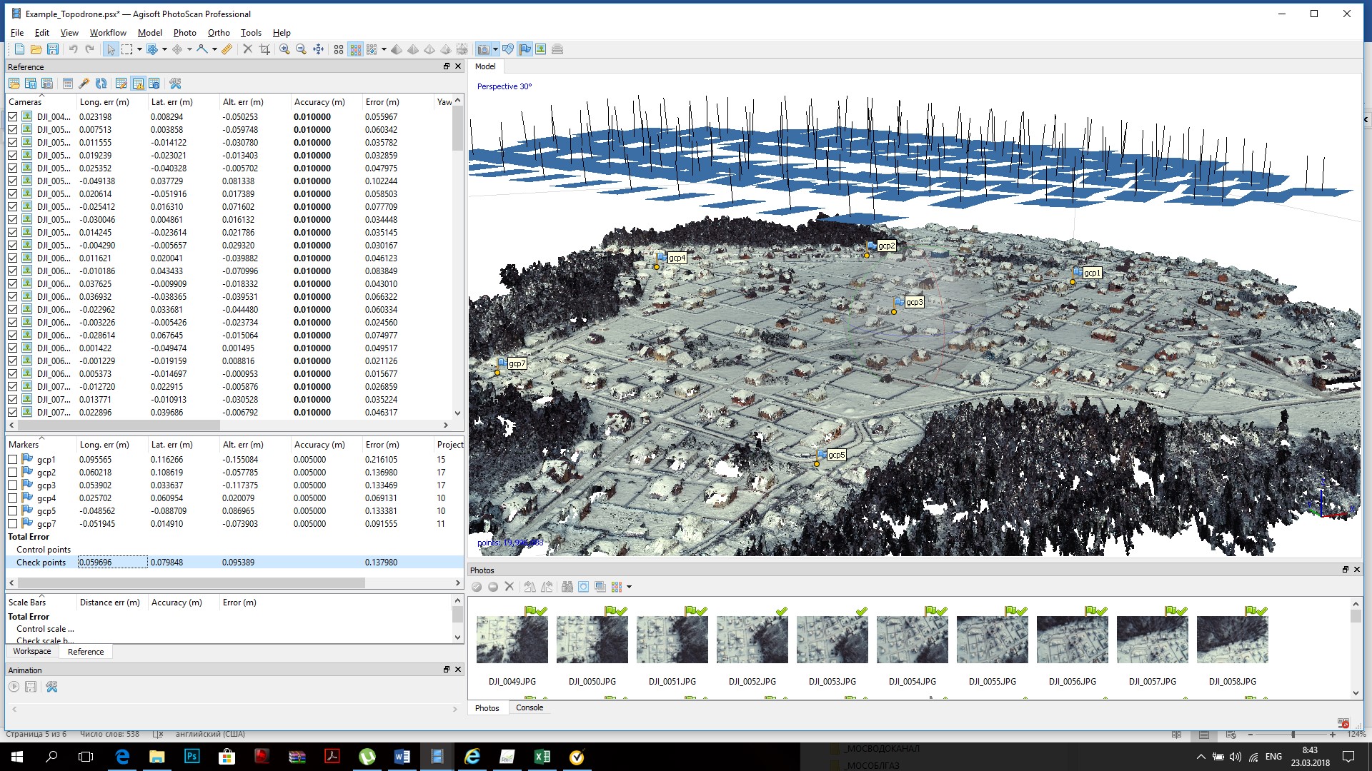
Photogrammetric processing was carried out in Photoscan software. Precise coordinates of image position were imported to the project and used for images alignment. Coordinates of ground control points were necessary only for the model accuracy estimation.
The following results were achieved with using precalibrated parameters of focal length F=3642.97108 and GPS offset Z=-0.21. (Pic.7,8,9)
Pic. 7

Pic. 8 Accuracy of image locations
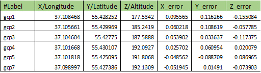
Pic. 9 Accuracy of GCP location
The results of the project shows capabilities to use a low cost DJI PHANTOM 4PRO upgraded with GNSS RTK/PPK receiver as a survey grade UAV. DJI PHANTOM 4PRO RTK/PPK provides high accurate drone data for precise mapping and 3D modelling. You no longer have to lay down GCPs or just minimize their number, saving countless hours and labor costs.
Demo dataset of this project including RAW GNSS files, images and GCP coordinates is available from
https://cloud.mail.ru/public/LcUW/aPGxNnehc
For more information please visit
www.eng.topodrone.ru