


Congratulations on the great work. please send me a quote: resuchecki@hotmail.com
How the Reach module get the power from? As I know, the log file should be at least 30 minutes for PPK processing.
It is not necessary to wait so long, just wait no more than 5 minutes.
what software you used for getting PPK points of the photos?
RTKlib for postprocessing
but how you extract the locations of the photos from that processing?
A file with coordinates of photo events is generated after post processing
please send me a quote: luch816@gmail.com
would you mind to send me a quote? rapakiri@gmail.com
thx
$4k
Congrats! Is this a DIY installation module? I’m very interested in PPK mode. Please send me a quotation.
We would like to announce a simple app TOPOSETTER for geotaging images in EXIF format with precise coordinates.
Now it takes few easy steps to embed accurate coordinates from event.pos file to images.
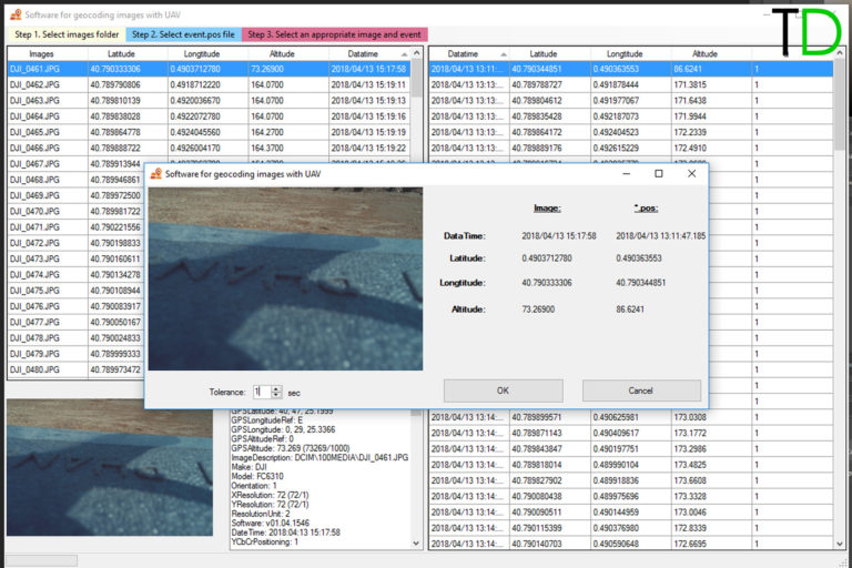
Please see more information on our website
http://eng.topodrone.ru/reviews/toposetter/
4 Likes
We would like to share results of DJI PHANTOM 4PRO PPK aerial survey project in Joensuu, Finland
http://eng.topodrone.ru/news/blog-8-4/
2 Likes
Hey @tinab I sent you a email from your website. I would like to purchase the instructions + TopoSetter software . I can do the hardwart part from my end. Also can you please upload this second project ? I can not download the first one
HELLO SIR
Is this drone helpfull for carrying survey like corridor project, area survey? thank you.
whats the price?
Yes, it will decrease field works as soon as you don’t need to lay ground control points.
Well done…awesome. Can you pls send me a quote? My email address is elias.wambo@yahoo.com Thanks !
please send me a quote: skydrone.maputo@gmail.com
would you mind to send me a quote?
bimbodanu888@gmail.com
Actually i already asking you on your email (info@topodrone.ru)