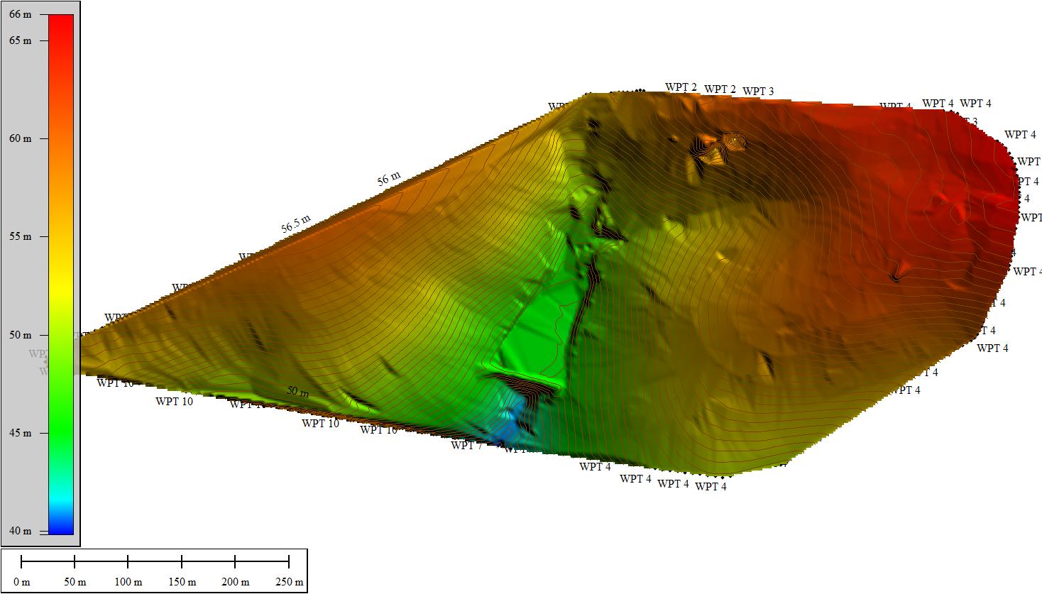
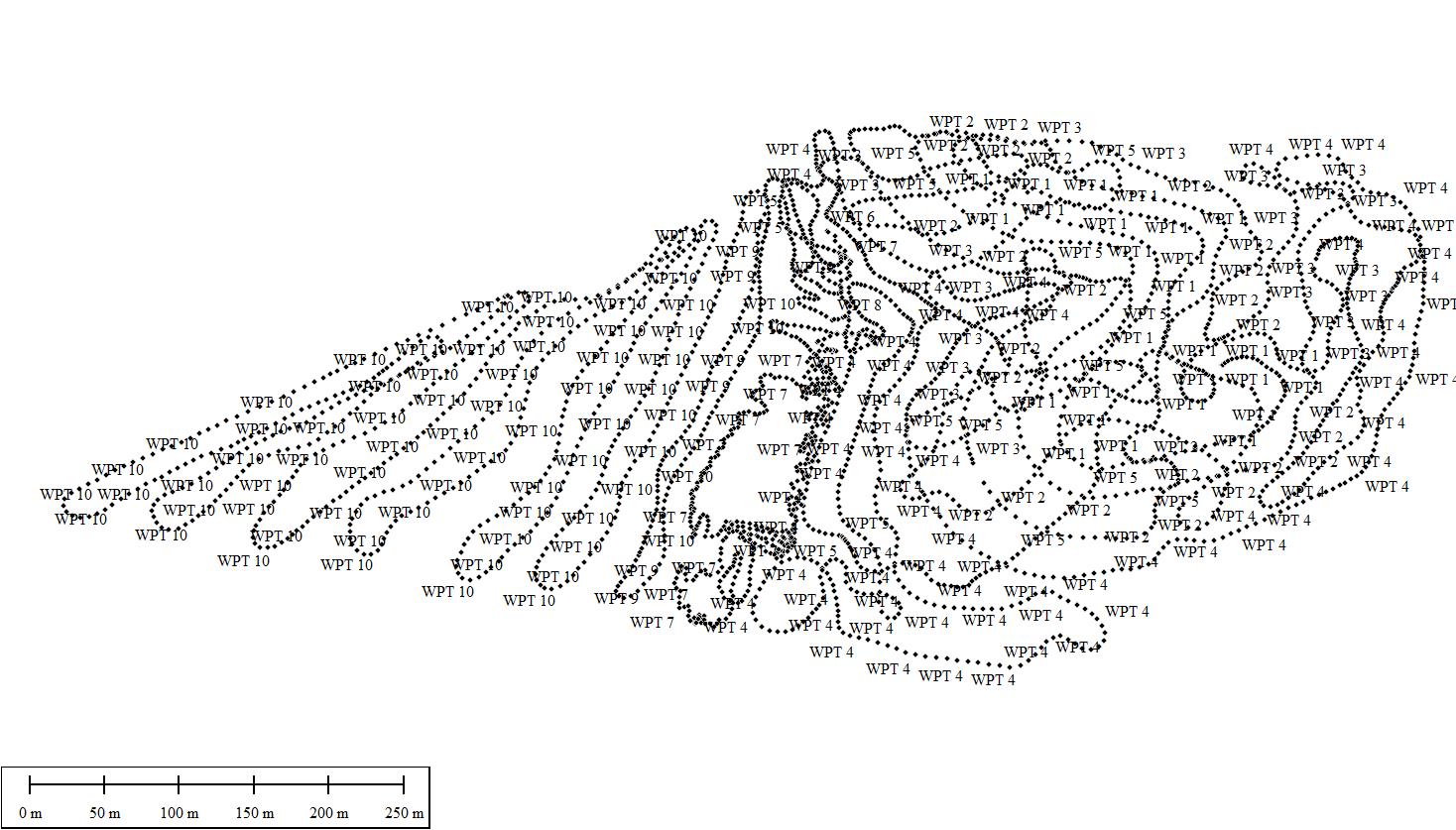
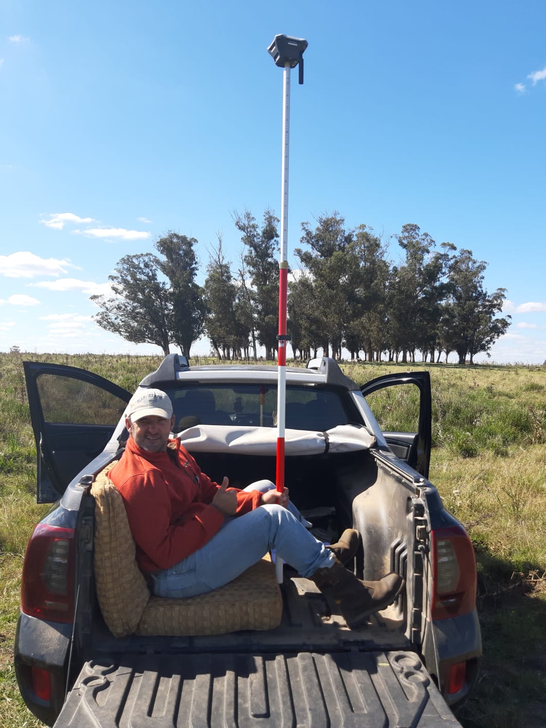
My name is Bruce, I am a regenerative landscape designer ( Green Curves design ) I am currently experimenting with ways to gather survey points over large areas without walking. Our latest experiment was using a vehicle. We set up the base and the rover was mobile at the rear of the vehicle with someone supporting it and we used the timing facility to take points ( one every 3 seconds ). As it was an experiment we did not stick to any specific pattern as we manoeuvred around the land but we did take more points where the terrain was more complex.
The conclusion was that it worked very well and the results were good ( please see images ) To improve this process we need to eliminate the person sat at the back, which in this case was me! I was thinking of some sort of gymbal that could support the device while maintaining a horizontal plane, has anyone had experience of this? I would welcome any comments or remarks or advice on how to improve this process.
Drone it. Tuffwing Emlid M+ PPK. There are a couple of good guides to several of us configuring the kit. 5-6 GCPs and you are set with cm accuracy. Absolute and relative.
Always willing to help if you are interested in learning more. There is some good content on this forum, but if you do proceed I would suggest joining the DroneDeploy forum at…
Nice work! Hard mount on to top of your rig near center of gravity with some sort of damping platform. I’m thinking about the effects of your suspension when in variable terrain. Closest to center of gravity will see least amount of “change”. Measure height to ground. Use app like Mobile Topographer setup with mock location on Android. Use contour generating feature. You could even generate a grid for your driving and upload into mobile topo pro and then just follow the grid if your any good behind the wheel. Then drive like you stole it! (well depends on your update rate)
I will be doing something similar on both a quad and truck but I need to get the antennae up above rider height on quad but makes big old lever arm. What I like about your approach is it is simple to accomplish your needs
Thanks Hunter, Yes we are experimenting with ways to use affordable technology to gain the information we need, creating quality work while keeping prices low for the client. I mostly work in South America where disposable income is low. The process is a bit rustic but he created great results, I need to tidy it up now I know what it can do. Thanks for your advice, I will take your comments on-board.
There’s nothing magical about this. We actually built a single axle for a laser scanner. I later mounted a survey rod to it and it worked fine. No suspension and a static height needs to be over one of the wheels. Preferably harder tires.
It’s not like you should be driving around Mickey Thompson style so the body mounted setup typically stays within about 0.2’. Exactly centered between a four wheels, but I normally only use it in smoother conditions and definitely don’t use any of this near as much since starting the drone program.
Lidar would be a very elegant method, but some of us just want an excuse to shift the truck into 4x4 to survey the terrain
I think that with the result of the device in the picture above, you would be getting an average height for the ground over a 2m+ width. If you went with @michaelL’s idea, you would be getting the point height under that tire.
Stretching that idea further, I can imagine a setup hanging over the side of your truck box with a vertical PVC pipe sleeve that has another pipe inside that slips up and down. At the bottom, it has a bracket that attaches to your wheel with cable ties. Of course there’s a bolt which allows it to rotate as you drive (SLOWLY). And at the top is a cap with Reach RS mounted on it.
I see an hour roaming the aisles of the local hardware store, $50+ spent on a couple of boards, some PVC pipe and fittings and a few screws and threaded rod, and another hour or two putting it together (in the harware store parking lot). If you also purchase a drill/screwgun there for putting it together, please don’t take it back inside the store to return it after you are finished.
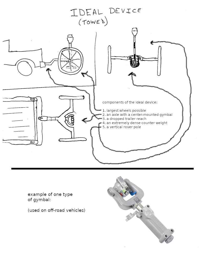
It will hold the wheel on the ground with spring tension. Bigger wheel maybe and of course the rover pole. But going down this road, we are loosing track of the OP’s request for a gymbal.
If the gymballed survey trailer was made so that a long extension could be added to the trailer reach, then one could perform bathymetric surveys in ponds. At least around the edges up to a couple of meters in depth.
Yes, this. Funny I was just chatting with one of our GPS reps yesterday and asking why they couldn’t figure out how to tie in a laser disto system to the GPS receiver so that you never had to worry about rod height again. This would be a pretty good application for that.
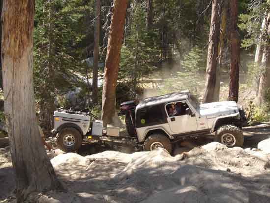
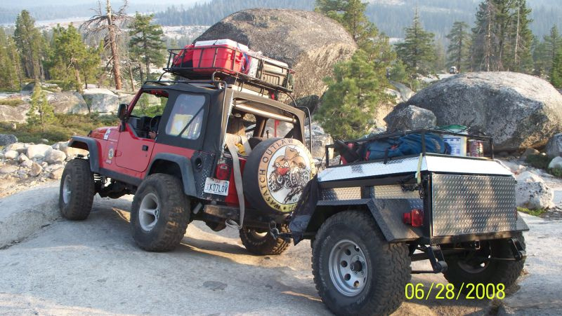
Not me, but this is what we use in my neck of the woods for rock crawling (4x4). You would be surprised what you can pull these through… Mounts your Emlid and keeps your beer cold! Has the fancy trailer mount too!


 Excellent!