I agree with @michaelL on this point
It is pretty easy to figure out what the IP address of the RS2 is and then enter that into a web browser to access RV2’s interface.
So you can have RV3 up in a native app, and access RV2 (config) via the browser.
I flip back and forth as needed.
Works great so far for me.
ReachView 3 4.11 Beta for Android is now available! Make sure to check the full changelog – there some fixes and updates you may not want to miss.
We fixed an issue that could cause random reordering of points when exporting a project as CSV. Such behavior seems to appear while working with data collected before the 4.10 update. Be advised that CSV files created by the previous app version are prone to have points reordered. @aleksey.mikhailov It’d be great if you can test this fix and share results with us.
Now it is possible to edit LoRa configuration in correction input settings.
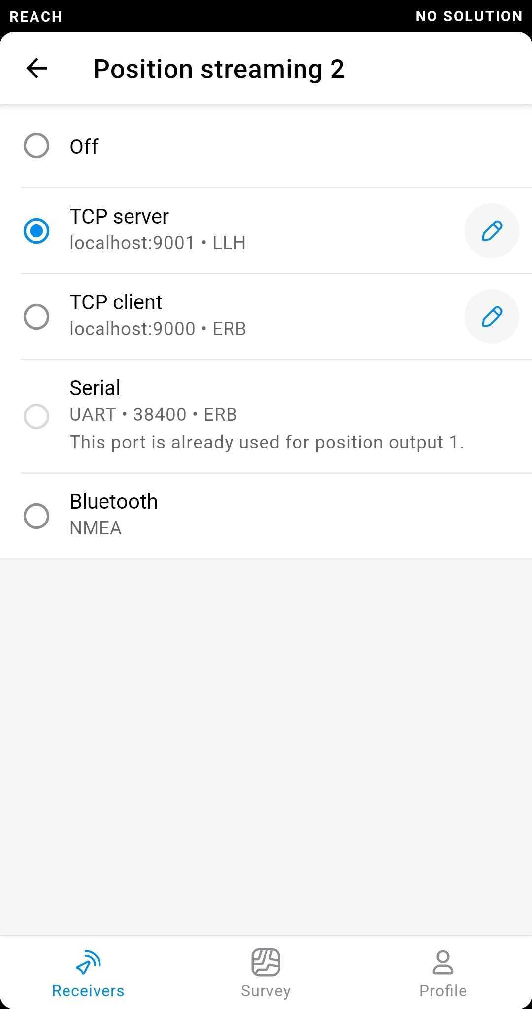
TCP configuration is now editable in position streaming settings.
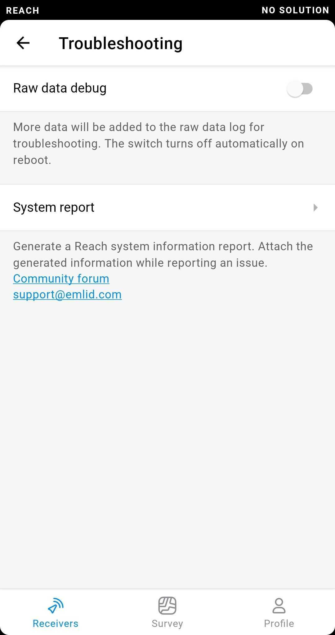
The Troubleshooting and System report sections are now available from the General device settings.
The input field in the antenna wizard become smarter! When you tap on it, all text inside will be highlighted to make it easier to enter a new value.
Now, the map zoom level will remain the same when you select a point from the list.
Hello everyone!
ReachView 3 4.5 Beta for iOS is out for testing! In this release, we bring the following changes:
Now, you can see all points of a project as a list! Access the list by tapping on a button on the bottom left corner of the map or ‘Points’ in the project info view. Overview your work, get primary info on project data, and select points with ease.
Serial configuration is now editable in correction input settings.
Please, note that due to an unstable iOS 14 update, there are some visual issues with the map – horizontal alignment of the points can be off. We are aware of this and will deploy a fix as soon as possible.
1.) how is it possible for you to add the DHHN16 vertical ref. system in Germany when it’s not freely available?
2.) could you also add the official Austrian vertical ref. system, which is publicly available here (here’s also the documentation, which is held in German, but you can get the details from the table I think even without understanding German). In case you need the geoid undulation (for GRS80 and Bessel) too, it’s freely available here.
3.) Wouldn’t it be easier for you to just enable own geoid file import as s csv file, so users can bring in their own geoid files in case those are bound to a commercial license?
The point information screen contains geographic coordinates for every point in a separate section just for this case.
Due to the nature of RTK positioning, those coordinates will actually be in your base’s coordinate system, in this case it’s ETRF2000. ETRF2000 itself is similar to WGS84, but slightly updated and adapted for use in Europe, so it’s probably what you need.
I tried the newest ios RV3 yesterday on my iPad. When I wanted to start a point-averaging, it was very sluggish, seemingly queuing up commands (which makes averaging kind of recursive start/stop proceess with the start/stop button at the same coordinates ) .
On my iPhone, running same version, it just flies!
Hi Christian!
Thank you for your report!
Could you please tell us what iOS version is on your iPad and iPhone? That would make our investigation a lot easier!
Thank you again!
We do not have a date on the official release but are working really hard towards that. However, I do have some good news: the upcoming v2.24.0 stable channel firmware will be supported by ReachView 3. I think this is a great change that will give many more people a chance to try the new app.
We added it temporarily to the beta app for testing purposes. Before the full release we’ll change how we handle proprietary licenced geoids, but right now we needed to make sure that the system works.
2.) could you also add the official Austrian vertical ref. system, which is publicly available here (here’s also the documentation , which is held in German, but you can get the details from the table I think even without understanding German). In case you need the geoid undulation (for GRS80 and Bessel) too, it’s freely available here .
We should have that added in the upcoming release this Tuesday (it might become available slightly later due to the app store review process).
3.) Wouldn’t it be easier for you to just enable own geoid file import as s csv file, so users can bring in their own geoid files in case those are bound to a commercial license?
Even though we might have to do that eventually, the unfortunate answer is that it wouldn’t really be easier. That way we will have to make the app handle erroneus, incomplete or somehow broken grid file. We also won’t be able to make sure we provide accurate results.


 ) .
) .