


I noticed this base coordinate and base line function the other day. This is a massive win for ReachView3!
11 Likes
Hi,
collecting points within a project defined by cs: 25833 ( ETRS89 / UTM zone 33N) and vertical cs: 7837 (DHHN2016) does not work. The measuring button is greyed with the caption “out of cs bounds”.
A project defined with the same cs:25833 and and different vertical cs: 3855(EGM2008) or elipsoidical height works fine.
The vertical cs is already downloaded in the app.
Thanks for the great new app.
Hi. I have some problem with export data after update app.
When I export project data i get
- wrong data.csv sometimes ( a few points names have replaced other random points names )
- my data randomly sorted
I have over 8k points in project and new export make some problem
Hi @grass!
Unfortunately, DHHN2016 doesn’t cover the whole area of Germany for now. Please, check if your area of interest is inside the supported zone, see Egor’s message below:
If your area is inside the bounds and DHHN2016 still doesn’t work, please give us to know.
Thank you!
I’d like to ask for additional info so we can investigate the issue:
- Platform (Android or iOS) you use
- Phone model
- App version
Do export problems occur while exporting large projects (8000+ points) or with smaller ones as well?
Version Android: 10 QKQ1.190910.002
Version MIUI: MIUI Global 11.0.1 (QFGRUXM)
Model phone: Redmi Note 7 (M1901F7G)
Version app: 4.10 Beta
I exported project 7k+ points without problems
before update:
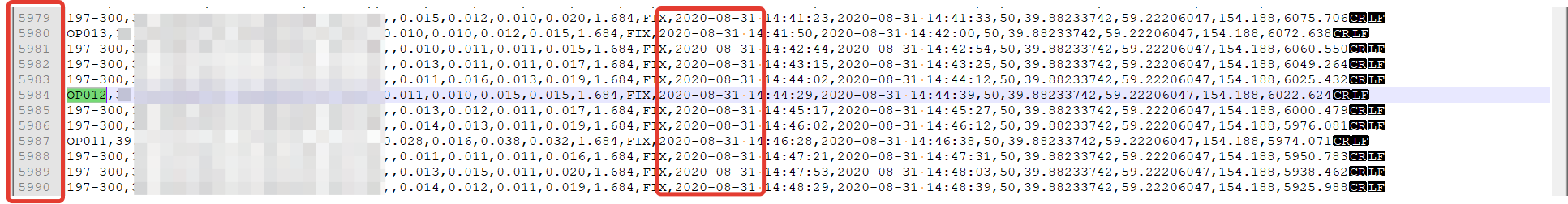
after update:
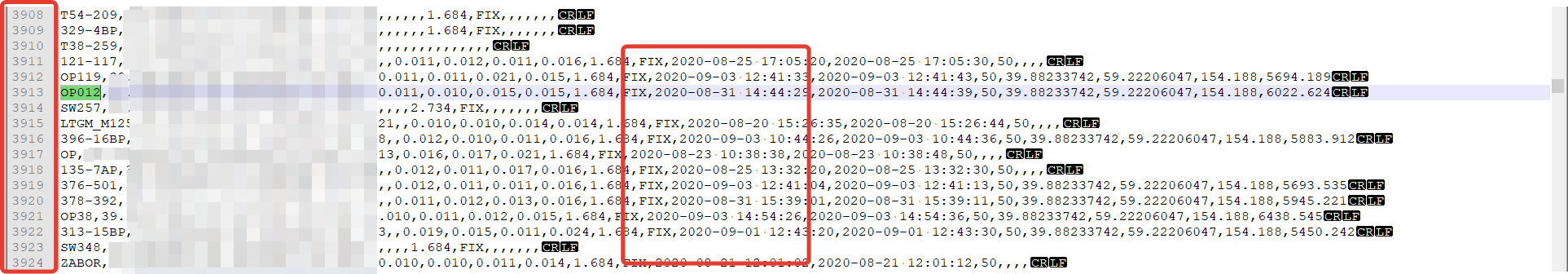
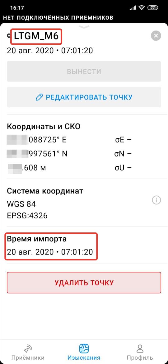
all points we surveyed in this app before 20 august was imported on this date, but we did not import it
Thank you for the info! We’ll investigate the issue.
I wanted to use this feature EPSG 5650 (ETRS 89 / UTM zone 33N (zE-N) )+ EPSG 7837 (DHHN2016 height) . When i want to collect a Point it says “Out of CS bounds” too.
Location is Rostock/Germany. It is defintely inside (It’s the federal system in this area since 2017). Any hints? Did i something wrong?
Beside that, i would be glad if EPSG:5783 (DHHN92 height) would be supportetd too. Thank you.
ReachView 3 version is 4.10 Beta
Android 10
Samsung Galaxy S10
Hi @Nordstern,
You’re right your location is inside the DHHN2016 height area of use, but for the moment we have not the whole Germany covered with DHHN2016 geoid, it works properly only in mentioned bounds:
from 47.225° to 50.6° in latitude, from 7.426° to 13.9° in longitude.
And unfortunately, the coordinates of Rostock (54.116651, 12.129841) are outside the area we currently support. We are working on this issue, so stay tuned for new updates.
We’ll investigate the ability to support EPSG:5783 (DHHN92 height), thank you for your feedback!
1 Like
So i know where i am and i have to be patient. Thank you.
3 Likes
Hi,
Any news about when will Reachview 3 be available for Stable release of Reachview 2.22 and not the Dev versions? I understand that it is still Beta.
First of all, thanks for all the continous improvements on Reach View 3 beta.
As civil engineer in Switzerland, i miss a crucial feature cocerning the vertical datum.
As stated by the Federal Office of Topography the vertical Datum LN02 (EPSG:5728) is still the official height reference datum. Reach view supports only the newer not yet officially standardised successor LHN95 (EPSG:5729). That means the height has to be “reprojected” for each and every output file before importing in GIS- or CAD-Software. It would be very nice if reach view would support the old but still in place vertical height of LN02.
Example: Using CH1903+ / LV95 (EPSG:2056) as the coordinate system and “ellipsoidal height” as vertical datum, i get an offset of around 50 m in height.
Following the link to some transformation calculation formulas of Switzerland: https://www.swisstopo.admin.ch/content/swisstopo-internet/en/online/calculation-services/_jcr_content/contentPar/tabs/items/documents_publicatio/tabPar/downloadlist/downloadItems/19_1467104393233.download/ch1903wgs84_e.pdf
6 Likes
Hi everyone
Your are taking about something very interesting and is more or less my same question.
I am using rs+ stand alone connected via NTRIP.
Starting using ReachView 3 I noticed a warning when selecting the coordinate system.
Essentially you have to use the same which the NTRIP provides you.
So here my question.
Here in Italy we have ETRF2000 epsg :6706 and the NTRIP provider transmits that kind of corrections.
What happen if I need to have coordinates WGS84 straight out from ReachView ?
Which error can I have?
Grazie
Hi @Doppler_Uav!
To provide you with the best experience while using ReachView 3, we rely on the receivers’ latest features and updates. Unfortunately, it’s improbable that ReachView 3 Beta will support firmware versions 2.22.x.
We’ll be experimenting with the upcoming stable releases. Please, stay tuned – we’ll always notify about changes in supported firmware versions.
3 Likes
I´ll be waiting. I have a RS2 and would like to use Reachview 3 because it has cool features, but as for now, it´s only compatible with Dev verions, and I understand that Dev versions are only for testing purposes and not for real jobs.
I want to buy another RS2 but will wait Reachview 3 to be compatible with Stable Firmware releases, I hope it’s soon!
Thanks!
1 Like
@Doppler_Uav - I accidentally downflashed to 1.22.7 stable from 1.23.6 dev (using manual method).
It wiped all of my data and settings, but didn’t seem to noticeably affect operation.
Then I flashed to 1.23.9 dev.
It seems to be working fine (I’m using it with RV3 iOS and I like the experience much better than RV2)
I haven’t tested all features yet, so I don’t know if anything is broken, but so far I’m glad I updated.
4 Likes
I flashed both my RS2 units to Dev 23.9 . I can not get RV3 to work properly in iOs or Android. Only a few settings are available. RV2 works fine. I have noticed that the mobile data switch is showing off even though connectivity is present so that must be a bug. I have a Huawei M5 running Android 8. I also have a Google Pixel 2 XL running Android 10 and RV3 Will not function on it either.
Have you used RV3 before? All it does right now is connects to the receiver and surveys. The cool functions are in surveying. All receiver configuration is still done in RV2.
2 Likes
today was the first time I have tried RV3, Thanks for letting me know on the functionality. I was a little late to the party 
At first it’s a little akward and I am sure the plan is to flesh it out, but it actually works out because you never have to get out of the survey and can just swap to RV2 when needed. I been using FieldGenius most of the time anyway. Once RV3 comes a little further maybe I won’t have to. One function  .
.