


Hello Guys!!!
Good news for professional surveyor who do a lot of Survey using Local Grid Control.
Today, I perform some experiment using my Reach M+ and an android software ( 3rd party software)
My Reach M+ perform well using the said software. I can perform Point Stakeout, Line Stake-out, Topo Survey and LOCALIZATION which is exactly lacking in REACHVIEW APP. Those who would like to do survey using Local Grid Control. This software is a Must for you. The software is very straight forward and almost perform like a Field Genius FG9. I believe emlid team will not waste their efforts and time on incorporating a CRS method and localization in their Reachview. I still suggest to emlid team to add it on reachview app.
4 Likes
?
Welll…… what is it?
the software is develop by tersus for their GNSS receiver OScar and DAVID but it is compatible also in Emlid Reach M+/RS+ as lo
ng as you can stream nmea messages.
4 Likes
Exactly!! It is Must software for surveyors doing localization.
2 Likes
I think @agrimgalina came across this here:
thanks guys!
1 Like
Do not forget that EMLID has provided us with the most important hardware at an affordable price, applications are a plus so a big thanks to the team !
6 Likes
Software is expensive and time consuming to develop and maintain. Not sure who was the survey influencer, but it doesn’t seem like there was an end-to-end workflow created or some of the feature requests over the last 6-months would have been parts of the original release. Nonetheless, progress is the name of the game and they should be commended for that.
3 Likes
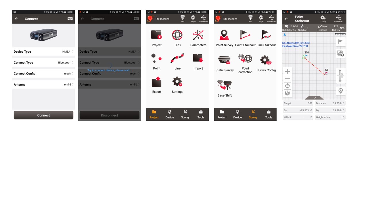
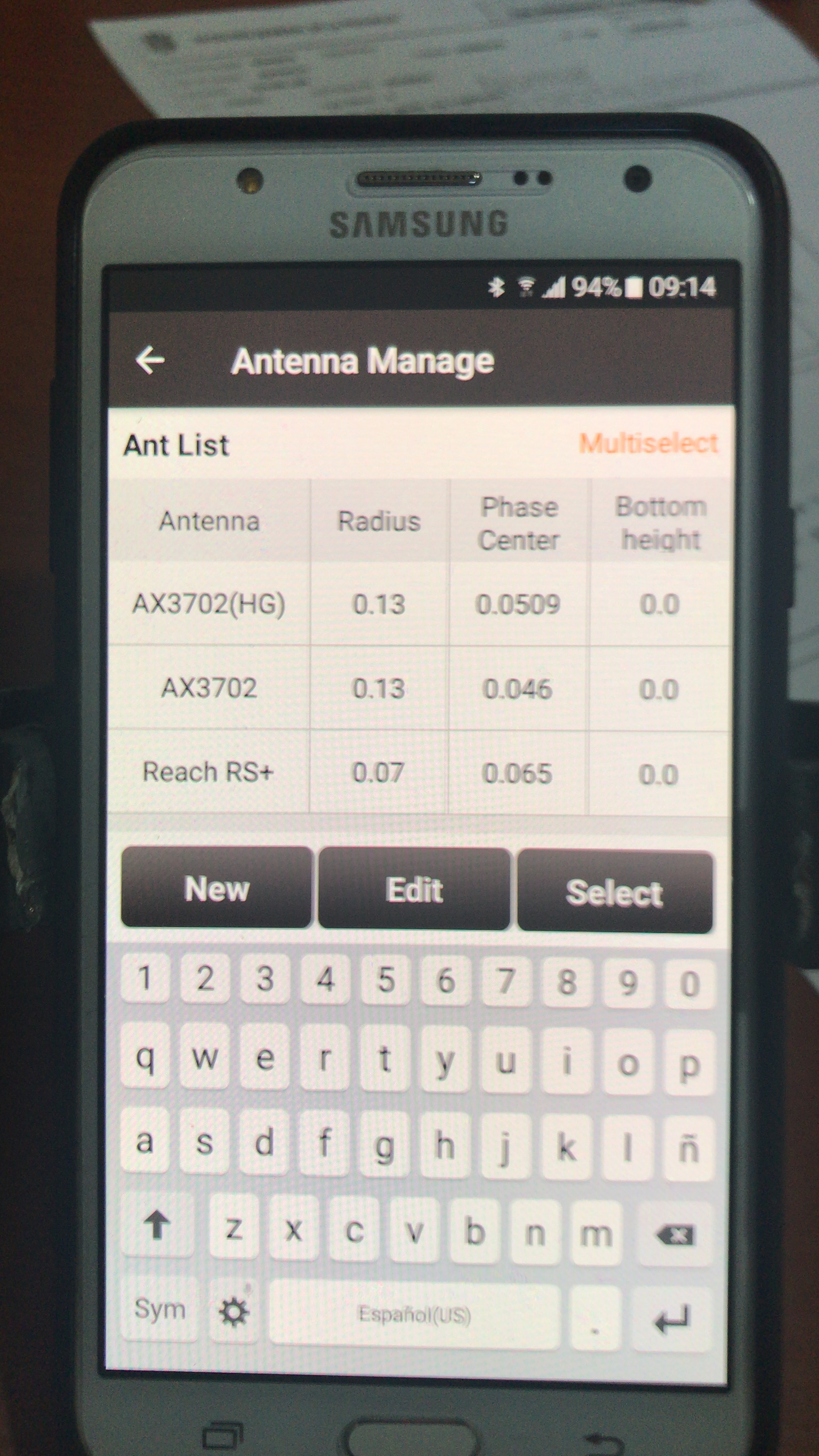
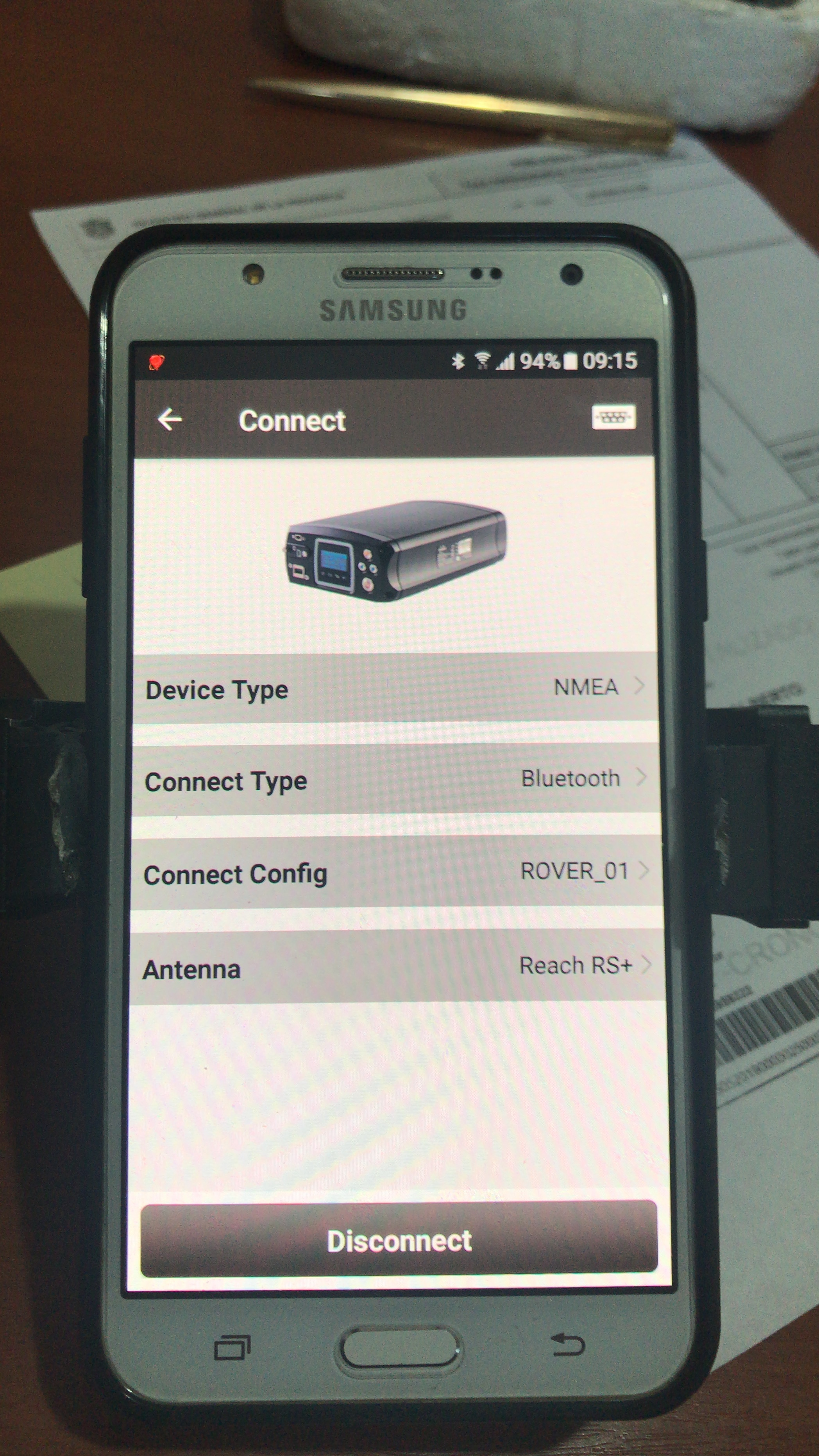
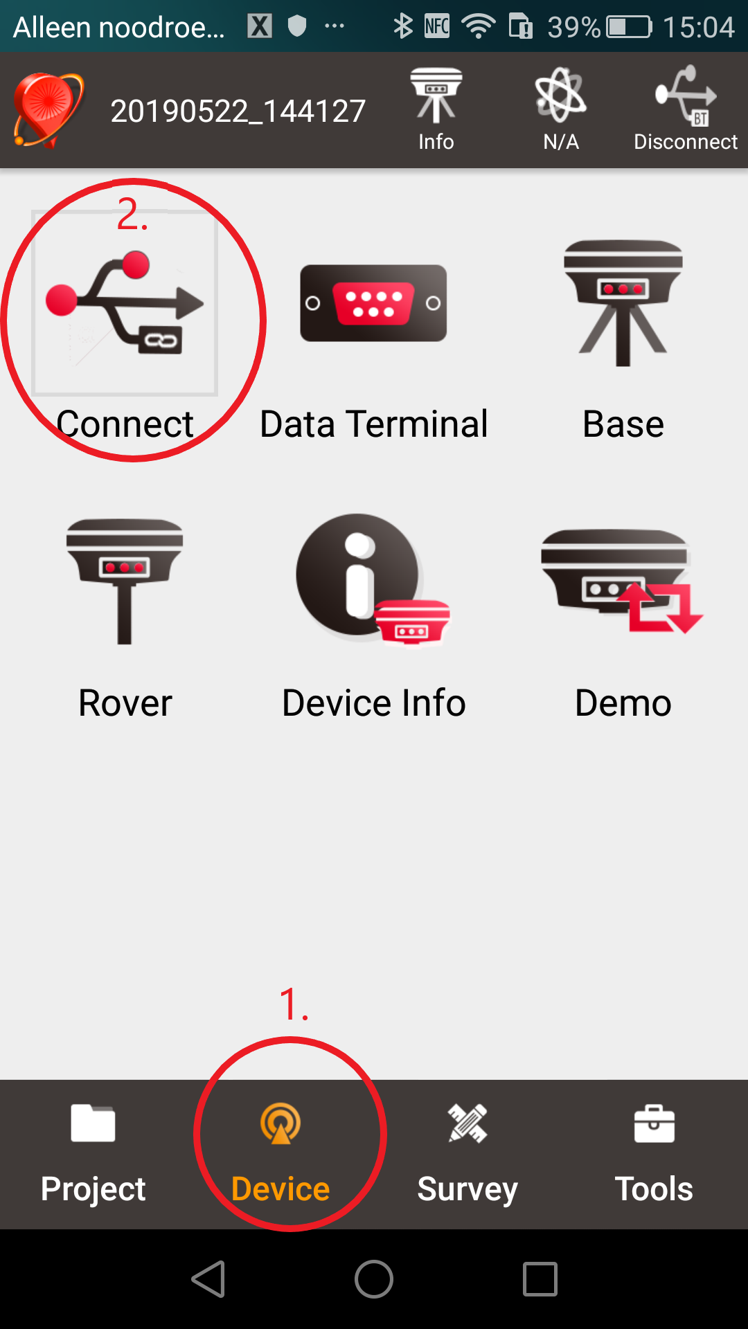
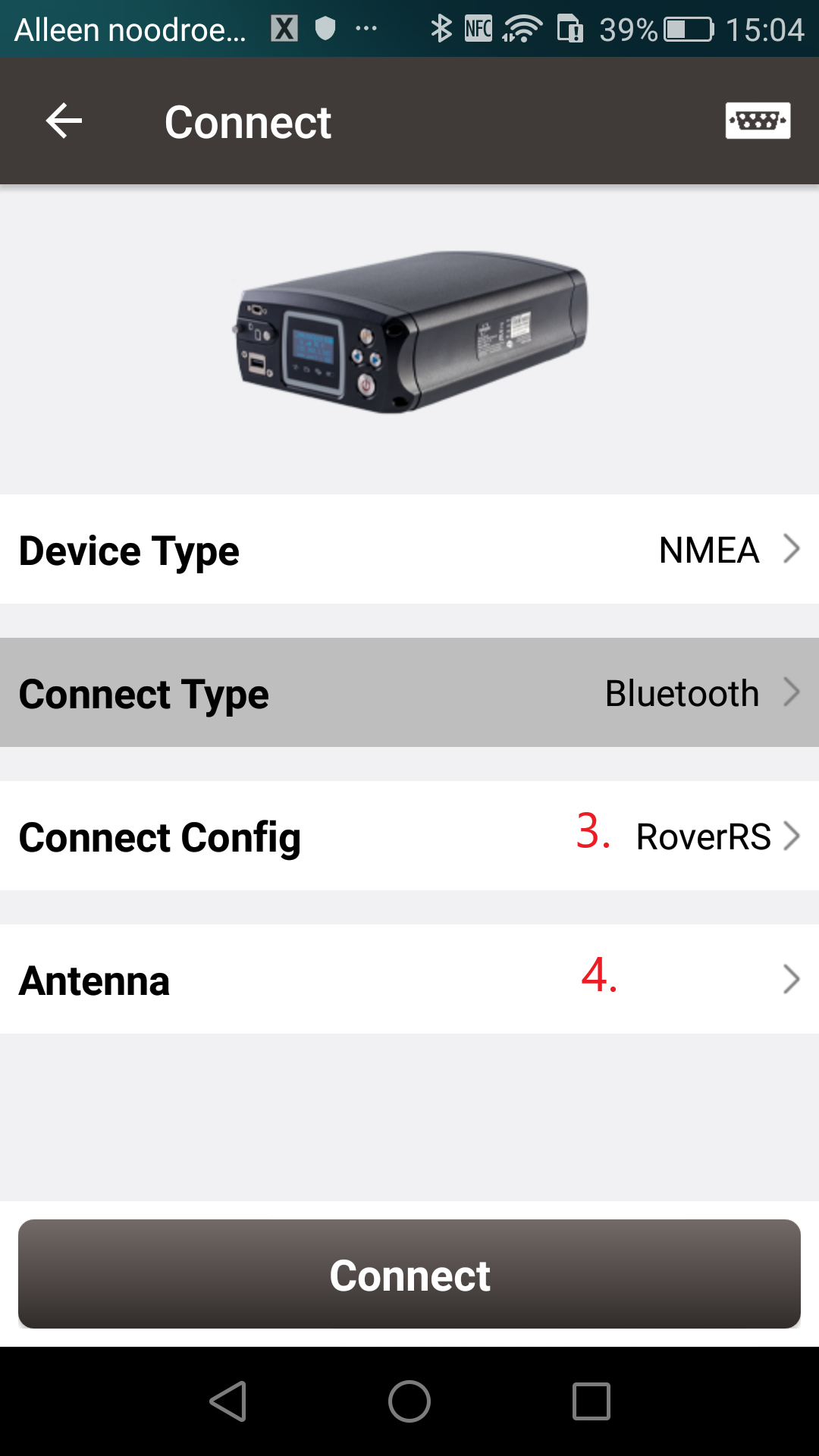
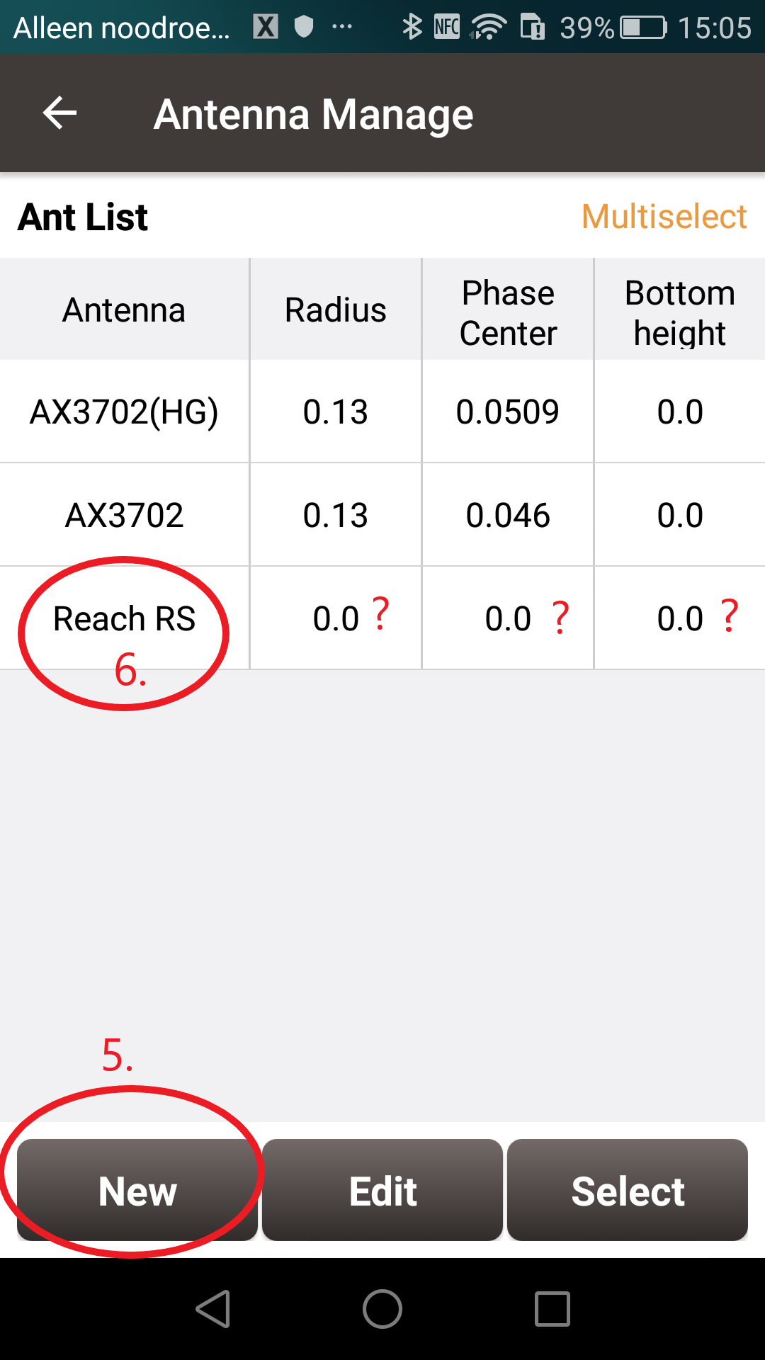
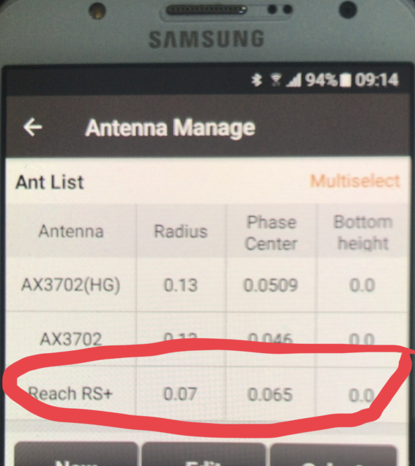
Hello! How to add an antenna? I can not connect to bluetooth android and reach
You should connect Reach and your mobile device via bluetooth and follow the steps shown in the pictures. Step 1, 2 and 3 are about connecting your mobile device with Reach. Step 4, 5, 6 are about adding an antenna, but you can also edit and rename one of the existing antenna’s. According to @agrimgalina post above the settings for “Radius”, “Phase Center” and “Bottom height” for Reach RS/RS+ should be: Radius 0.07, Phase Center 0.065, Bottom Height 0.00.
1 Like
Like it! Doing similar in FieldGenius, but much more survey scope. I’d like to try some of these apps, but I think they are a light for what we are doing.
2 Likes
NEW -add parameters
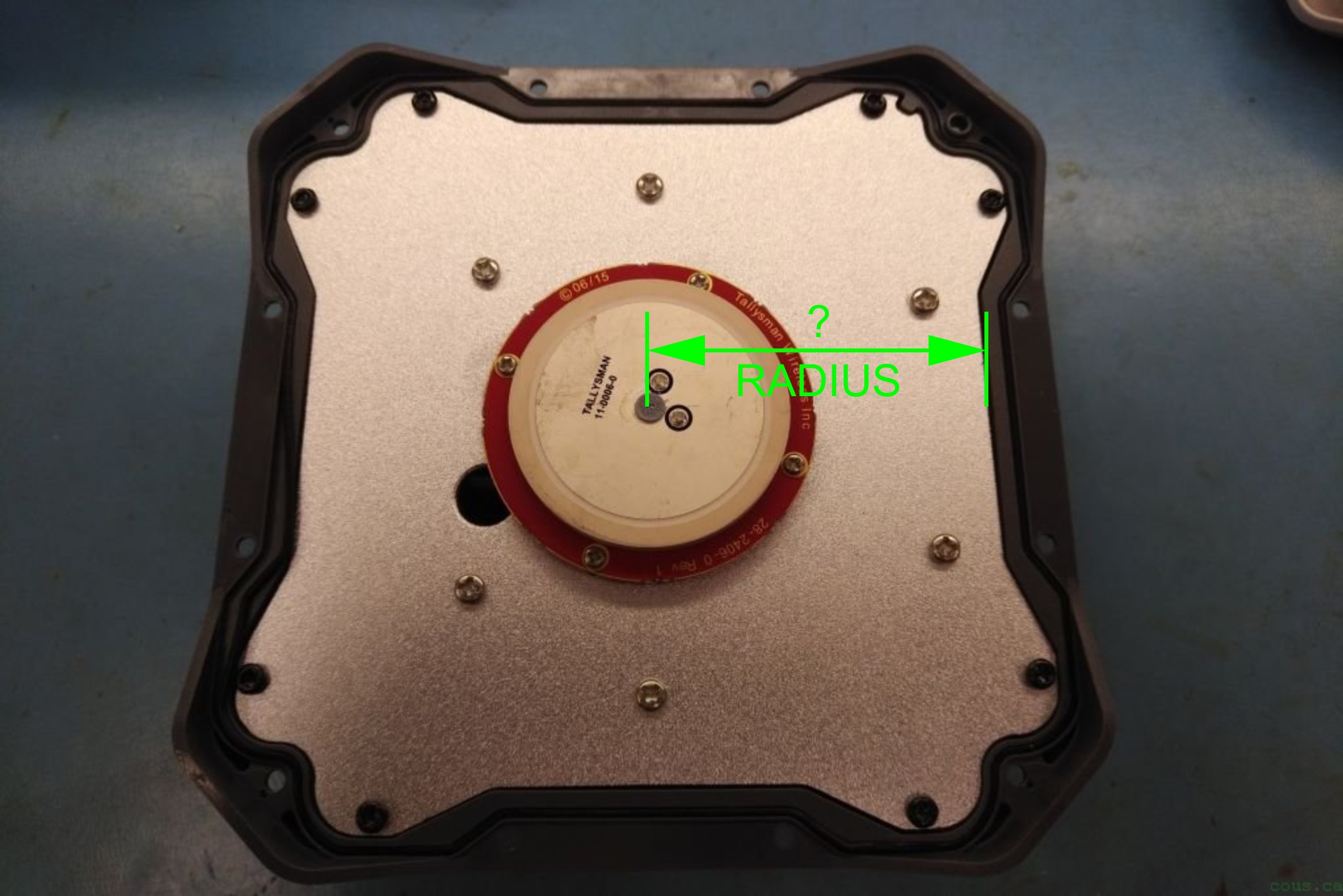
Just to make sure, can EMLID please confirm the ANTENNA RADIUS is in fact 0.07m or 70mm for the Reach RS/RS+?
Thank you!
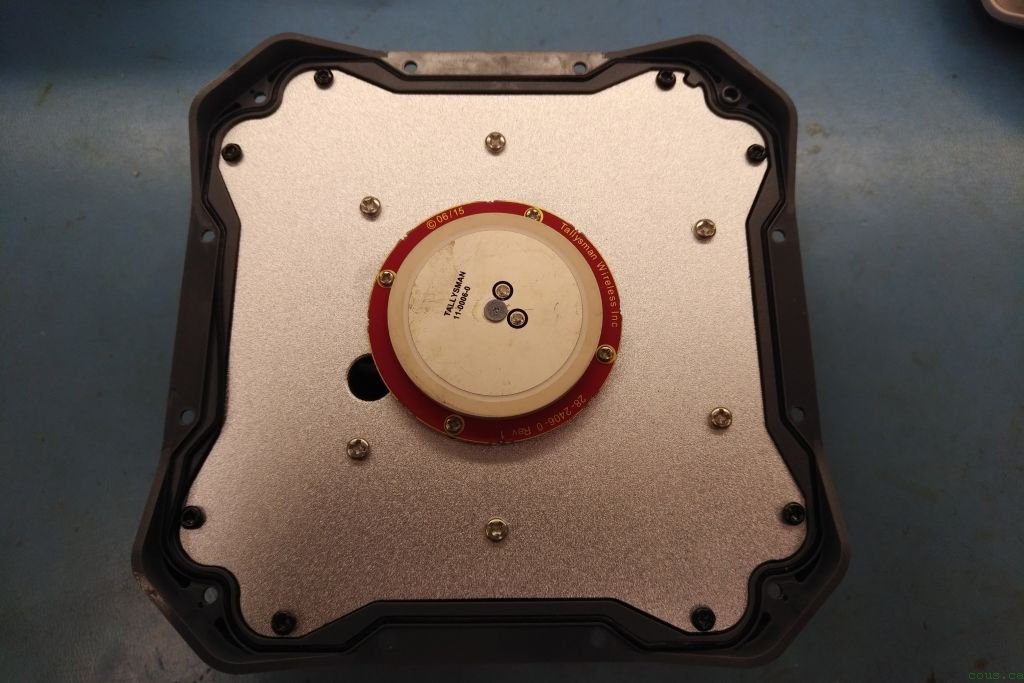
Inside Reach RS it’s Tallysman tw2406 => TW2406 Embedded Single Band GNSS Antenna | Tallysman
Size of ground plane here need to be know :
4 Likes
Reach M+ ground plane min. specs etc. (70mm x 70mm min.)
Example shows 100mm x 100mm.
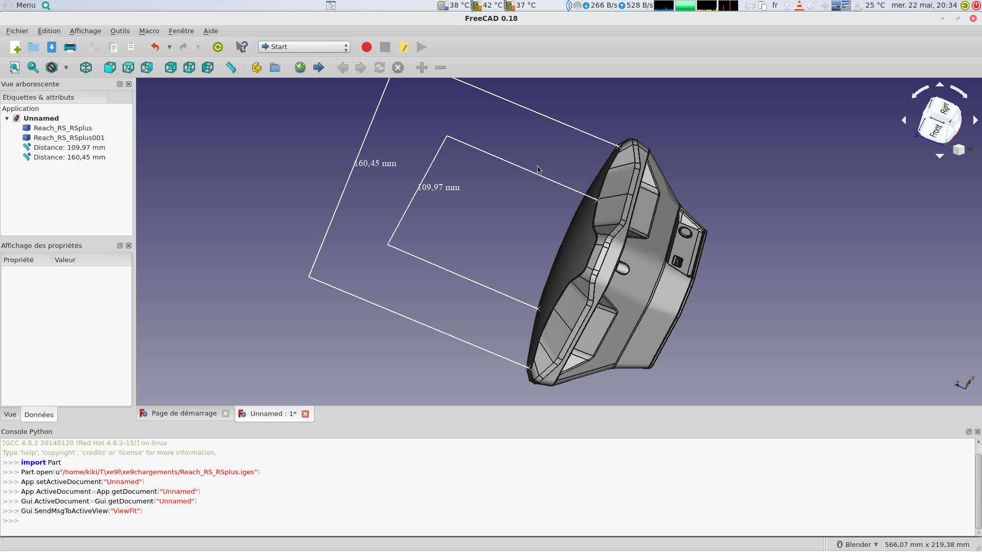
Seems to me it should be whatever this physically measured distance is? Emlid would know versus guessing.
1 Like
2 Likes