


Every geodetic survey begins with the selection of a coordinate system (CS). There are numerous CS options available, even within a single country:
In this series of tips, we will try to explain what a coordinate system is, its components, why there are so many CSs, and how to choose and set the appropriate one for your project.
In fact, it all comes down to the shape of the Earth, which is difficult to describe, and today we’re going to take a closer look at this problem.
The Earth’s shape
The Earth’s shape is complex, and there are no exact mathematical figures to describe its shape. The only way to do this is to use approximations—figures that roughly describe the Earth’s surface.
Ellipsoid
One of the most approximate figures to describe the Earth’s shape is an ellipsoid. The problem is that it does not replicate the Earth’s surface—the global ellipsoid is in most places much lower or higher than the actual surface of the Earth.
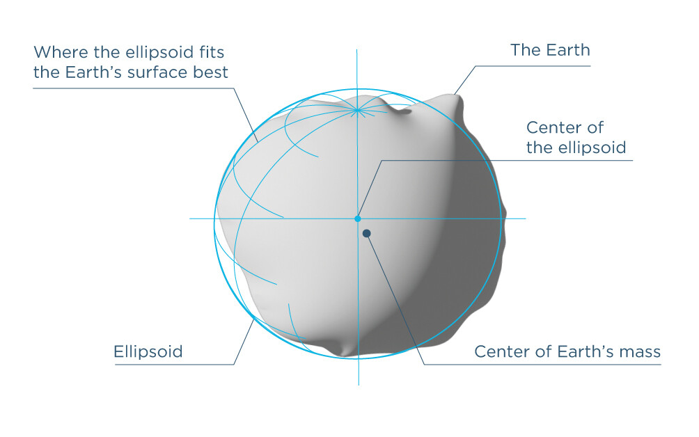
To try to solve this problem, there are reference ellipsoids that are designed specifically for particular areas—they are tied as close as possible to these areas.
However, such ellipsoids do not solve the problem of altitude representation. They provide only ellipsoidal height that approximates the Earth’s surface. But there are still mountains and hollows on the Earth, and the ellipsoid’s form is too perfect to describe the real picture.
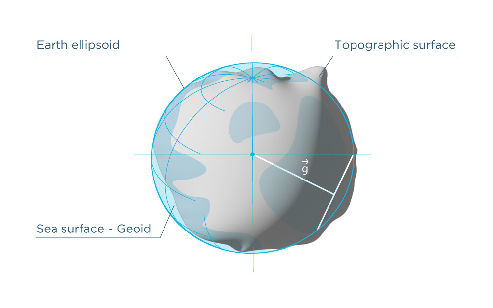
Geoid
To solve the altitude measurement problem, the mathematical figure known as the geoid was introduced. This figure replicates the shape of the Earth more precisely and is based on mean sea level. Mean sea level is the average level of the sea from which the heights are measured. It is not the same everywhere on the Earth. That’s why there are also many geoid models. The height above the geoid is known as an orthometric one.
Both ellipsoid and geoid models are used as a part of a datum, which is one of the components of a CS.
In the next tip, we will try to explain what a datum is and what kind of datums are used in CSs.
If you have some difficulties with selecting the right CS for your survey project, you can always contact us at support@emlid.com. We’ll be happy to help you out.