New video out on how to compute VRS from stations up 1000km away with GNSS solution
Special thanks to @r.pazus for tips and info about rapid static computation and great knowledg about processing with long baseline and processing in general.
To compute vrs from long baseline is excellent in areas with poor access to VRS service or baseline longer for PPK to handle.
With base and rover out in the field, you dont need known point or live RTK feed in any way.
Start your base and log raw data from average position. Your rover can work RTK from base or just log raw data. Keep a minimum of 15min raw data on base for rapid static to work, rover can have less and work as PPK instead.
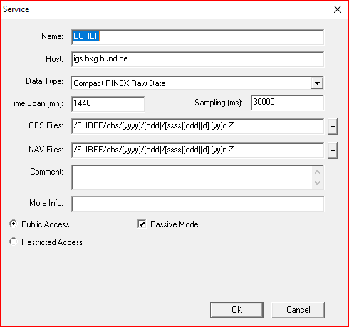
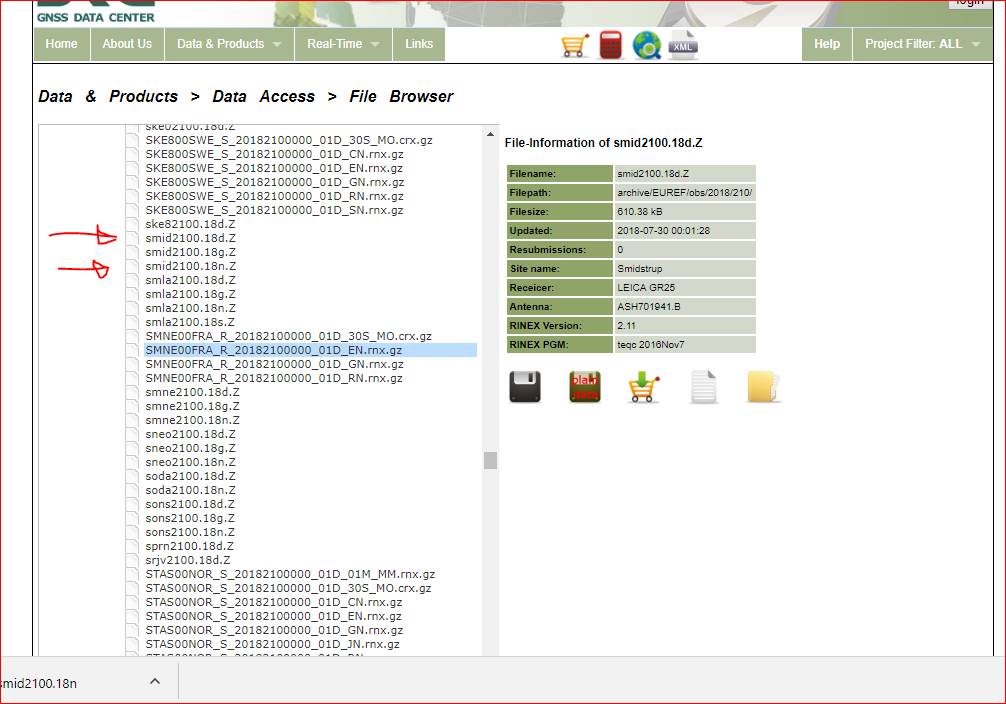
When done. Download obs and nav data from gnss service, e.g https://igs.bkg.bund.de/
Then process raw basedata, compute VRS and generate absolute coordinates for base and rover.
Accuracy is sub cm, but depend on distance from baseline lenght.
From my example i generate VRS 7,2m away from base with baseline refrence 140-480km and an offset from known point about 5,2cm. Can`t do that with PPP and L1!!
Its an old software but still kick some serious coordinates
EDIT: After watching the video i noticed now i filled in the delta height in the wrong colum in RTKconv.
This would throw my offset of with 65mm… well well. Not going to make a new video for that
Edit: I updated this with a video describing rapid static
Nah, im not getting fix with baseline above 300km from this survey ( To short time) .Two out of three stations drops out of the average in PPK. VRS is way more accurate in this case i would say
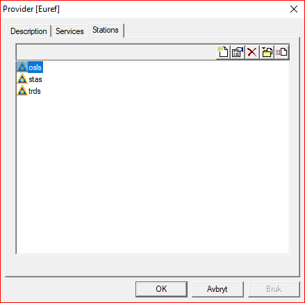
Got the download function to work. Had the stations letters uppercase and changed them to uncapitalized.
Its now working to download from gnss solution
These daily observations is produced after a day or so. So high rate is really not necessary, unless your are in a hurry?
Where are you located? country is close enough
With RTKPost I have seen that sometimes 30 sec sampling rate screwed with the fix. Reverting to multiple 1 hz 30 min files did the trick (but have also seen the opposite)…
I’m in Denmark, so generally have good conditions for VRS, as I would be inside a CORS triangle.
Using the automatic downloader, how did you fix the iono error ? Did you setup these as well ?
I get stuck here, as it tries to connect to some non-responding server in Switzerland.
I can’t see any reference to that server in both of the service setups (ref and emph).
Yep, those two, i.e.
Didn’t download manually. I set up the software to automatically grab the 18d and 18n, which works, but then iono-thing start going on.
Can you reproduce if you do automatic download?