Do you have the raw .UBX file from reach?
I need to add the stations first, but can give it a try
Yep, have sent you a PM with a link.
I updated the first post with a youtube describing rapid static wtih 15min and ordinary long observation.
My I have a copy of your UBX files please for testing my GNSS solutions - GNSS solutions fails at ‘process all baselines’ with an error ?? (I’m using some base UBX files I found on here).
How do you verify with NRCAN PPP please.
Dave.
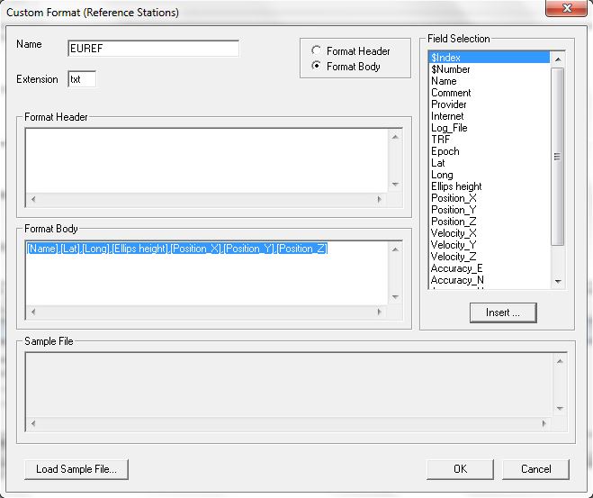
If you add this [Name],[Lat],[Long],[Ellips height],[Position_X],[Position_Y],[Position_Z] under import stations from files and add all the EUREF stations from my list https://drive.google.com/file/d/17SKy1HZ0mIHWXwr_WW0MP0Yigd-pMUy7/view?usp=sharing it all works automatically.
Dave.
I dont think its the .ubx file causing your error.
What kind of error do you get?
Thanks Tore ?, That worked perfectly the of UBX files must have been duff in some way.
Just have to figure out what file (obs?) to send to NRCAN PPP to verify !
Dave.
NRCAN PPP Will give you much larger rms and absolute position deviation using L1 only.
You are much better off with vrs or even just RTKpost.
Use the computed vrs point and convert it to rinex. Send this L1/L2 observation to nrcan
Edit: The bvrs files from my example is generated from 4.5 hours of observation and with l1/l2 this should produce fairly accurate coordinates to compare with the one on software.
15minutes of L1 observation to nrcan is no good 
Land Survey Overview3.pdf (186.6 KB)
Another daft question, where do I find the VRS file? - which on do I convert .
Gnss creates a folder called “my project” in a subfolder of your C:/ drive. Then look for your project that you named something. Inside this folder you probably find a file named BVRS or something. This file is open with Rinex converter you download from the same place as GNSS solution
Many thanks, I recalled seeing it within the download section but didn’t put two and two together, I was trying with RTKCONV 
I think lots of other people would find all this information very helpful too. Thanks guys !
Dave.
I’ve just found an issue with RTKCONV. When you do a conversion for the second time using exactly the same settings the converted files come out a lot smaller.
Update, What I have found is with a second and subsequent conversions the .obs file only has a header with no data
I have also seen that issue multiple times. So, you’re not alone.
In general, RTKlib apps are barebone apps. They do the job, but not much more, and not with a nice workflow.
Thanks wizprod that’s reassuring. It appears to a problem when using a time Interval, untick it or make it zero and it works ok.
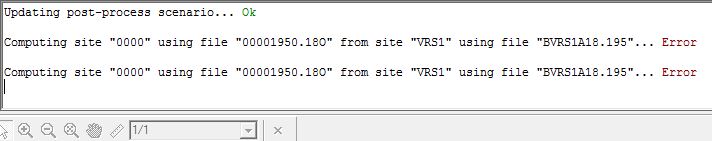
Hi, I’m trying this method, but I have 2 coordinate result sith different control point. And I try to put the coordinate, but not in the right place. Would you kind to help me to find the right result? This is my files.
It seems your point is to far off to get minimum 3 refrence station in the VRS computation. Do you know of a station that could be added to this setup?

Tore,
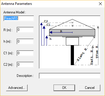
What values, if any should I enter here.