This is indeed one of the most frequently asked questions. And when it comes to choosing, you should know that it’s all about how you get corrections—from your own base or NTRIP service. If so, is there a big difference?
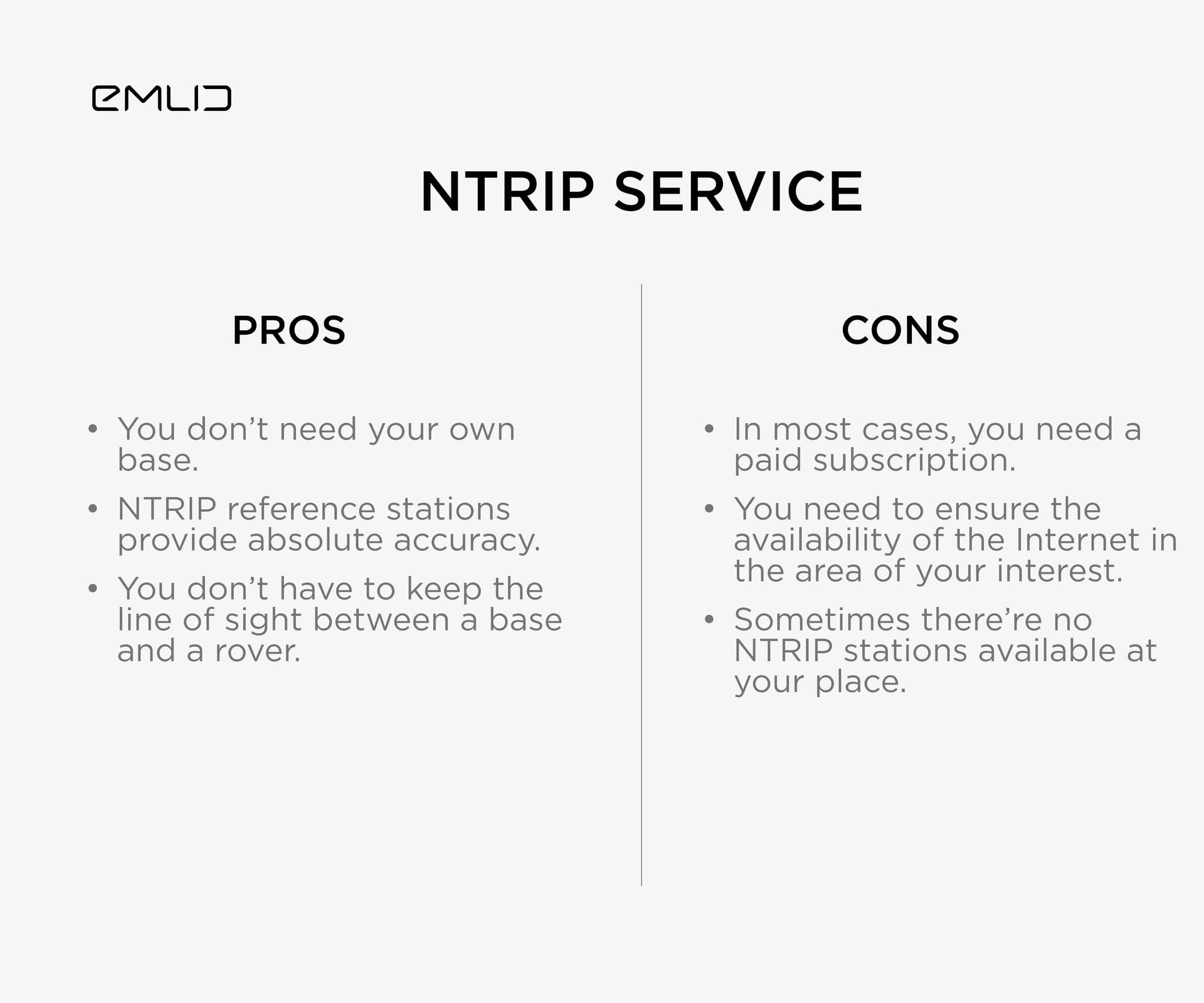
Let’s begin with an NTRIP service. By the way, if you forgot what’s the difference between an NTRIP service and an NTRIP caster, check our blog post. First of all, it’s just an alternative setup that doesn’t add any additional accuracy. Below are the pros and cons:
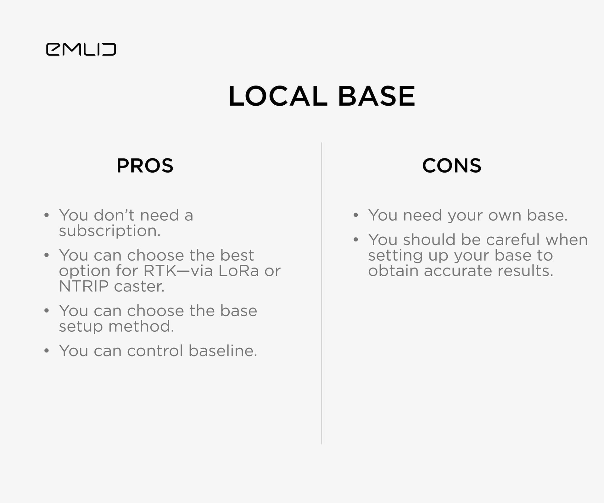
So, now it’s your turn to weigh up all the pros and cons and make your choice. Check the guides that can be of help when setting up RTK—Working with NTRIP service and Base and rover setup. Don’t forget to share with us your findings and best practices!
P.S. If you missed it, here is the previous post that explains how to obtain projected coordinates using the corrected CSV from Emlid Studio.
Good writeup on the Pros & Cons of each method. Though I would like to add one other possible item in the Con section for the base setup. Setup time and the fear of having the base grow legs and walk off when unattended. When they start stealing the security cameras watching the jobsite, you know your’re in for some problems!
There is so much good information here. I’m really new to this and everyone is so helpful.
My problem is every solution seems to have at least one problem.
I feel like my main issue is getting a position that is already known for the base. Many job sites I go to will not have a known point. The CORS network in Nebraska is not public. Many of them don’t even record data to pull for PPK.
The other option is NTRIP and everything I find tells me it’s like $2k - 3k per year. That is not much to some but for someone getting started it’s a lot.
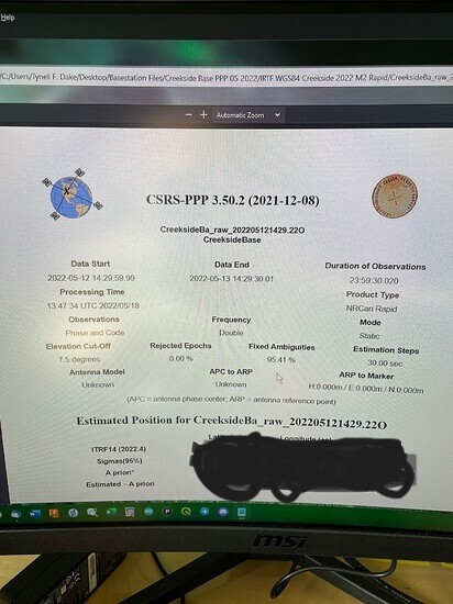
I could always get a base and set it up and bake it for 90 min but that’s a lot of time on every job. I assume if I do that once I can use that same point as a known point later buts it’s still long.
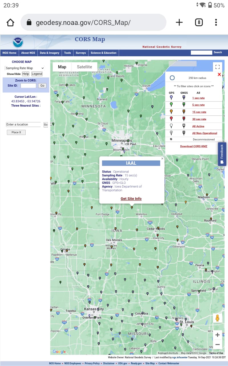
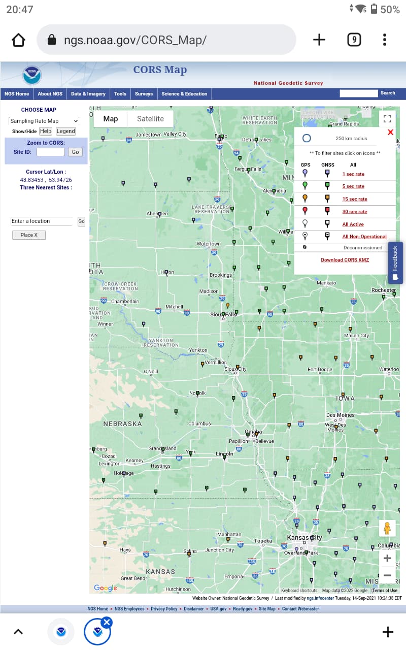
I think my only option right now is all PPK. Use my rover to get all my GCP’s and pull the base info from the one CORS site I can reach in Iowa. It is only 15miles away. They look to record and log all the time.
I am now seeing what you are talking about. The NGS cors stations in your state are no longer public (they used to be) for FTP download so If you are working in eastern Nebraska, you would need to get data from iowa. I don’t know why you can’t just establish a point by setting your mobile base up for at least a 60 minute log while you are roving with your rover. I am not sure that you would need 90 minutes depending on your accuracy requirements . Then you can do static processing off the cors with your base and finally process your base off your rover. Depending on your accuracy requirements, you could literally just be out there with your rover logging taking longer observations and Post process off of download of cors data.
What a discussion, guys! Happy to see this one resonated with your experience.
Everything sounded so easy until I read this step Thank you for sharing the step-by-step workflow, super helpful!
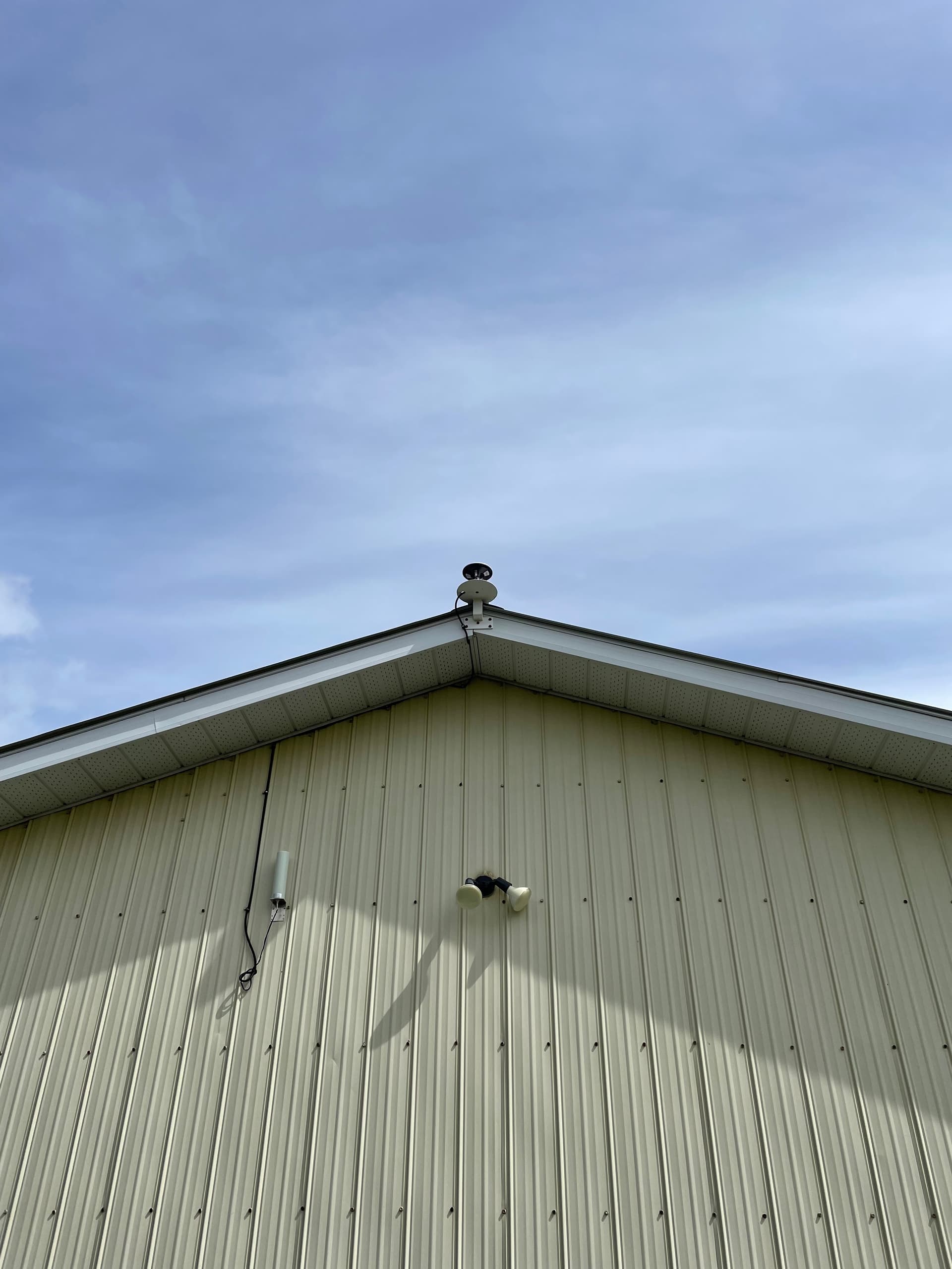
You’re right, time costs money too. And your thoughts about the fear are also fair. Maybe it’s worth placing the base somewhere high, as @PotatoFarmer did.
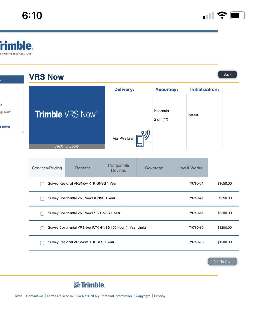
That’s a good recommendation. I believe Trimble vrs now will do a three month but I believe it’s close to $900 and I cannot seem to find it. I would just do the hundred hour bank at 1200 bucks.
Yeah. I was wondering if you could get it from Cors. They (The majority of the Nebraska stations) are technically owned by Trimble now and part of the VRS now network. Surely they have an agreement where NGS can receive base files via user friendly CORS, right?Testing now.
Just go to the sites I mentioned. Most NGS CORS stations are either local or state government agency owned and maintained. The majority of the CORS use Trimble receivers as apparently they will give a substantial discount in leasing or ownership of the equipment. All of our state RTN and CORS are maintained by the SC Geodetic Survey and are exclusively Trimble receivers (mostly NET 10’s).
Very few CORS are privately owned or operated. NGS has a strict set of specifications for mounts and receiver types they prefer. Also, they require the data to be available 24/7 with backup servers and also strict IT standards.
If the data is not available for any station, it’s usually due to equipment, IT or software issues. I like using the UFCORS website as you can also view the station raw data logs and see if there are any issues with the data. Usually, if there are PP issues with OPUS, the station logs are the first thing I look at. 9 times out of 10, it’s usually bad station data for whatever reason. Most of the time waiting 24hrs or picking another CORS will fix any OPUS related issues.
That will work for him in Iowa but again, the Nebraska stations haven’t been available since the end of February. These base stations used to be owned and operated by Seiler instruments but I have now moved under Trimble’s VRS now service And the logging seems to have been suspended or disabled for public use.
Boy that’s weird … first time I’ve seen this. I would contact NGS directly and ask about this. If they have it in their CORS network system, the data should be there unless there’s some issue with the data storage. I’ve seen one or two of our states’ RTN CORS down for a day or two. Usually you can use their ftp sites to get the missing data after the problem is fixed.
HI everyone,
Im a newbie to using my Emlid Reach 2 rover and base for setting ground control points for drone mapping and other GIS-related data collection. I want to have great accuracy in my point collection, and I get confused between all the different options. From this thread, it sounds like using an NTRIP service doesnt provide more accuracy, just a different way to collect points without a base. It also sounds like I can use CORS data to correct the point coordinates collected in the field using a base and rover to gain greater accuracy. Is the third option to just let the base sit for around an hour to gain enough corrections from the satellites? I appreciate any “laymans terms” insights y’all can give for the best way to collect accurate data out in farm fields miles away from cities.
You got it right: NTRIP service indeed doesn’t provide better accuracy. But it always provides absolute accuracy, so you don’t need to think about establishing a known point on a site.
In a few words, absolute accuracy means that all your points have actual global coordinates relative to the Earth’s surface. If you want dipper understanding, we have an article in docs. As you work with GCPs, I assume you need absolute accuracy.
There are a lot of different scenarios for your case. But since you already have your own base and rover, I’d suggest the following workflow:
Connect the base to CORS, and average its position in a Fix. This way, you’ll have your own known point on a site. From this step, you won’t need CORS anymore to obtain absolute accuracy
Just work in RTK with Reach RS2 base and rover
If you share some additional details, maybe I’ll suggest something else