Visible Float & Fix solution status, elevation & antenna height, collection time & Moving the Base.
Following on from your much-appreciated responses to my previous topic:
Single, Float or Fix Solution Status
Q. Is the “Single, Float or Fix “Solution Status visible in ReachView while I’m collecting a point?
Q. Is the collection complete once the status bar has filled and changed from red to blue (sometimes a few seconds)?
Index number viable anywhere .
Q. Prior to exporting the survey data file i.e. While I’m collecting an actual survey point can I see its index number somewhere in the ReachView App after I’ve renamed that point?
Subtract the antenna height from its associated elevation.
Q. I’m collecting centre line ground profile data under existing powerlines in remote locations in Australia so am simply setting up a base RS+ on a tripod for GPS corrections over LoRa to an RS+ Rover on a survey pole and traversing along the centreline o the powerline collecting changes in elevation, pole, stay, T-Off etc points for use in a modelling tool for conductor to ground and conductor to structure clearances, so coordinates and elevations need to be accurate but only need to be relative i.e. a CSV file containing point number, point name, Lat, Long and elevation all associated data (pole & conductor data is added to the CSV after being exported) so with this in mind is the ReachView elevation output the Ellipsoid height with the antenna height already subtracted or do I need to do that manually?
The same data collection process goes for my next two questions about moving the base as and if needed ; i.e. when I don’t have an NTRIP service but the data collected (coordinates and elevations) need to be accurate but only need to be relative for the powerline modelling tool.
Q 1. If I need to add additional points to a survey either after I completed it or to extend it, do I need to setup my base in exactly the same place as it was originally or can I setup the base in a different location further along my survey rout, collect some of the original points again for reference and continue taking points?
Q 2. With the previous question in mind, could I setup my base antenna on my vehicle and once I reach the GPS corrections over LoRa limits move my vehicle or set up a tripod base, retake some of the previous points for reference and continue on?
In the Survey tool, the antenna height is already subtracted if you specified it before a point collection.
Could you please clarify which accuracy you require?
If the base is placed on an unknown point, you’ll get new base coordinates each time you set up and average the base. So, there will be a shift between new measurements and the previous.
Thanks heaps for your responses Tatiana; they are really appreciated.
I wasn’t sure because I hadn’t noticed the solution status change from Fix.
Attached below are screen shots of the collection status bar Im asking about.
I’d like to get centimetre accuracy if possible; especially in elevation.
Sometimes the terrain I’m working in wouldn’t allow me to collect all points for a single location without moving the base to maintain correction over LoRa. which is also why I asked about mounting my base antenna on my vehicle which I could move easily if I loose LoRa signal.
Normally only up to a kilometre or two but if I get a series of poles to collect data for it can go out to several MK’s, in urban areas the distances are much shorter but the line of sight and obstacles & buildings is much worse and could cause loss of radio signal.
I’m hoping to get RTK to save time & effort and I haven’t ventured into the area of PPK yet.
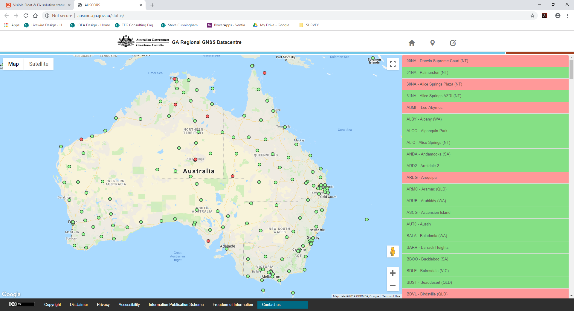
I’m also toying with NTRIP using AUSCORS at to moment, so that’s another learning curve I’m on right now too.
At what point or how long should I wait between selecting Collect and selecting Accept when collecting survey points?
I’d like to be able to get to a site and if I have internet service grab just the rover turn on and log in to NTRIP and start collecting points OR if no internet is not available setup my base and setup LoRa and start collecting points
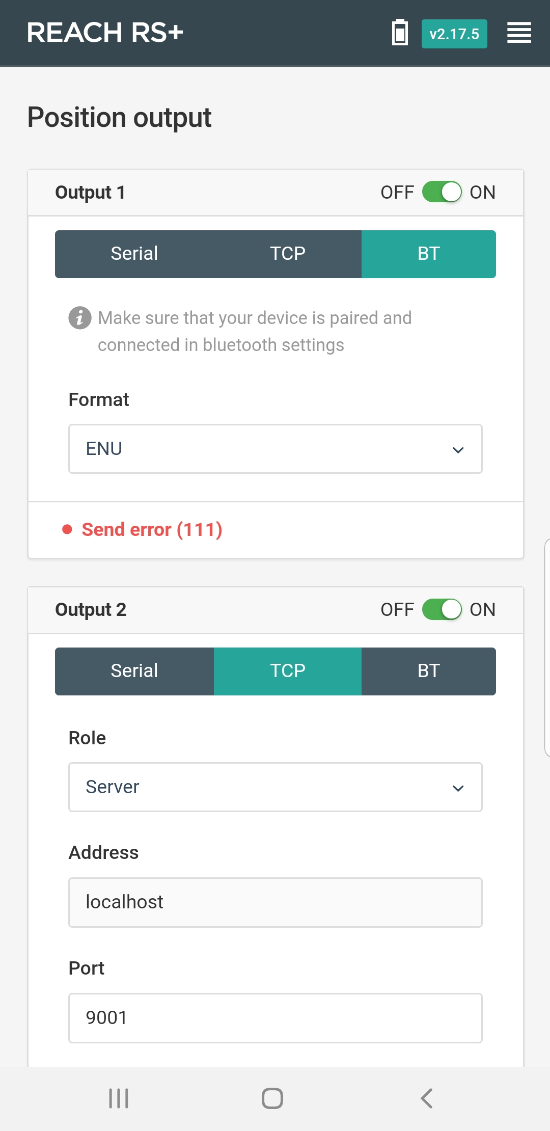
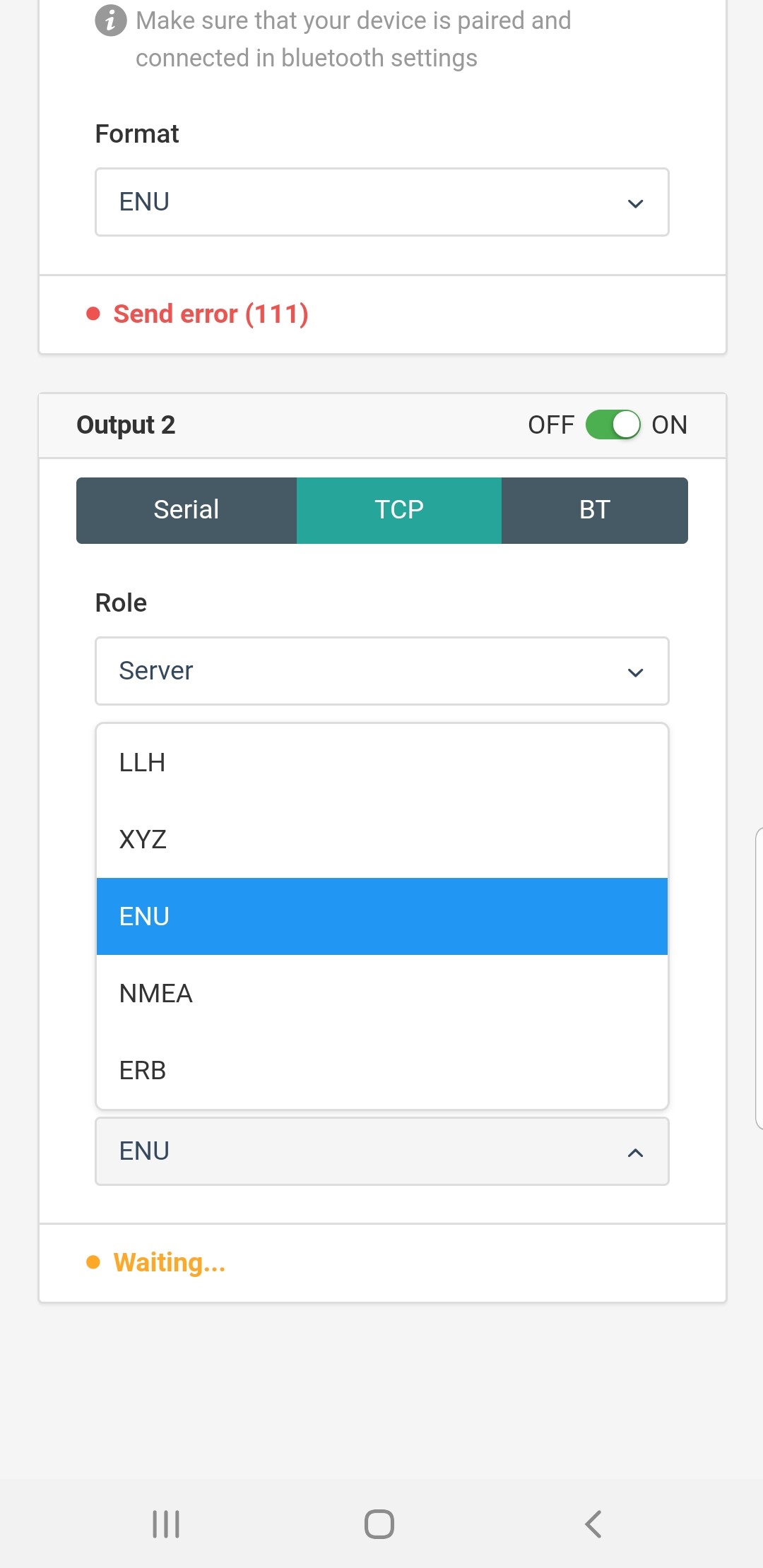
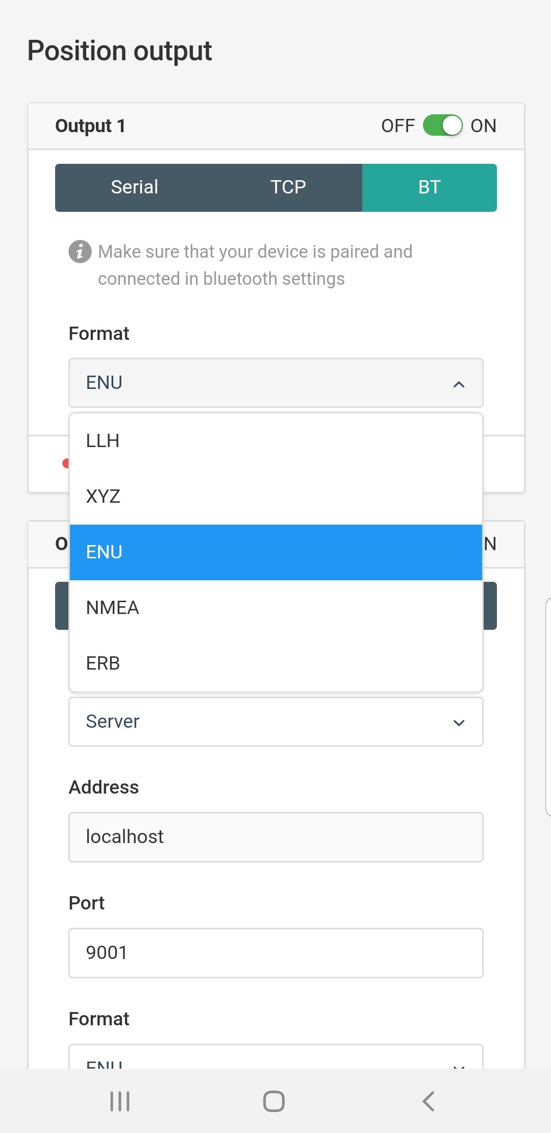
Just another question; I want to change the survey data output from LLH to ENU but don’t seem to be able to and my exported CSV data is still LLH even though I change it in the Position output tab, what am I doing wrong please?
We only have around 40 AUSCORS NTRIP Broadcaster points across Queensland, so I’ll rarely be within the ICSM recommended 20 km; what is the error margin as I get outside the 20 kms from a Broadcaster points?
It is so disappointing and to find out now that what is in the Emlid Docs and the ReachView App is misleading, because having the ENU position output format was a major point for me in purchasing the Reach RS+ because the ENU output format would allow me to upload the data straight into the modelling tool without having to do LLH to ENU conversions on everything
Emlid obviously intend to include this functionality because its in their documentation and App so does anyone know if and or when Emlid intend getting this function operational?
In the meantime, you could use the “Position output” to send the live position data to your mobile device where a third party survey app can do what you want and work in ENU.
Can you suggest a comparable, easy to setup & use 3rd party survey app to send the live position data to.
Cheers @ Christian Grüner
That’s the setting I was told I could change if I wanted ENU instead of LLH format for my survey export data. Its a shame the only support for such a popular product is via its user community forum and not by the company’s own customer support area. Anyway, glad I didn’t pre-order the RS2 now.
The tool does exactly what you need. The current reachview app does not. Send position output to mobile topographer pro or QField. That reachview does as @bide already said. Or just use reachview as is and import survey into QGIS and apply whatever transformation you desire. Again the tool works for your needs just not the app.
As @bide said, ENU format is available for position output in the ReachView, not for the Survey tool. It means you can transfer the ENU data to any third-party software. You also can record the log with ENU positions in the ReachView.
We usually answer to all of our users here and on support@emlid.com within 24 hours. We always strive to resolve all the issues as soon as possible.
We recommend creating threads on the forum as there are a lot of users that experienced the same issues earlier and might participate in the discussion. It allows getting an answer faster. It also helps other users to find a solution to their issues because most questions were already discussed here.