Did you add those 3 stations manually or the entire euref list of stations?
I kind a struggle getting it to read or add new stations list.
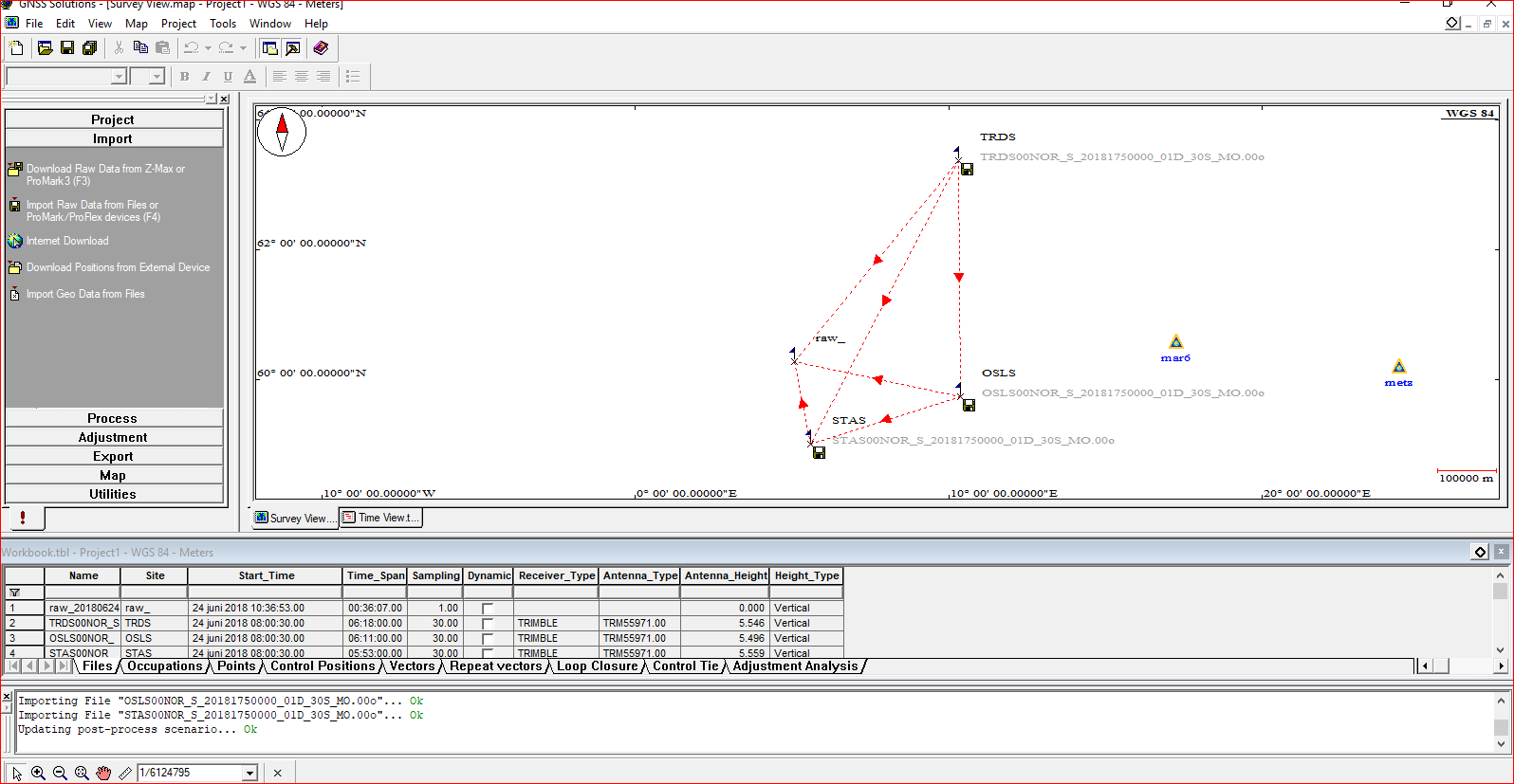
I am missing the norwegians as you can see here
I added it manually, but it is quite complicated, because old software does not accept the new file name convention. In my activity on the domestic market, there is manual for this, but it is in Polish.
Does this point have coordinates in NTM? What about its height? Was the height to the ARP measured?
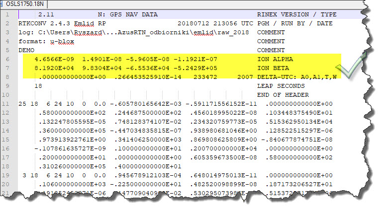
It is difficult to advise in a few sentences. There was probably no ion data in the navigation files. But here we are leaving the thread ! It is important to conclude that there are methods of a short static session with a good result.


 . Program crashed when trying to compute vrs. Going to try a workaround and see if it works then.
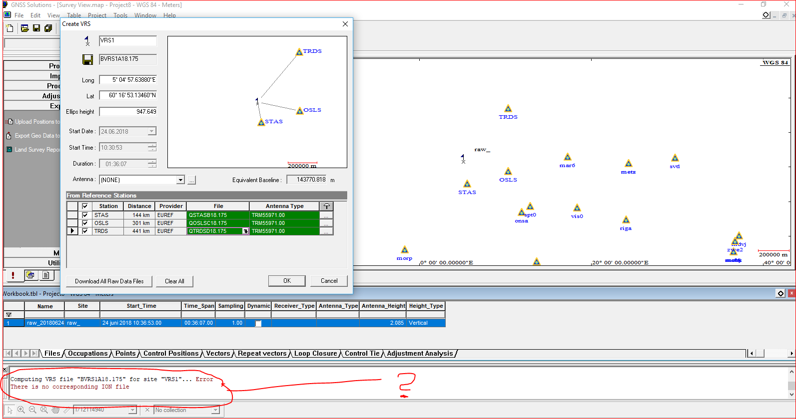
 ! It is important to conclude that there are methods of a short static session with a good result.