Hi all,
I am having trouble justifying paying 1600 eur / year for a local NTRIP subscription. So I would like to hear your experiences with using the free euref network.
I have to place some permanent markers for stockpile volume measurements (so I can do the job faster, without having to measure out markers each time), so the absolute position is, as such, irrelevant. However, comparability between the jobs, I would like to have some sort of absolute precision (mostly for my self, not a requirement for the customer (not yet at least, maybe after seeing that they can actually compare, they’ll change their minds).
Would it be better/good enough to:
Use euref NTRIP using a point 178 km away (should give me 17,8 cm+ 7 mm of inaccuracy?)?
or collect 8-24 hours of raw-data and compile it using PPP afterwards, then feed the manual coordinate to my base station?
What would you say is the main difference between using PPK, like you suggested and PPP, when talking a static position ?
As I understand PPP it also takes atmospherics etc into account, like PPK with NTRIP?
Since Brent seems to be asleep, i give a shot at it.
PPP is not possible with current RTKlib version from Emlid, you have to use 2.4.2 which is somewhat buggy in some areas.
PPS, not K, its static. With reachview version 2.13.0 you can now use Glonass AR against different brands, not possible in RTKlib. Crossing my fingers i got the facts right
I get better result with PPP in RTKlib 2.4.2 and process ionos/tropo/clock/epherm finals then nrcan.
I used CDDIS but investigating differente option now.
You should get better result with PPS long range ( 178km) then PPP in either way. You also get a position faster with PPS, since you dont have to wait for final products.
There are other ways but i havent fully tested it yet.
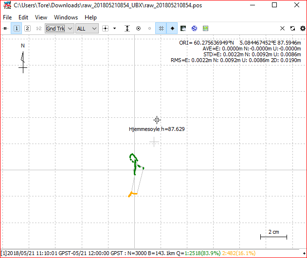
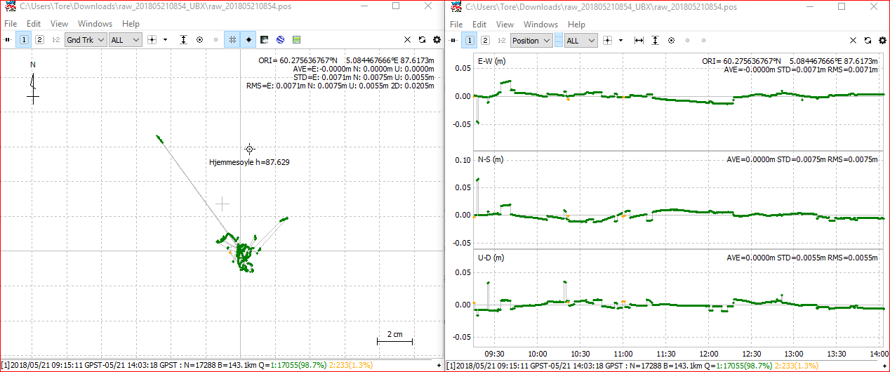
I’m surprised by that accuracy for 143km baseline, do you know if that’s consistent or could it get worse with poorer weather conditions?
I guess another option, if your client insists on more accurate absolute accuracy and you have the time, could be to set up your own Base within a reasonable distance from the NTRIP station, say 90km, and find its location using PPS. Then use PPS again with rover data over your site reference point and logs from your new Base to find your know site reference point. You could shorten the baseline distance from 90km but you may have to repeat the process and step stone known points to your site. I haven’t done this myself to compare how effective it is but it should improve accuracy if you log plenty of data for each PPS.
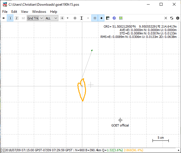
Trying with example data. From MUEJ to GOET (GREF Network) (both in southern Germany), baseline 390 km, GPS+GLO. 24h and 15 min obs time, both with 20 cm in XY. 24h obs is 4 cm away in Z…