


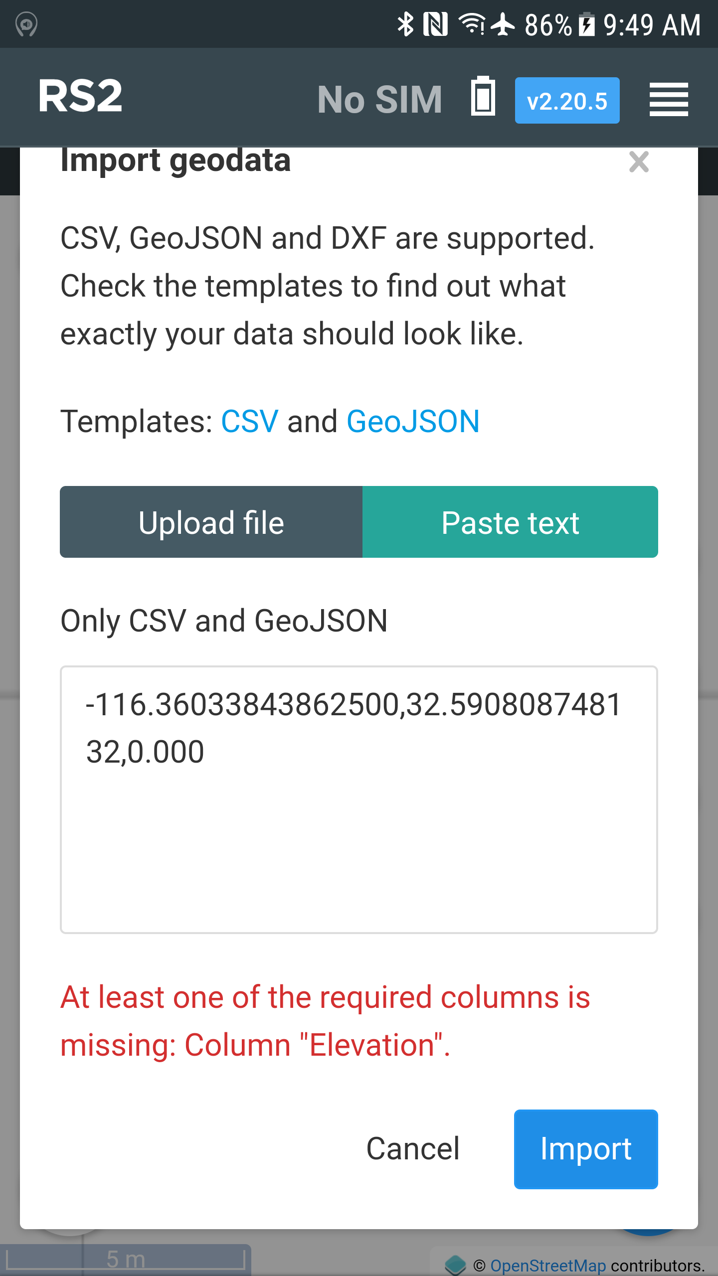
Hello iop help when uploading a .csv file this tells me that a lost column has some idea upload the file and photo
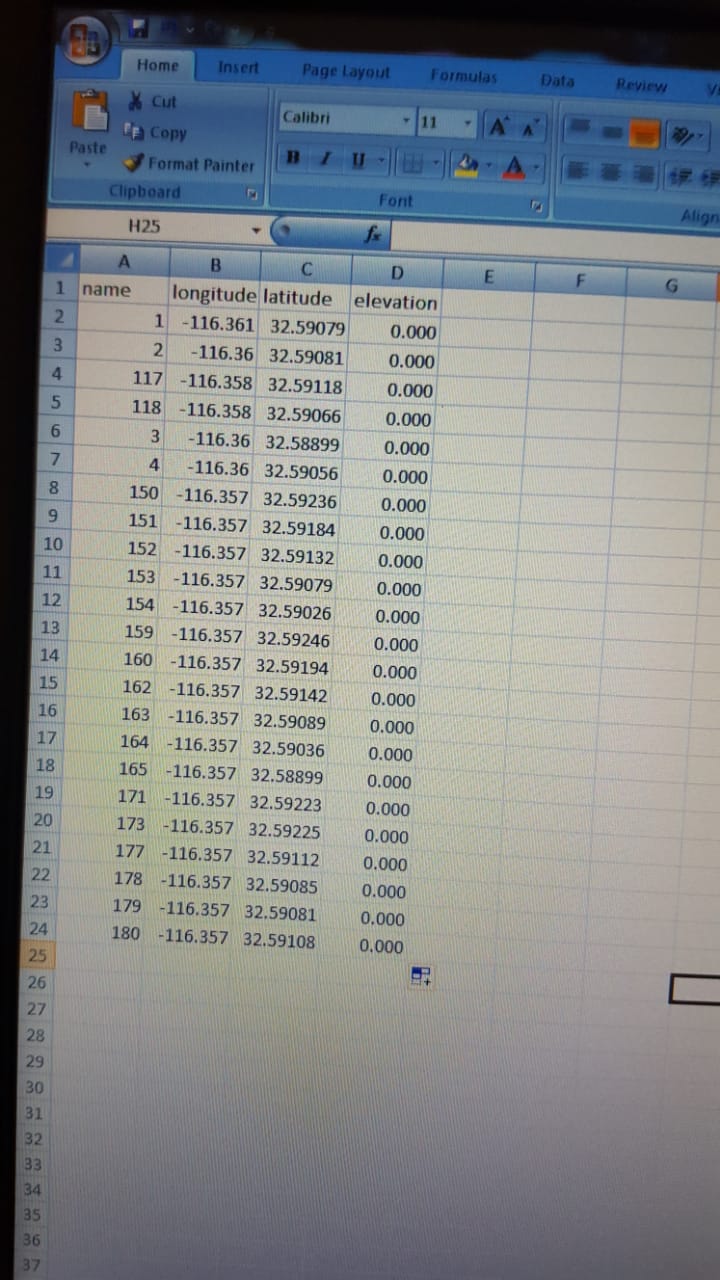
| name | longitude | latitude | elevation |
|---|---|---|---|
| POINT 001 | -116.3608708 | 32.59078821 | 0. 000 |
| POINT 002 | -116.3603384 | 32.59080875 | 0. 000 |
| POINT 117 | -116.3584835 | 32.59118142 | 0. 000 |
| POINT 118 | -116.3584364 | 32.59065798 | 0. 000 |
| POINT 003 | -116.3600893 | 32.58899336 | 0. 000 |
| POINT 004 | -116.360212 | 32.5905582 | 0. 000 |
| POINT 150 | -116.3566005 | 32.59236343 | 0. 000 |
| POINT 151 | -116.3565535 | 32.59184088 | 0. 000 |
| POINT 152 | -116.3565063 | 32.59131649 | 0. 000 |
| POINT 153 | -116.3564589 | 32.59079024 | 0. 000 |
| POINT 154 | -116.3564114 | 32.59026209 | 0. 000 |
| POINT 159 | -116.3548218 | 32.59246322 | 0. 000 |
| POINT 160 | -116.3547811 | 32.59194033 | 0. 000 |
| POINT 162 | -116.3547402 | 32.59141558 | 0. 000 |
| POINT 163 | -116.3546991 | 32.59088897 | 0. 000 |
| POINT 164 | -116.3546579 | 32.59036048 | 0. 000 |
| POINT 106 | -116.3601957 | 32.58898805 | 0. 000 |
| POINT 171 | -116.3609837 | 32.59222865 | 0. 000 |
| POINT 173 | -116.3603449 | 32.59225329 | 0. 000 |
| POINT 177 | -116.359562 | 32.59112083 | 0. 000 |
| POINT 178 | -116.3595408 | 32.59085081 | 0. 000 |
| POINT 179 | -116.3602319 | 32.59081197 | 0. 000 |
| POINT 180 | -116.3602531 | 32.59108199 | 0. 000 |
when I try to upload the .cvs file I can only do it by the browser but it tells me the same as in the photo and when I try to upload a single point dxf file (although these are in utm system) maybe give me an error in the dxf but the .csv are in LLH
I am sure you followed this:
https://docs.emlid.com/reachrs2/common/reachview/survey/#points-import
Maybe collect a couple points in ReachView Survey, then EXPORT the CSV file and use that for your template?
DXF may be a little trickier depending on where it came from. i.e. AutoCAD, FieldGenius etc. So you’ll have to make sure the correct EXPORT settings from those programs are correct or trial and error until you get them in. I am sure ReachView will have restrictions on DXF, such as linework, probably ONLY points allowed.
3 Likes
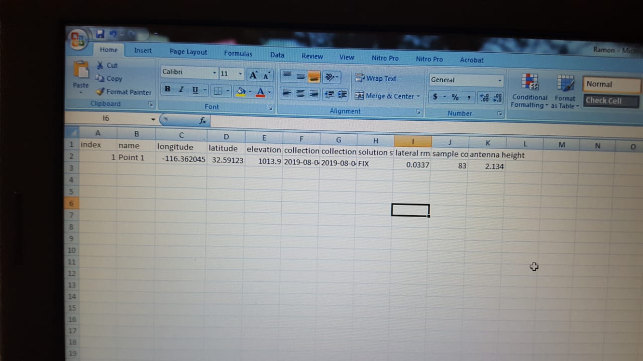
in the second photo I have the file as explained the support documents but still let me import the dots
maybe the EXTRA space after the decimal “.” is causing the problem?
Your error above complains that ‘elevation’ is missing. You are actually missing all the column names:
name,longitude,latitude,elevation
POINT 001,-116.3608708,32.59078821,0. 000
If you don’t include the column name, then it doesn’t know which column is which. Ask youself, “How would it the importer know which is longitude and which is latitude without including the column names?”
2 Likes
in my file I add the name of the columns as it is that the importer does not know the order because in documents so it marks
Can you try this?
Or just use the Emlid csv template?
name,longitude,latitude,elevation
Point 1,30.339,59.958,53.618
Point 2,30.334,59.960,58.944
i try it this moment
and I wanted to use mobile topographer but Ntrip client does not work and mapit does not connect to rs2
Hi @abel.ccaamao,
May I ask you to post your CSV file here?
Please create a separate thread and specify on which step of this guide you faced an issue.
Hi Bide.
Could you give an example of the correct form?
In my RS I have the same problem when I manually enter the points for stakeout.
You can find template in the Import window in ReachView as well as in our docs:
name,longitude,latitude,elevation
Point 1,30.339,59.958,53.618
Point 2,30.334,59.960,58.944
1 Like
Thanks Andrew.
It’s the same way I do it when I manually put them in.
I get the missing message column “elevation”.
The only difference is that I use more decimals in Long and Lat.
Can you confirm that manually entering the coordinates in the RS works correctly ?.
Before I had no problems to do so until the latest versions.
1 Like
Here’s a working example with your data:
name,longitude,latitude,elevation
POINT 001, -116.3608708, 32.59078821, 0.000
POINT 002, -116.3603384, 32.59080875, 0.000
Please, share your csv file here.
What RS device and ReachView version do you have?
Oh no, I manually place the coordinates.
open reachview.
I create a new project, then I go to the “import” option and choose to paste text.
I activate the keyboard of my iPhone and write the coordinates, columns: name,Lon, Lat, Elev …
In previous versions I did it without problems but in these last ones I cannot.
My devices are Reach RS v2.18
I am noticing that in the example you gave Abel there is a space between the columns.
name,longitude,latitude,elevation
point1,(space)-116.3608708,(space)32.59078821,(space)0.000
Is the space between coordinates and elevation correct?.
I do not place that space, it can be my mistake.
The example above is acceptable by RS2 20.2.5 and RS+ 2.18.1.
There’s no issue with importing CSV file.
That’s my fault, there should be no spaces.
However, Reach can handle both options.
1 Like