Does the Fendt also need to be set to wgs84? I don’t remember seeing it in Trimble 750 either but we are using that device plugged into back and the lefebure app to receive the ntrip corrections
1008 can also be 0.1, it was quite the dream getting that message out of an emlid and a feature request from this forum.
If the two tractors want to work together they have to interpret the datum model the same way. WGS84 is the stock setting but can be changed to many others, worth reading the manual about.
RTK set up improperly for farming still works awesome, If you get everything proper its almost a magic trick with multiple machines. Learn as much as you can about RTK from the surveyors on this forum, anything worth doing is worth overdoing.
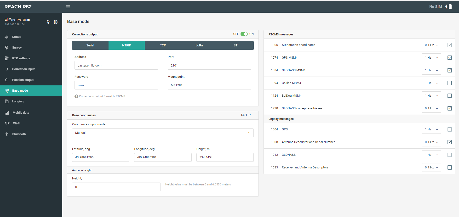
I see @PotatoFarmer has already answered your question. Just want to sum up: to use Reach RS2 as a base with the 3rd-party rovers, you need to output from Reach correction messages with the following frequencies:
1006 ARP Station Coordinates, 0.1 Hz
1008 Antenna descriptor and Serial Number, 0.1 Hz
1004 GPS, 1 Hz
1012 GLONASS, 1 Hz
1006, 1008, and 1004 messages are minimally required. You can also find more info on using Reach RS2 as a base in this guide from our docs.
The coordinate system of the rover should be related to the same datum as your base station.
I assume that you use Average Single to set the base. It provides your base with WGS84 coordinates. That’s why you need to set a coordinate system related to WGS84 on your rover as well.
Actually what we have is an rs2 mounted permanently on shop roof and connected to Wi-Fi. Have the base position set to manual and inputed the manual coordinates based of of doing avg. Single 6 times over , over a few days and using the avg. And now it’s set to manual. We need our AB lines the same year after year and the base may never move. Let me know if we did it wrong and should do it different
Did you create your AB lines with this setup? If so, you should have repeatability no problem. Once established with a base that doesn’t change, they stay solid unless the base data changes. If both bases are “surveyed” in, there should be little to no change in your AB lines.
If the AB lines where set from a different base or NTRIP that was surveyed in or not, your lines may shift whatever distance your manual base location is off from the previous base/NTRIP.
yes that makes perfect sense
we will be making all of our ab lines with this setup,
could someone clarify if we only have one base station and dont switch to any others does our own have to be surveyed in for our own use.
I think that your workflow should work well. But I have a couple of comments.
For the tractor guidance, it’s usually required the relative accuracy only - the accuracy of the rover relative to the base. So to keep the measurements accurate from year to year, you need to fix the base position and note its coordinates achieved in Average Single.
You don’t need to Average Single position several times or do it again next year. Simply do it once, set achieved coordinates Manually, and don’t change them until you change the base position. Don’t forget to mark the initial base location if you want to move it but need to set it back later.
Just want to add that even though your base coordinates are set Manually, the way you achieved them is still Average Single. That means that they are in WGS84. So your rover coordinate system should be related to WGS84 as well.
It doesn’t have to be surveyed in. If you ever take it down and put it back up you must have the same manual data for the base location or else, all of your lines will shift.
I would get it as close as possible if I could. If you have a state CORS network, connect to it and do a Average Fix location for your base. That will get it extremely close.
up untill we had setup our rs2 for our own base we were buying a local rtk subscription through ntrip as well and that one has not expired yet so i can log into that one and our own still to compare. couple questions
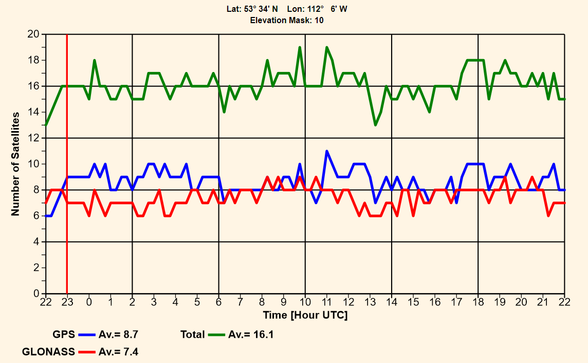
if i log into the old one i get about 13 plus up to 16 satellites on fendt display after rtk correction has been established vs the emlid one its struggling to see an avg of 10-12 max wondering if its how our emlid base is setup
i can go farther from the old paid subscription base and keep an rtk fix vs the emlid on our own…
does it make a difference on what ntrip server we use , say for example how clean and fast the ntrip messgaes go through server etc. and back down to the rovers. on emlid base we are using the free caster.emlid one should we use something thats better or more stable, we have noticed a few times already that on the we b where we se whats logged in that after a week or two our mount point for caster says disabled instead of active seems it shuts off or something. should we setup our own on site caster maybe…
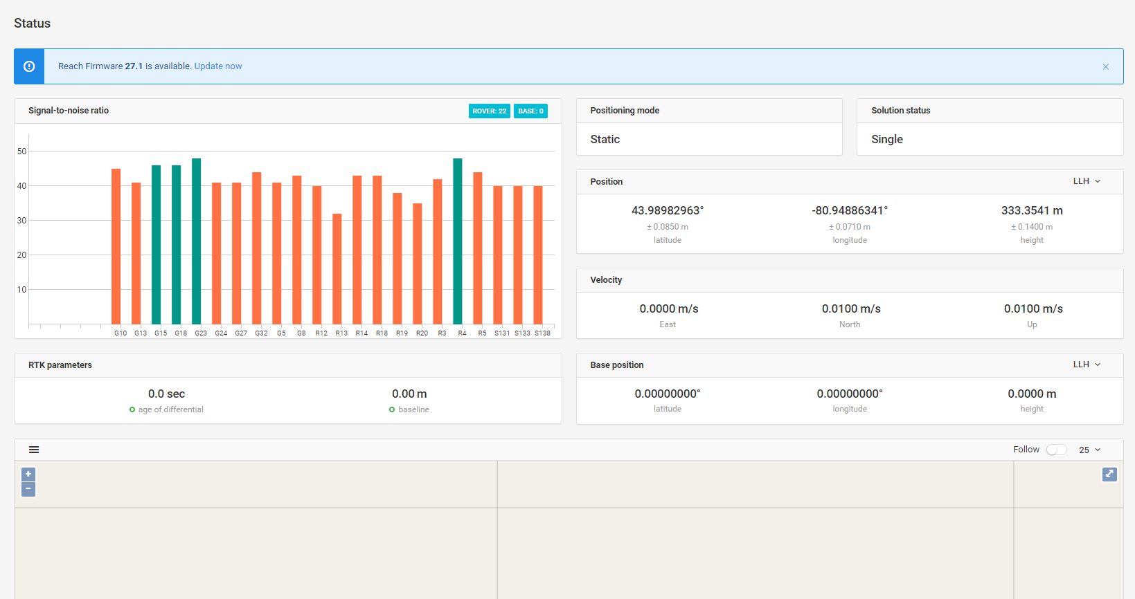
on our reach base RTK settings we have gps and glonass on at update of 10hz positioning mode static elevation mask 5 and snr mask 35 . should see more than 10 sattelites on fendt…
Are the log in times back to back for your satellite number comparison? GPS+Glonass varies greatly even by the hour, and day to day the satellites are moving. Anything between 10-19 is pretty normal.
The base is at the peak of our shop roof and it’s wide open out the one way and a few trees on the other side over by the house. The Emlid base reads about 24 satellites with GPS and glonass turned on .
I’m not exactly sure how Ro go about to ping the caster … or where it would read the latency?
The Fendt screen shows number of satellites it says gps+glonass then the number I’d assume that’s with them combined…
The Trimble 750 I’d say acts the same as it had when connected to our other ntrip rtk provider reading in the mid teens of GPS count when it has rtk.
The Fendt display reads like 18 satellites before it gets rtk then as soon as rtk activates the count goes to 10-15 area that’s cause its only showing the ones the Fendt and the Emlid base both see and use at same time right?
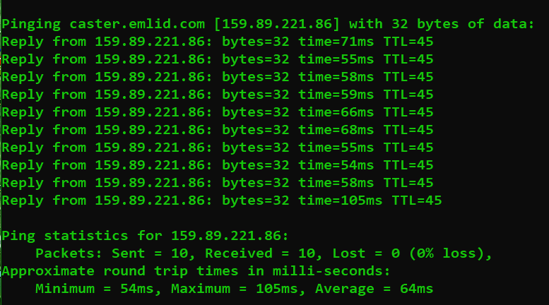
You will get some data that looks like this, the “time=55ms” is the ping, or the round trip time to their server it may vary a small amount like mine did. I connect over cellular internet, but emlids caster is a very fast connection for me through the cellular network.
What you do not want to see is spikes way over 200ms, especially not 1000ms or more. If you are seeing spikes like that its most likely a slower local connection issue. If you see packet loss that means messages are being lost completely.
I am unsure what the fendt would actually display for sats, but i am guessing if it is jumping down after fix that may be the case. The fendt will only use corrections for satellites both it and the base simultaneously see at the same time you are correct.
Any chance the newer fendt might have Galileo unlocked?
I’ll try that tomorrow. So your saying connect windows phone to same provider as Fendt. Our base is off wifi from shop which is explornet wireless high speed internet and Fendt is off bell SIM card in tractor…
Does our Emlid base have to run off same data source as the rover ,so base needs a bell SIM card if rover is running off a bell SIM card? Or can I do the ping from the internet provider the Emlid is connected to which is explornet
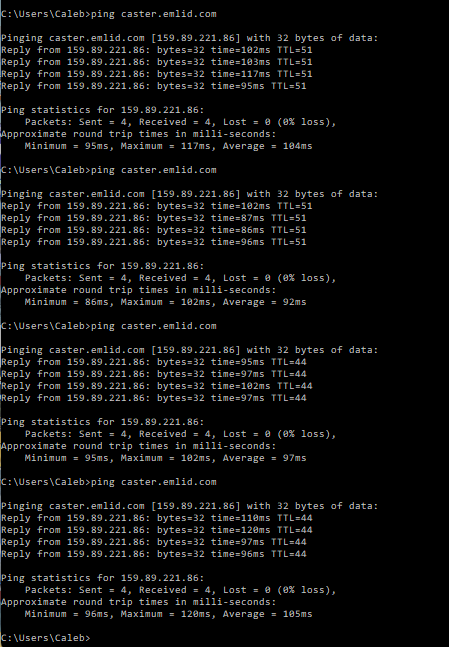
the ping looks good id say. heres a scrrenshot of the base of status page. should so many of the bars be orange or if they are what does it mean it would appear that their still being used i guess…