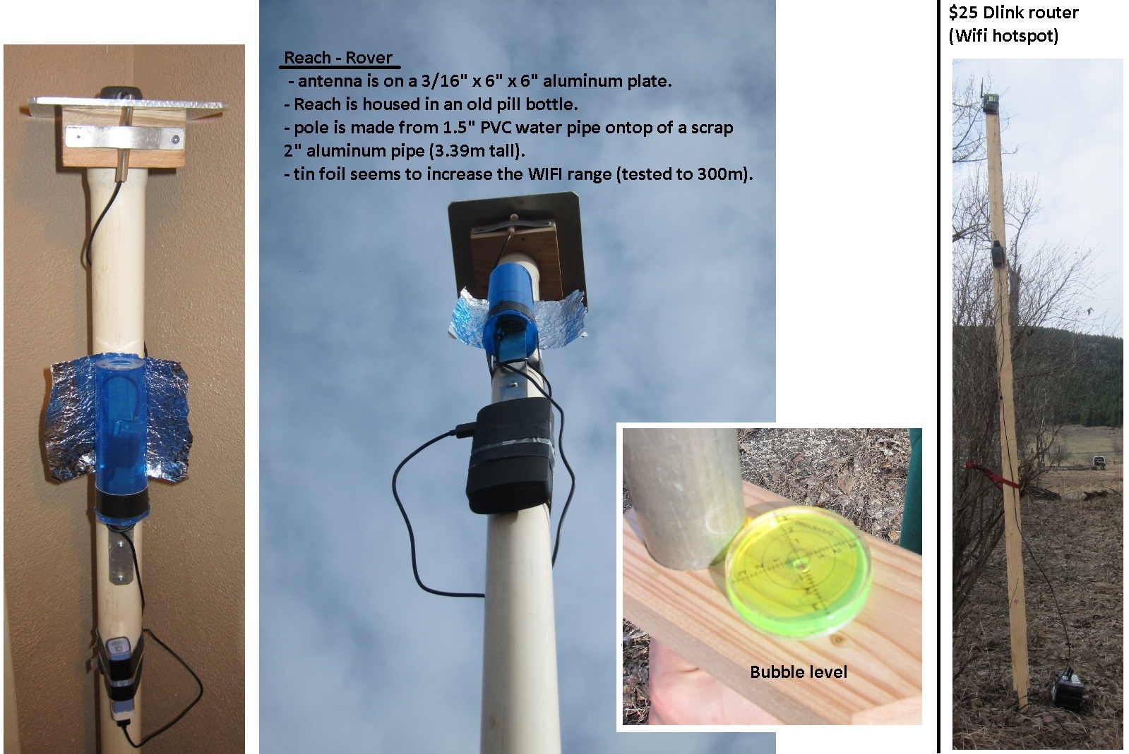
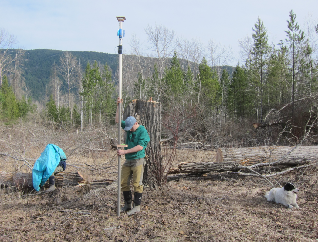
I’m using my set of Reach modules to survey a fence line beyond a set of known corner pins. Nobody knew the fence was so far off until a surveying crew installed two of the pins last fall for a highway project. The original corner markers were wood and are long gone. In total, the neighbours will gain about 5.5 acres form my place and my parents place. My procedure and some images follow. Last image shows my helpers. Notice my one son hiding under my jacket trying to see RTKPLOT on the laptop to see how far away we are from a way-point. If anyone knows of a better way to locate points please let me know. I assume when Bluetooth is working we can use an app on a phone instead of using the laptop. The thing I like about RTKPLOT is that it gives the distance as a grid so you always know how far you need to move.
Actually, I had tried a few other methods first that were based on data from the internet. At first I tried just taking co-ordinates from an online map. Next, I found a way to get a shape file for the parcel in question. I eventually realized this data is not accurate enough for what I’m trying to do.
Here’s what I ended up doing.
Logged data at newly installed pins located at point 0 and 21 and uploaded RINEX file to PPP site.
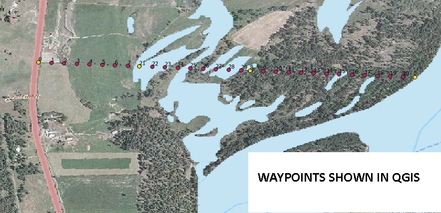
Entered these two points in QGIS to establish a known straight line. They are 392m apart (to give an idea of scale).
Exported points as UTM10 to DXF file and imported into a CAD program.
Extrapolated line to were corner should be down at river. Distance taken from old survey plan that I found online. Entire fence length is almost 1500m.
Imported back into QGIS to add extra points and extract coordinates of points as WGS84.
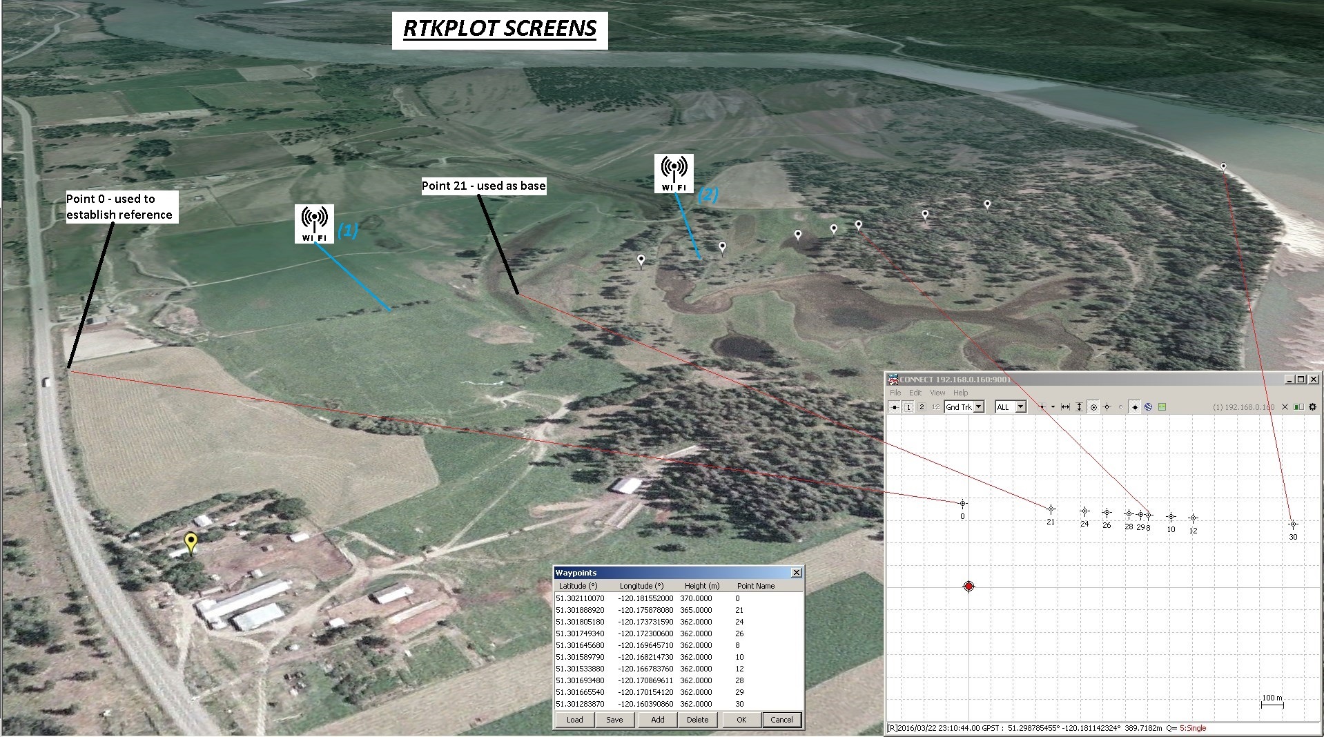
Put router at location (1). It’s 14 ft tall. I haven’t got the WiFi hot-spot from a cell phone working yet.
Setup base station.
Surveyed point 0 as a check. It was within a few centimetres so I was happy to continue.
Moved router to location (2).
Continued to other points until trees became a problem. Will probably wait for logging to happen before going any further.
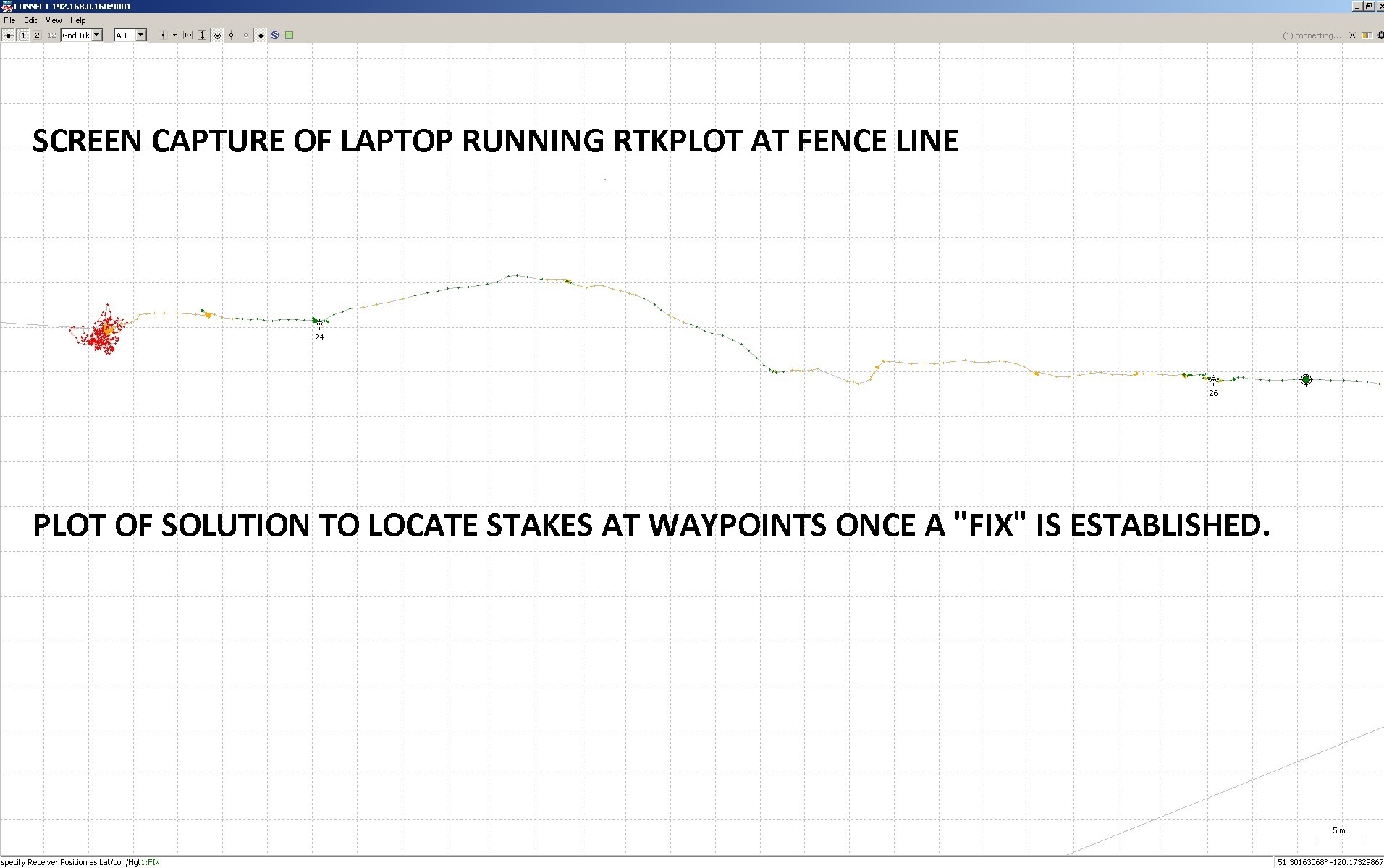
As a check, because I’m still close enough and the terrain is flat enough, I can see that my new stakes line up with the existing portion of fence between points 0 and 21.
@mikhail.avkhimenia just said after reading your topic “I wish we could also use these devices, not just develop them”
Best of luck with standing up for your land! Glad that Reach could help, by the way we have released Bluetooth output yesterday. Now working on a blog post and docs
Bide, sorry to confuse! Both me and my parents lose some land. My parents the most. We are on the south side of the fence. I only own from point 0 to 21 and my parents are the rest of the way. The neighbour runs the full length to the north from the highway to the river and is gaining. I guess no one is actually gaining or losing but the fence will be put closer to where it should be.
Oh, that’s too bad you’ve got to give some up. It certainly does look funny that the line on such a big block isn’t running straight East-West. I do remember reading somewhere that back when they were first cutting up the land, some surveyors were making blocks perpendicular to the roadway instead of N,E,S,W and there was some controversy about it.
Hi robins, i`m just curious about the wifi range you got. This range was without any other radio connected to reach, just the stock reach wifi signals?
Edit:One more thing, how did you go about actually “finding” the correct spot in the field. Did one guy walk around with the jacked over his head and yell right or left, or little more to north.? hehe, sry for bad language. I`m from Norway.
Yes, wifi range was just with the standard reach antenna. We always kept them pointed at the router and had them about 3m above the ground. Laptop was also able to connect to router at these distances but cell phone not as far.
Yes, that is basically how we found the correct spot. We would first get in the general area and then someone would sit down with the jacket over their head giving directions. I did do it in the dark one evening by myself and it was much easier to see the screen but I was holding the laptop screen in portrait instead of landscape so that my walking direction lined up with the motion on the screen. A tablet or cell phone would be much easier. With Bluetooth now working there might be an easier way.
Nice article. On your laptop, were you using the GPS Information Panel in QGIS to connect to a Reach solution output stream or did you load your waypoints in RTKPlot and use it? If the former, can you describe your configuration? I was hoping to use a Bluetooth serial connection or the tcpsvr, but I think a com port driver on the Reach side is missing for Bluetooth and I don’t believe there’s any way to make tcpsvr compatible with gpsd. How are other folks linking their Reach solution output stream to any windows software besides RTKPlot?
I currently don’t have time to verify what I did but I do remember that using RTKPlot was better than the GPS. I believe that QGIS was possible but I’m not sure the settings. Here is screen capture of what’s in QGIS
I did try the serial device and tcpsvr connection. In RTKPlot the waypoints had to be entered in one at a time because the import function doesn’t work.
I plan to do more with this in about 1 month.
Robin.
collect 2 points,
draw a line between the 2 points and or extend it longer the direction you want it,
you can also add points to that line at any given interval,
then stakeout the line or points on the line , Done