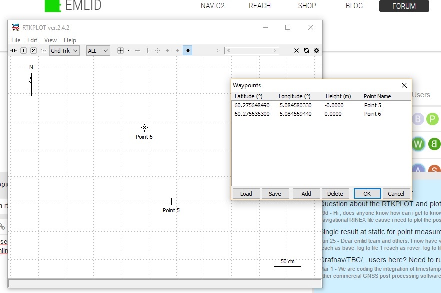
Point 6 is supposed to be more south then this.
Tried different online map services and they all show correct location of point 6, but not in rtkplot.
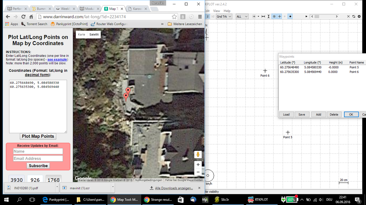
When i plot the same coordinates into a different mapservice like this Norgeskart
Point 6 is more south and correct placed and everything lines up great.
Point 6 should be south of point 5. And by the look of the north value of point 6, it show a lower value then 5…
Both numeric values in the pictures are correct but is displayed wrong.
The grid is correct
The visual distance is also correct but, point 6 as statet above is in fact south of point 5.
Edit: it is only the latitude direction of point 6 that is wrong.
No info there.
I didn`t run or load any data into rtkplot, just open empty rtkplot, open waypoints and manually enter coordinates.
That should work ok?
One more thing. I see i wrote importet coordinates in the heading, but this is not intirely true.
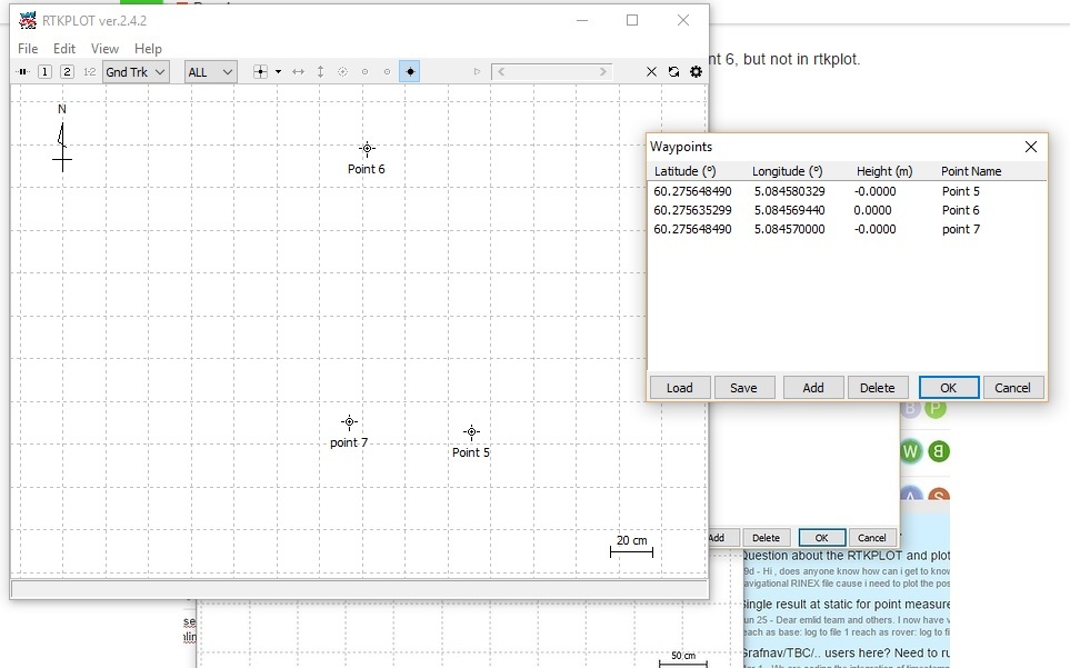
I manually entered in points under waypoints in the menu. Could this be it?
Does anybody get the same result if they do the same thing?
I think its always been there. Have seen it ocaacionally in later versions too.
I am under the impression it only happens if you open RTKplot and work with waypoints only (or at least start of with waypoint/add waypoints manually.
If you open RTKplot from a processed file (RTKpost) , it doesnt happen as i can recall
I can’t confirm that as I haven’t tested it yet, but I can confirm the Emlid branded version b33 of RTKplot has the issue whereas the same version from here of b33 doesn’t - both used independently of RTKpost, very strange.