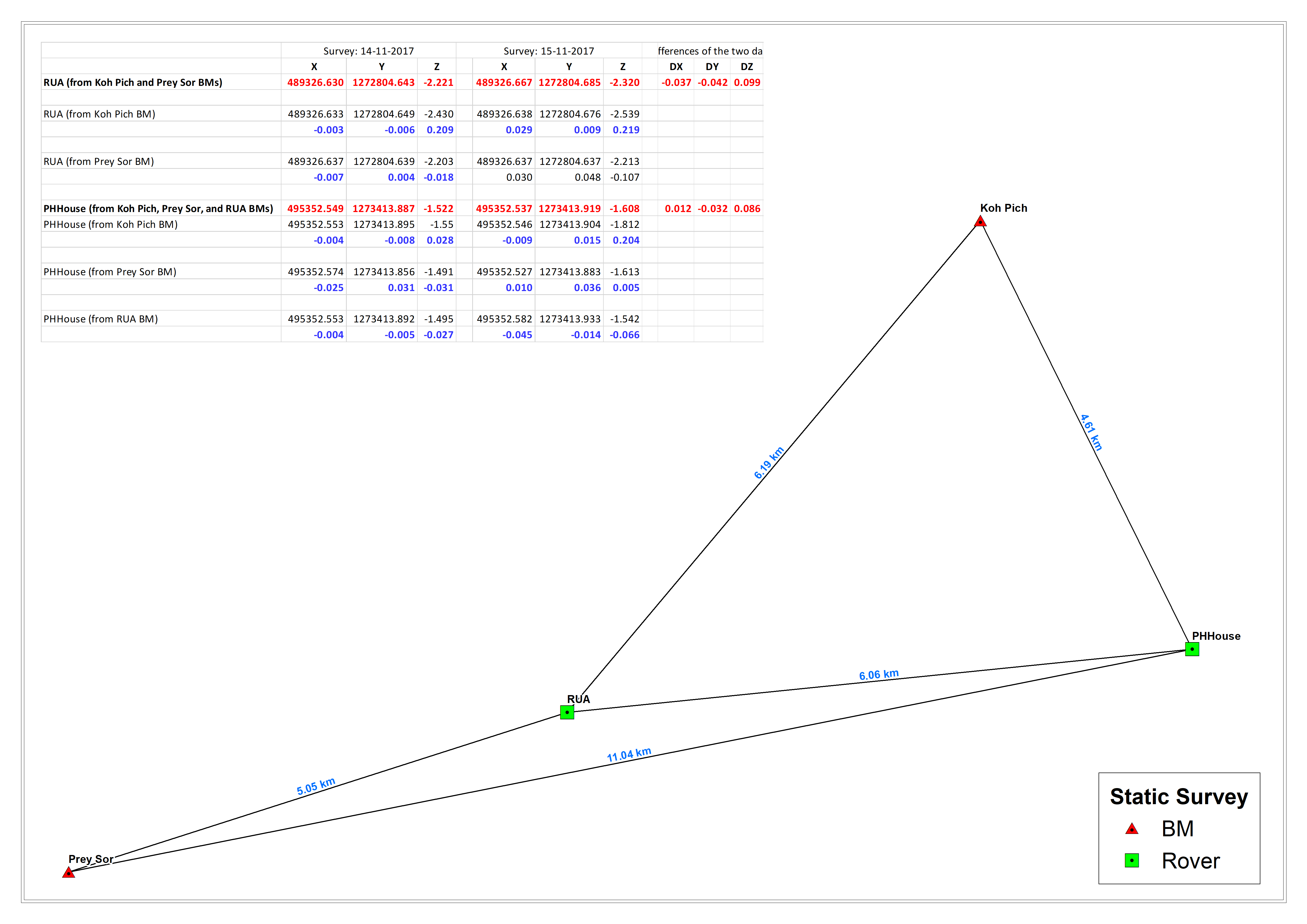
We have done some tests of static surveying with with two Reach RS units. We did static surveys for about 35 minutes at each site. We did the same survey for two different days. Each day, we had two sections in which in Section 1 we survey on two known national BMs (Koh Pich and Prey Sor sites) and on an unknown site (RUA), and in Section 2 we surveyed on three known BMs (Koh Pich, Prey Sor, and RUA-computed from Section 1) and on an unknown site (PHHouse). The coordinates in red colors were from network adjustments. It seems to us that in general the accuracy of the XY is <=5cm and Z is <=10cm.
It would be great to hear your comments and feedback on this.
Agree with @bide. would be good to reference in each of the reference points from one of the other reference points. What order were the national BM’s? I know in Australia we are at or exceeding the accuracy of the national second order BM’s so unless the points were part of the more sparse geodetic network it really is a case of who is checking who.