We use Carlson Civil and Carlson Precision 3D Topo. I would suggest looking into that if you want to work from the raw LAS point clouds. Takeoffs are much easier and it breezes through DTM’ing and measuring.
Can you please explain how you came up with those volumes?
Thanks for the tips with Carlson software, My background is in marine environment (commercial diving, ROV, sudsea mapping) with a BS in CE and drone mapping is all new to me as I am semi-retired now at the age 47 living as expat in Mexico with my wife and children (wife is mexican and her parents need a little help with the ranch).With drone mapping as a means to earn a little extra money on the side in a country that has very little competition.
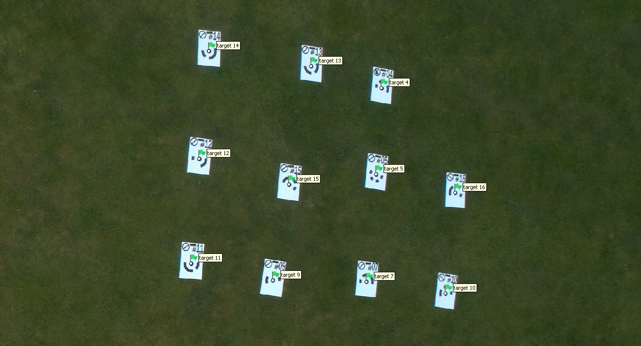
The volume calculations are taken within Metashape and verified with Autodesk Civil. Large sand dunes and valleys to fill to achieve a level grade.
Yes, but I stopped using that when I got Precision 3D Topo. It is much more suited to drone point clouds. The standard Point Cloud program was developed more for laser scanners and surveying workflows for field to finish codes and classification. It handles the drone point clouds okay as long as they’re not too big. It will decimate them to where you can work with them better in Civil, but I don’t recommend decimating them too much.
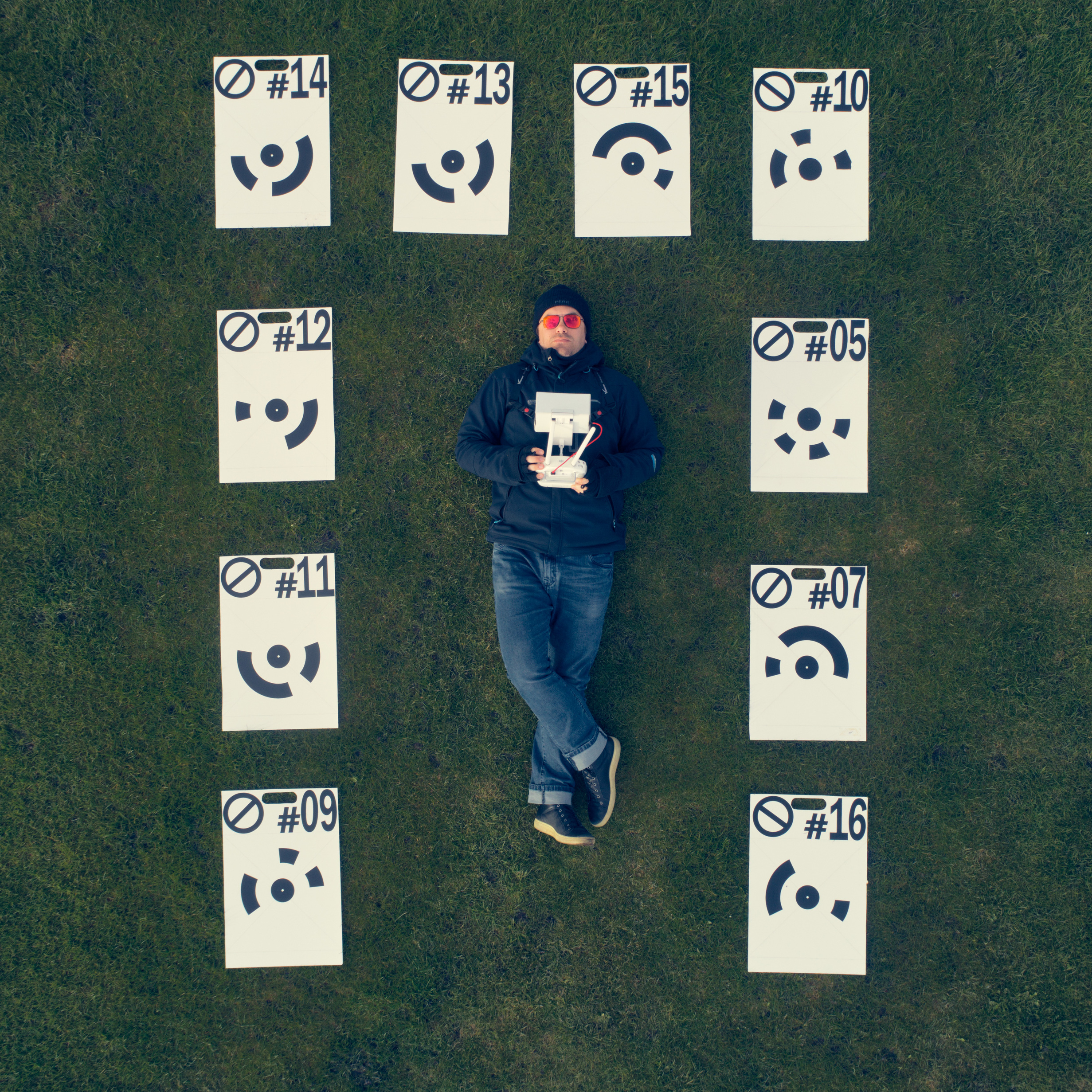
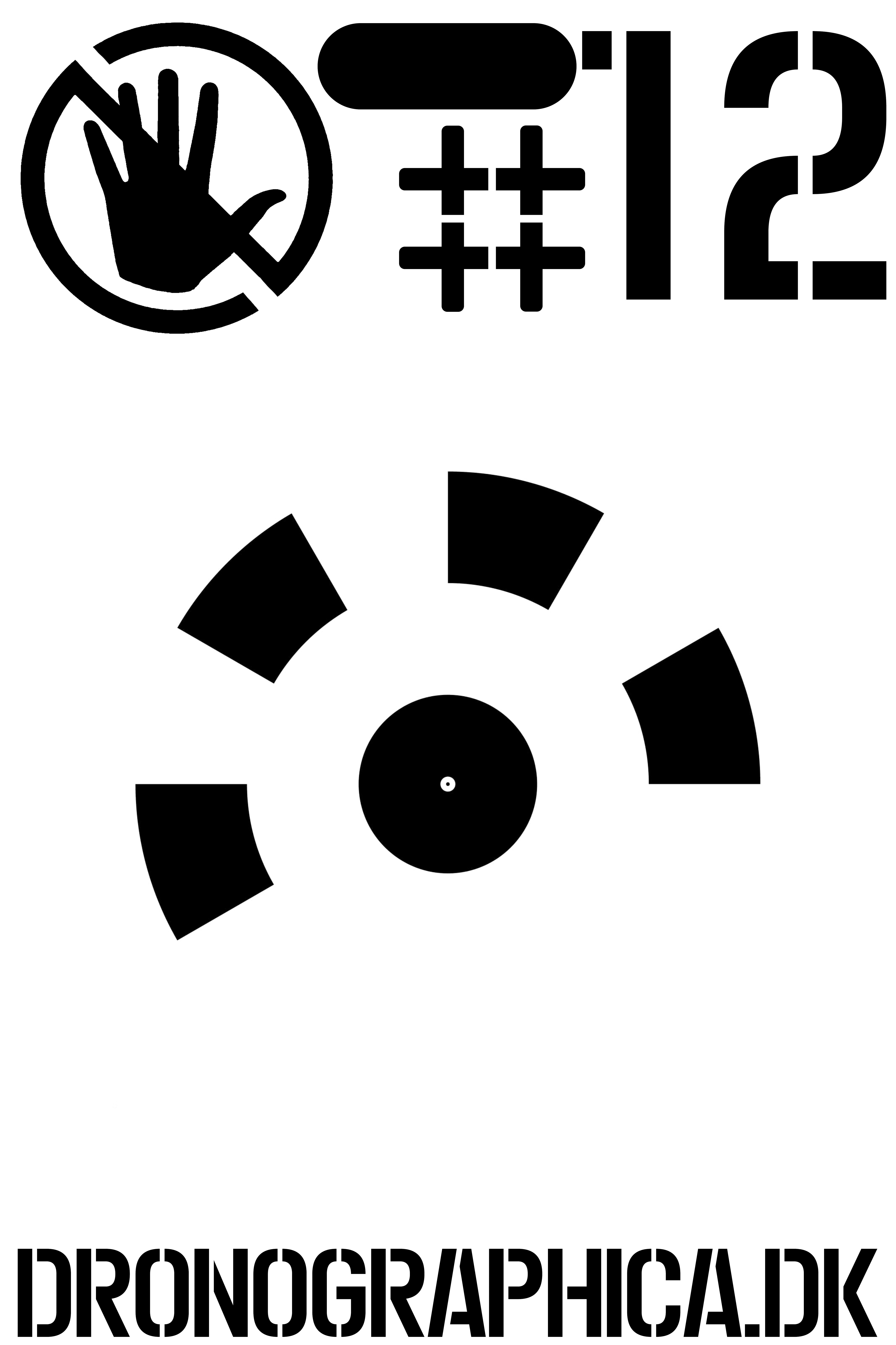
Ongoing design, 60x40 cm plate (cut out from 120x80 cm).
Photoscan/Metashape 12 bit coded target
Stencil-shapes cut out on on cardboard with Brother ScanCut DX SDX1200, and then applied to board with blackboard (chalkboard, for You Americans) paint.
Material thickness 3 mm.
4x12 cm slot for handling in the top
Will also have 4 holes in each corner of the 40x40 target area, so it can be secured to ground with spikes.
That’s awesome, but i’ll stick to my $1.50 12" (30cm for the rest of the world, lol) disks. Though I wish I could find something biodegradable after a year or so…
This has been my favorite thread to watch lately. Even though I’m not flying drones, I feel like I have to make some contribution, so here is one GCP graphic design that surely nobody will steal :
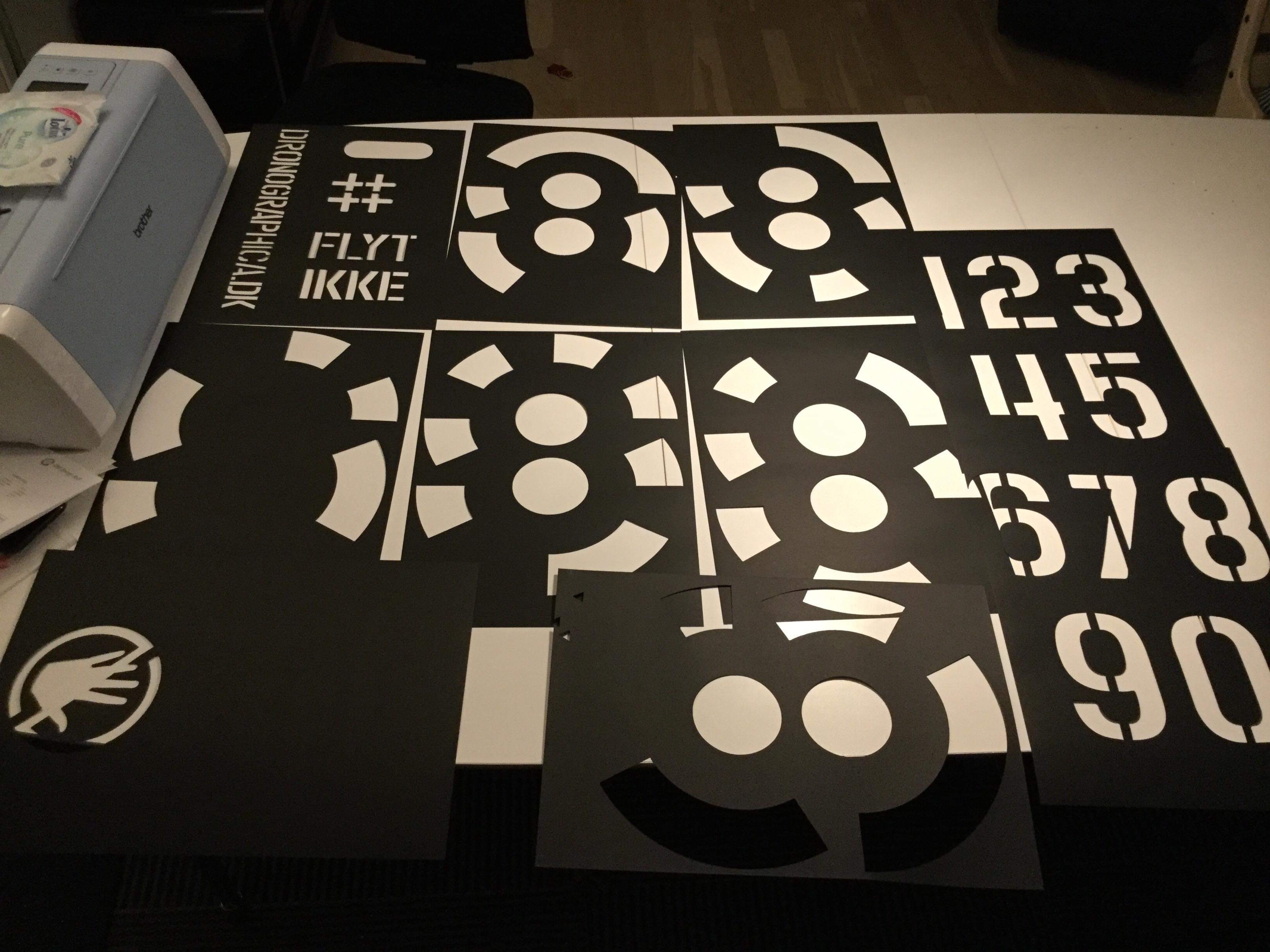
So, they are now ready! Lots of work, and getting smarter in the process…
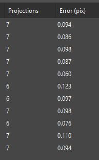
Quick test with Metashape shows (at 27 meters AGL with Phantom 4 Pro, 0.74 cm/px, my favorite stockpile flight-height) auto-detect accuracy at avg ~0.1 pix. That I am pretty dang happy with (as you can see from my big smile below! ).


 ).
).