


The second part is, what do I choose for “Ionosphere Correction”, “Troposphere Correction” and “Satellite Ephemeris”?
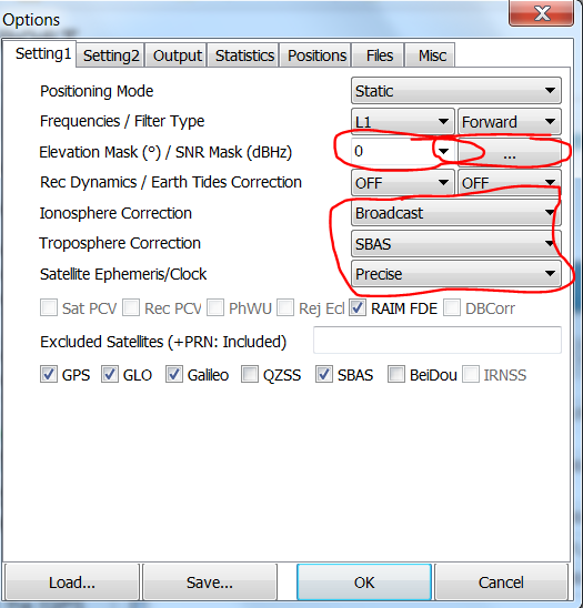
I believe I collected the appropriate data from the SBAS satellites- can I use that for both Ionosphere and Troposphere? Should I use the “Broadcast” or “SBAS” for Ion and “Saastamoinen” or “SBAS” for Troposphere?
I am pretty sure that I should be using “Precise” for Satellite Ephemeris (that’s what the .sp3 file is), but when I use it, my errors tend to increase (by around a factor of 10). “Broadcast” gives much lower error, but the locations are different (which would be more accurate?) Please let me know if I should be using “Broadcast” or another option.
I should note that I have been trying to use a combination of Emlid’s tutorial with this: POST-PROCESSING GNSS DATA WITH RTKLIB - INTRODUCTION.