I am having issues with the accuracy of RS2 in NTRIP RTK mode. On the last job I had a height difference in one point (measuring twice, averaging around 30 sec) of 2+ meters and generally several points were inaccurate to 2-3 meters (Dix solution).
All started after upgrading FW to 2.22.4 .
Now I would like do PPK my logs for another survey.
Here are my questions:
A) In the Solution file LLH, the FIX points are basically the RTK solution with cm accuracy?
B) How can I extract thos points to csv or kml or shape?
C) What is the process of PPK with the RS2 and NTRIP corrections?
→ do I just RTKPOST in Static with the raw logs as rover and the base corrections as base?
→ where do I take the base position from or does it take it from the Rinex header?
I attach the files here, if someone is interested in taking a look: ObereKarl-Shapefile.zip (1.6 KB)
Yes, they are the RTK solutions, but they will represent the same that you saw at the field. If you had a difference when doing RTK, there will be the same difference on the solution LLH.
You can try “Point Extractor”. It´s a software created from a user that allows you to records points with Reachview and then after post-processing the rinex files from rover-base, extract the coordinates from each point: https://community.emlid.com/t/ppk-point-extractor-software/12822
Download rinex logs from base and RS2. Use rtkpost to post procces and then use Point Extractor to get the coordinates for the points. Use the official coordinates for the base (permanent station) you are using.
Yes you can. If you want to do post-process static points you don´t need NTRIP as it is a RTK correction.
You need the rinex files from the base (permanent station) and rinex files from rover (your RS2). Both logging at the same time. The time logging on each point will depend on the distance between base-rover. Then use Rtkpost to post-process.
I am having issues with the accuracy of RS2 in NTRIP RTK mode. On the last job I had a height difference in one point (measuring twice, averaging around 30 sec) of 2+ meters and generally several points were inaccurate to 2-3 meters (Dix solution).
Could you clarify which coordinate system your NTRIP provider uses?
Regarding PPK workflow questions, I just want to add that if you want to extract exact points from the RTK solution log without external software, you need to know timespans for each point and trim the log at these intervals. So, it’s not the easiest way. It’s more convenient to collect points in a Survey project.
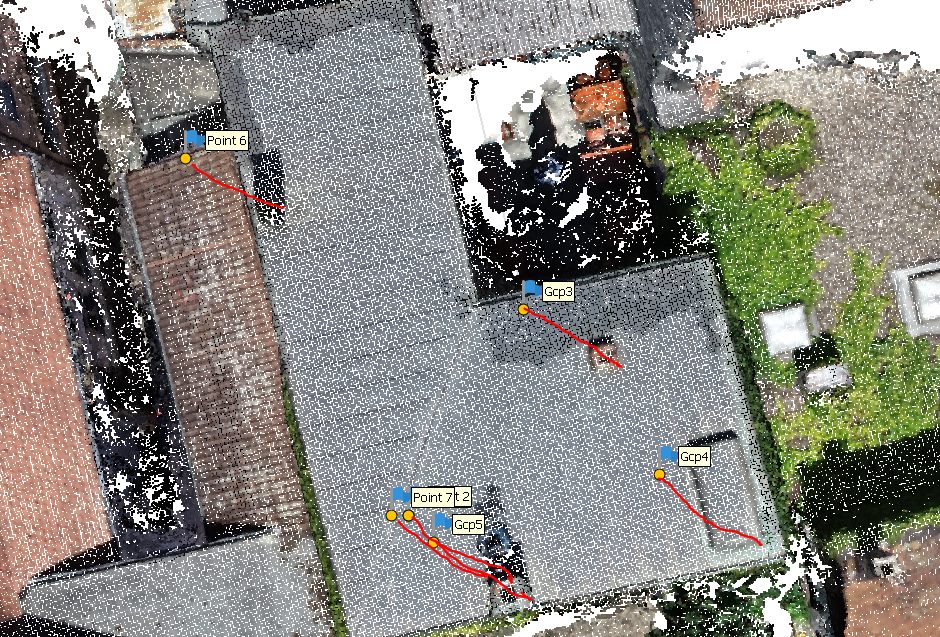
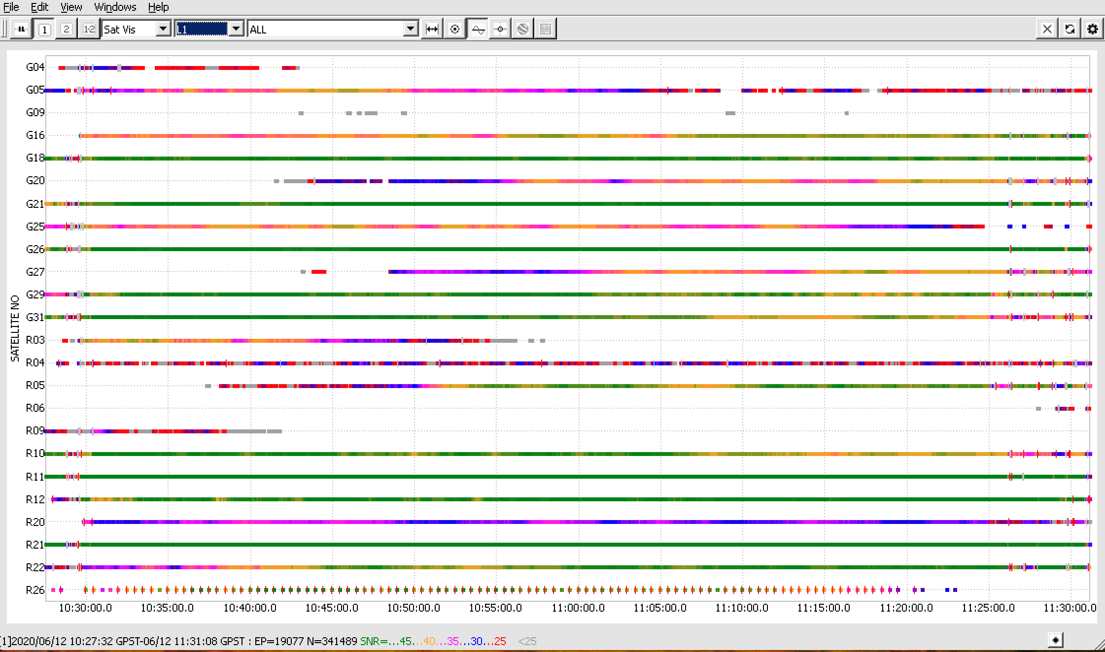
The raw data looks ok. I’m a little confused with cycle slips at the beginning of the log, but I guess the GCPs were not collected during this interval.
Also, the R26 GLONASS satellite behaves weirdly. However, it shouldn’t affect the solution quality much.
I’ve noticed that all GCPs have almost the same shift in one direction from their real positions. Did I get correctly that you’ve compared GCPs positions with a dense point cloud in some photogrammetric software? Could you clarify whether you built this cloud using data from Reach as well?
Since the shift is the same for all GCPs, it looks like the base wasn’t placed on a known point, or there was a mistake in its coordinates during the post-processing.
I believe the issue occurs before the photogrammetric processing step. If you use the base corrections from NTRIP caster to get images’ coordinates as well, please make sure you enter them correctly.