we are using a Reach RS2 and a Wingtra Drone with PPK System (Septentrio). After having initial Issues with the processing of the Emlid Data in the Wingtrahub I finally succeded but, I’m not convinced that what I did was correct. Just to be sure.
I have set the Base to “Static” RTK and it Receives Data vom NTRIP (SwiPos - SwissTopo). The Station is in Rover Mode. I have set it to Average Fix and let it settle for 5 Minutes until it locks the base coordinates. I assume those are then used for NTRIP as well.
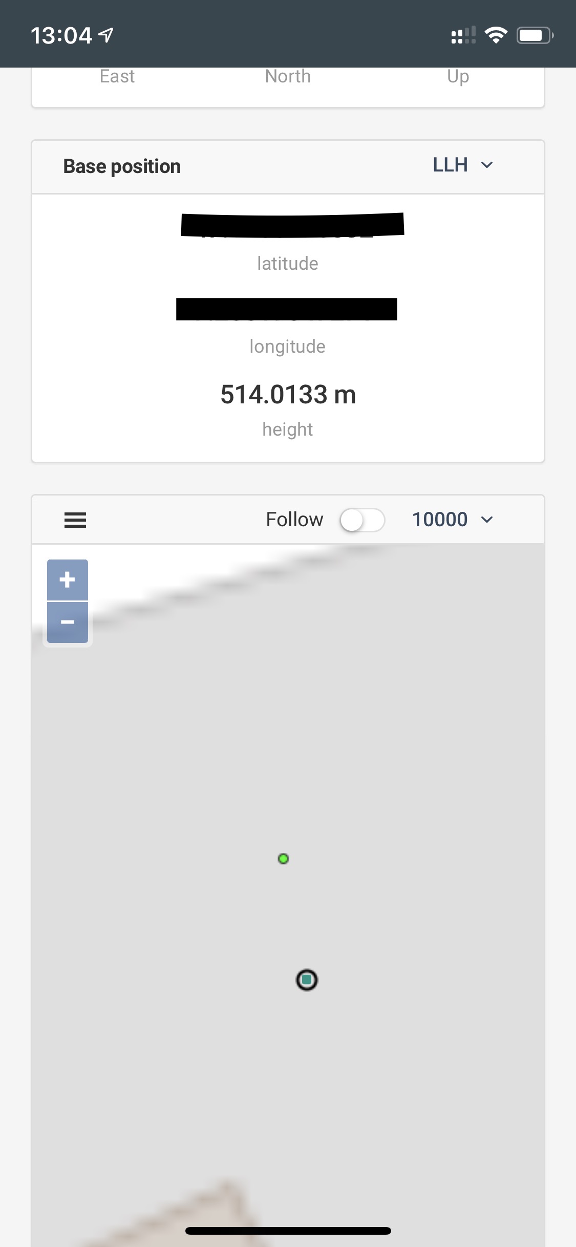
(Disregard the “KINEMATIC” it is now STATIC, this is an old image, just to illustrate the rest of the Data).
First Time Processing I configured the Base Location at its location where it was, during recording of the Flight. Das Processing File I have used the “Base Correction” Rinex 2.11 File. With this I got an offset of roughly 22m. I noticed that this was the amount I have moved the GNSS from Poweron to the location where it recorded during the flight. So for the second Processing I have removed the Station Location Setting and let the Processing Software use the first Location it finds in the file (I assume this is the Base Location which is shown with a bright green dot in the Map of the Status view).
Question: Is this the right way to register PPK Data as Base? Is then Base Correction the Bases current Position Data (which is, as far as I understand, a Fusion of the current GNSS Signals & the NTRIP Data), or is in the Base Correction File just the NTRIP Data, so we could also skip using the GNSS on location?
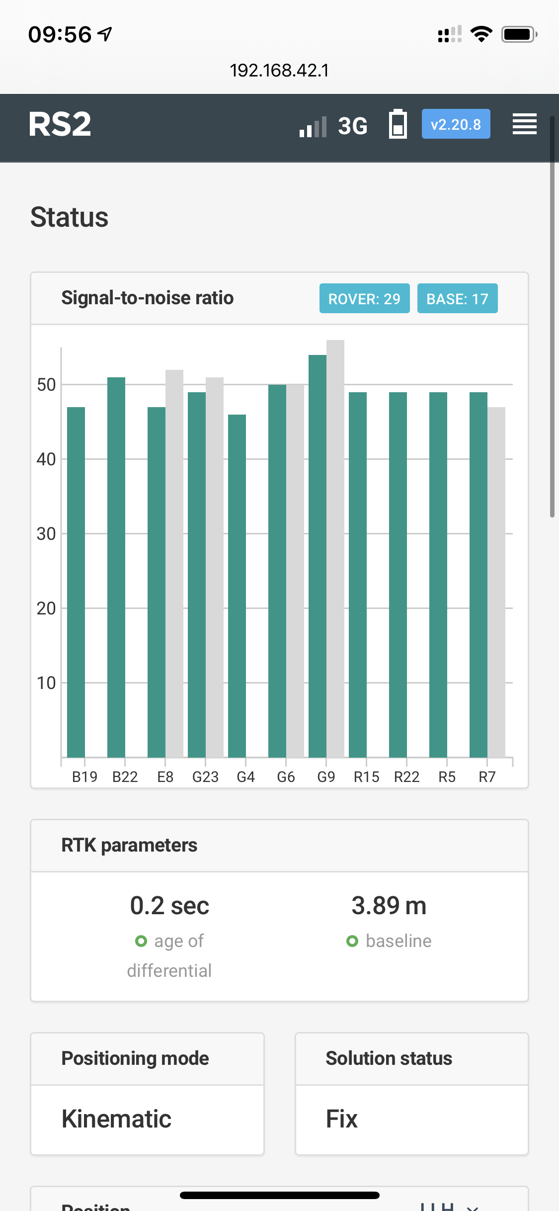
The System is using the latest Software 2.20.8
Added:
I have noticed, that the virtual Base Station Coordinates differ from the absolute Coordinates the GNSS produces afterwards. I assume in order to have the initial GNSS Position which is then sent to the NTRIP Provider, only legacy GNSS (Single or Float Fix) is used. Once received the Position is calculated with the Data from NTRIP, correct? See attached Image (the GNSS was not moved after Power-On, light green the virtual Base Point from NTRIP, dark green current location. The Delta is about 1.2m):
For post-processing, you need the raw data log in RINEX format from both the base and the rover.
Please, make sure you’ve entered the base position you’ve established with the NTRIP in your software as well. I assume this step is generally essential for getting centimeter-level accuracy in any post-processing software.
thanks for your Reply. Yes we use SwiPos (Switzerland) NTRIP Service and we actually can get a FIX for the Station. I have noticed, that the Virtual Base and the current Position from the RS2 differ once the FIX is established.
So what you say is that the “Base Correction” Log contains the very same information that has been recorded from the NTRIP Network just in RINEX Format in our Case? So there would actually be no benefit from using the RS2 when we could also download the Correction Data from our NTRIP Provider? Or is this the Base Correction File Data from NTRIP and processed with the local Information from the current RS2 Location?
Yes for PPK I have used the Base Correction .obs File from RS2 and the Septentrio.sbf File from the Aircraft which is then mingled in the WingtraHub Software.
Maybe I would be happy if it could be clarified:
RAW Data is this only local received GNSS RAW Data or is this processed with NTRIP?
Base Correction Data is this only NTRIP Data eventually converted to the selected File Format without any local added Information from RS2?
If I have to enter the local RS2 Coordinates would I use the ones where the Receiver was really (dark green dots) or were the VRS Fix was established (light green dot)?
If I have to use RAW Data the Septentrio SW does not like several particularities of the file. As others have noted for instance the Timestamps are not “even” which the Software can not handle, so I can not use RAW File.
Any Hints? I have checked the Online Documentation but as to my understanding it was not really explained which file has what kind of information and where it originates from. Maybe the documentation could be improved with the answers to the above points.
Yes, it contains the raw data from the NTRIP network. It’s not modified by the Reach receiver.
It means that you post-processed the data from your NTRIP service with the data from the aircraft. Reach RS2 data wasn’t involved as it’s included in the raw data log.
Raw data log contains GNSS observations from the receiver without the calculation of accurate coordinates.
Yes, the base correction log contains the corrections from the base only. The log format is defined by corrections Reach accepts from the base.
If you managed to establish the fix solution, the Reach RS2 determined its coordinates with centimeter-level precision. You can, for example, average the coordinates with the “Average Fix” mode of the “Base mode” tab and use them afterwards.
Do I understand correctly that your software doesn’t post-process RINEX files where the time is not an integer?
i was able to use the BASE Correction File. RAW failed so far. I made a follow up for this, since the Problem seems to a general Data Quality Problem. Followup is here: RS2 showing bad L2 Data Quality