When using Irish Grid TM75 and bringing it into our geo-referenced ordnance survey maps the points are about 75metres out on the x & y. If you record in Irish Tranverse Mercator then convert to Irish Grid TM75 with a separate app its seems good.
I have the latest Android app and the Reach RS2 firmware’s up to date.
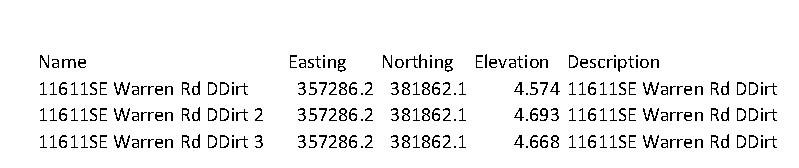
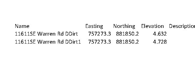
I put the EMLID on a bipod and took 5 measurements averaging over 1 minute for both IRENET95/Irish Transvese Mercator + Belfast height and TM75/Irish Grid + Belfast height.
I took a measurement with one coordinate system then immediately took a measurement in another coordinate system and moved to the next point and did the same thing.
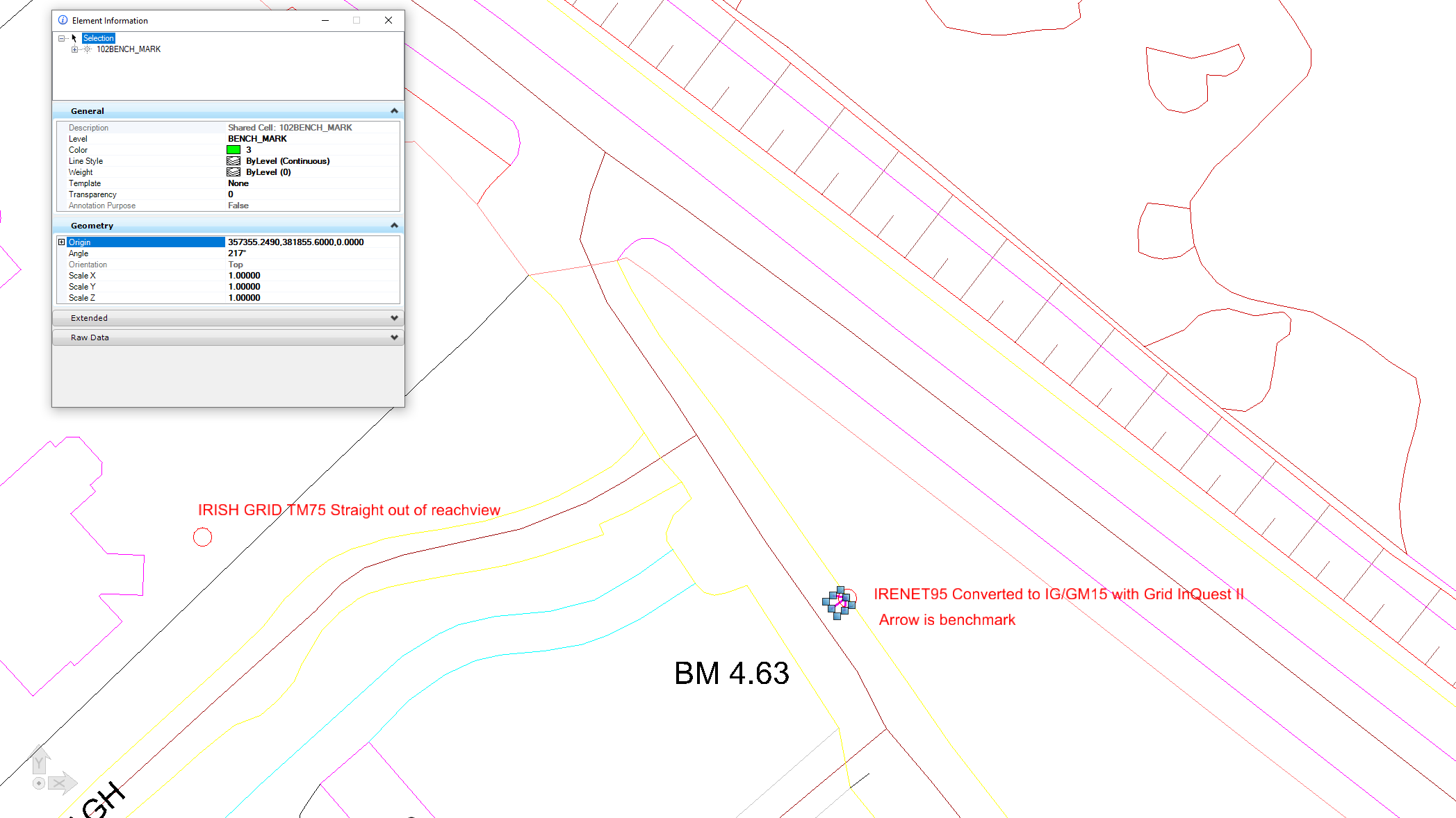
I also converted the IRENET95/Irish Transvese Mercator set into Irish Grid IG/GM15 with Grid quest. (IGGM looks close to TM75. I could be wrong but ties up to Trimble R10)
Can you convert these points to Irish Grid TM75 with your converter? This way, we can check the difference with data in the same CS from ReachView 3. Do I get it right that the Irish Grid TM75 points from ReachView 3 you shared are shown improperly on the map?
Also, is there a chance you have a known point in Irish Grid TM75 nearby? If so, please record it with ReachView 3. Checking how much the collected coordinates differ from the known ones is one of the best helpers in locating what’s wrong.
The maps are already Georeferenced to Irish grid TM75.
The third set of coordinates are converted from IRENET95 to Irish grid IG/GM15 which is pretty close. But I’m no GIS expert so I’m not 100% sure if its exactly the same. Once I bring the third set into my maps they come in very very close to our Trimble R10 set to TM75.
So you want to compare the 2nd set straight off reachview in TM75 to the third set which is converted from Irish Transverse Mercator to IG/GM15.
I’m unaware of any known points nearby but I’ll have a look.
If I find some I’ll get them recorded. What exact method would you want me to use to record them? Just use Irish Grid TM75?
Thanks for testing this on a known point! I’ll need a bit more time to look into the data. If I need any additional details for the investigation, I’ll let you know.
As I see, the base’s coordinates are the same for both surveys in Irish Grid TM75 and IRENET95/Irish Transverse Mercator. But ReachView 3 requires a base in TM75 for Irish Grid and a base in IRENET95 for Irish Transverse Mercator.
If your base is not in TM75, please try to set it in this CS in the Base mode. Does the shift persist? In case you’re working with a local NTRIP service, please let me know which CS it uses.
NTRIP services usually provide corrections in local datums, so they depend on the country. I couldn’t find which datum is used by your VRS service, but you can reach out to them to check it.
I’ve looked into this with our devs, and it appears you’ve caught a transformation issue with TM75. Such situations are extremely rare but can come up since it’s hardly possible to test all CS locally. Still, we constantly check coordinate systems in ReachView 3 to ensure everything works correctly.
Our devs are now researching the situation with TM75 to provide a solution. In the meantime, you can work with a base/NTRIP in IRENET95 and coordinate systems based on IRENET95, such as Irish Transverse Mercator. They should work well.
I can’t take credit for finding the problem. It was GeoConor from the link in my first post that spotted it.
I only confirmed it hasn’t been fixed, but then he didn’t update you with any of the information you requested.
Hopefully it can be fixed soon. Currently I’m only using the EMLID Reach RS2 to pick up 5-10 GCPS so having to convert the coordinates isn’t too much of a hassle. If fixed I will probably recommend the platform for use within a few other departments within our company. When fixed and after a bit of testing we’d probably buy a few more.
I’m back with the news – starting with Emlid Flow 9.5, TM75 / Irish Grid (non-legacy) is available in our CS registry. It supports the necessary transformation and should work fine. If you have a chance to try it out, we’d be glad to receive your feedback!