If you updated your Reach via wi-fi, then turning it on in this network’s range will make it connect to it by default. If Reach connected to your home network, it won’t have the same IP address. Try opening ReachView with http://reach.local url(if you changed Reach’s name, put it in before .local).
If it’s blinking magenta/green, then Reach is waiting for time to sync. In the hotspot mode this can only happen with the antenna plugged in and some moderate satellite visibility. Check 192.168.42.1:5000 to see if my guess is right.
We’ve decided not to start the app before the time sync occurs as it leads to some unpleasant consequences when writing logs. You can still access reach with some kind of SFTP manager, like FileZilla.
I tried out 2.2.5 with the Pixhawk, but noticed that the altitudes are still in WGS84 rather than MSL. Will the Ardupilot GPS driver for the Reach require updating?
I can confirm that NTRIP is working now on v.2.2.5. I am using rtk2go.com and it’s working including dropdown menu. Of course, I don’t know if that’s the update or if rtk2go got something fixed. Thanks.
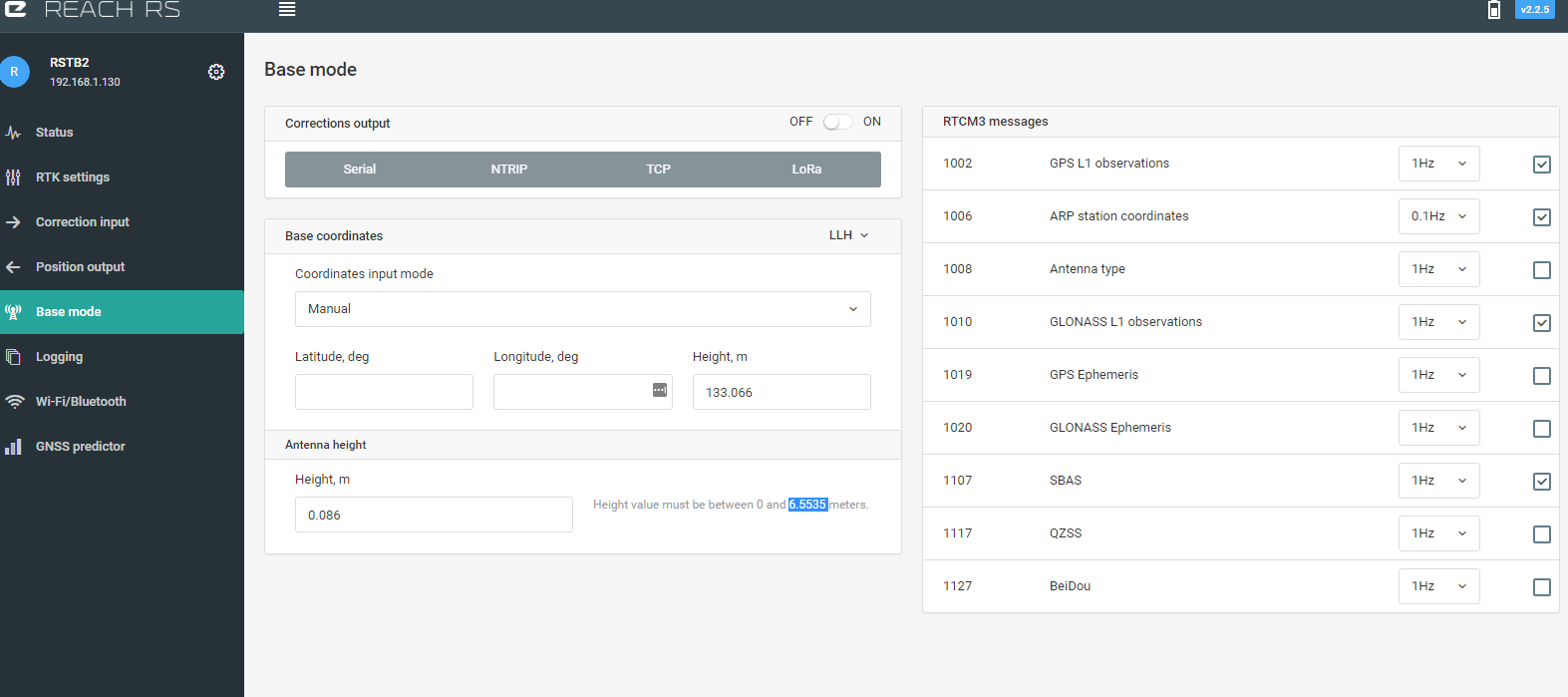
Unless we give up that 1/10th millimeter antenna height accuracy and move the decimal point for a max 65.535m then it would be OK. I don’t know what repercussions that mod would have in RTKLIB or the various protocols though.
Oh well, I guess I just have to shorten the pole to 6.5535m then.
Yes, MSL is wrong in the ERB binary protocol. My solution is to subtract 42,125m to the reach reported height. state.location.alt = (int32_t)((_buffer.pos.altitude_msl -42,125 ) * 1e2);
This is of course very ugly, but it works for the locations that I fly at.
By the way could you please add “differential age” and “AR ratio” to the ERB binary protocol ?