We have added manual input of the coordinate system parameters in the ReachView 3 app. Now, if you work with a coordinate system (CS) that is not included in EPSG, you can set up its parameters in a few steps.
Configure Coordinate System Parameters
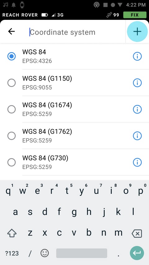
To run the New CS tool in the app, start creating a new project, click on the Coordinate system cell, and tap on the plus button.
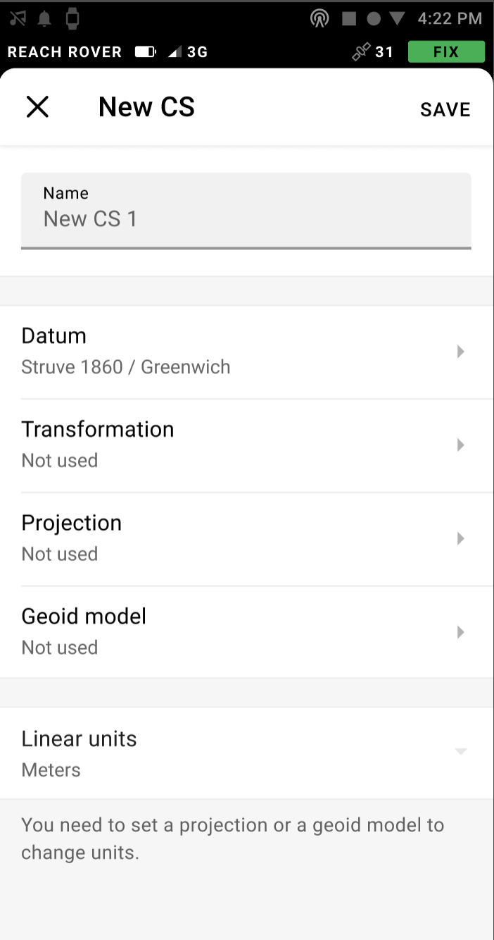
First, enter the name of your coordinate system and select the ellipsoid your datum is based on. You can choose the ellipsoid from the list.
Then you can set the required parameters or skip some steps, depending on the use case. For example:
If your base transmits coordinates in one datum and you need coordinates in another datum, you only need to perform the transformation, skipping projection and geoid model;
If the projection is performed from the same datum as the base, you can omit the transformation;
If you work with the ellipsoidal height, you don’t need to select the geoid model.
Once the new CS is configured, click the Save button and finish setting up your project. The new parameters will be saved for later use and will be available at the top of the CS list when creating surveying projects in the future.
Check out the detailed guide on setting up your coordinate system parameters in our Docs.
I have been waiting for this custom coordinates for ages, only what remains now is manual input of coordinates in point stake out and line stake out using bearing and distances.
As mentioned in an earlier post here, this is a very good development, manual entry of coordinates when staking out would be wonderful.
Personally I’d love to see reachview have the ability to import polylines and polygons either in shapefile or dwg format.