


Thanks and a great weekend to you too 
Hi, In the new version of Emlid 3 beta. There’s a way we can measure point or a group of point, ( cogo), like other software.
So we can get the area of circumscribe an area.
3 Likes
Its a GREAT day! Thanks EMLID
2 Likes
First off congrats on the great work @egor.fedorov. Long time coming. Lots of great input here. Really looking forward to localization and custom CRS support!
5 Likes
This requires a better introduction to the topic so that there is no doubt about the origin of the calculation formulas for coordinate operations.
My general remarks:
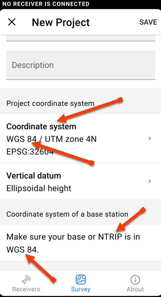
The terms WGS 84 coordinate system and NTRIP are colloquially used. There is no such CRS (coordinate reference system) in Europe, actually, ETRS89 is used (the title should be ‘Coordinate operation’ instead of ‘Coordinate system’).
For example, in Poland we have in use:
PL-1992 (Transverse Mercator Mapping Equations, Hooijberg, Practical Geodesy, 1997,)
• 19 ° E (-5 300,000.00 m X, 500,000.00 m, 0.9993)
• Note: one zone 10 ° 30 ’ for the whole country
which requires an extended mathematical formula.
Hence my question, what sources do the calculation formulas come from? There are several of them, one of them is the IOGP documentation: Geomatics Guidance - Coordinate Conversions & Transformations including Formulas.
My general remarks:
The terms WGS 84 coordinate system and NTRIP are colloquially used. There is no such CRS (Coordinate Reference System) in Europe, actually, ETRS89 is used (the title should be ‘Coordinate operation’ instead of ‘Coordinate system’).
1 Like
Hi Miguel!
COGO functionality is definitely in the roadmap, we understand it’s essential to a great surveying tool. Right now we are focused on general coordinate system support, and at this point we need feedback from the community to make this work for as many areas of the world as we can. As soon as we’ve done that necessary step, COGO and other surveying features will start finding their way to the app.
7 Likes
Thank you for the your kind words. Obviously, the new app is a product of an enormous effort of our whole team, so the congratulations will be shared
7 Likes
Thank you for your questions.
ETRS89 based projected systems (like EPSG:25832) are supported and can be found in the project systems list just like WGS84 based systems. So, in Europe this idea is to use ETRS89 based systems.
I can see the logic behind using the term coordinate operation, using it makes sense. However, we’ve decided to stick with system, because this is how the EPSG registry is structured.
The Poland case turned out to be quite complex. We are currently investigating actions required to implement it. I’ll make sure to notify you once we consider it ready for testing.
1 Like
Maybe You know it,but I didn’t read about, I created a new project and tried to import a few points, just for testing, I couldn’t import them, but after that I tried same thing using same file, but the project was where I tested reach 3 , and I could import them. Hope it can be useful to solve that in case it was necessary. See the pics
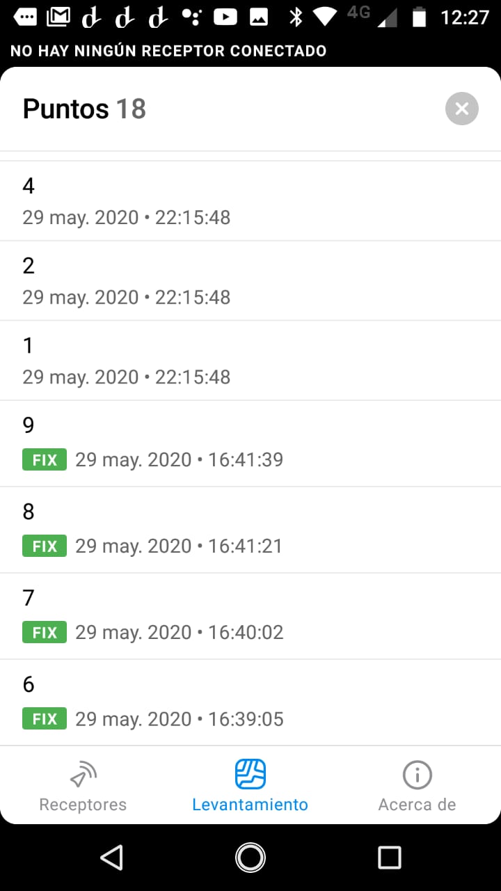
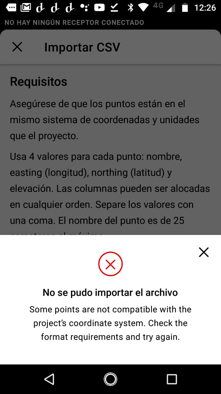
both project are posgar 98 Faja 4
Forget what I said, now it works, I installed again the app and it works
Great news, thanks for the hard work!
Since you are already reworking the RV app, would you be able to make the choice of coordinate system even more idiot proof? Perhaps let the person choose which country (or click/pick to a rough geolocation on a map) they are working in and have only the option (-s) applicable to that country show up (or being able to be applied)?
5 Likes
![]()
![]()
![]()
3 Likes
This is truly an incredible step forward. congratulations and thank you.
4 Likes
Thanks for the report. The app did not crash, did it?
Please PM me some details:
- the csv file you’ve tried to import
- Coordinate system your project was in (I see the CS in your next message now).
- Your phone model and Android version
We’ll take a look and try to investigate.
That’s an idea we definitely want to pursue. We’ll offer stuff that’s relevant based on the user’s location once we go into a full production release.
Thanks for your suggestion.
4 Likes
Hi @egor.fedorov, Ghana still uses EPSG 2136.
EPSG 2137 never replaced it officially. It’s something that is mostly discussed at our universities that train surveyors. The government spent a lot on that project. As to why the Legion projection based Clarke 1880 ellipsoid was never implemented we have no idea. The only clue I’ll bet on is Ghana was in a military era. Thank you. Let me know if you need the datum, projection and ellipsoid details. I’ll gladly forward it to you. You can find it on the epsg website as well just that some of the information as far as Ghana is concerned, is misleading . Stay safe!
1 Like
Any thoughts about adding the ability to upload a jpgw or similar georectified raster image to be used as the background map in survey and stakeout modes? I find that the OpenStreetMap as a background does not provide sufficient detail at the scales I work at to be useful.
7 Likes
It should also be possible to disable all cards. Important for large-sized shooting.
Excited to take the new app for a spin! (My field personnel are going to be thrilled that they don’t have to remember to grab the metric tape measure every time they take the Reach units out). 

Thanks for all your hard work, Emlid team!
8 Likes