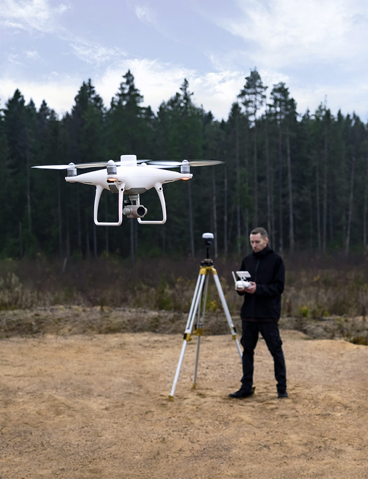
Emlid team has tested DJI Phantom 4 RTK with Reach RS2 as a base station. Phantom 4 RTK receives all corrections from Reach RS2 over NTRIP and gets instant and reliable fixes in the field.
In the case of RTK mapping, precise georeferencing of the photos occurs in real-time. The DJI RTK drone needs to get corrections during the flight from the base station with the NTRIP caster. That requirement makes Reach RS2 a comprehensive fit for the flight mission.
We gathered all the information about how to get started with this bundle for you. We tested this workflow with Phantom 4 RTK, but it also will work with any RTK-enabled drone from DJI. Check out the detailed guide about integrating Phantom 4 RTK and Reach RS2 in our docs!
I’m a beginner at this, so apologies if there any obvious flaws in my thinking.
In this article the RS2 is the base and then in communication with the drone (which is acting as a rover) it can send the corrected position in real time to write to the exif of the photo.
In the article just published featuring Christian Greuner he speaks of using a second RS2 as the rover and fixing GCP’s and Checkpoints. I think that article said 15-120 seconds was typical to get a fix for the rover.
My two questions:
Given that the drone is traveling at x m/s and thus the position needs to be written nearly instantly, how will the absolute accuracies of the two methods compare given than an RS2 rover needs much more time to figure out the position?
Could this article’s method integrate the use of checkpoints by just taking a set of photos from around a site and then pulling the position data from those? Or would that not be “independent” enough?
I’m no official source, but I have a couple observations.
Regarding 1, it’s not that it takes RS2 longer to get a fix solution, it’s that you can minimize inconsistencies if you do a short averaging. It would be best if we always did that but, obviously, it’s impossible on a moving drone so it is the main reason why many will tell you that PPK is superior to RTK in that case. I can’t quantify the absolute differences between instant and averaged accuracies, but it should only be the difference between very good and best you can possibly get. Since the rover would be used to measure GCPs, the second option is definitely desirable.
Regarding 2, the idea is to have a set of tie points that are independent from your flight, using them to anchor the entire survey to reality. Often the images will yield products that are mostly aligned with GCPs right off the bat and It could appear possible to skip GCPs entirely. But then without those it would be difficult to validate the results and ensure good quality control. With GCPs, it also then becomes easier to further tie/compare the entire project to a geodetic network if you really need bombproof validation.
We’ve tested that Reach RS2 can transmit all necessary corrections to the DJI Phantom 4 RTK. It should allow the drone to calculate precise image center coordinates. However, I can hardly comment on the particular accuracy DJI Phantom 4 RTK can achieve, as we haven’t done any thorough testing of that.
Let me elaborate a bit on how GCPs work to make it clearer.
GCPs are points with known coordinates on the ground in the area of your interests. You can use them to improve and check the accuracy and get the map’s correct scale and orientation. Also, they are needed for absolute positioning. To find some tips on placing GCPs, you can explore the Breaking Down the Drone Mapping: A Step by Step Guide.
If you work with a drone that can save image center coordinates in RTK, you will need only a few GCPs to check the accuracy. With a lot of GCPs placed, you can get centimeter-accurate results without RTK/PPK mapping drone. Please note that in this case, enough GCPs quantity highly depends on the site area.
As Gabriel said, GCPs should be linked to the ground and be independent of the flight data. That’s why a subset of photos can hardly help to check the result.
Hello,
Thanks for the article.
I red in a Facebook Phantom 4 RTK group that a guy successfully used a Reach RS+ unit as RTK base thanks to your caster.
I actually tried it with no luck.
Did you tried it?
It would be great to have a feedback from you!
We haven’t tested Reach RS+ as a base for the DJI Phantom 4 RTK. As far as I know, the drone has a multi-band GNSS module onboard. So, it likely requires multi-band base corrections, which Reach RS+ can’t provide.
I think you would struggle with a single band receiver even with a clear view of the sky, far better to use PPK with the RS+ which works well. As Kseniia says the P4RTK has a multi band receiver and expects multi band correction data. We use both PPK and RTK (via Emlid Caster) with the RS2 and our P4RTK, PPK is our preferred workflow, however if we have a base position we’ll fly missions in RTK (which provides better positioning of the UA) but log observations for PPK, that gives us the best of both worlds! We have found PPK to be significantly more accurate than RTK with both the RS2 and the DJI D-RTK 2 (which we never really use now).