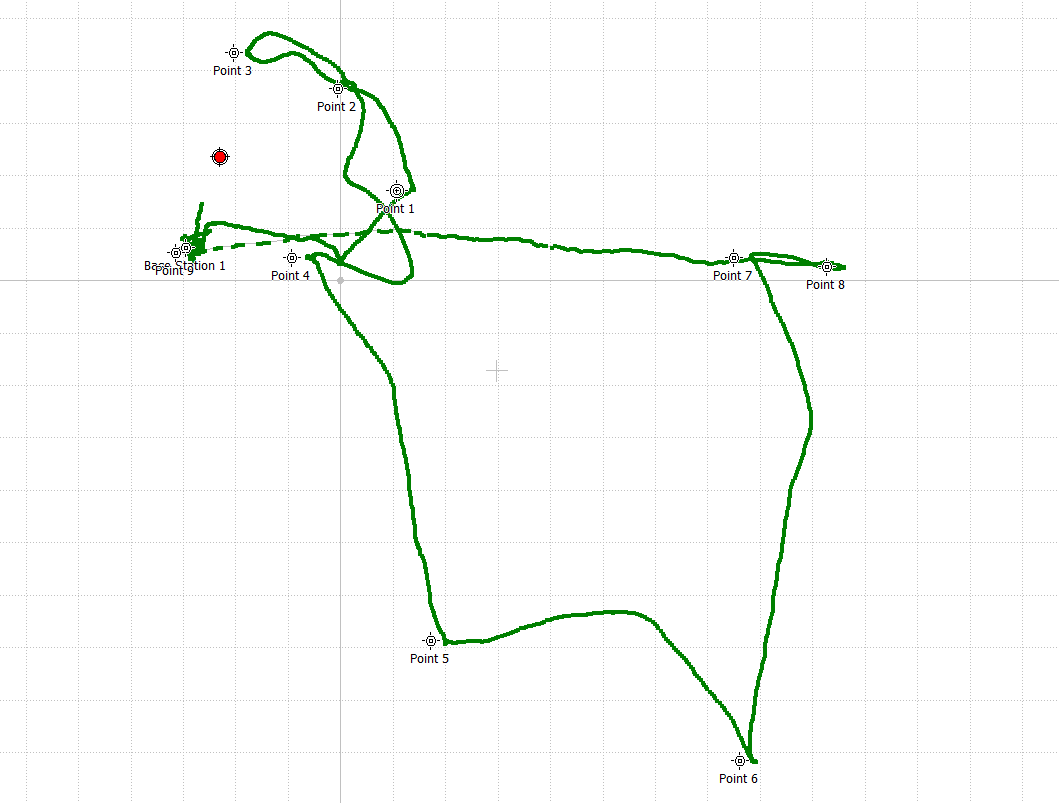
I have tested my Reach RS+ I am not sure which one I used to measure my GCP? I am not using Ntrip, But this is my GCP coordinates and this is how is shown when you plotting them.
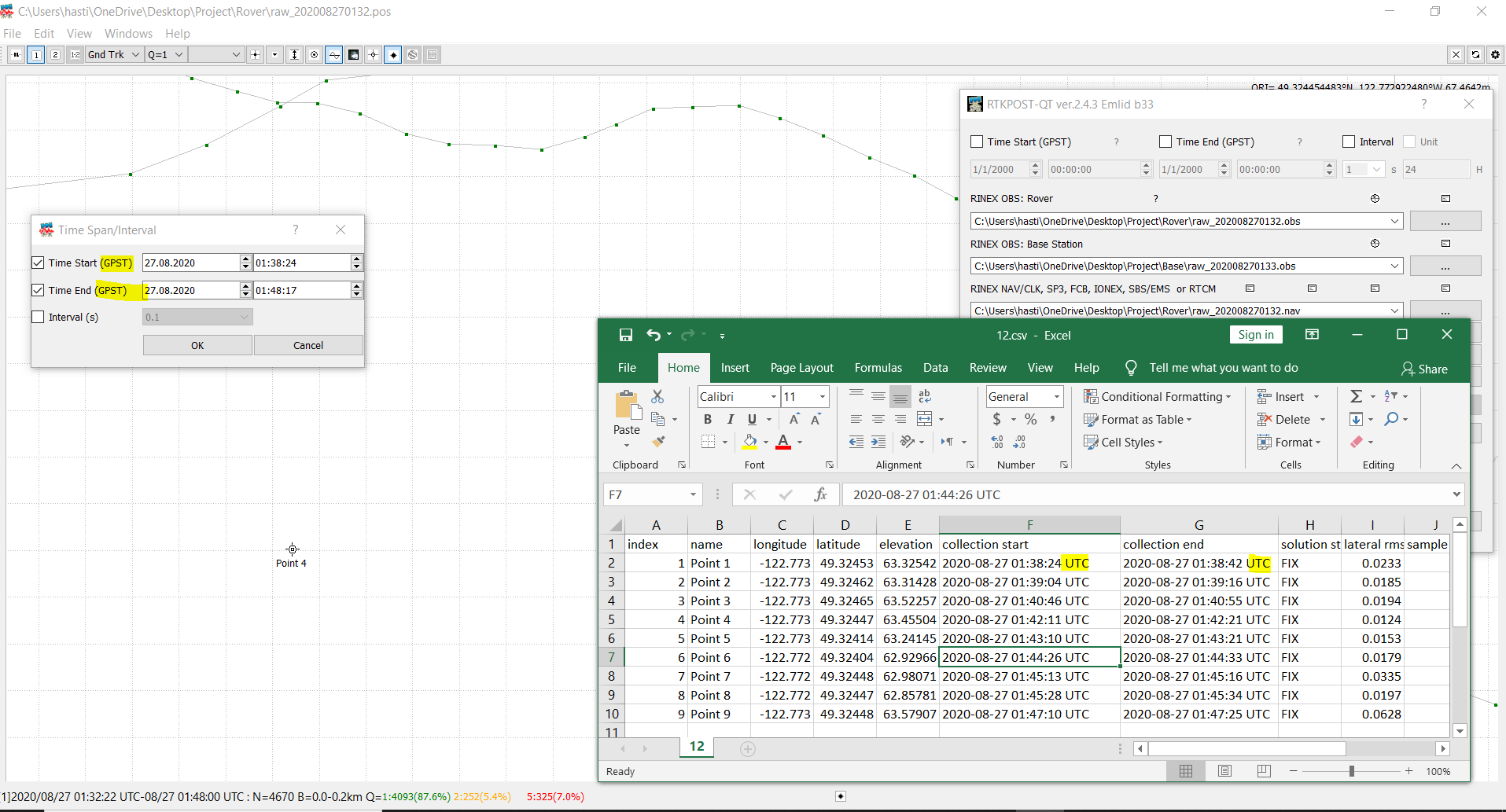
1- How to get exact point after post-processing?
2- How to write down the time, I believe there is an 18-sec difference between GPST and UTC? Do I have to calculate it manually ? or there is an option in Plot you can change It to UTC but still, it shown as GPST is it changes when I change it in the option.
I can suggest using a 3rd-party app, as RTKLib doesn’t support the GCPs extraction just out of the box. You may take a look at the Point extractor, which @agrimgalina mentioned. We haven’t tested the software, but our users confirm that it works fine.
You may use a workaround to get the point’s coordinates. In RTKLib, you can process a raw log in installments by time intervals for each point. If you choose the Static Positioning mode in the Setting1 tab and the Single Solution for Static mode in the Output tab, you will get a single point solution.
I’m afraid that in RTKPost you can change the time format only for the output result. However, you can change the UTM to GPST manually adding 18 seconds to each value.