If you really want to use as many satellite constellations as possible, then use (2) RS2 receivers and LoRa.
Or just settle for what the NTRIP provider offers and it will probably still work just as fine. i.e. fast FIX and in troublesome areas like under trees etc as LONG as you have that NTRIP connection via Cellular or whatever. You’re also at the mercy of this also.
So I go back to what I “personally” prefer… (2) RS2 receivers as BASE and ROVER via LoRa.
There will be tradeoffs for whatever the situation is. i.e. long distance beyond LoRa, or hilly/mountainous terrain may need to use NTRIP “IF” good cell reception etc.
Hi Tim,
surely I would like to have 2 RS2.
I planned to buy another one shortly.
I wanted to see how it worked before taking another.
But the network provider says they have had a contract to provide free ntrip fixes on the four constellations.
So it’s something I’d like to use.
Se hai due RS2 collegate via ntrip, puoi anche lavorare in due uomini…
Here in Italy, you can’t always leave a base unattended, in some cities it would be stolen after 5 minutes.
understandable, one would be foolish to leave it on it’s own…that’s why you need to have another man stay with it…or use NTRIP like you want and just settle with what the provider offers. Tradeoffs. ; )
Right now I’m in another region, about 300km away from the “Umbria network”.
I think I can still try some mount points, because it can connect; only mount point near will be different.
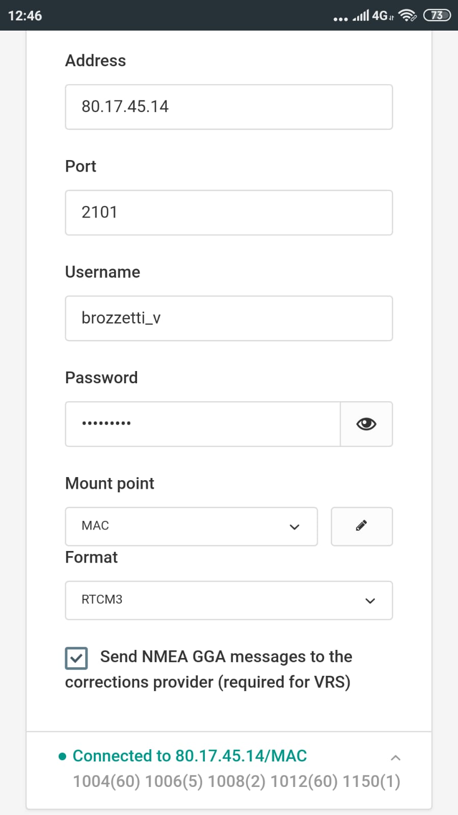
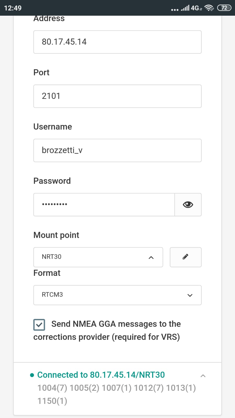
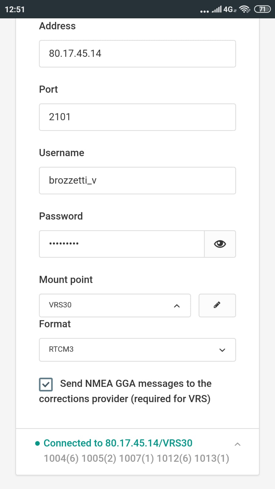
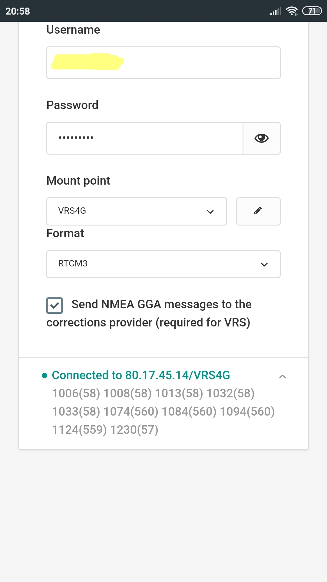
mount VRS30:
this mount behaves strangely; even the network provider does not know why VRS30 connects to a base here where I am now at 3/4 km;
I’m about 300km from the umbria free network.
I send you screenshots and logging data anyway.
Hi Gleb,
this morning then, I was contacted by the provider NTRIP, he told me that perhaps the failure to correct GALILEO and BEIDOU depends on their problem.
They told me to try another port and mount; I am sending you this further test:
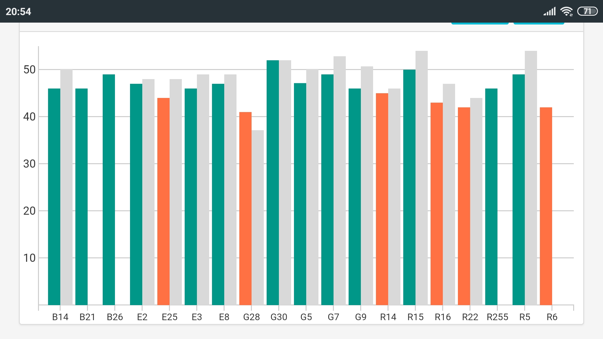
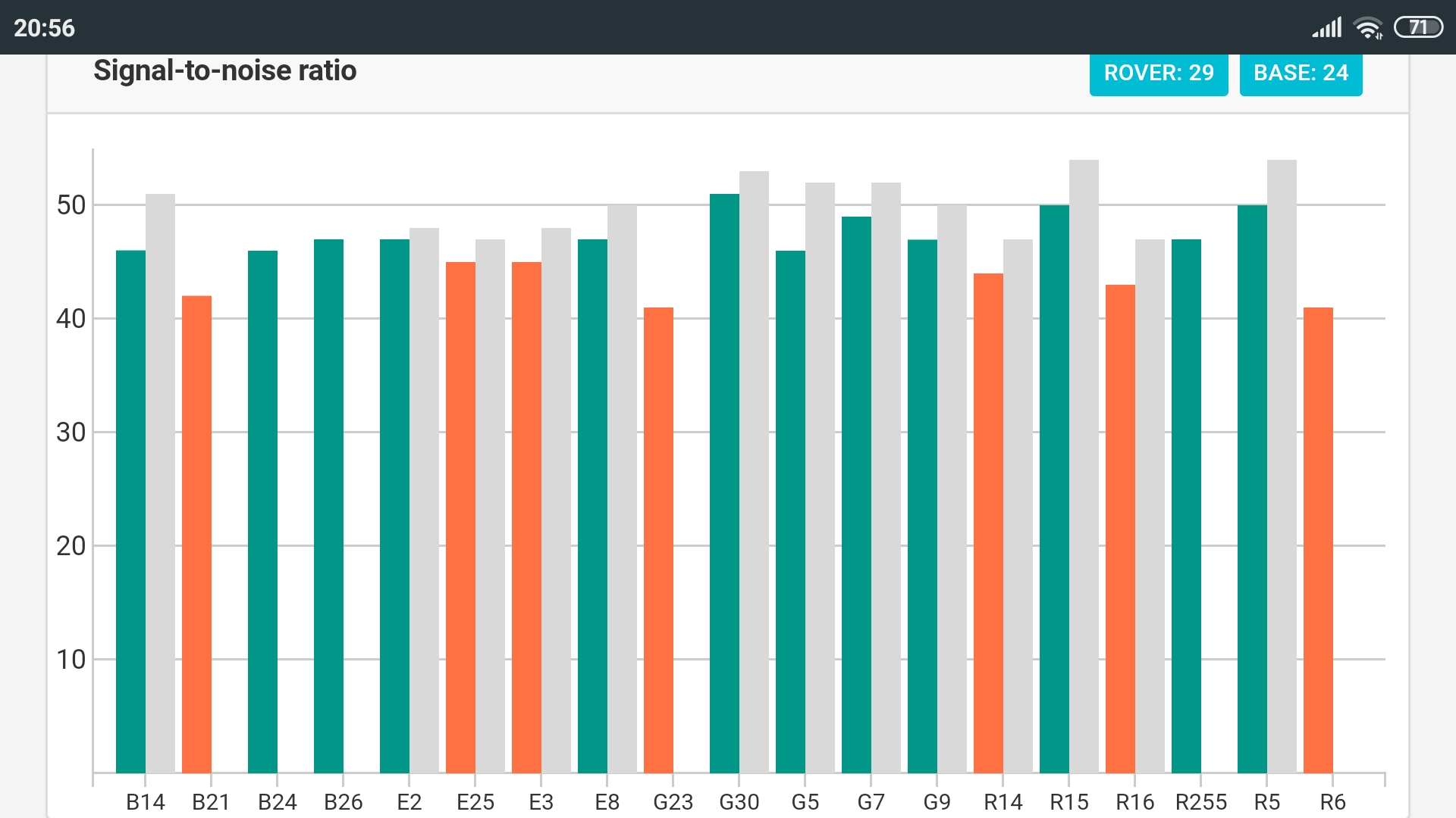
with this configuration the codes appear (1094, 1124), but SNR shows only GPS and GALILEO correction; GLONASS has disappeared and BEIDOU is not visible.
Another very strange thing in the status is shown baseline of a few centimeters … ??
How is it possible?
It is a VRS, so the Base position is made up of data from multiple physical stations and made into 1 virtual station, hence why checkmark in “Send NMEA GGA…” is important when using VRS NTRIP
Thanks Christian,
I had never seen a base VRS so close (12cm), I thought it was a mistake.
Another strange thing that makes me think of a mistake, is the fact that this VRS starts from 0cm, and then increases continuously until it reaches 70 cm and then now 8 meters … as if it were also average with my rover; is this possible?
Hi Christian,
i contacted the provider, he also thinks that the strange behavior of VRS is linked to the excessive distance from the Umbria network.
But the referent of the provider cannot tell me much more, because its specialist sector is not GNSS systems but he is a computer scientist.
The service provider then has a contract with a topographic equipment supplier, when there is a problem, the provider contact this supplier.
If your CORS/NTRIP provider cannot reliably give you an answer to some straightforward questions then I’d be looking at another provider pronto.
…or save the CORS subscription, buy another RS2 as your own base and feed the corrections into to your own SNiP caster or rtk2go service. Become your own multi constellation NTRIP provider!
Hi DirtiHarry,
Yes, I also think I want to buy another RS2.
I also have another paid NTRIP provider which is only GPS GLONASS.
I use this paid provider to verify the other free NTRIP provider … The free provider is a young service, born a few months ago, perhaps the provider’s contact person is not very experienced, but it is worth doing some tests, since he seems able to provide corrections on gps, glo, bei, gal … Even the paid ones do not offer the 4 constellations …
It is worthwhile to make tests.
Hi gleb.gira,
I managed to talk to the designer of the “Umbria Network”.
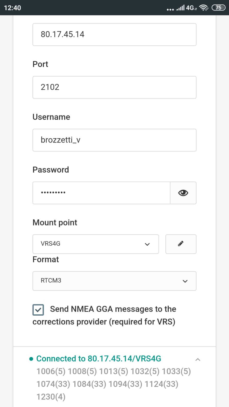
Maybe now I’m getting an NTRIP fix on four constellations.
Only this evening I was able to do the first test and compare with a GCP.
The network managers ask me to do tests;
I am the first user (and for the moment the only one) to use the correction of the four constellations.
If the tests give a positive result, the manager will open the correction configuration on the four constellations to all users.
I will do field tests as soon as possible, to see in a practical way how it behaves with this configuration in working conditions.
I ask you if possible to verify the data I sent you to understand if the system is working correctly.
Hi Dmitriy,
I couldn’t try any checkpoints again, because I worked outside the region.
Another problem for testing is that the ntrip correction service (gps, glo, gal, bei) is not stable.
At this moment I can connect to the port, but I don’t get any rtcm messages.
On other occasions I contacted the service provider who temporarily fixed the problem, but after a few days for some reason I don’t know the service stops.
I have to start over and contact the provider to understand the reason together.
Hi gleb.gira,
I was able to talk to the engineer who designed and installed the ntrip network. They are working to fine-tune the service.
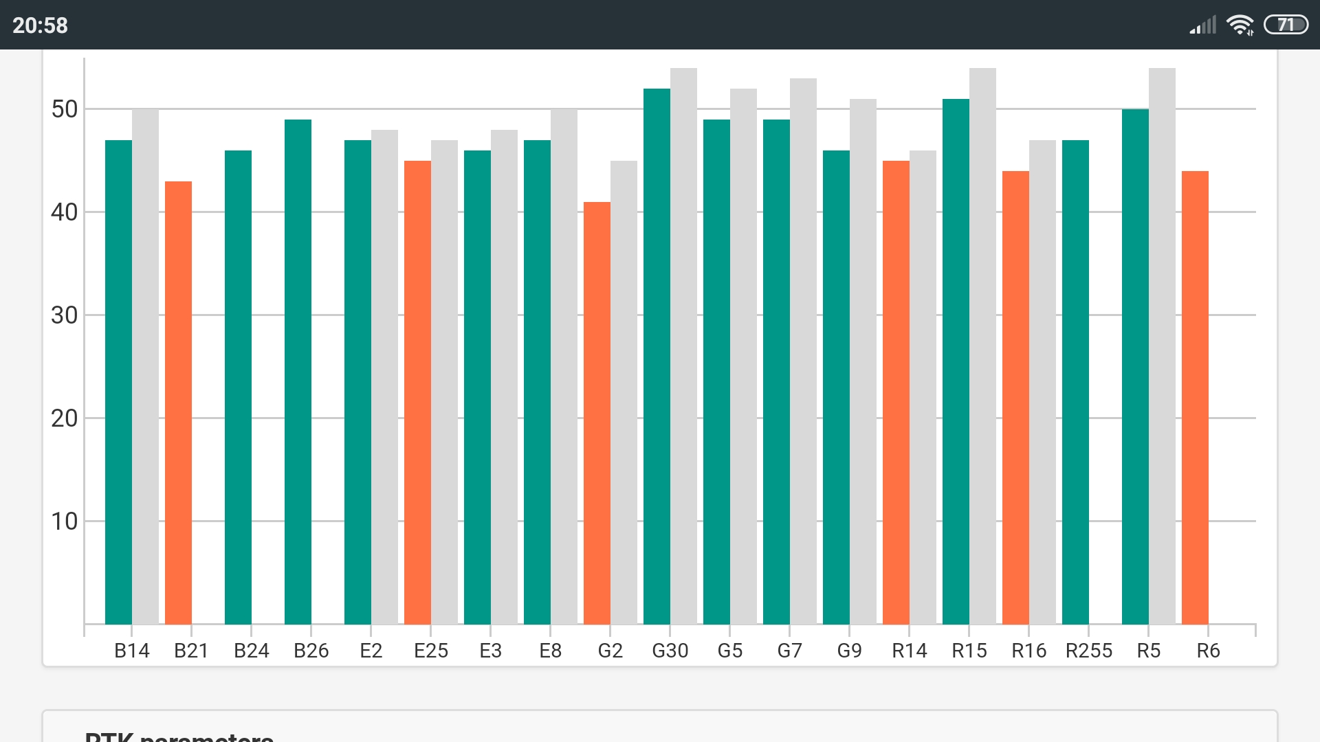
Now I can receive ntrip correction on the 4 constellations, but only in VRS.
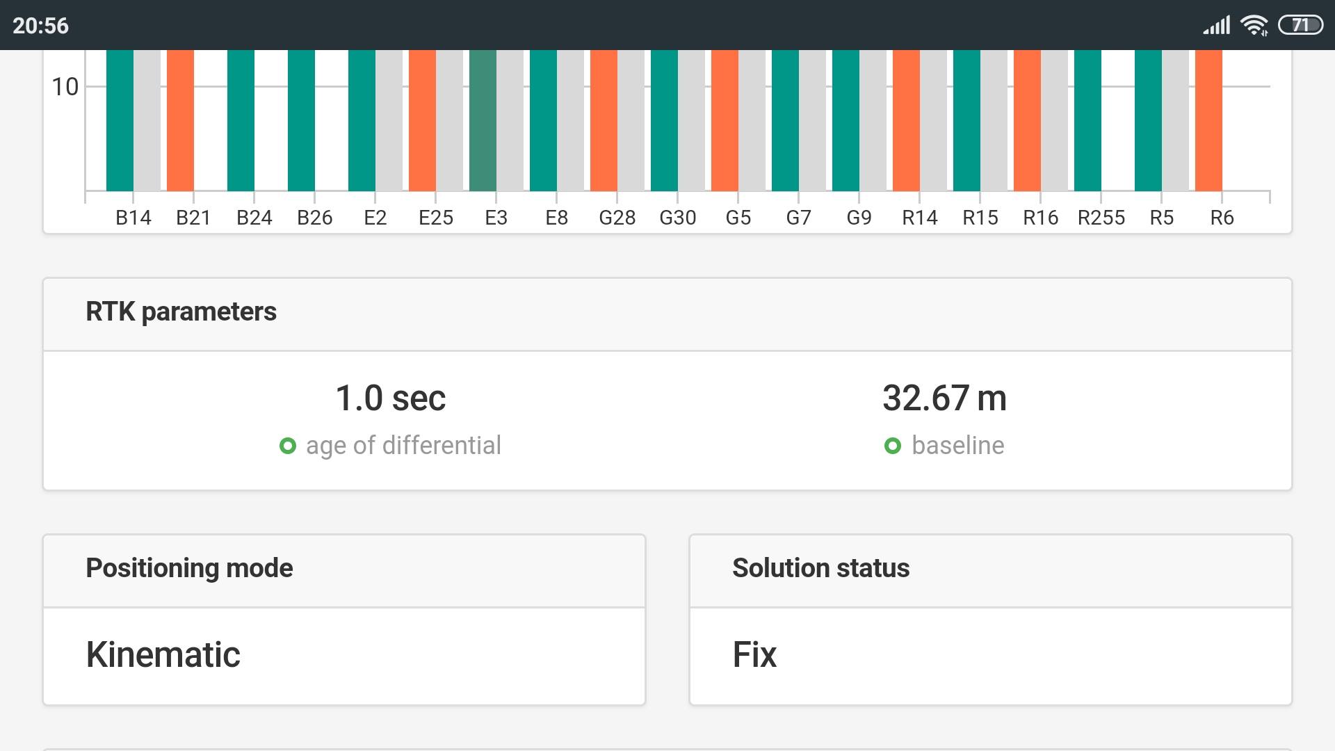
I found an anomaly with the baseline in VRS; the baseline in VRS is always too short (a few centimeters).
I spoke to the supplier and he replied that (a few centimeters) is a mistake; they will correctly set the baseline of the network at about 4 km.
I asked the design engineer of the network, if it is possible to have the ntrip service also on NEAR mountpoint; he replied that they can do it.
I am waiting for the supplier to make corrections to the ntrip network service and then I will send you the registry of basic corrections.