


We Took Multiple times on data same issue faced on Every time RS2+M2.
We Use RTK Lip qt & Redtools Trail

You need to explain a bit more.
Hi,
This is Venkat We are using Emlid RS2 &M2 for PPK, Field Survey after We use RTKLIP Qt & Redtools software (Trail Version) for Geotagging but Both Software is not Properly Geotagging so we cannot process the data…
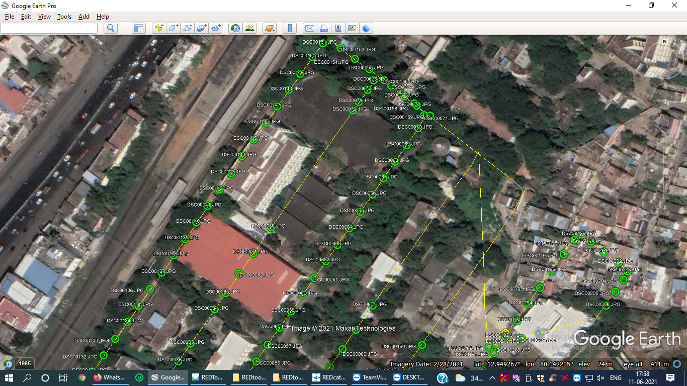
Below one Raw data Attached Wetrasfer Link - https://we.tl/t-YVOTFTEDLP
We sent the same data Redtools software peoples…
Thanks…
Thanks…
Your Rover SNR isn’t too good. Can you show your hardware setup?

How and where is the M2 installed? Can you show a picture?

Is the top cover also lined with copper tape?
yes its top cover also lined with metal sheet along with copper tape multi layer.
Please check your connections:
- From the M2 to your camera, this can cause missed events.
- From the M2 to the GNSS antenna.
In general, your rover data quality isn’t too good. Try moving or elevating the antenna.
From M2 to Camera its direct soldering and no chance to disconnect from the unit.
M2 to GNSS antenna made all possible isolation and shielding with copper tape and also metal sheet under the antenna.
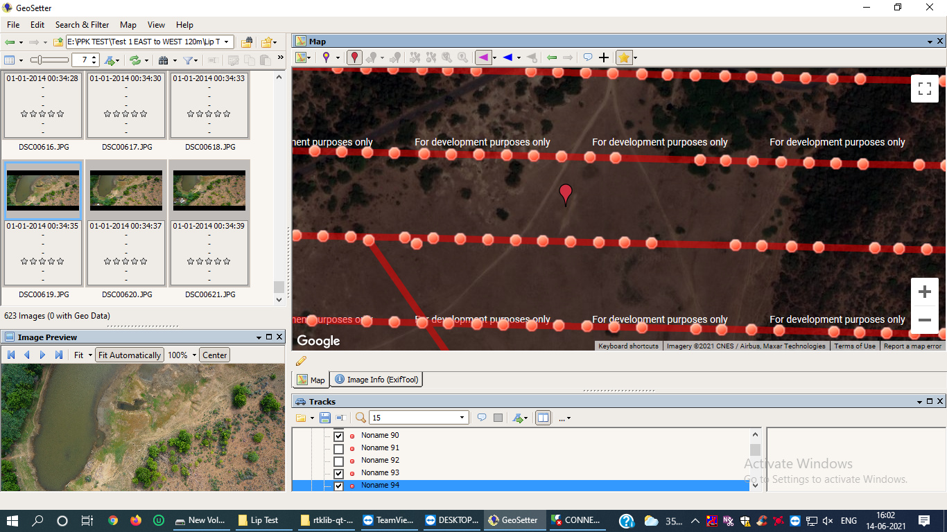
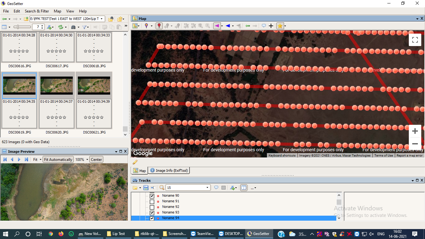
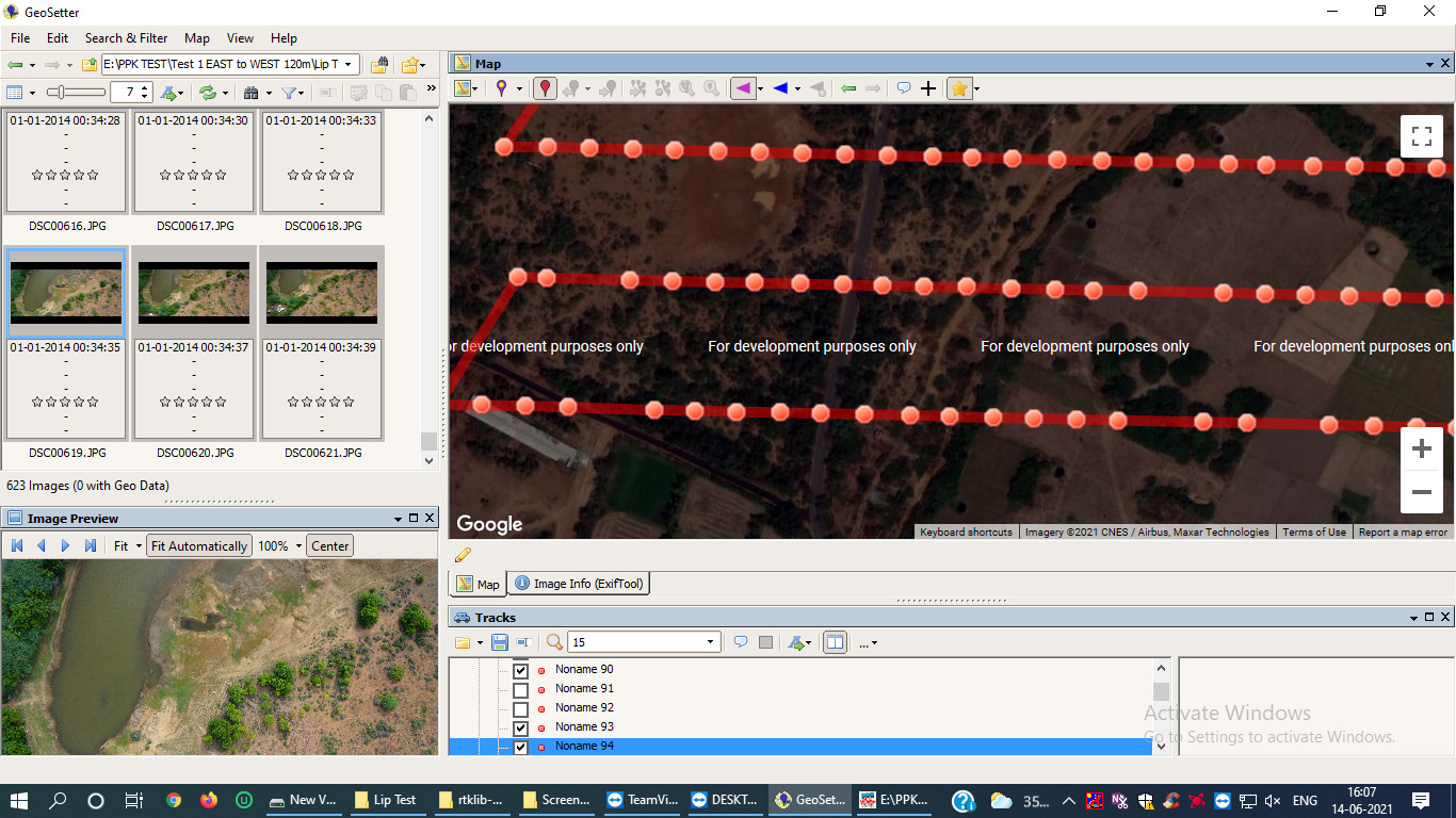
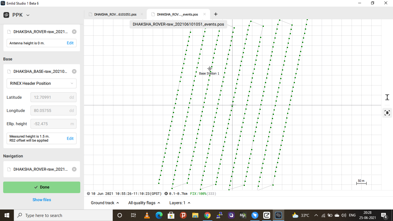
you can see the RTKLIP Qt Rover event pos file which never misaligned but why with GEOSETTER.
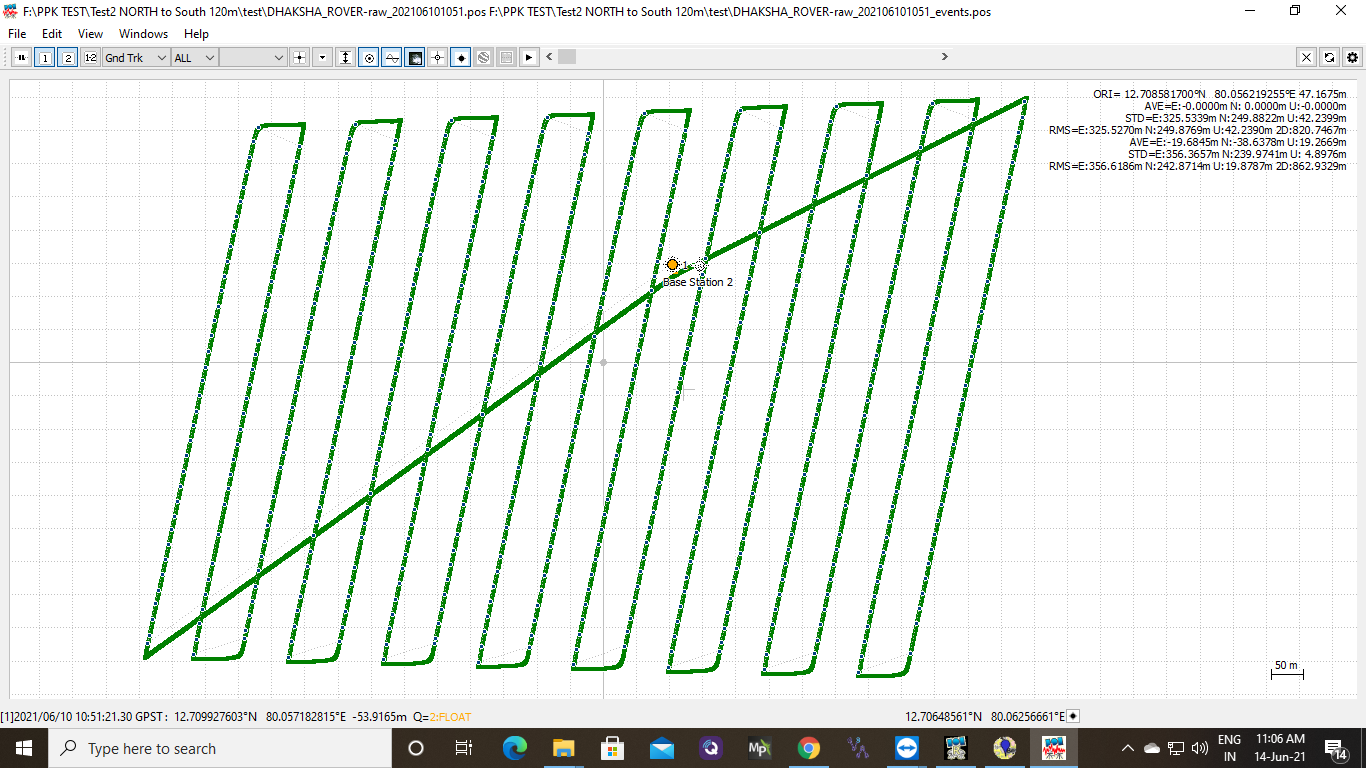
I have no experience with geosetter sadly. However, the rover only generates a Float solution in EzSurv, and if processed using Continuous mode in RTKpost (demo5 b34b), only ~60% of epochs have a fixed solution.
Hi guys,
As far as I can see from the last screenshot, the track has a Fix solution status all the time. So, it seems that the issue occurs at the GeoSetter stage, indeed.
May I ask you to share the raw data logs once again because the first transfer seems to be expired. I’ll post-process the data and try to align images with GeoSetter.
thank you for showing interest to investigate my problems .
here are the screen shots of emlid studio also.

I have one doubt that when uploading Rover UBX file its ask for an antenna height. **
** An Antenna height we have to take respect with camera to antenna bottom or ground(relative height)to antenna bottom.
as you said we got 100% fix solution ,but why not with GEO setter for Geotagging.
did any tool emlid developing for geotagging with images like emlid studio?
same uav same are data taken but you said its bad SNR and noisy signal .
Hi guys,
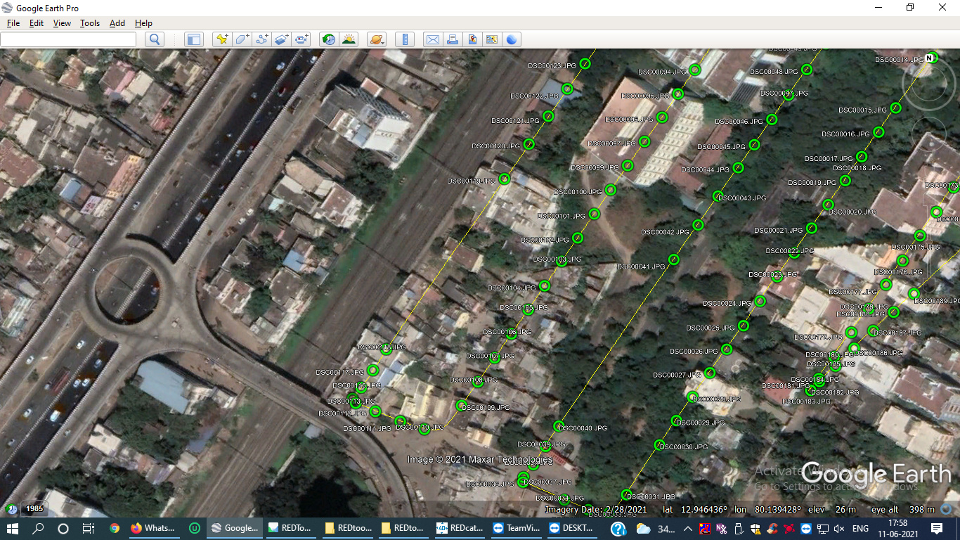
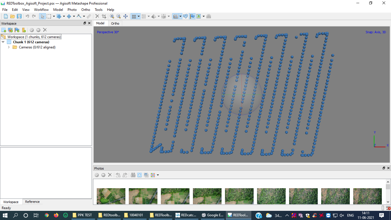
For correct processing in GeoSetter, the number of photos should match the number of image centers. As I see on the screenshot, you’ve uploaded 623 images to GeoSetter, but there are only 200 photos in the folder you shared. Also, I see that you got 333 image centers after post-processing. Could you please clarify which number of photos and time marks do you expect to get? Do you face any difficulties when you upload only the photos that correspond to the time marks to GeoSetter?
An Antenna height we have to take respect with camera to antenna bottom or ground(relative height)to antenna bottom.
You can calculate the antenna height as a vertical distance between the camera sensor center and the antenna phase center. Reach M2 GNSS antenna phase centers’ offsets for L1 and L2 are 0.035 m and 0.037 m, respectively. Alternatively, you can enter the antenna offset in photogrammetric software.
did any tool emlid developing for geotagging with images like emlid studio?
Thanks for the request! We’ll consider adding this functionality in future versions of our software. However, I can hardly provide any ETAs for now.
same uav same are data taken but you said its bad SNR and noisy signal
As Svetlana noticed, the SNR level changed periodically, so it looks like the satellite signals were affected by RF noise from electronics nearby. However, this influence seems not to be critical, so the Emlid Studio can still calculate 100% of events in Fix.
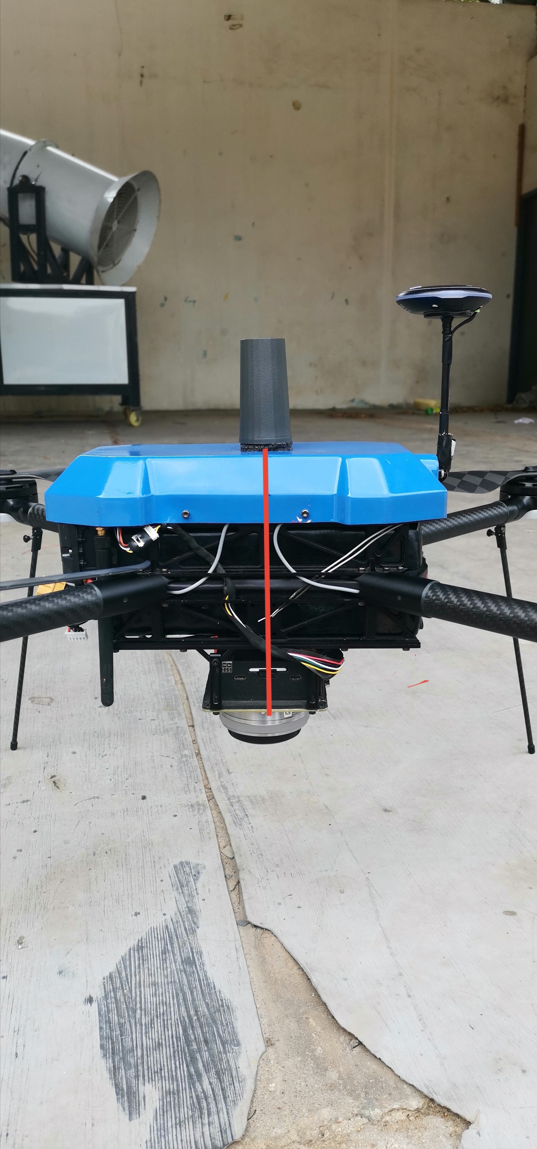
Thank you for support here…here is the my quad camera and M2 placing photo same I have marked for antenna height which is correct
Hi,
Yes, you can measure the height difference between antenna and camera as shown in the picture and add 0.035 m for the phase center offset.
Why L1 band height instead of L2 band ?
The difference between the L1 and L2 offsets is 2 mm only. So, you will get centimeter-accurate coordinates using any of them.