


With the drone it is putting a record in events file, that contains a timestamp. After PPK, you can extract points from big POS file based on the timestamps. It is not estimating position, based on velocity and direction. Difference with survey is in the collection time, survey collection usually is much longer.
1 Like
Sorry to muddy up the post all. I guess I should have tried to PPK a survey before commenting. I guess I don’t understand where the “point” is in the POS. Thanks for the explanations!
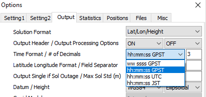
Yeah. I always try to export in UTC when possible. Would be nice to have a tool that could handle both.
Ok, so here is the software. It is the first version, so please, be patient. ![]()
https://drive.google.com/open?id=1XMWNmNe0g1spZd8y96uj6aWILTCmfO5A
To start the software just run electron.exe file. You will see the window, where you must choose CSV file, which is survey exported in CSV format. Then, you will have to choose pos file (output from RTKlib) and after that proceed to extraction. Batch process is still under development. You will see the button, but nothing will happen, if you will click it.
For now, you can go each point and click Process button. New window will appear, where you have to choose fields, that correspond to collection time and collection end values. Then press “Filter POS data” button and wait a bit. The wait time depends on the amount of data, that you are processing. Just be patient. In future, I will add some process bar here.
Once the records are filtered, you will see the graph with all the points (records), that are filtered, as well as red point, that corresponds to centroid of the filtered points. In “Centroid coordinates” you will see coordinates and altitude. Just press “Save point” and continue to the next point.
After processing of all the points, simply press “Export CSV” button, and all the points will be exported.
There are no checks in the software, cause it is still a beta version. Software will crash, if you will input any other files or if you will choose any other columns, except collection time and collection end. If you will encounter any errors or you will have some suggestions, please write them in this thread, or privately to me.
There is also sample data, which you can find in the folder sample_data. I tested everything on these files. If you will have problems with your files, consider comparing them with sample_data or just send me your files, I will have a look.
9 Likes
Thanks for all you time and efforts !!
Thanks @jurijs.jeshkins, downloading it now. I have two projects from this morning so once I get through them I will try this out.
That sample dataset processed perfectly. The future looks bright from what I can see !
So, it has been a week. Maybe, who has tried the software can give me some feedback? How it can be improved?
I am looking forward to give you another version this week. It will include a bit improved design, as well as batch processing of the points.
@jurijs.jeshkins first of all thank you for taking the time and effort!
I’ve used electron for a few days now and it works quite well.
Couple of suggestions:
- Coloring the points displayed in the plot - i.e. Green = Fix, etc…
- Up and down buttons for incrementing/decrementing the time by 1 second or maybe 10 ? I think this would make it easier to quickly change the time span.
So far, so good. Look forward to the updates…
Started some testing and this is very promising. Works great, thank you for your efforts.
Couple suggestions:
I’ll echo @darellon to color points by Q status but extend further to have ability to filter out points by Q status (only Q=1). Even show statistics of Q distribution in that time frame per point prior to filter (percentage of Q=1, Q=2, Q=5 in that survey window)
For difficult solutions, the full survey collection time from CSV may not bode well to a quality solution and will have to be trimmed accordingly. Rather than up and down buttons by 1 second or ten, a simple slider in the magnitude of milliseconds would be slick. But to make this determination for deciding on appropriate time frame it would still be extremely useful to plot not only the ground track as you have done in Electron but also position from ORI, velocity, acceleration and sats like RTKPlot. Maybe you can incorporate RTKPlot as your graphing engine or something of the like.
In the main menu after making edits it would be nice to see both original data as a heading and the processed data as a heading underneath. Or flip once have been proccessed but either way need to see both. After processing it would be nice to have the standard statistics of your processed points: AVE, STD, and RMS and saved into your exported CSV.
Is any data (milliseconds) lost if you output as UTC from RTKPost? Lose a conversion step here as @dshean suggests.
Looking forward to continue working with your program. Thanks.
Love it we have an in house developer, I would love to play with your program and give you some feedback.
This will be included in the next version of the software.
I don’t understand, what do you mean. Like a slider with 2 ends (start and beginning) on the base of the whole POS file?
This can be done in the future, but I need more explanation. We can get in touch in the future to discuss this functionality.
You mean comparison of data between processed points from POS file and CSV coordinates?
This will be added in one of the future releases.
I don’t know, haven’t experimented with this. I keep default parameters, since the most of the users does so.
Thank you for testing! I really appreciate your work!
Sure, grab a software and test it.
Hi @jurijs.jeshkins,
great software, thank you for the work!
As almost everybody I’m also struggling with that problem and I also did write a script to solve it (not beautiful electron but only win95 style, but I have an idea how much work you have invested ;-)).
I took another approach, which I would like to share for discussion and as input.
- instead of filtering the pos file I use rnx2rtkp.exe to calculate a static position (continuous mode) for each observation periode in the csv survey file
- from the resulting pos I calculate a mean position
Can you say how much your centroid approach differs from a simple mean lat/lon/height calculation?
1 Like
Yes, but only for each occupation not whole POS. Survey CSV time for each point is whole occupation but ability to trim within that time frame would be nice.
Sure, I was just thinking if possible to incorporate what RTKPlot has already written code wise. I don’t know enough about programming to know if can be done like that. Additional data plots to help understand data quality be nice.
Yes, like such:
Processed: XYZ w/ satistics
Original: XYZ w/ statistics
Ok, so the new version is coming.
New features:
*Altitude plot
*Batch processing
*Quality statistics (RMS is still in progress, though)
Improvements:
*A bit improved design
*CSV loading screen (no need to input column names every time)
*Colour coded coordinates plot (based on measurement quality).
*Some algorithm checks
Batch processing can take some time. For the sample data it is about 30-45 seconds, so be patient. Also, sample data doesn’t contain rows for points after 22. It is ok. Statistics is still not available. I am trying to figure out, how to calculate it correctly. I can calculate in degrees, but everyone will need it in mm, so I am looking for some formulas. Maybe it is just as easy as to convert degrees to mm with simple mathematics, I don’t know.
You can get the new version here (for Windows): https://drive.google.com/open?id=1H7oVwet3s9-GkG9IlBRAP8zxEjH2NwYX
If you need this software for other systems (Linux or MacOS), then PM me.
Previous version is still available, if you will have issues with this one.
Please, send me some feedback after testing.
3 Likes
I think you should look for some libraries. Than you could also integrate conversion to UTM… .
1 Like
Thanks! This library looks like something I need to use.
I plan to implement proj4 for conversion.
Great, please share your experience about it. If you use external programs anyhow, did you think about implementing rnx2etkp.exe?