lanzo
July 3, 2017, 7:17pm
1
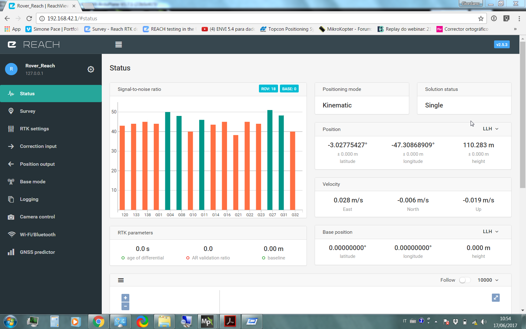
ReachView 2.5.3
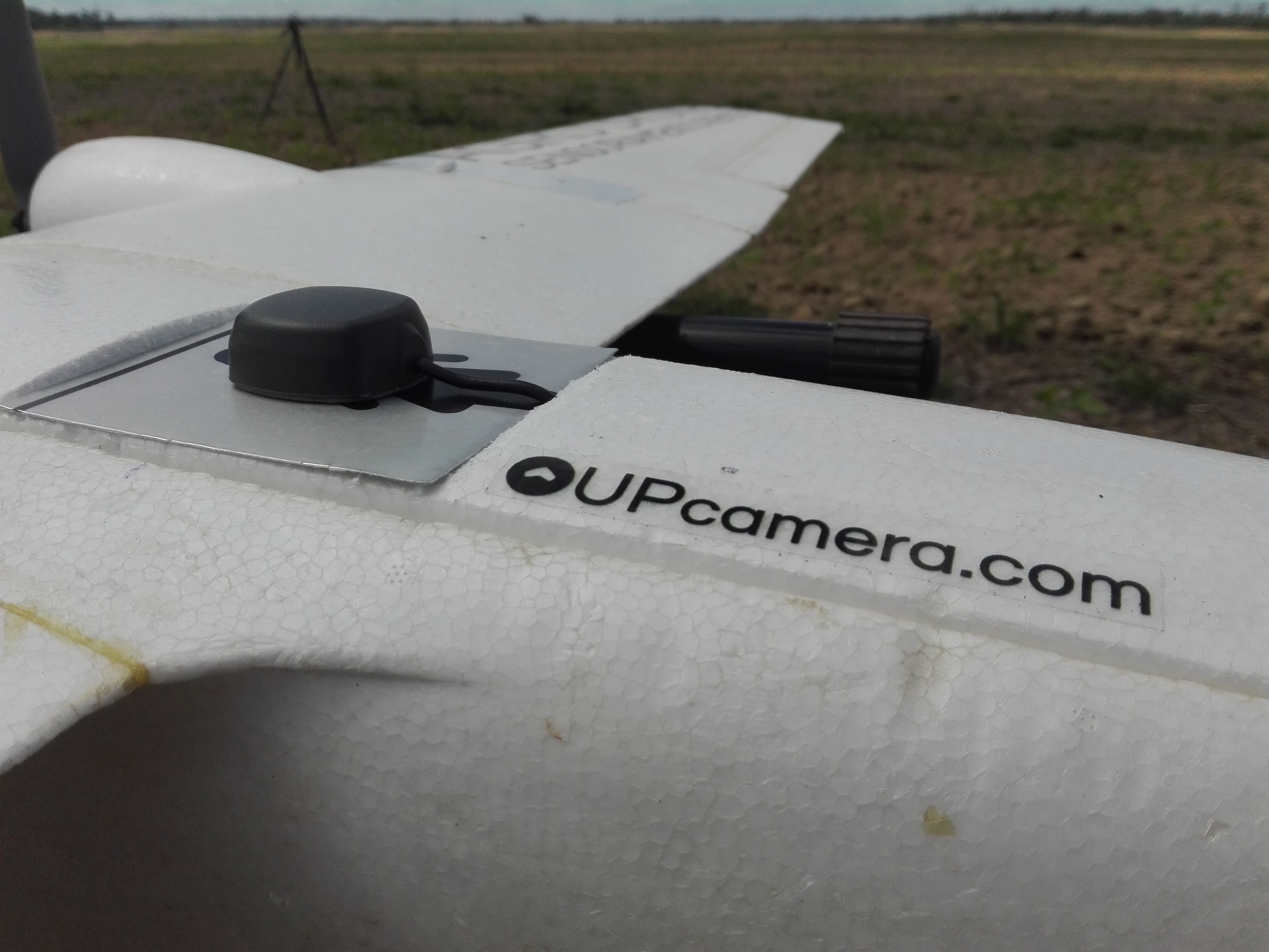
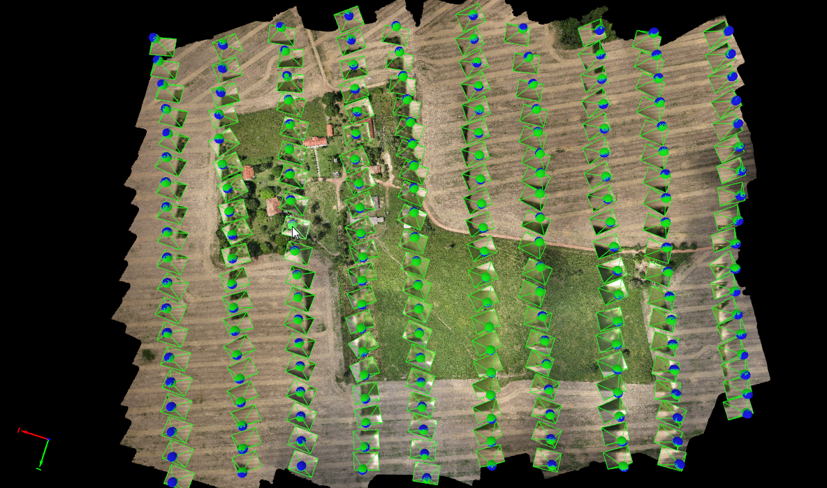
Rover_Reach on the RPA
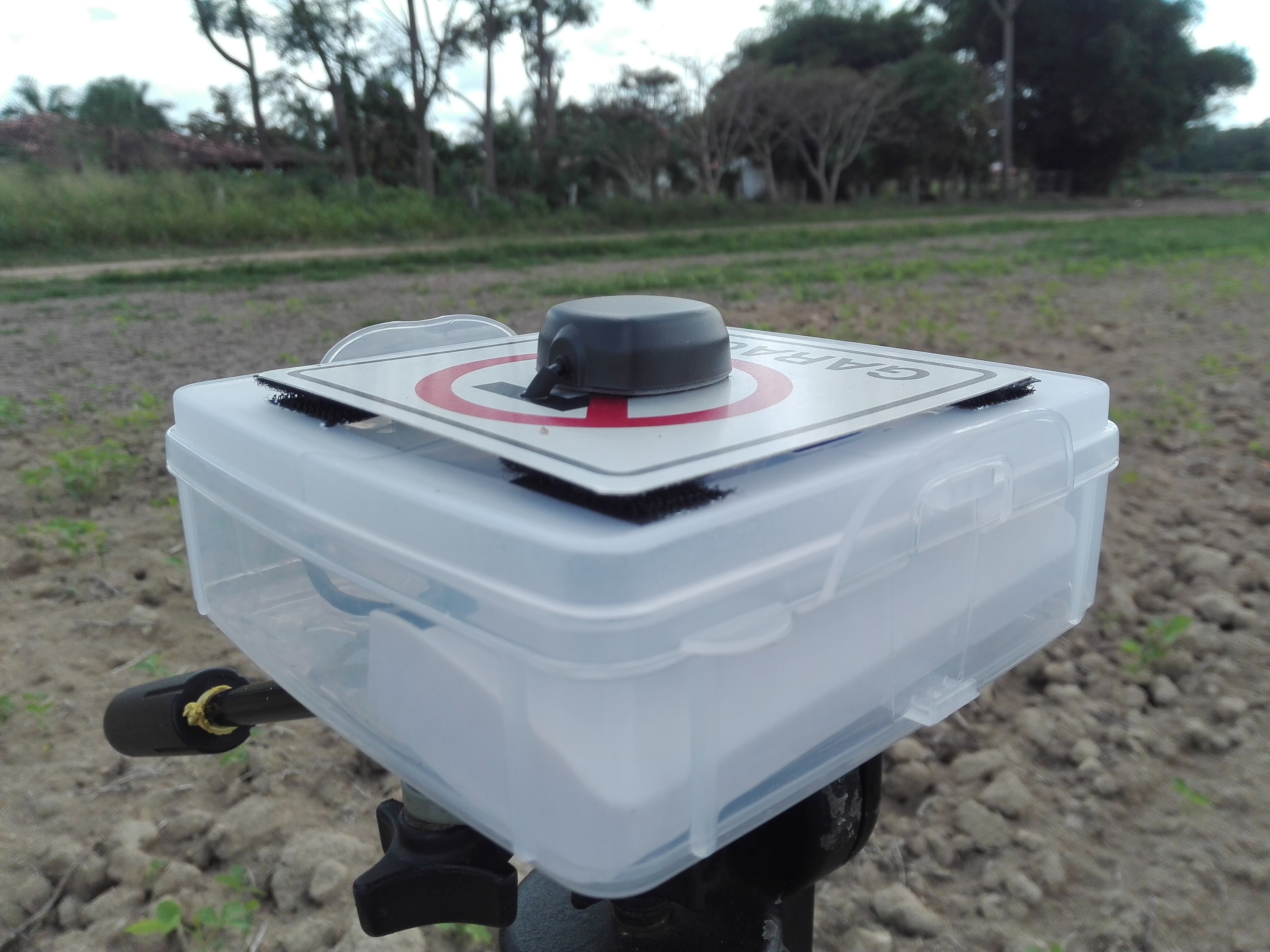
Base_Reach _ ReachView-RTK-Settings.pdf (58.1 KB)Rover_Reach _ ReachView-RTK-Settings.pdf (58.2 KB)
I followed this guide Kinematic processing | Emlid Studio
The result in RTK Plot is only a Q2 fix.
Now I would like to know if there is a chance is due to wrong inputs in RTKPOST and I only need to study and tweak it more at the office or I have to do the survey again changing something else.
I have tried with the rinex from a Trimble geodesic instead of the Reach Base too but same result.
Thank you
1 Like
Looks like the base is not injecting corrections.
1 Like
lanzo
July 3, 2017, 7:31pm
3
It is post processing, only to geotag photos later
The screenshots are made after takeoff, and this one was made before
@lanzo I am doing the same thing mate using a Topcon GR3 in static mode as a base and a Reach unit on a multirotor UAV to get PPK photocentres for geotagging. I had a look at your rover settings did you try just GPS @ 14HZ ? That is what I was told by @Luke_Wijnberg he has been doing the same thing with a fixed wing UAV.
1 Like
Can you please post the raw data logs? I am sure that we can find the reason there.
1 Like
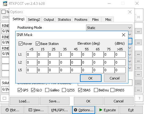
you can use SNR mask like this, just type 1 against the value you want to use(someone please correct me if i’m wrong), 35 or 40 will be good.
You can refer the following topic for setting in rtkpost :
Been testing RTKLIB changes in RTKExplorer Demo1 and RTKLIB 3.4.3b9 recent developments.
On short baseline dual Reach static survey, my impression has been positive. Results for me have gone from skeptical to close to 100 percent RTKPost Fix solutions over a one hour test.
I use dual gps/Glonass and reject many satellites with RTKPOST. My tests have been near buildings & tall Pine Trees.
Has anyone else tested these recent versions? Any results to share?
maybe this helps
1 Like
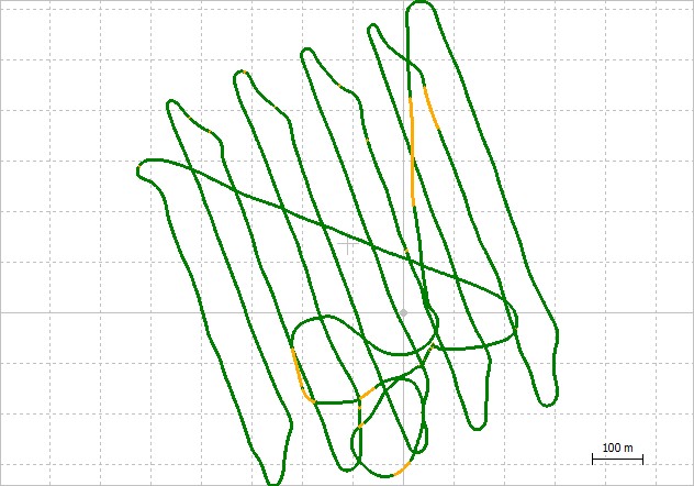
lanzo
July 4, 2017, 2:58pm
7
RAW Data logs:https://drive.google.com/file/d/0B5D4NWIsFtYmTHB0MXIwNjNGYlk/view?usp=sharing
I have logs from a Trimble R4 and from a National Station too, I took some GCP too to compare the results, but first I need to know if I have the fix otherwise I have to do the survey again.
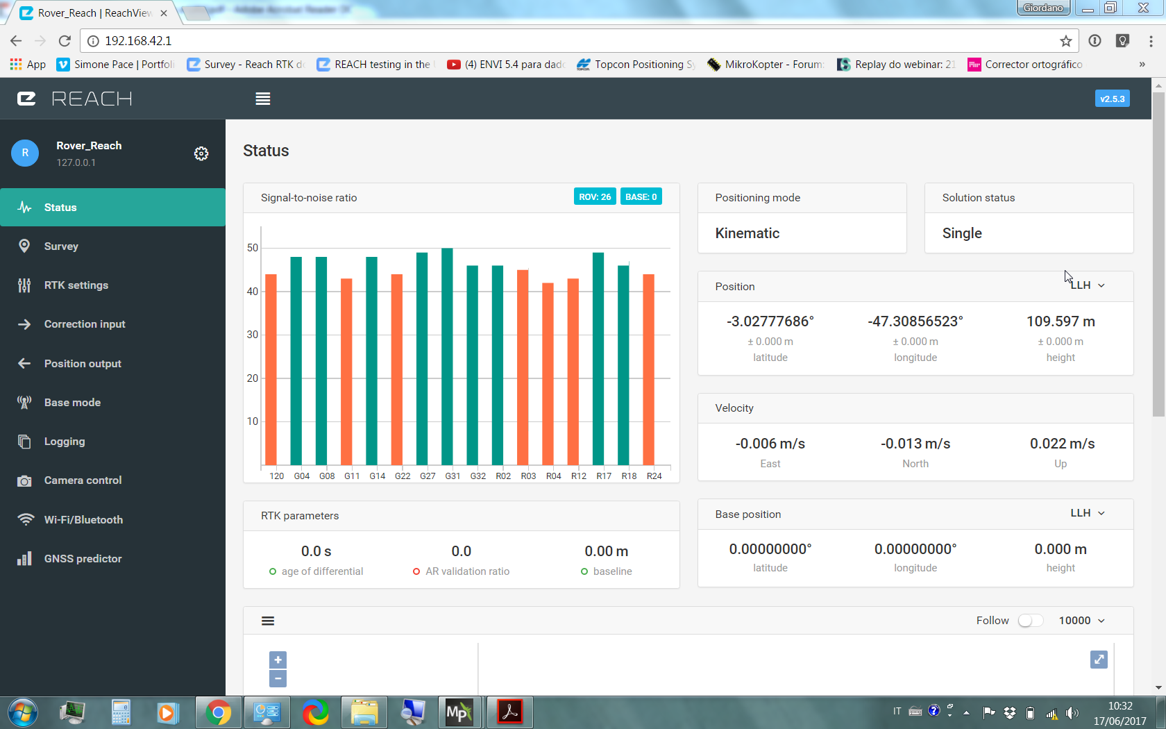
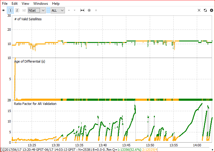
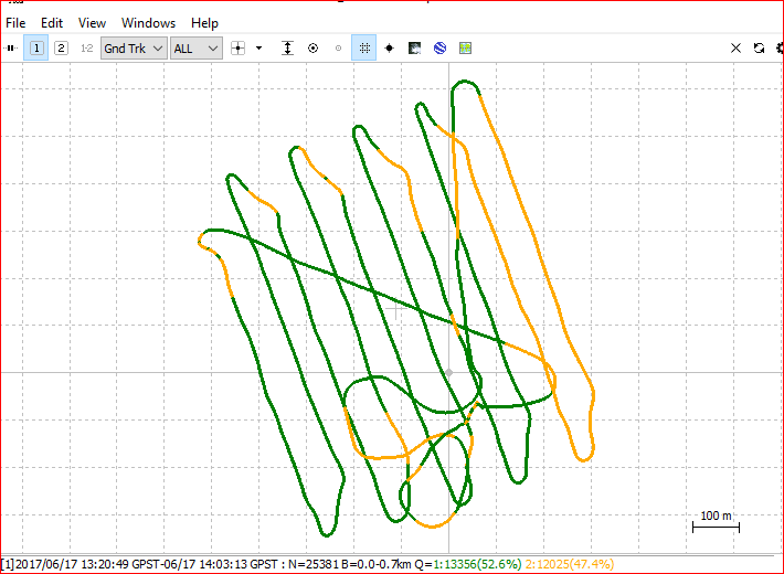
First run looks somewhat ok, might get better then this.
1 Like
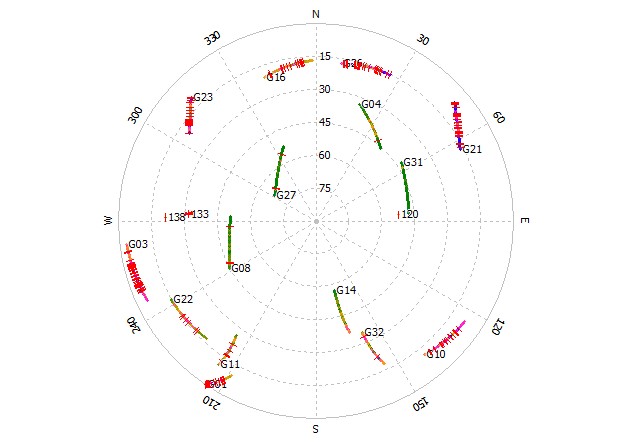
Though your rover end is getting much interferenc on the low angel. 45-50 degrees and below. And some noice a bit higher
1 Like
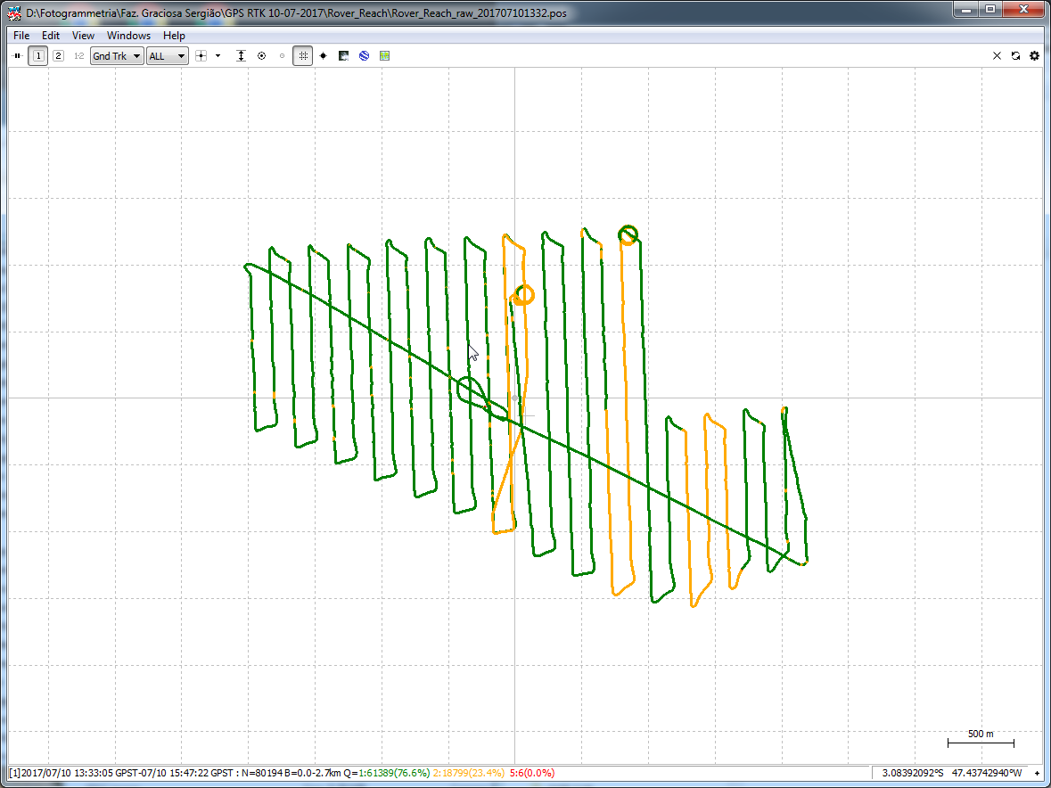
TB_RTK
July 4, 2017, 5:21pm
10
Fix&Hold looks much better
1 Like
lanzo
July 4, 2017, 6:47pm
11
wow, how the magic works?
Tim sent me these points:
ImgName latitude(deg) longitude(deg) height(m)
lanzo
July 10, 2017, 1:23am
12
Dear TB_RTK Can you share the config you used in RTKPOST to obtain that result? I am playing with setting of the old Tuffwing tutorial and the new tutorial from emlid with bad results, thank you
TB_RTK
July 10, 2017, 7:43am
13
Here you goLanzo.zip (442.2 KB)
1 Like
lanzo
July 10, 2017, 8:38pm
14
Thank you very much TB (what’s your name?)
4 Likes
lanzo
July 10, 2017, 11:24pm
15
What do you think TB_RTK?
1 Like
TB_RTK
July 11, 2017, 6:02am
16
I noticed you have uhf/vhf antenna on your tale (plane). I would raise gps antenna above this point to eliminated any unwanted interference. And yes, banking the plane may cause reach to loose fix,due to the angel and loosing line of sight to satellites. Other then that it looks like a good run, but practice makes master right
1 Like
It remembers me a thread on diydrones :
I wanted to do long range telemetry so I got myself a dipole antenna for the modem.
I never could check the range because the plane couldn't get a gps lock anymore, with the modem powered on. With the modem powered off, I had a 3D GPS lock, 17...
But his dipole is far from reach antenna. Do you think it really interfer ?
1 Like
TB_RTK
July 11, 2017, 3:40pm
18
Im not sure how much it effects the gps but would definitely investigate it further.
1 Like
lanzo
July 11, 2017, 9:00pm
19
The little dipole near the GPS is the telemetry radio 900Mhz 500mW(maybe false). I can put it back on the tail.
1 Like
lanzo
July 11, 2017, 9:03pm
20
Dear TB_RTK If I use a reference station (like US CORSS) instead of the Base Reach I must get a better result, the RINEX version is 2.11 and the file is .17o, do I have to convert the Rover RAW to same RINEX version?
1 Like