thank you both @wizprod and @agieyogaswara for your help. I finally managed to configure everything propperly. I used the NTRIP correction just as it came in from the NETWORK for now and I will also look at the PPK of the Base position as recommended by Christian…
Many thanks for your help. It is much appreciated.
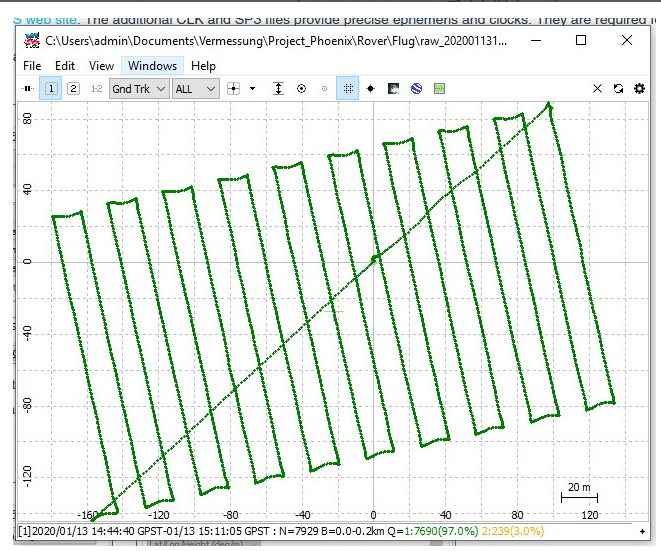
Awesome. If it hadn`t been for that final diagonal track across the squared track it would be perfect.
Kidding of course, FIXed PPK is perfect in any shape
just a quick update:
Here is an answer that I received from EMLID:
Hi Sebastian,
Thanks for contacting us.
At the moment, ReachView supports WGS84 coordinate system only. However, if your NTRIP caster provides corrections in ETRS89, the coordinates in the survey tool and the base position in logs will be provided in this system, even if it’s specified as WGS84 in ReachView.
That means you need to convert the position of your base to WGS84 after you establish it, as RTKLib also works with WGS84. While post-processing in RTKLIB, on the step of selecting base coordinates source, choose the option “Lat/Long/Height (deg/m)” instead of “RINEX Header position” and enter them manually.
Thank you!
So seems like I have to convert before PPK… I have some serious distances between my survey points and the orthophoto so I guess, I will have to try sorting that out with the crs conversion.
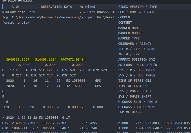
Do you know how I can extract the base position from the ubx log files?
ECEF er not so much used. It’s the native coordinate system GNSS recivers use.
It’s this format rover will receive the base (ntrip too) locations coordinates in.
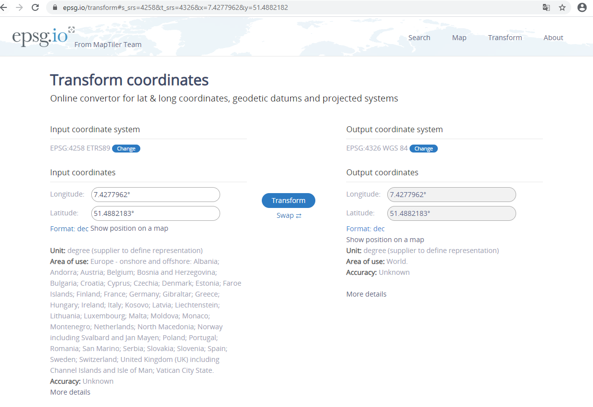
I don’t understand. Is it possible, that this epsg.io transformation is not up to date? WGS84 and ETRS89 used to be the exact same in 1984…but the current one is different…
Qgis is a tool I would recommend.
This is getting somewhat hard to understand and many mix up datum and system without really knowing what they are doing.
WGS84 Original and WGS84 latest realization is one pithole.
No, I understand and appreciate. You understand correctly that I am not a surveyor. I will do the lecture from PennState, it looks good. I read the ublox script for a start…