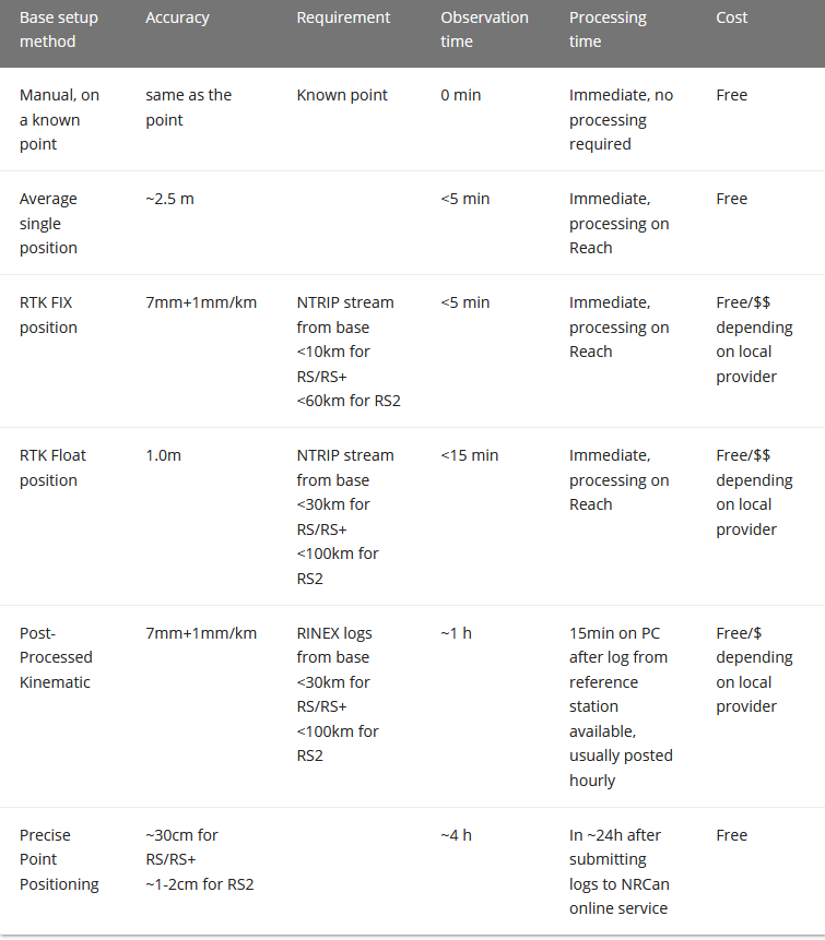
No, they are raw-data, so if processed without correction data, you will have 2-3 meter accuracy. You can post-process using RTKlib or other GNSS processors (like EZsurv).
If you use the Reachview Survey tool, you can either set start/stop times manually in RTKplot, or you can use some of the automated approcahes made by community-users here (or commercially available options) to extract the points based on the start/stop times (fed by the resulting position .csv)
Thank you Christian,
I just read through it and this is almost exactly what I did for correcting my rover position (drone M+) with my base position (rs2). Do I understand correctly, that I need the Rhinex files from the NTRIP station as a BASE input and the correct my RS2 with it (as rover)?
I am a bit confused because I don’t understand what the point is of having a mobile data connection to receive NTRIP corrections if I still have to post-process. I thought with NTRIP
we use basically an RTK mode, so no post-processing (for the base)… ?
Using NTRIP is mostly a way to get rid of the need of local base station for RTK.
CORS (Continuously Operating Reference Station) is more commonly used for Post Processing. Many times, it gives you more constellation compared to the NTRIP feed from the same station.
You don’t need post-processing for other things than processing the M+ data.
However, it usually gets a little bit more precise, and you are more in control of the processing parameters as well.
I understand. Thank you!
I got only float accuracy from my M+ on the drone but a friend told me, that it was likely because my base was setup not far from buildings. So probably the post-processing of the local station data will not change much… But I will try and see if it helps…
That is one component at least, but there are many more. Usually the real culprit is how the antenna is setup on the drone. Do you have a few shots of it ?
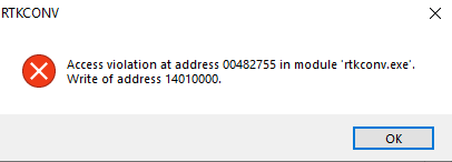
Ok. While we are at it, I am trying to download the correction data from the local distributor. But I am struggling with using RTKCONV to get the .obs file I need to use RTKPOS to correct my base station…