I am hoping to execute my surveys in a local coordinate system. When I create a new projet in ReachView 3, I am invited to select a project coordinate system and a vertical datum. Under the section, there is a notice showing up saying “make sure that your base or NTRIP reference system is in NAD83 CSRS” (which is the chosen system). However, I haven’t been able to find where in the Reach Panel I must do this modification. I have looked up all emlid documentation and browse the forum, there is no mention of this.
You indeed don’t need to specify the base’s datum directly in the app. To get accurate coordinates with the rover, add the base’s coordinates in NAD83 CSRS in the ReachView 3 Base mode tab.
Here are a couple of ways to do it:
Do you know the base’s geographic coordinates in NAD83 CSRS? If so, you can enter them in the Base mode > Manual. I’d recommend ReachView 3, since it supports both decimal degrees and DMS, but it’s possible to do it in Reach Panel as well. I’ve recently posted a topic about placing the base using known geographic coordinates - it can come in handy.
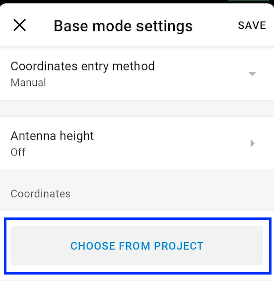
In case you have a project in a CS based on NAD83 CSRS (like one of NAD83(CSRS) / UTM zones), you can use a point from there to set up the base. Once you place the base on the point, go to Base mode > Manual and choose the point from the project: