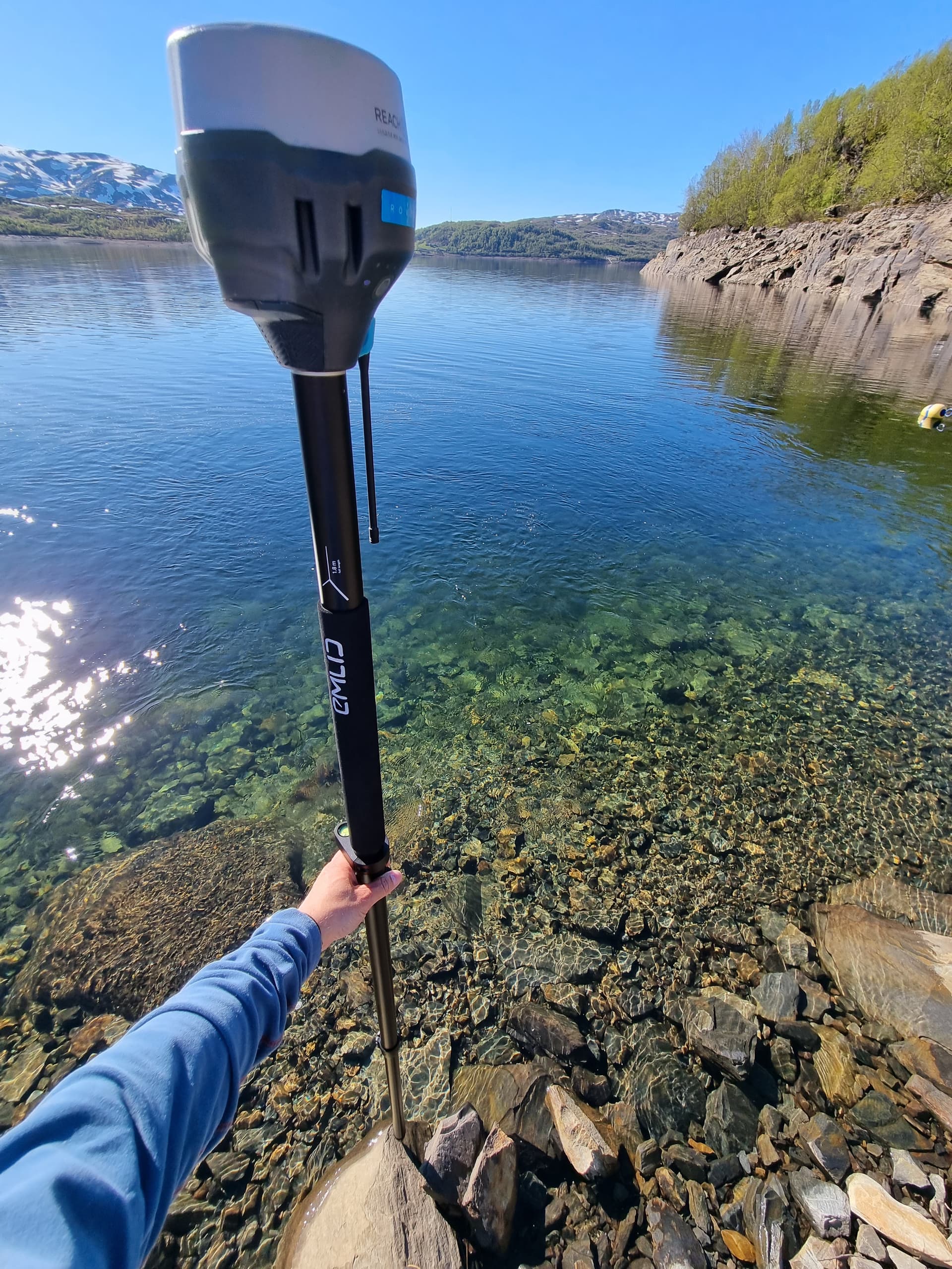
Hello All, I’m am working with a nonprofit to create a bathymetric map of a fish pond that needs to be dredged (doing a before and after dredging map of depth). The average depth is 3 ft. Originally I was going to try to use a depthsounder connected to a kayak, but since it is shallower than I thought, this plan may not work so well. I was wondering if anyone has an SOP or methods they could share with me for creating a bathymetric map of a shallow water environment? I have a Reach RS3 and access to a base station.
As I understand, the workflow may depend on the result you’d like to obtain. You can, for example, collect a predefined number of points with Reach RS3 using RTK, which can help you create a map afterwards.
If you return to using some special equipment, you can stream Reach’s position to your device to obtain coordinates for the collected bathymetric data.
Would these options work for you? Or are you planning some different workflow?
The workflow you described first was the option I was wondering if I was limited to-- collecting points in a grid-like fashion over the 30 acre pond and uploading the depths to arcMap for a post process. I would need to collect a point at the substrate and then again at the surface of the water to get the volume of water-- is that correct? Or, could I skip the height of the water every time by knowing and marking the edge of the water line (wondering if that would be tricky due to tidal influence and changes if this takes me a couple of hours).
As far as specialized equipment goes, what did you have in mind? I am looking for any options that may speed up the workflow.
As far as I know, bathymetric surveys are usually carried out by echosounder equipment. But I’m not really into this field, so I can hardly recommend a particular device.
Using any kind of them, let’s check how it can accept the streamed position from a GNSS receiver. With Reach RS3, you can stream the position via Bluetooth, TCP, or the receiver’s serial port.
What kind of base station is it? Is it your own receiver? Or do you have access to an NTRIP service?
I’d also like to share this post with you. It covers some examples of performing bathymetric surveys with Reach receivers that may help you choose a setup. Of course, I can also help you with the configuration if you decide on a particular workflow.
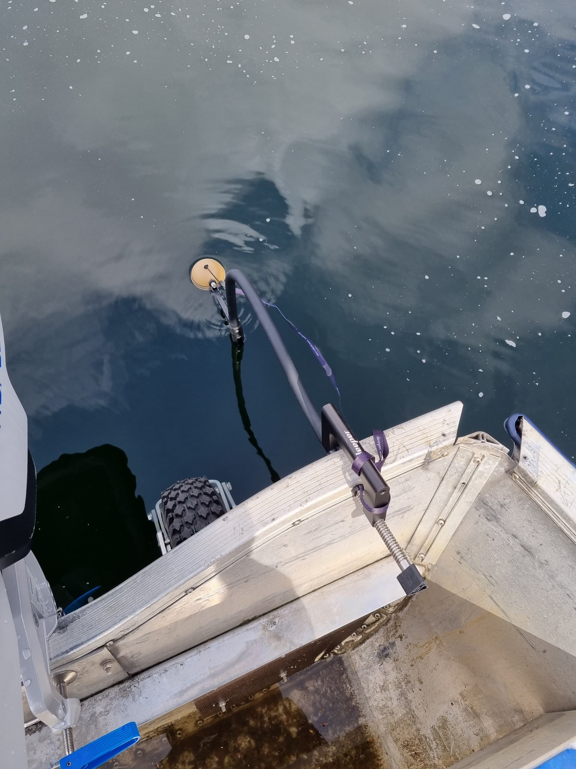
With surveying a 30 acre pond, I’m sure you’ll have someone in the boat with you. If you are sure the maximum depth of the pond is 3’, I’d just set the rod height at 8’ or longer if you have a suitable mount. We picked out landmarks to create a rough grid, basically you are doing a cross section at approx intervals. You don’t need to take an elevation shot at each point of the water level. Make sure you keep up with your correct rod heights also.
Once you are through doing the depth shots, you can locate the edge of the pond or more ground features like the slope or top of dam.
We’ve done this same type of survey before on <30 acre ponds. Many of the ponds we did were mostly mud holes. Just be careful and don’t fall in !
Thanks for your help with troubleshooting. Originally I had planned to use an echosounder, however, because the fishponds I’m mapping are so shallow (average 2-3ft) that won’t work for us.
I have access to an NTRIP station in Lahaina, Maui and and wondering if the corrections will reach to South Molokai (~26miles across ocean channel). I’m still struggling to connect my RS3 with the NTRIP station though.
Thank you for your help! This is what I had in mind. We also have a lot of mud, so I was asked to sink the rod as far down into the mud as possible to get a depth of the mud layer, and the one measurement at the top of the mud-- to approximate how much will need to be dredged.
Appreciate you walking me through your process! for no persons-overboard drills.
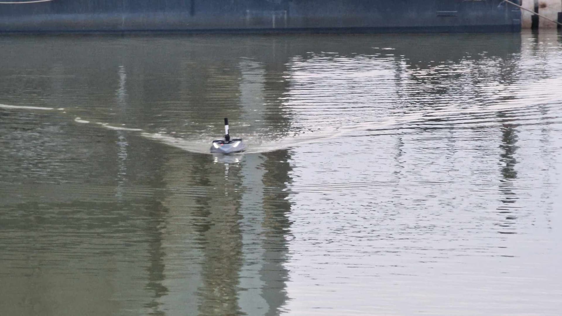
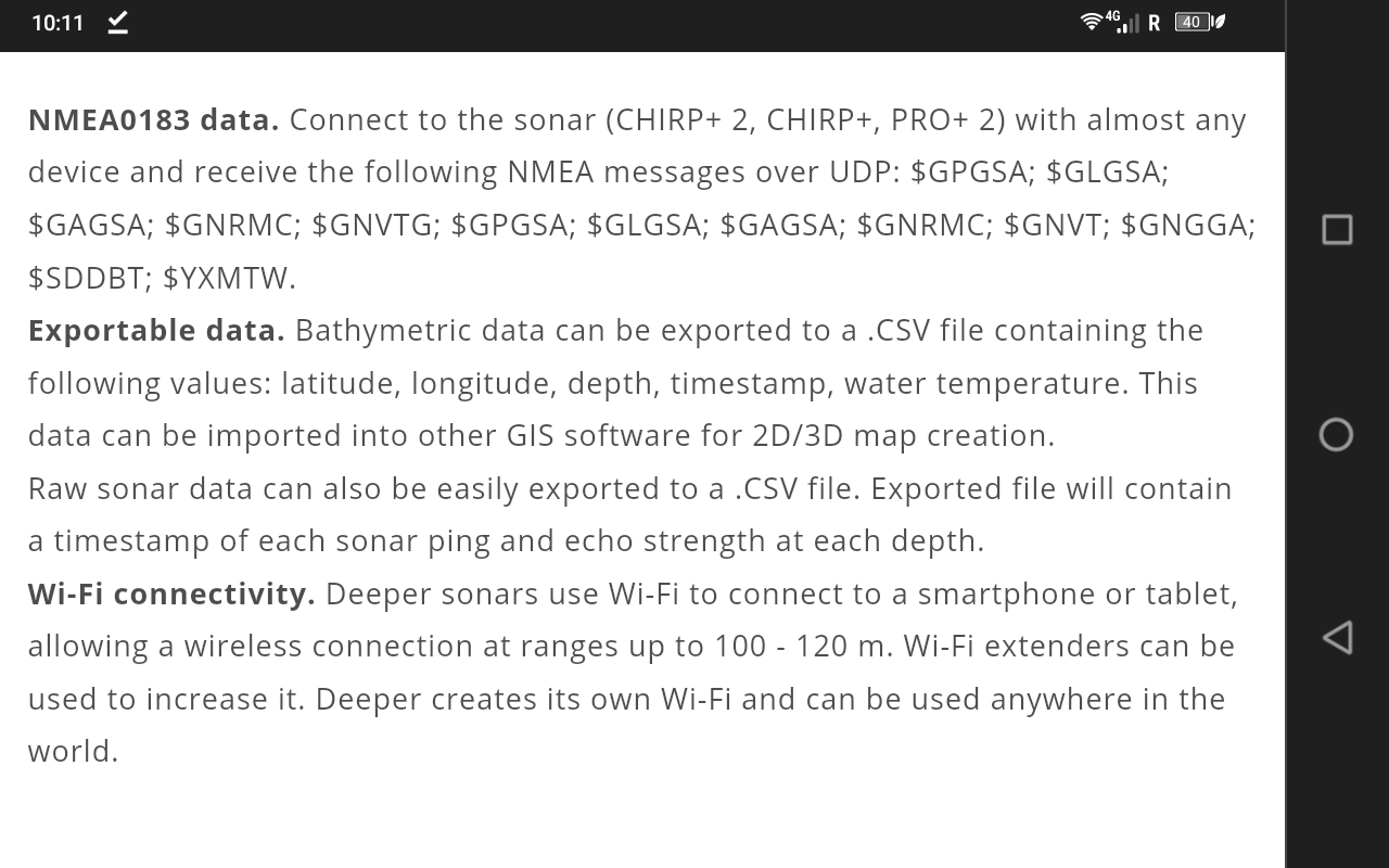
WOW ! This is such a cool device… makes pond surveys easier. I read through all the info and was surprised to see that the data could be exported. You can create depth/contour maps very easily. Thanks for the link, I’ll have to buy one… very low cost for what it provides !
Ja, it doesnt get much simpler then this. Been using Deeper with Reefmaster for few years now and the data export is vital. The major con is battery drain of the device you connect, it need to be on all the time. Your will need few battery banks if the pond turns into minor lakes. Other then that its great piece of tool.
Looks like they have an integrated sonar and rc boat in the works that includes an autopilot for grid missions. I asked them for a sample .csv file, but they didn’t have any available. They thought it was a good idea and will perhaps work on having one available.