


_Originally posted on Emlid blog: https://emlid.com/performing-rtk-ppk-bathymetric-surveys-reach-rs/_
Reach RS+ improves georeferencing accuracy of collected data when used on surveying boats. Depending on the mission goals, it can output the position in real-time (RTK mode) or store data for post-processing (PPK mode).
This post overviews these workflows and demonstrates how Reach RS helps to deliver accurate bathymetric and hydrographic services.
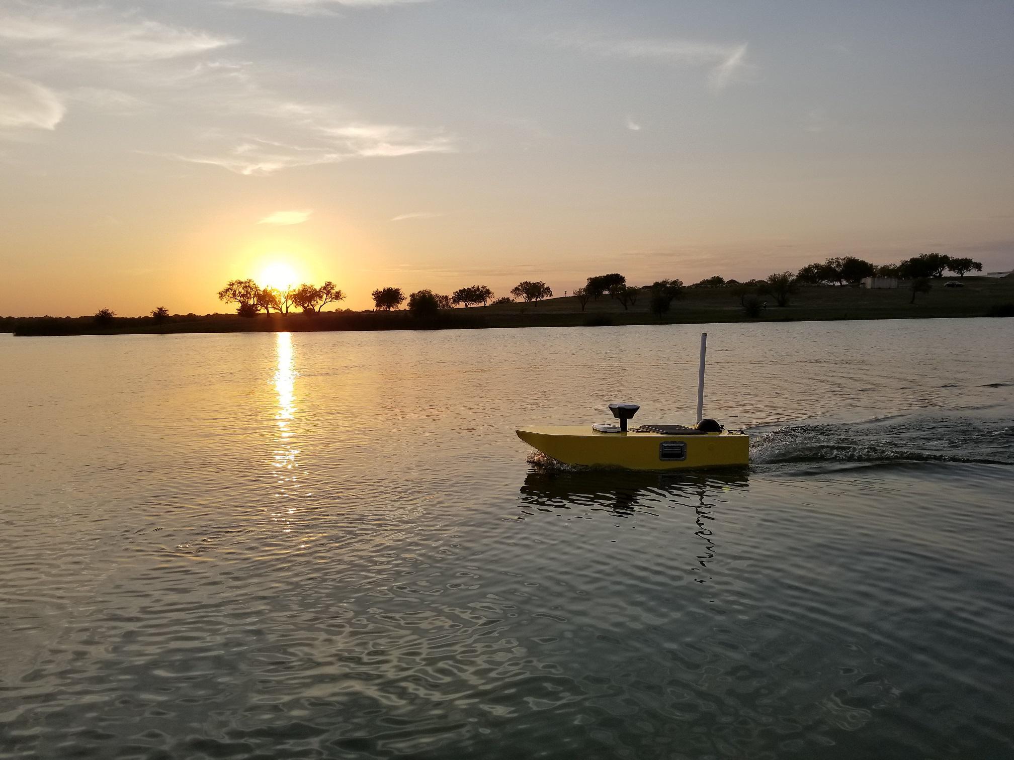
SimpleUnmanned is a US company from Texas developing unmanned marine systems(USV). The company successfully integrates Reach RS+ to its boats to achieve centimeter-level survey accuracy. The setup involves 2 RTK units: Reach RS+ base on a shore and a rover on a sonar-equipped USV.
Reach RS+ base can be deployed fairly quickly – within several minutes. Good absolute accuracy can be reached if RS+ base is placed over a known point or a public reference station (CORS, NTRIP) is available nearby.
Example of a mission with 100% Fixed Solution @ 5hz rate, post-processed against a CORS station with a 5km baseline
Depending on environmental conditions and project objectives, SimpleUnmanned conducts surveys using two following scenarios:
Post-Processing (PPK)
Base and rover units log raw observations throughout the USV scanning mission. Collected data is post-processed after survey run and merged with data from sonar.
You can learn more about PPK in our Docs >>>
RTK
Base unit transmits RTK corrections to the rover on a boat over LoRa radio. Rover sends precise coordinates in NMEA format (or any other, like LLH/XYZ) to the logger in the real time. The logger automatically merges positional and sonar data.

“Reach provides superb performance on our USVs and provides a remarkably high percentage of fixed solutions, even on long baselines. ” − Willis Maxson, CEO, SimpleUnmanned
Bathymetric survey of Marine Creek Lake with Reach RS
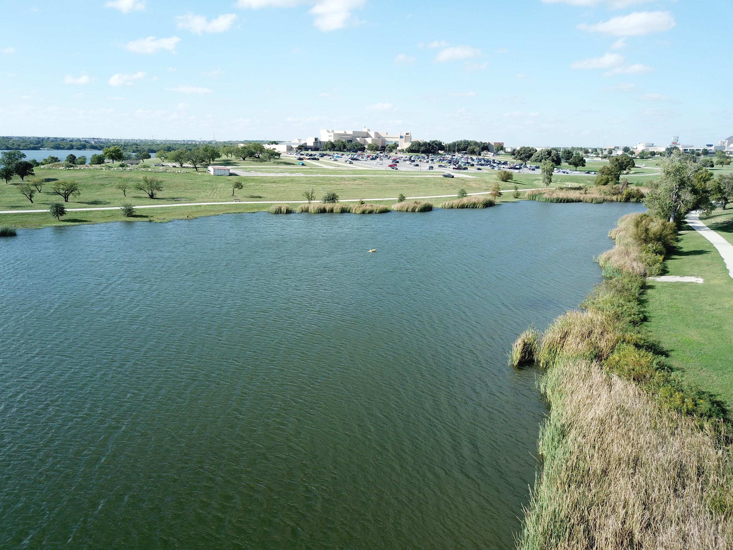
Marine Creek Lake
Let’s take a closer look at a project SimpleUnmanned completed on Marine Creek Lake in Texas in September of 2018. This was a run completed with Reach RS base station and a boat equipped with a Reach RS and a sonar system.
The bathymetric survey mission included several steps:
- Planning an autonomous mission
- An autonomous USV survey in PPK mode
- Post-processing and export of the coordinates
- Comparing positional data to depth data saved from the logger based on the timestamp
- Merging data using utility developed by SimpleUnmanned
The video below demonstrates some of the steps outlined above:

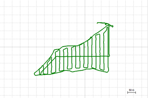
The results of this project are illustrated below. An absolute position was verified by post-processing rover log against CORS station.
PPK track of a boat in RTKPlot
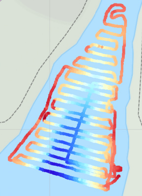
Track merged with Sonar data
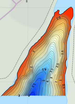
Final Depth Map
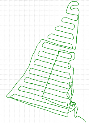
On the images below there’s another part of Marine Creek Lake surveyed with HarbourScout equipped with Reach RS. The position was post-processed using a CORS station located a few kilometers away so fix quality is excellent, even without a local base.
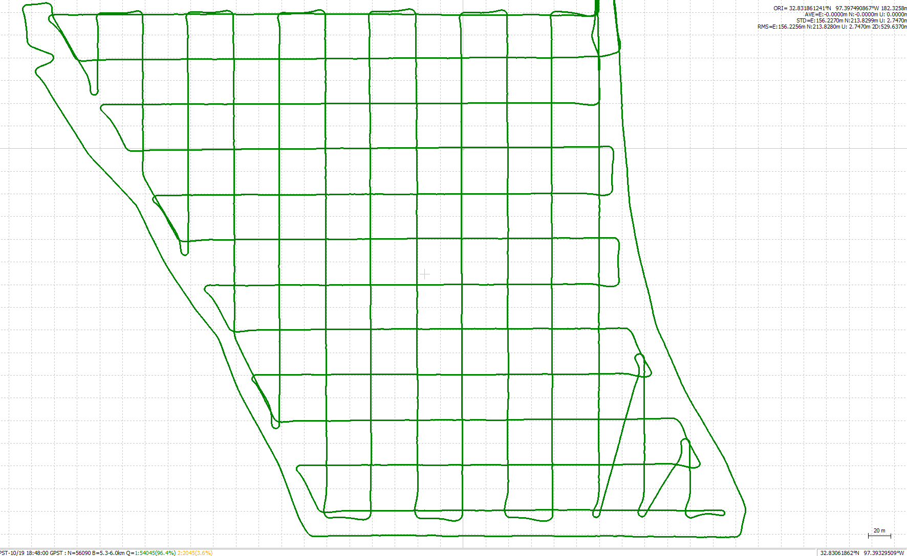
PPK Plot
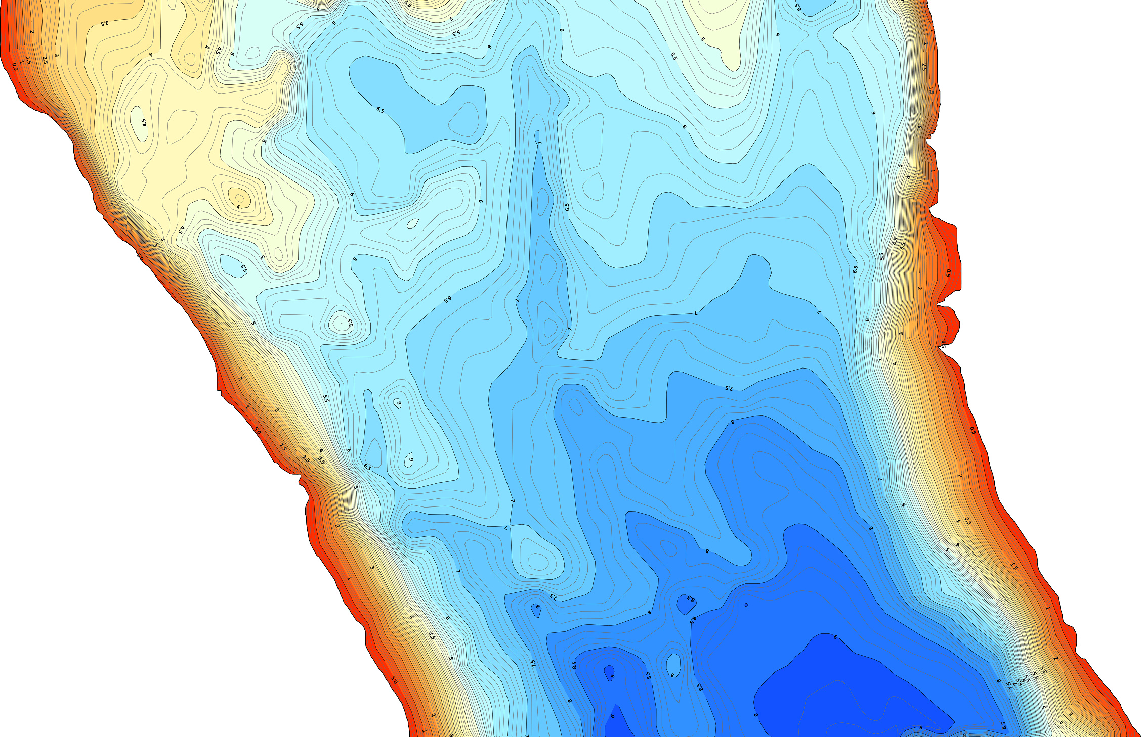
Depth Map
Reach RS+ for accurate georeferencing during bathymetric and hydrographic surveys
Reach has IP67 waterproof rating and fits great for lake surveys. It integrates smoothly with a boat’s equipment and can work in RTK and PPK modes.
https://emlid.com/wp-content/uploads/2018/11/simpleunmanned-emlid-lake-gif.gif
HarbourScout USV used for the bathymetric survey with Reach RS
In PPK mode, there’s no need in integrating Reach with boat’s systems. However, you’ll need to merge the positional data with data from sensors at the post-processing step.
In RTK mode, the rover receives RTK corrections over built-in LoRa radio from Reach RS base station. Reach rover outputs the position in NMEA format with a 5Hz update rate (for GPS+Glonass+Galileo GNSS selection) to the boat’s software which automatically merges the positional and sensor’s data.
About SimpleUnmanned
The fleet of SimpleUnmanned contains several types of Unmanned surface vehicles (USV) designed for different payloads. Each boat is easy to set up and operate and allows to carry out accurate bathymetric and hydrographic surveys.
At the SimpleUnmanned website, you can learn more about the solutions for bathymetric survey and how to make them centimeter accurate with Reach RS Survey Kit.