


EMLID please add the possibility of staking out lines in ReachView, if I take two points in the field, join them with a line and be able to stake out that line, even extend the line and be able to stake out that projection… another very useful thing would be that in the map you can see the points with their description, or an abbreviation or code of the point to be able to know what is being surveyed in the field. not only the number of the point… the same, when exporting the survey in dxf format, only the number of the point and its height are exported… we need the description or the code to be exported to be able to know which points they are and do the cad drawing… and also please, the satellite image of google maps or earth in the background, for location and reference while the survey is being carried out in the field… they are very useful things that are needed and would greatly help the work in the field.
It’ll happen probably sometime in the near future is my gut feeling .
Hi Edmundo,
We definitely want these features to be supported in the future! We see they’re highly requested, and your post is another proof for this. So, stay tuned.
By the way, you can use point names as descriptions if you’re planning to export DXF. It can be a workaround for now.
Thank you Edmundo for your request!
Here Is one more: WE NEED LINES for stakeout in the ReachView app!
Uli
Hi Uli,
Your +1 is also noted.
Hi Emlid-Team, stakeout works fine, but sometime (often) i miss the old version with the “distance overall”. It would be fine if next to the “North-East-Distances” the “distance overall” could be diplayed.
Hi Andi,
That’s actually an interesting feedback. Can you describe in which situations the distance overall is useful? I understand it may be hard to describe, but at least one example?
Hi Svetlana, i use this feature when searching a given point in the undergrowth where i can’t get FIX. Then i take2 Points in a triange for example in 5 or 10m distance (where i have FIX) and take the additional measurement by Tape. that is exact enough for my work.
Otherwise i use it when planning a sewer to measure the distanz to the next manhole.
Andi
Hi Andi,
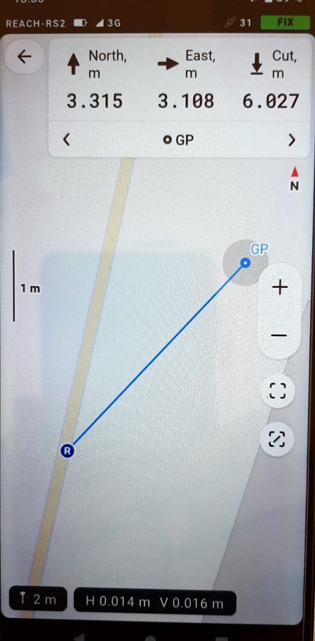
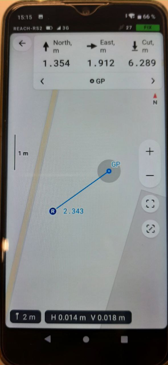
Oh, sorry, I got what you mean now. And there is overall distance in ReachView 3 stakeout tool, just next to the Rover icon:
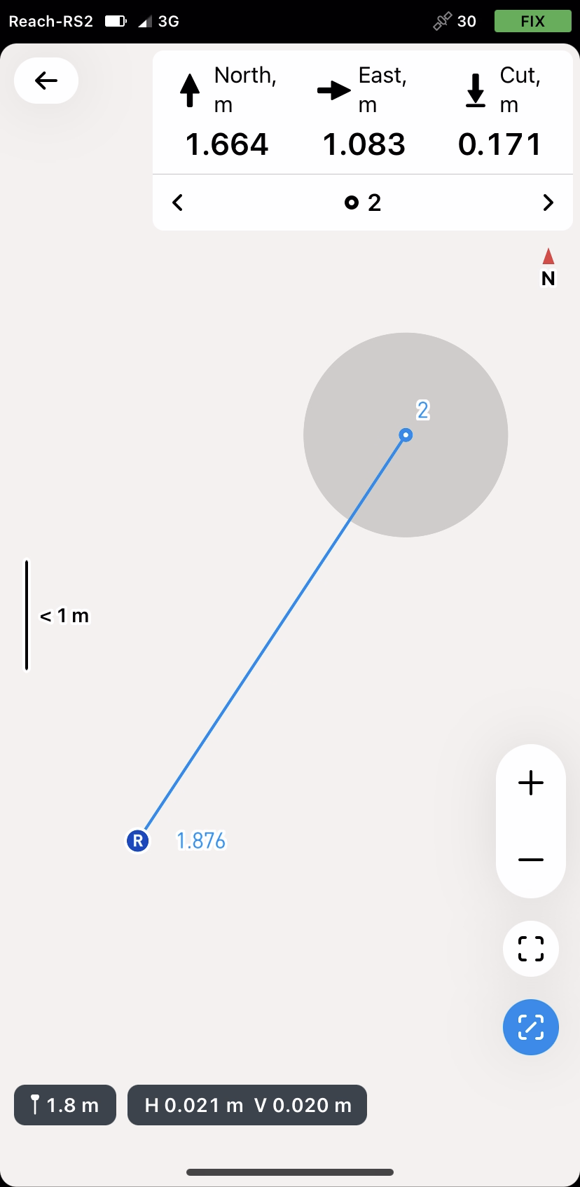
Is that what you missed?
Hi Swetlana,
yes, that is what i miss! But I can’t find the distance on my display. I’m using RV3 7.15.
Hi!
Can you please send us a screenshot of the Profile tab? The dev team would like to see the exact version of the app.
Alternatively, you can take a screenshot of the App info screen (long press on the app icon, go to info, and scroll down to the version).
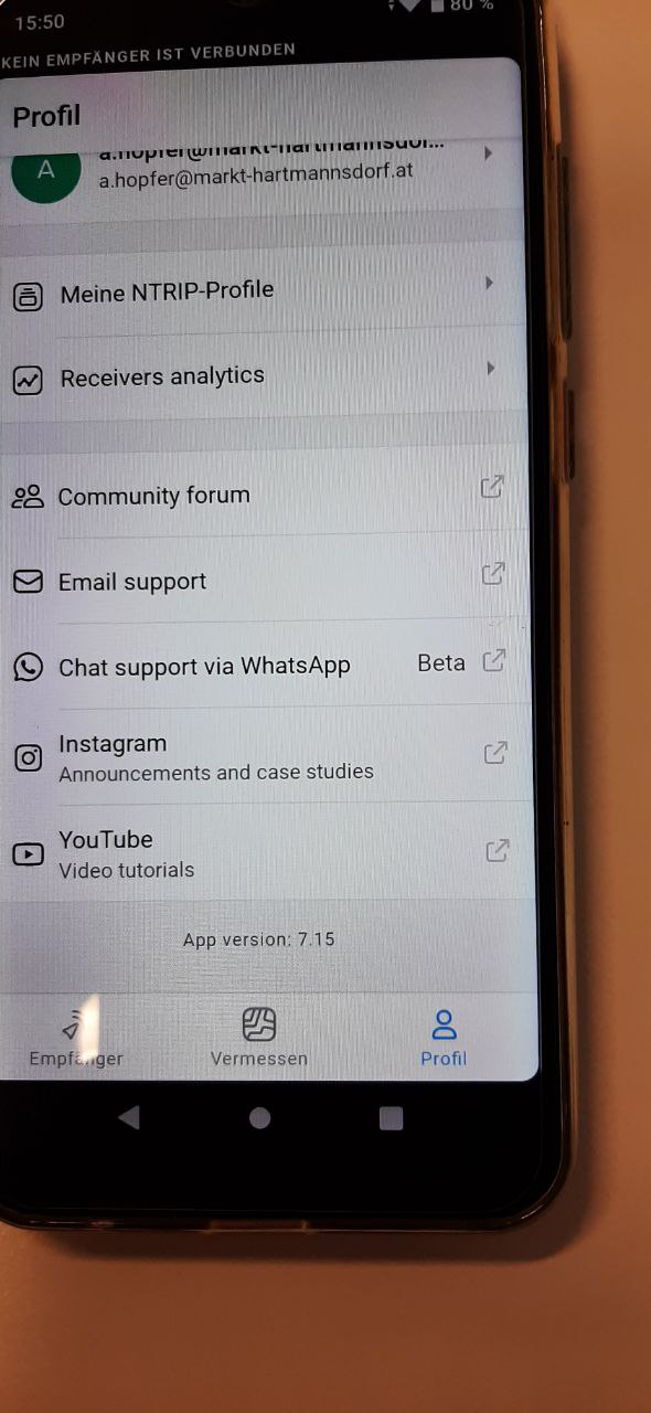

Thanks! I’ll pass these on to the dev team.
Interesting ![]() Is it repeatable? I mean, does it work fine for different points/projects? Or if you close and open the app again?
Is it repeatable? I mean, does it work fine for different points/projects? Or if you close and open the app again?
Hi Svetlana,
I tested it on Friday and today several times by changing Projects, start and close the app. I did it with RS2-Hotspot and Smartphone-Hotspot, work with app on an other smartphone, open, close, change projects, different points. Now it works ![]()
I think the problem is solved.
Thanx for your quick help!!!
Hi Andi,
I’m happy to hear it works!
It was a weird issue, but I hope it indeed was a one-time. If any other difficulties arise, let us know!
So the line function has finally been realized. For 45$ per month. I am insanely disappointed.
Hi there,
The linework is now available in Emlid Flow (previously known as ReachView 3) under the Survey plan.
And we updated our monthly pricing to $25/month. @igor.vereninov has explained our reasons in this thread in detail: