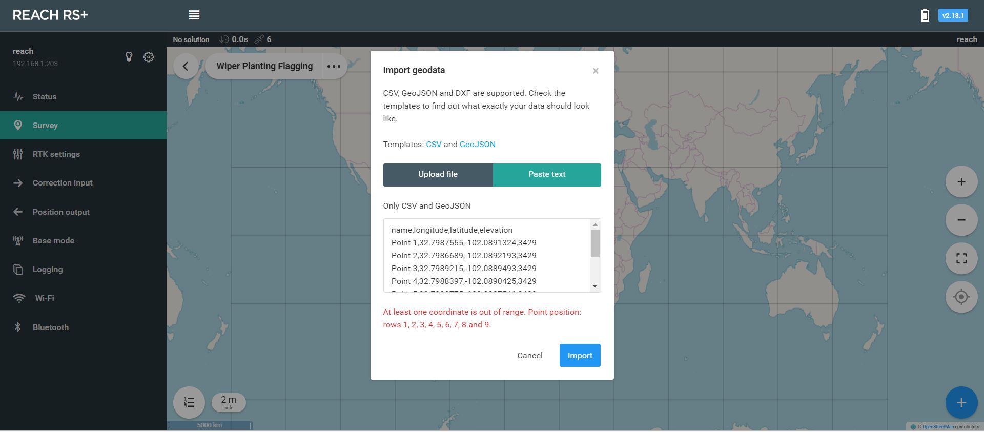
I’m kind of new to surveying and working with Emlid. I’m trying to import a series of points into ReachView to then use the "stake out " feature. The problem is whenever I try to manually enter the points or upload a Microsoft Excel spreadsheet in CSV format I get an error: “At least one coordinate is out of range. Point position: rows 1, 2, 3, 4, 5, 6, 7, 8 and 9.”
To be honest I don’t know the actual elevation of the points, that’s just an estimate. Do I need to put in the real elevations for each one, based on a GIS?
That is very easy to do since the Emlid CSV template is backwards anyways. That really should be changed, but probably never will be since already established. Typically read as LAT LONG versus LONG LAT???
But then again, for coordinate systems, most say Northings (Y) and Eastings (X), but I like to say EASTINGS (X) and NORTHINGS (Y).