


Like I mentioned before, I had it connected consistently a couple of days ago. All I had to do was connected through the windows Bluetooth and then through magnet. I don’t recall having to set any com ports.I just had to make sure that I had it set up to use the pin. I hate to reboot the rover again in fear that I might lose my fix, LOL.
1 Like
@Brent_W, Does your receiver report as an audio device and Magnet?
I’ve had finicky problems also with BT and FieldGenius9 also… so I purchased a Emlid External Serial Cable CBL103 i think for my Nomad 900G which solved that problem immediately for a direct connection on COM1. But I’d rather use the BT for sheer convenience when its not finicky! I got the cable as backup in cases like this.
Yes, audio device also and I think one other thing also, cannot remember at the moment though. very screwy experience indeed though.
Nice set up Brent! The thing that bugs me the most with Topcon software though…are those dang HAMBURGER icons! ha! ; )
Michael, glad you are finally getting somewhere with this…we all start out like this and actually still learning obviously…but the Emlid Reach RS units are awesome! You’re expectations may be naturally a little high coming directly from the big dog $$$ multi frequency devices to just L1…but it works great for my needs so far.
2 Likes
Hamburgers… 
1 Like
Actually, yes. I think it does report as audio device.
That’s a great idea @timd1971. I tried putting the Rover on com7, but the same behavior remained. I am at a loss as to what happened from when I could connect. What’s the spec of the connector for the Reach end? I wonder if it is the same as the Topcon?
There are 3 kinds:
There are posts about these also, so you’ll have to search.
https://community.emlid.com/t/shipping-time-for-emlid-accessories/10791/6
I have CBL103
FYI, the BT does work, it’s just kind of iffy if you don’t set things up just right for some situations (i.e. Windows 10 tablet, old Windows Mobile data collector, survey software etc). More convenient than the cable also if it works for you.
1 Like
I figured out that the serial cable from the Topcon does fit, but I still do not know if the pins are in the right configuration. Still receiving the orange spinning sync icon. I went back to basics and reset all settings and connections, going back to bluetooth and same thing.
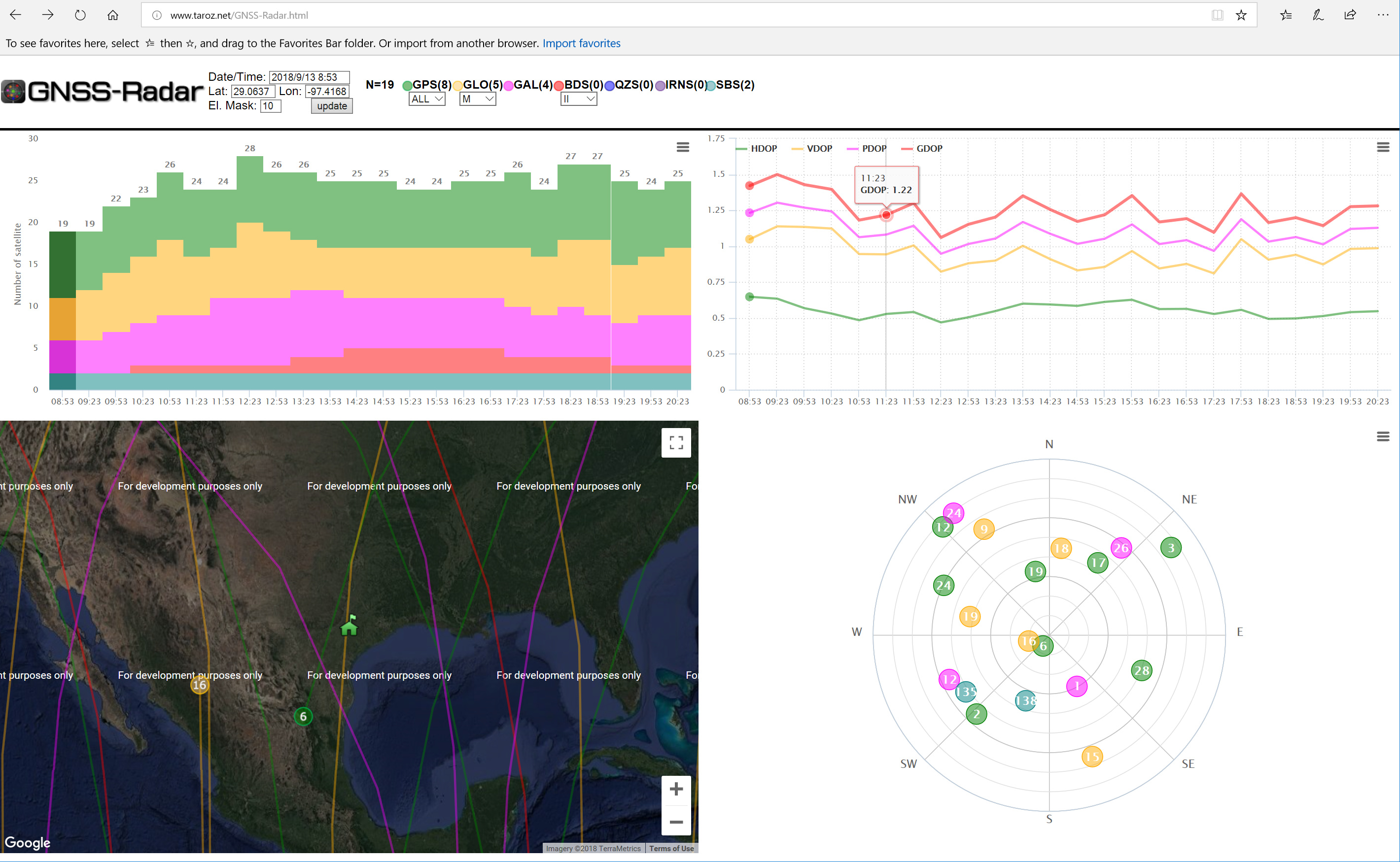
As for the fix it appears to be the GLONASS that is having the most issues. I tested today running just GPS and got float for a while so I added Galileo and got fixed after about 5 minutes.
In the USA, I use GPS, GLONASS, Galileo and SBAS and get a fairly quick fix with open clear skyview. I.e. open field, or up high no tall adjacent buildings.
I wouldn’t just go hooking up any cable in case of pinouts not matching … could fry things.
There are lots of posts about the external serial port.
I typically use those constellations as well and that is what we use in Topcon, but the last couple of times I have had problems getting fixed it was resolved by dropping GLONASS. I also found the pin mapping and they do match.
Surprised you have to drop GLONASS, typically really need that one. The more the better if in view.
Well, remember my signal inference issue with Glonass? 
no, I missed that… what kind of interference was it? Got to suck to have to remove such a big part of the GNSS for your use.
1 Like
Sorry, I misread the post. I thought the GLONASS interference post you posted was a response from CHASCO… I see now.
Yes, I do remember the interference you were having at the time due to the factory you were at.
but still… seems CHASCO shouldn’t have to eliminate GLONASS…but maybe he is in a special situation and just has too…hopefully he doesn’t have to do this most of the time… such a big part of GNSS of course.
I agree, we use GLONASS heavily with our Topcon equipment.
Okay, here I am again! Great satellites no obstructions and will not get a fix. I tried changing my channel and various satellite constellation combinations and cannot get anything. Very frustrating because I am so close on the magnet software. Ready to actually shoot in points off of a localization! Here’s my logs.
SystemReport.zip (220.7 KB)
just curious, can you take a few 360° or so range of horizon photos of your environment? being Texas and flat, should get better results than your getting?
I typically use GPS, GLONASS, GALLILEO and SBAS, and that’s with 2 story residential homes surrounding nearby closely with slower fix. In fields and higher clear elevations, instant fix. I have the RS non-plus Edison cpu versions though also, which shouldn’t make a difference, but you never know.
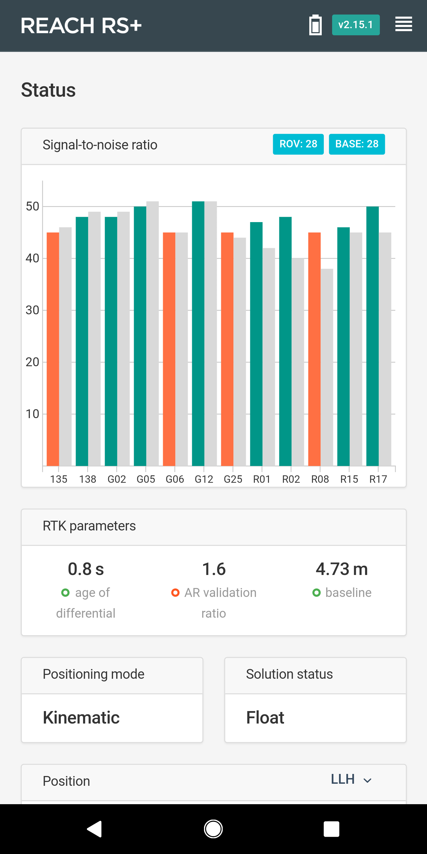
I waited about an hour while I was doing other things and have already picked up. I should mention that I am a major airport. No issues with the Topcon setups though. I was so close! It actually had a good enough float that I could have logged it, but magnet will not let you shoot if you’re not fixed.