I noticed that in the CSV files, the base position coordinates not appear in the file. It is so important it for me. I would like understand if it is an update issue or if it is a configuration error or a problem with my equipment.
I use Emlid Reach RS2, the firmware is 28.1 version.
I am using REACHVIEW 3, actualized on january 27, to 6.13 version in my tablet.
We have a support ticket in as well and thought it was possibly an issue with the projected coordinate system but have not heard anything definitive back. We have several setups on the same CRS so I’m not sure why only one of them is doing this.
Probably unrelated but I have also experienced a complete loss of points from a portion of a survey. In all 300 points were captured but the first 70 were not in the coordinate file. When I went back to the Survey Project the points were also gone from the screen.
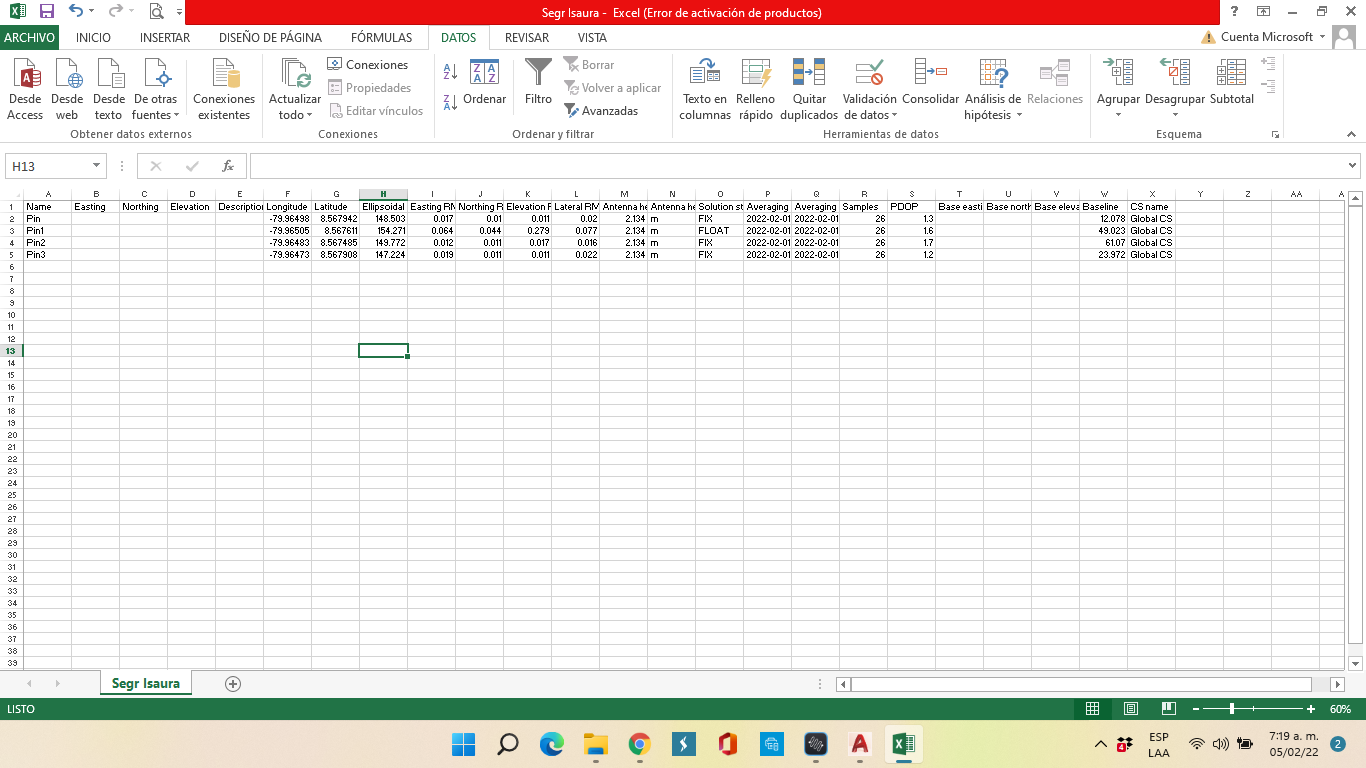
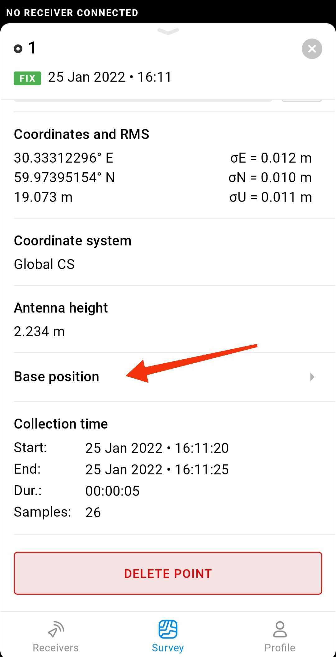
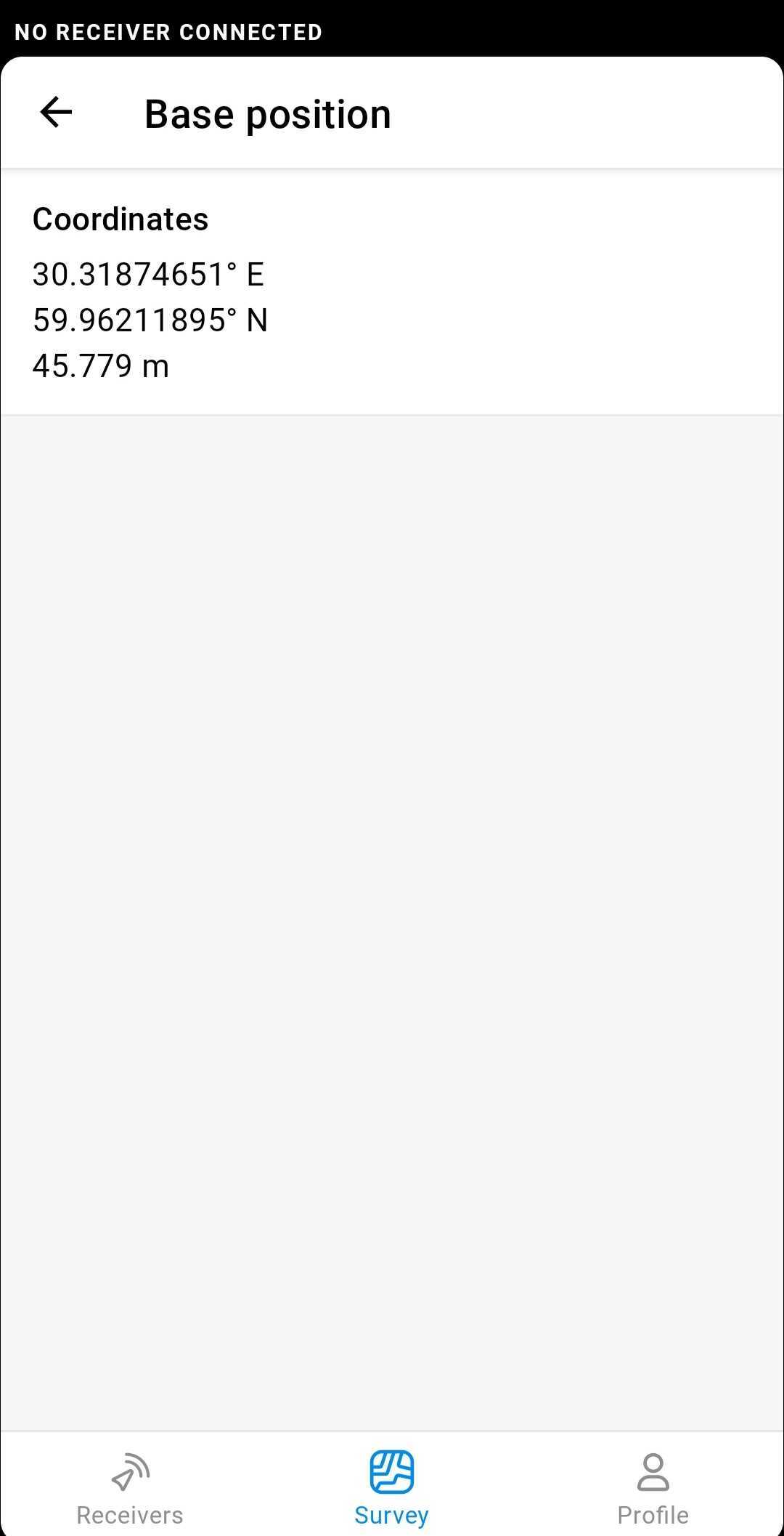
You use a Global CS option. This one allows you to work with non-projected geographic coordinates. It means that your points have geographic coordinates set: latitude, longitude, and altitude.
Any CSV file exported from ReachView 3 contains Base Northing, Base Easting, and Base Elevation columns. These are base coordinates projected in a local coordinate system. Therefore, these columns will stay empty if you work with Global CS. We’re going to fix this.
Still, you can check your base coordinates in ReachView 3. When you choose a point from the list and see more details, there’s a Base position with coordinates. I attached the screenshots below as a prompt.
All GNSS uses WGS84 and the projection is up to you but if you want to run something other than that like a projected coordinate system your base has to be supplying those corrections. Then you just pick that coordinate system when setting up a new project.
What’s interesting is that many of the expensive brands do include the base point so that you can start up your base station on a specific point that already has coordinates. Thing is though that is usually because they use a local site calibration so you want to set up on a known coordinate included in that localization. I think an easy fix for Emlid would be the ability to assign a point as control and allow that coordinate to be easily copied and pasted at least.
For your specific dataset, I think there’s a way to find the base coordinates since you have a large amount of points with baselines already saved, but involves numerical calculations (Least-squared method for non-linear equations) considering all the points you saved have a E,N,Z,Baseline. So you can find out the E,N,Z values for your base point.
Hi everyone. I have make a survey work with wgs84 and egm2008, and now I can see the base coordinates. I think is better use the local coordinates system, the same of the local network.